Hikes 5 to 9 in Colorado - December 2019
In December, we managed to sneak in five hikes for the 52 Hike Challenge. Hike 5 was a loop around Metzger Farm in Broomfield. For hike 6 we drove down to Rocky Mountain Arsenal National Wildlife Refuge. Barr Lake State Park was hike number 7. Walking a section of the South Platte River Trail was hike 8. The last hike for the month was on Coal Creek Trail in Boulder County. Each week we picked the best day according to the weekly weather forecast so we had decent weather to hike in.
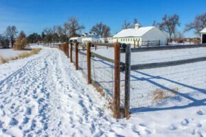
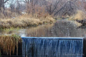
Hike 5 was 3.5 miles with an elevation gain of 130 feet in an hour and 25 minutes on December 1, 2019. Metzger Farm is not far from our house so we started the hike from our front door. We were hiking in snow. Right Buddy (RB) used gaiters, Left Buddy (LB) did not. The temperature was in the high 20’s. The sidewalks on the way over to the farm were clear with very few patches of ice, but LB seemed to find them. The trail in the farm open space was snow covered, but packed from foot traffic. There was one set of cross country ski tracks and one set of snow shoe tracks. A coyote ran across the frozen pond. We noticed the windows have been replaced in the farm house and it looks like it might be put to use sometime soon. Metzger Farm is a 152-acre property that was placed on the National Register of Historic Places in 2013. The Metzger family, who began living there in the 1940’s, sold the property to Broomfield and Westminster to be used for public open space. There is a farmhouse, barn, outbuildings and equipment near a pond. Great blue herons nest in the trees on the other side of the pond. An old windmill stands in the middle of a field which adds to the ambiance of the farm. We saw swallow nests in the pedestrian tunnel under Lowell Boulevard and interesting ice formations in the stream. There was a bird, a northern flicker, sitting still on the sidewalk in front of us. It looked like he didn't see us coming or he was trying to be so still so we wouldn't notice him. We feel lucky that we have such a wonderful place to walk and connect with nature so close to our home.
Hike 6 was a total of 5.7 miles with 135 foot elevation gain in two hours and 40 minutes on December 3, 2019. Our hike was two separate hikes, First Creek Trail and Locust Loop Trail. There was some soft snow and mud on parts of the trails. RB used gaiters, but they were not needed. The temperature was in the upper 40’s and low 50’s. There is no entrance fee for the Rocky Mountain Arsenal National Wildlife Refuge. We saw a lot of wildlife: prairie dogs, bald eagles, a ferruginous hawk, mule deer, white-tailed deer, and bison. For the First Creek Trail, we parked at the lot outside of the refuge at the southeast corner on E. 56th Ave, just west of Pena Boulevard. From there it is a half mile walk up old Buckley road to get to First Creek Trailhead. The trail goes up to the First Creek Overlook which has panoramic views of the refuge overlooking herds of deer and buffalo with the mountains as a backdrop. There is another trailhead on Buckley road closer to the overlook, but the trail is probably a little more scenic than the old road, even though vehicles are no longer allowed on Buckley road. After hiking First Creek Trail, we ate our lunch in the van. RB forgot to pack her lunch, but LB gave her one of his three granola bars and she took another one from our emergency stash in the van sink cabinet. After lunch, we took the eleven-mile Wildlife Drive around the refuge before parking at the Locust Loop Trailhead near Lake Mary. It was during our drive that we saw all the buffalo. The refuge keeps the buffalo in a separate fenced off area (quite large), that you can drive through, but you are not allowed to leave your vehicle. The refuge is 15,000 acres located within sight of downtown Denver. The property was originally farmland, then a chemical weapons manufacturing facility, then an agricultural chemical production site, then used for Cold-War weapons production and demilitarization before becoming a wildlife refuge in 1992. However, the environmental restoration was not considered complete until 2010 (Rocky_Mountain_Arsenal). From the Locust Loop Trail, we headed up the Army Historic Trail to the flag pole which is near where the U.S. Army’s headquarters building once was. There were descriptive markers along the way. The locust grove was started by farmers. An old farmhouse, once occupied by the Egli family, still stands near the trail, the last one remaining from the 200 families who once lived in the area. We had to walk through a small herd of deer along the Locust Loop Trail and the Army Historic Trail. They did not seem in any hurry to get out of our way. It is refreshing to know that an area can be cleaned up and used to allow wildlife to thrive. The density of wildlife we saw that day seems to confirm that the animals are doing well here.
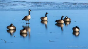
Hike 7 was 10.6 miles with a 175 foot elevation gain in five hours on December 10, 2019. We took the Perimeter Trail in Barr Lake State Park, which goes all the way around the lake and across the dam, along with all of the side trails and boardwalks. The temperature was in the 30’s. The trail had patches of snow, ice, and mud, but not very deep. RB used gaiters but did not need them. We also did not use trekking poles nor our Yaktrax (paid link) as we did not need them. The state park charges an entrance fee of $8 per vehicle. Only half of the park is a wildlife refuge. Dogs, boating and hunting are allowed in the other half. Several boardwalks and bird blinds are located in the refuge. There is a nice nature center with lots of activities for children. The park is a popular field trip destination for groups of school children and we remember both of our children having visited here. We heard there are 27 bald eagles that call the park home, with one nesting pair. Geese, ducks, gulls, pelicans, bald eagles, hawks, prairie dogs, squirrels, great blue heron, and other birds are the wildlife that we saw that day. We also saw deer tracks and raccoon tracks, but did not see any deer or raccoons. A fish head skeleton was in one of the bird blinds and a large fish head skeleton was along the trail, perhaps left by an eagle?. A bald eagle nest is visible in the distance from the gazebo at the end of a boardwalk. Along the northwest side of the lake (about mile 4.5 to 5.0), the trail runs right beside the train tracks. Quite a few coal trains went by, which were loud. Interstate 76 is not that far away and we could hear the traffic noise. The Perimeter Trail can be used by hikers, bikers and horses. We saw quite a few horse tracks, but no horses, and a couple of people on bikes. The trail goes along the top of the dam along the northeast side of lake. The trail on top of the dam (Crest Trail) is closed on Wednesdays and Saturdays from October through February for waterfowl hunting days. The lake was partially frozen, with interesting chunks of ice along the shoreline. A pleasant surprise was a tree that was made into a sculpture of a whimsical creature with human qualities. We ate our lunch of granola bars and apples outside of the Bruderlin Stone House at the north end of the dam. It is a historic house, built by Emil Bruderlin in 1890, which is now the headquarters of the Bird Conservancy of the Rockies. From all the birds we encountered that day, it is easy to see why they made Barr Lake State Park their headquarters.
Hike 8 was 12 miles with a 214 foot elevation gain in four and a half hours on December 18, 2019. The South Platte River Trail is a continuous bike and walking path that follows the South Platte River all the way from Chatfield Reservoir south of Denver to E-470 north of Denver for a total of 44 miles one way, although the trail changes its name several times along the way. It is part of the Colorado Front Range Trail. The vision of the Colorado Front Range Trail is to extend from the New Mexico border in the south to the Wyoming border in the north, for a total of 876 miles. Currently, only 270 miles of the trail exist. For our hike, we only walked on six miles of the trail. We parked at the Fishing Lakes South Parking Lot off of Henderson Road in Brighton. From there we walked north to E 470 and back, ate lunch at a picnic table by the lakes, then walked south past 120th Ave and back. The temps were in the 40’s to low 50’s. The trail is paved the whole way. The Adams County Fairgrounds is adjacent to the lakes, so we walked a little bit around the fairgrounds as well. The trail follows the South Platte River with a couple of bridges to cross over. The Riverdale golf course is nearby. The trail goes through a disc golf course. Swallow nests are in the underpasses for E-370 and 120th Ave. It was more scenic to the north, following alongside a few small lakes. To the south was a sewage treatment pond between Henderson Road and 120th Ave. Then there is a quarry area to the south of 120th Ave, perhaps for top soil? There was a constant parade of semi trucks hauling off dirt that was being loaded by a back hoe that was running non-stop. The wildlife that day was ducks, geese, hawks, great blue heron, gulls, pigeons, American kestrel and other birds, and a bunny rabbit. The Adams County Museum nearby looked interesting, but we did not stop to check it out. A couple dozen cyclists went by. A handful of people walking, mostly with dogs, went north from the parking lot. We saw one jogger to the south. Of course it was a weekday and cool. We’re sure the trail is used a lot more on a warm weekend. It looks like the trail will be extended further to the north soon. The pavement is laid, and a bench and sign have already been installed. We’re not sure how far this new section will go. We have ridden our bikes on quite a bit of the South Platte River Trail before, but we had not gone this far north. Walking instead of riding a bike made us appreciate how long this trail is.
Hike 9 was 11.3 miles with a 406 foot elevation gain in four and a half hours. We drove by the Flatiron Vista Trailhead to see if it was open, but it was closed again like it was in November due to too much mud on the trails. Instead, we ended up at the Aquarius Trailhead on Empire Road in Louisville. It was foggy in the morning, and the sun didn't come out until the last hour of our hike. It was 28 degrees when we started, with highs in the mid 30's by the time we finished. From the Aquarius Trailhead, we headed east on the Coal Creek Trail and followed it up to Baseline Road. The ground was frozen on the way out, and turned to mud on way back. The trail follows Coal Creek, bordering a few neighborhoods in Lafayette and Broomfield. It also passed by an office park and an industrial park (was that odor a hint of marijuana processing?). There are no restrooms at the Aquarius Trailhead, but vault toilets exist at the South Public Road Trailhead and at Flagg Park. We ate our sack lunches at Flagg Park, which is a short spur trail off of the Coal Creek Trail, just south of Baseline Road. There were people out walking when we were near houses. Quite a few joggers passed by. A man was walking a horse down the trail. The horse was wearing a saddle, but the man did not mount the horse. The horse stopped and wanted to check us out when they passed by us while we were having lunch. A couple of oil wells are located near the trail. The ducks on the water in the creek were mallards and American wigeon. We saw a few birds, one pigeon, a northern flicker, and a couple of hawks in the distance. Cows were grazing in a pasture next to the trail. Two rabbits darted out in opposite directions as we walked over a small culvert. Clouds hid the mountains from view. Several patches of snow and ice were on the trail, but we did not need our Yaktrax. What looked like beehives were situated near the creek bank near South Public Road Trailhead and again near Aquarius Trailhead. We’ve been on Coal Creek Trail before, but not as far as we went that day. Even though we are familiar with the roads in the area, exploring new sections of trail gave us a different perspective of the landscape between the roads, which we appreciated.
Although we enjoy hiking in warm weather with an abundance of greenery, bright flowers, and wildlife, there is something special about getting out in the colder months. There is still wildlife to see and observe as well as the beauty of the muted colors of the dry vegetation, that is when it is not covered in a beautiful blanket of snow. We encourage you to hike year round and enjoy nature first hand for yourselves. Stay tuned for the next blog post on our January hikes.
Check out our related video: Hikes 5 to 9 in Colorado - December 2019
(RB)

