
Hikes 1 to 4 in Colorado - November 2019
At the beginning of November last fall, we signed up for the 52 Hike Challenge. This blog post shares our experiences during the first four hikes we did that month. The first hike was a loop from South Mesa Trailhead in Boulder. The second hike was in Clear Creek Canyon near Golden. For our third hike, we went from Country Estates Park to Stearns Lake in Broomfield. Our fourth hike was from our front door and around Broomfield County Commons. Let’s give you a taste of what we experienced during each hike.

Hike 1 was 5.6 miles with an elevation gain of 978 feet in three and a half hours on November 5, 2019. We initially wanted to hike Flatiron Vista, but the trailhead was closed along with Dowdy Draw Trailhead due to the trails being too muddy, so we ended up across the street from Dowdy Draw Trailhead at South Mesa Trailhead. The loop we hiked was Homestead to Mesa to Upper Big Bluestem to Mesa to Towhee trails. The trails were mostly muddy with patches of snow and ice. We put on our YakTrax part way through, but we really only needed them for one short section of Homestead just before the bridge. The temperatures were in the high 50's and sunny. Lots of birds crossed our path: magpies, a northern flicker, stellar jays, a red tailed hawk and a spotted towhee. Towhee was a new bird for us. There was a sign on Towhee Trail (of all places) explaining the birds. Just as we finished reading about them, we looked up from the sign and saw a towhee in the bushes nearby, so the trail was appropriately named. There were large boulders among the trees where the Upper Big Bluestem Trail meets the Mesa Trail which was a great place to eat lunch.

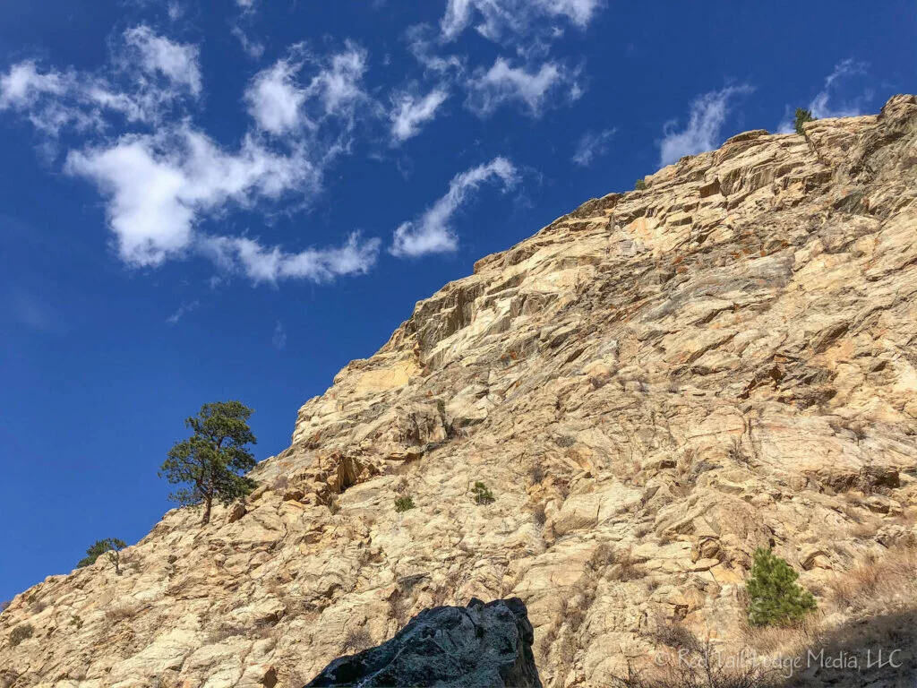
Hike 2 was 8.5 miles with an elevation gain of 490 feet in four hours on November 13, 2019. We parked at the Clear Creek Canyon Park Big Easy Trailhead along Clear Creek Canyon Road just west of Golden. The Peaks to Plains Trail is planned to be a 65 mile trail to connect the South Platte Trail in Denver to the headwaters of Clear Creek at Loveland Pass. Currently, only four miles of the trail have been completed within the canyon which is the section we hiked, from the Big Easy Trailhead to the Oxbow Trailhead and back. The trail is paved, but about one third of it was covered with slick ice which was then covered with snow. The rest of the trail was dry pavement. We used our Yaktrax the whole way because we were too lazy to take them off. The temperatures were in the forties, but the trail was mostly in the shade. There were only a handful of others on the trail. Quite a few rock climbers were near Tunnel 5 just below the Oxbow Trailhead. The trail follows along Highway 6 (Clear Creek Canyon Road), so there is is quite a bit of traffic noise. However, there are pretty views of the canyon and the creek most of the time. We stopped for lunch on a couple of large boulders next to the creek just before reaching Oxbow Trailhead. There were lots of cars at the Oxbow Trailhead, but not many cars at the other trailheads. We’re guessing most of the cars at Oxbow were from rock climbers. Right Buddy broke in her new hiking boots. They are the same model as her old pair, but one size larger. She was hoping a larger size would reduce the issues she had during Season One when her feet would swell and cause blisters, and with her toes hitting the ends of her boots on steep downhills. The terrain was not very steep that day, but the boots are doing well so far. Both of us tried out new trekking poles from Costco. They are reasonably priced for a carbon fiber pole and we're happy with them so far. We noticed a pumpkin floating in the creek, covered with ice, and climbing chains hanging from the rock overhead. There was a sign indicating that prospecting is allowed on a section of Clear Creek along with the rules around prospecting.

Hike 3 was 10 miles with an elevation gain of 560 feet in four hours on November 19, 2019. We parked at Country Estates Park in Broomfield where we walked a block down Aspen Street to pick up the Lake Link Trail. Our route was Lake Link to the west, crossing Highway 287 before taking Rock Creek Trail north to Stearns Lake. On the way back, we continued on Rock Creek Trail which goes under Highway 287 before joining back up with Lake Link Trail. The trail was dry that day and the temps were in the high 50’s. There were lots of dog walkers on Lake Link, and more bikers on Rock Creek. Some of the wildlife we saw were a coyote, a hawk, prairie dogs, and a bald eagle nest along with geese and ducks on the lake. Due to the eagle’s nest, the Rock Creek Trail detoured a small distance along 104th St. just south of Stearns Lake. There was also some construction on 104th, but they were courteous of the hikers and bikers coming along. The coyote we saw was camouflaged very well. RB caught a glimpse of it from a distance as it ducked down in a gully. Since the trail led us in that direction, we thought we were carefully scanning the landscape to see if we could spot the coyote again. Then we realized it was standing right in front of us. How did it get there without us seeing it? The picnic shelter at Stearns Lake, with clean vault toilets nearby, was a great place to eat our lunch. Rock Creek Trail runs right through Rock Creek Farm, so we passed by fields filled with pumpkin remains. We remember taking our children to Rock Creek Farm, when they were younger, to hand pick their pumpkins for Halloween.

Hike 4 was 5.2 miles with an elevation gain of 186 feet in two hours and twenty minutes on November 27, 2019. Since the snow storm the day before dumped over 14 inches on us, we decided to hike right from our front door instead of driving to a trailhead. Broomfield County Commons Open Space is less than a mile from our house, so that is where we went. Although it was partly sunny, the temperature was only in the mid teens. The sidewalks were plowed but icy, so we preferred walking through the snow. We walked about half the time on the sidewalks and half trudging through the snow. We wore hiking boots and gaiters. We took trekking poles and Yaktrax with us, but we did not use them. There were some cross country skiing tracks and snow shoe tracks, but most tracks were from boots and shoes. Geese, ducks, a meadowlark, and an American kestrel were the wildlife we encountered that day. When we stopped at the pond to take a picture, the geese swam away from us, but the ducks came right for us as quickly as possible, first swimming, then walking and slipping on the ice in their haste. They must have thought we would feed them. Kids were sledding on the small hill near the picnic pavilion and playground.
That's it for our hikes from November. We hope this inspires you to explore the trails in your state, when it is safe to do so, of course. Stay tuned for the next blog post on our December hikes.
Check out our related video: Hikes 1 to 4 in Colorado - November 2019.
(RB)