
Alcan: Marsh Lake, Yukon Territory - August 30th to 31st, 2022

Sometimes the journey is just as exciting as the destination. Our drive from Kluane Lake to Marsh Lake in the Yukon Territory was one of those times.

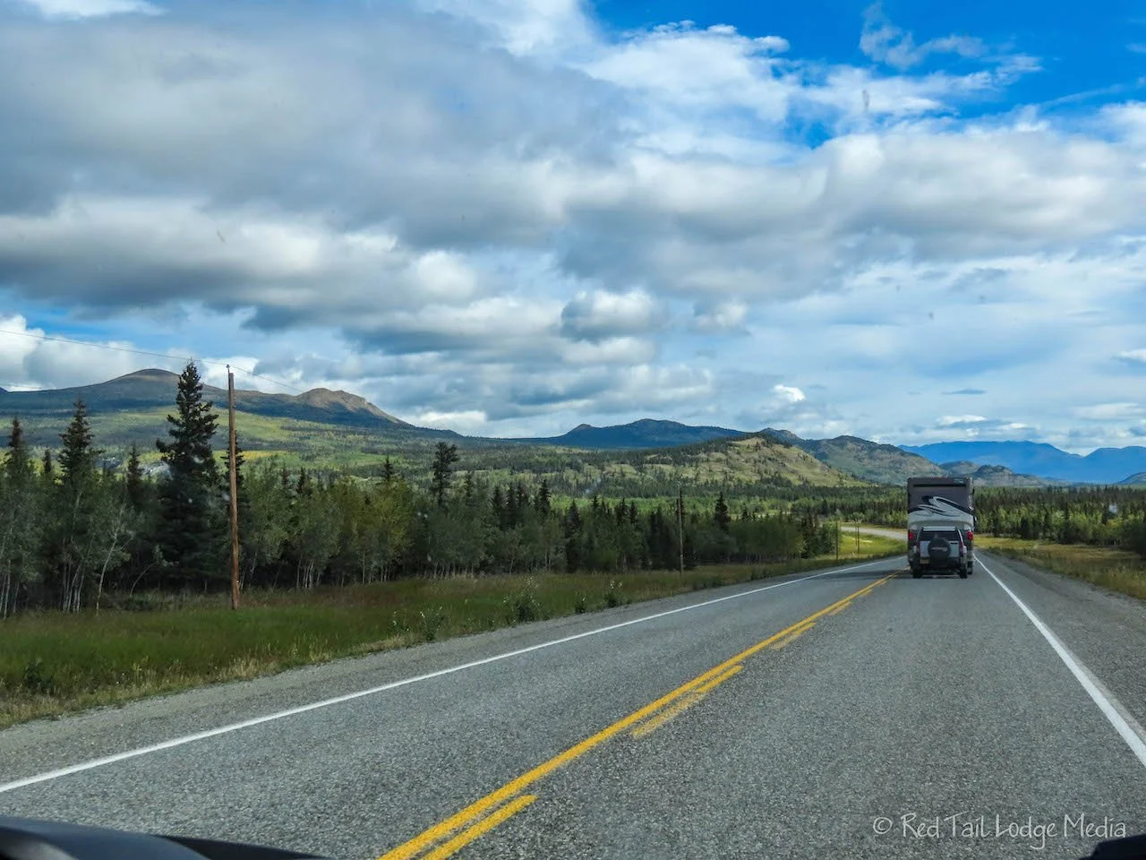
Tuesday was another long driving day with a first come/first serve campground for the next two nights, so we got an early start, up at 6:30 am, on the road by 7:30 am. It was another beautiful sunny day for a change. Well, it was partly cloudy, but that’s close enough for up north.
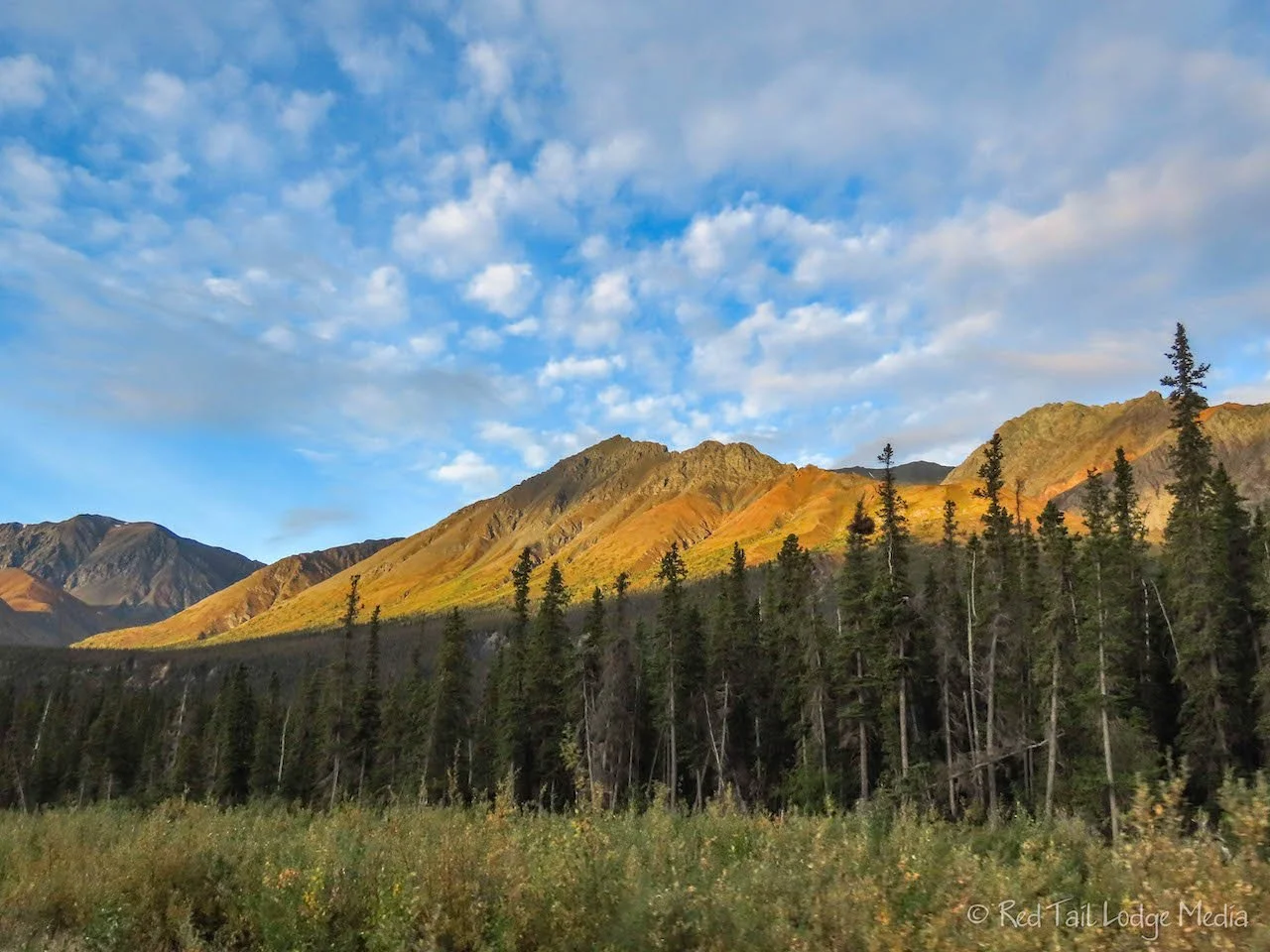
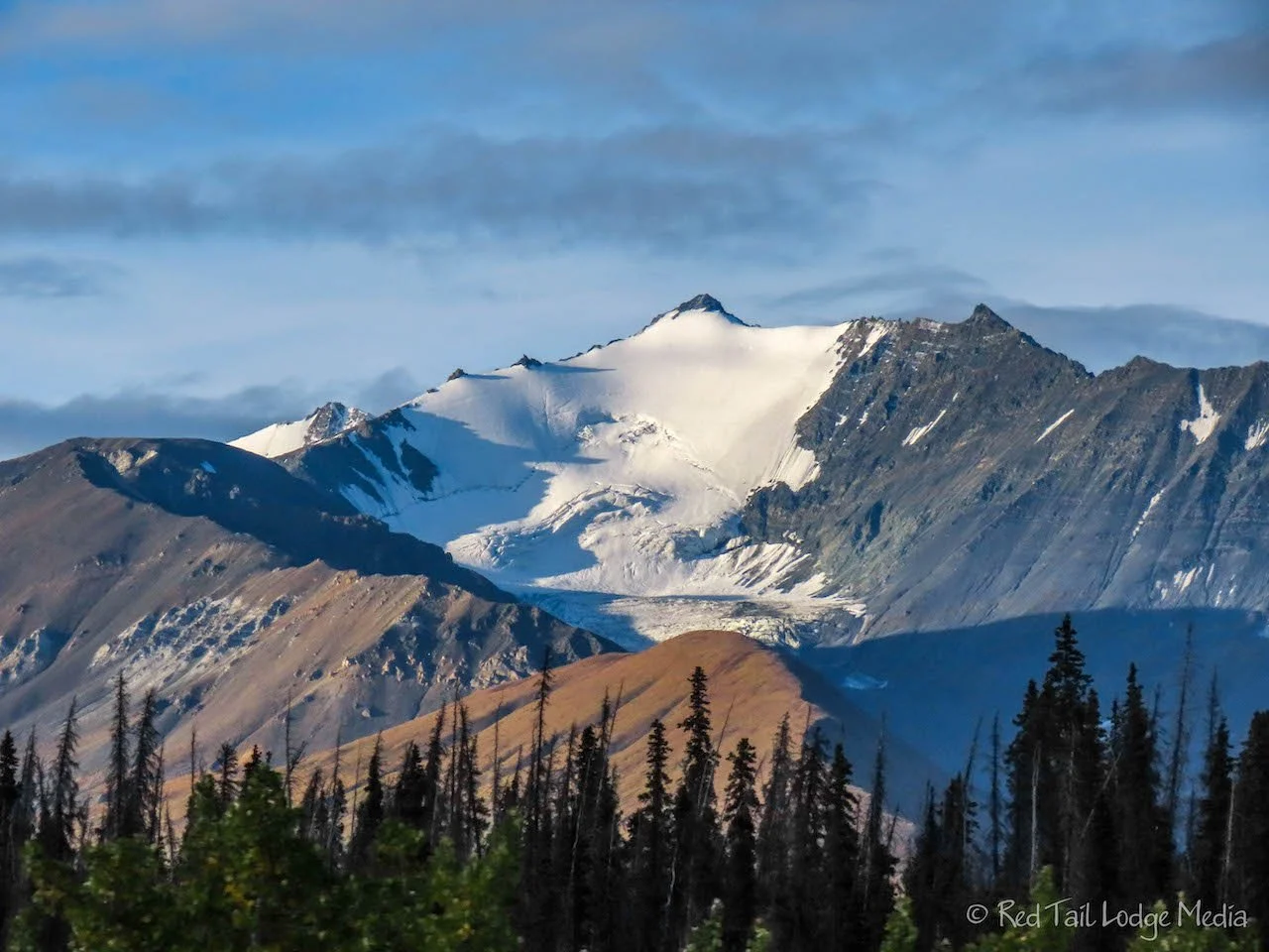
Starting out our drive, the mountains were stunning in the morning light. As we reached the southern end of Kluane Lake, we passed a sign that warned drivers of sheep in the area. Naturally, we pulled off at the next opportunity and scanned the mountain side with our binoculars. Sure enough, there were lots of sheep. They still were not very close, but it’s probably the closest we’ve been to Dall sheep all season. We could make out their features, such as legs and heads, but not in a lot of detail.

Just a little farther down the highway was the Thachàl Dhâl Visitor Center, part of Kluane National Park, where we stopped again to see even more sheep. According to the Mile Post, the sheep return to the south-facing slopes of the mountain in late August. Yup, it was late August and there they were!
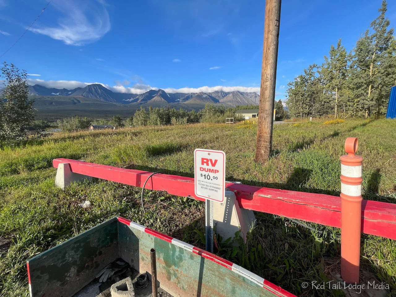
Our next stop was Haines Junction for a dump station and a bakery stop. The gas station charges $10 to dump unless you purchase 60 liters or more of gas. That’s about half a tank of gas for us, and we didn’t really need gas yet. So we paid our $10.
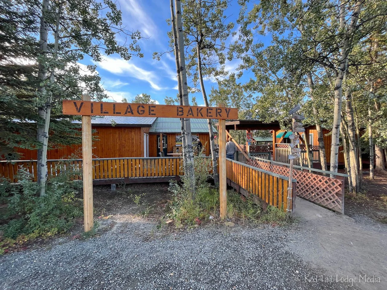
The Village Bakery was just a couple of blocks from the gas station. It is not directly on the highway, but on the corner of Kluane and Logan streets. Google Maps had us approach from Auriol Street and we weren’t sure we had the right place as all the buildings looked like private residences. However, when we turned onto Logan Street, it was clear we had the right place. There were cars and RV’s lining both Logan and Kluane.

The bakery was busy and for good reason. It was a fantastic bakery with all kinds of sweets, drinks, soups, and sandwiches. Ann picked out the apple bomb while Keith got a cranberry orange scone to go with our chai lattes. The apple bomb was just the right amount of sweetness, a real delight. Why didn’t we stop here the last time we drove through Haines Junction? (Alcan: Whitehorse, Yukon Territory - June 16th to 17th, 2022). It’s probably a good thing we’re not staying close by, because we would be here every day.
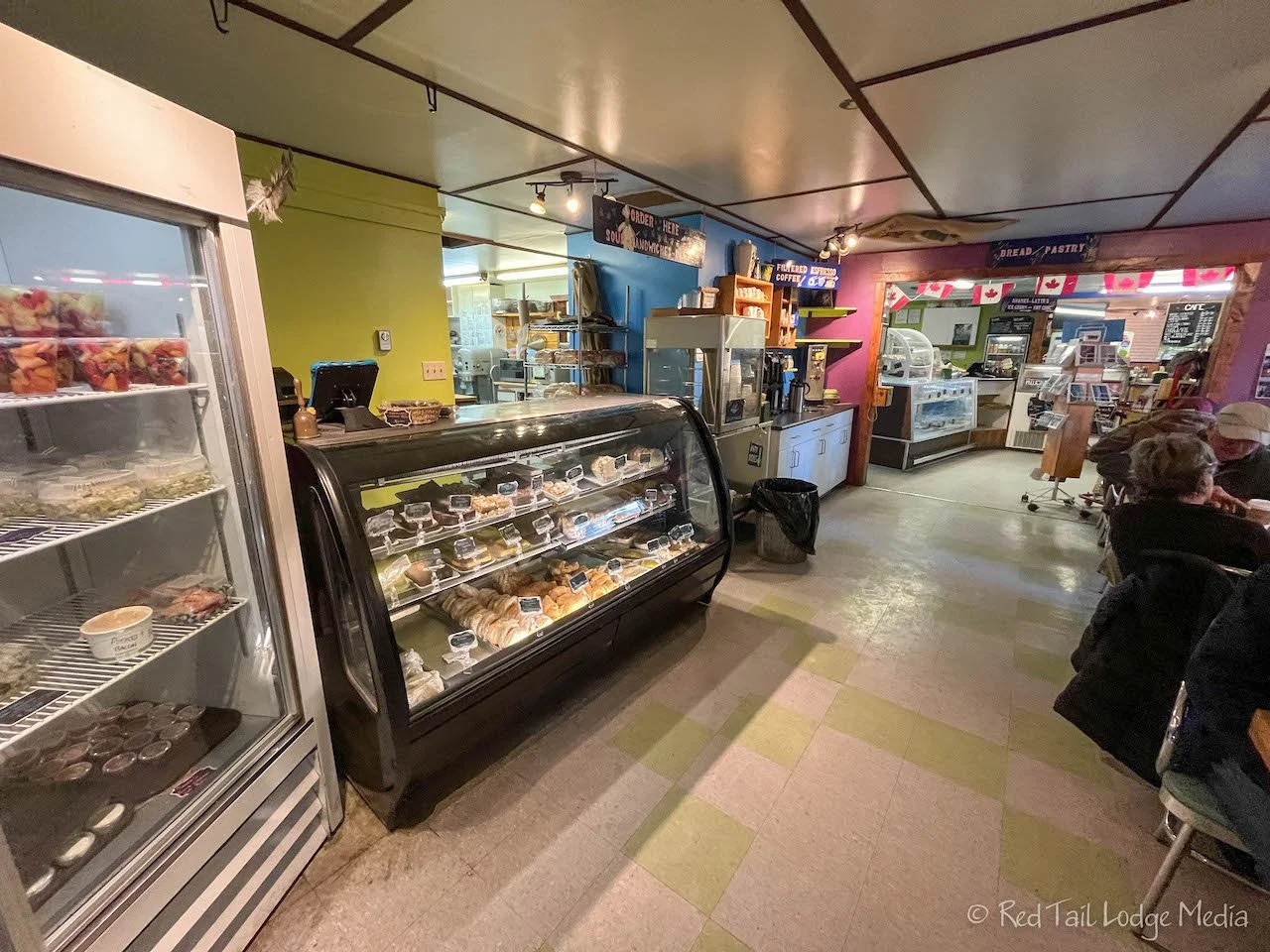
Keith spied the sourdough bread in the bakery, so we bought a loaf. Keith loves sourdough bread. The staff was kind enough to slice it for us, since we don’t travel with a bread knife. Maybe that’s something we should add to our packing list for next season. The bread was equally delicious. Keith prefers a little more “chew” to his sourdough bread, but the flavor was spot on.

The drive from Haines Junction to Whitehorse was a familiar one. However, this time the weather was better so we could see the mountains around us.
Our last stop for the day was in Whitehorse. After getting gas, groceries, and Canadian cash, we were back on the road. Even though it was after 1 pm, our campground for the night was only 30 minutes away, so we waited until we arrived at the campground to eat lunch.

Our home for the next two nights was Marsh Lake Campground, another Yukon government campground. It was just as nice as Congdon Creek, the one we just left. Arriving before 2 pm, we had plenty of open sites to choose from. The sites were in the woods, but many of them backed up to the lake. Our site had a nice view of the lake through the trees.

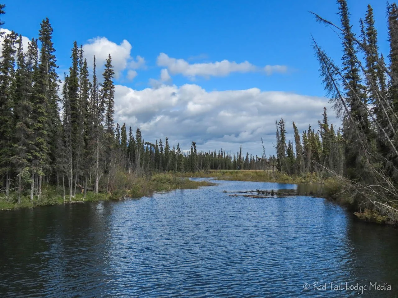
Marsh Lake is on the Yukon River. It is smaller than Kluane Lake, but still a large lake. However, the water of Marsh Lake has a wonderful turquoise color to it. We enjoyed eating our lunch out on our camp chairs, taking in the view. We stayed outside until the wind picked up and we started getting cold.

A few times we saw a couple of eagles soaring overhead. One of them landed in a tree not far from our camp site. Even knowing where it landed, it was hard to spot at the top of the tree. Camouflage is amazing.

After dinner, we walked around the campground. Even at that time, more than half the sites were still available. However, it was a Tuesday, during the week. The weekend may be a different story. Since it is so close to Whitehorse, there are probably locals that come to enjoy camping on the weekends.
The weather was also nice on Wednesday. In the morning, we walked around the campground. There was a short bridge over some water to what looked like a day use area on the park map. However, there were also more tent sites over there. To access those sites with a vehicle, you needed to turn onto the road just north of the one for the main campground. There was also a housing subdivision down the same road. That probably explained why we had a cell signal in the campground. We were expecting to have none. However, the cell signal was not very strong or our AT&T plan was being throttled since we are not a priority on Canadian cell networks.
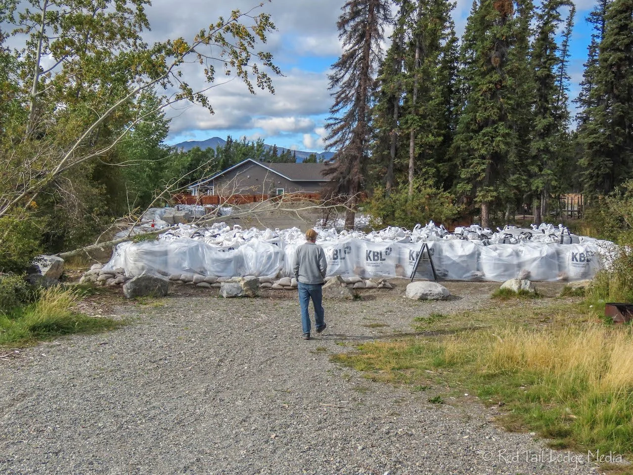
Just after the bridge over to the other area, there was a ring of large sandbags, along with a sign saying the area was closed. The closed area was just a portion of the day use area. We noticed before that the lake water level looked high. We’re not sure why it is high. Perhaps it was still high from all the flooding that occurred along the Yukon River in the spring or there was a higher than normal rainfall during the summer, or perhaps both.

As we walked around, we noticed a lot of squirrels. It was very refreshing to see more animals again. We didn’t see a lot of little critters while we were in Alaska. One of the squirrels was high up in a spruce tree, throwing down cones left and right. We’re not sure if he was trying to scare us off or he was gathering the cones at the base of the tree. The rate he was throwing them seemed rather comical.
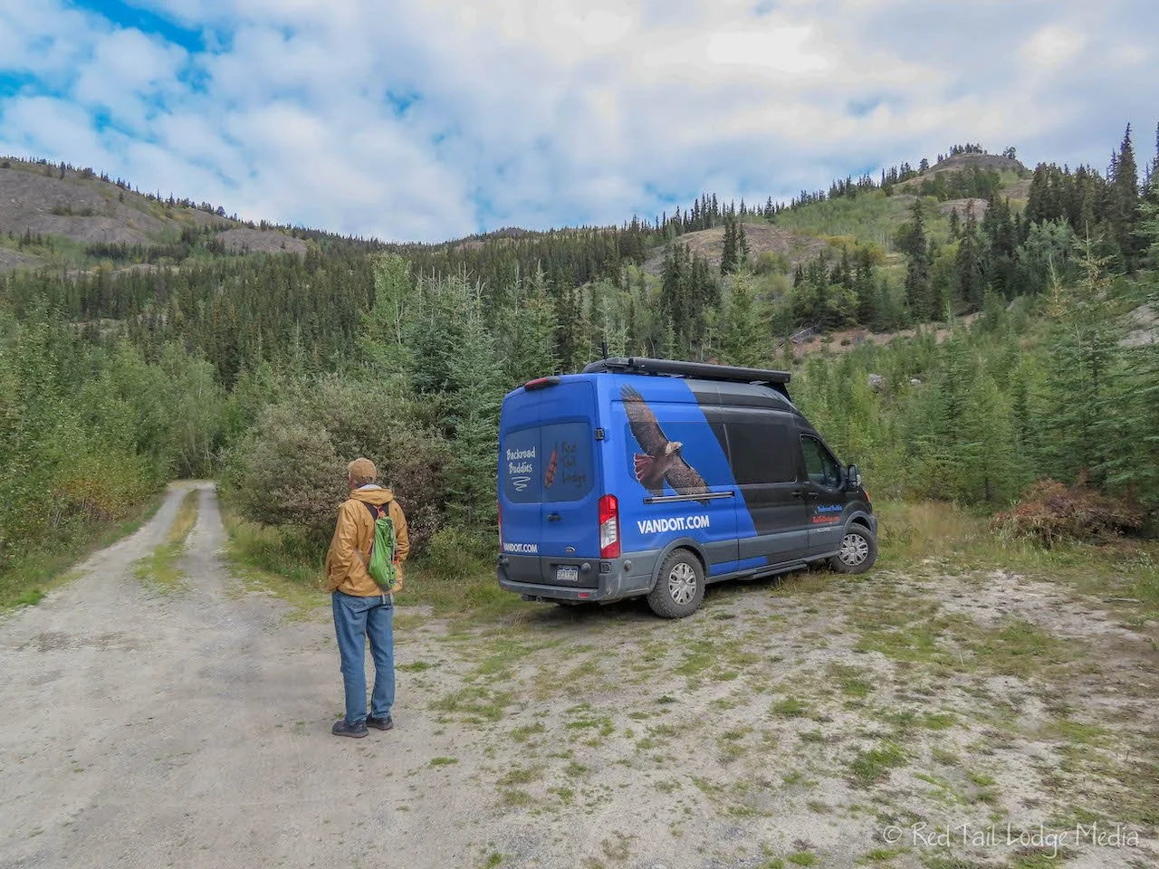
In the afternoon, we went for a hike. Ann found a nearby trail in AllTrails called M’Clintock West Ridge Trail. It was not a marked trail, but Google Maps did list the trailhead. As we approached the trailhead on the Alaska Highway, Ann was also watching our position in AllTrails just to make sure Google Maps did not lead us astray. If you didn’t have Google Maps or AllTrails, you would miss the little turnoff for the trailhead. It is an unmarked dirt road that leads a short distance back into a gravel quarry. The road was pretty rough, so we parked as soon as there was room off to the side. Just a little further down the road was a little dirt trail leading up.

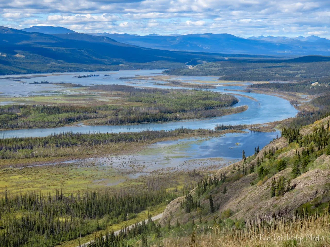
The trail is only 1.2 miles round trip. It goes up to a ridge with views out over Marsh Lake and back towards Whitehorse. However, the trail is steep, 780 feet in about half a mile. It is also loose dirt. We just got started and realized we should have trekking poles with us. Ann went back to the van to grab a trekking pole for each of us. As we starting climbing up the steep trail, with questionable footing, we hesitated. Would we have trouble getting back down? It was borderline in our minds, but we kept going. It’s such a short trail, we could slide down on our bottoms if we needed to.

Our hearts were pounding and we were breathing hard in no time. On the way up, there are two additional view points. Of course we stopped to take pictures… and catch our breath. Our calf muscles were definitely getting stretched out. It took us about 45 minutes to reach the top. Yes, 45 minutes to go half a mile. We’re not fast hikers by any means, but that is a slow pace even for us.

We enjoyed the views from the top for a little while, then started the careful descent back down. At least we were not breathing hard on the way back down. We took our time. Ann did not want to fall and break her tailbone again (Shades State Park, Indiana - April 6th to 7th, 2022), or any other bone for that matter. By the time we reached flat ground again at our Red Tail Lodge, we had gone we had gone 1.2 miles with an elevation gain of 705 feet in one hour and 15 minutes. Or at least Ann went that far because it included her trip back to the van to get our poles. Our mileage and elevation was a little less than what AllTrails listed. That’s because the AllTrails route followed the ridge line a little further past the top. We were ready to turn around when we reached the top and had no desire to continue along the ridge. This was hike number 38 of our 52 Hike Challenge for 2022.
The trail was not our favorite. The views from the trail were nice, but we like to enjoy the trail on the way as well and this trail was not fun for us. If you like a challenge, you may like it, but we prefer something where we’re not concerned about getting hurt. However, it did feel good to get our hearts pumping for a change. We needed the workout and it was better than just hanging out in our Red Tail Lodge (our camper van) all day.
The nice weather certainly added to our enjoyment of not only Marsh Lake, but our drive to get there. Sunshine turns beautiful scenery into breath-taking scenery. We’re not sure if our impressions of the area would be different in different weather, but we were thankful for the sunshine all the same.
Check out our related video: Alcan: Marsh Lake, Yukon Territory
(Ann)