
Alcan: Kluane Lake, Yukon Territory - August 28th to 29th, 2022

It was late August. The vegetation was starting to don its fall colors. It was time to start heading south. Our first stop on the Alaska Highway, after entering the Yukon Territory, was along Kluane Lake, near Destruction Bay.
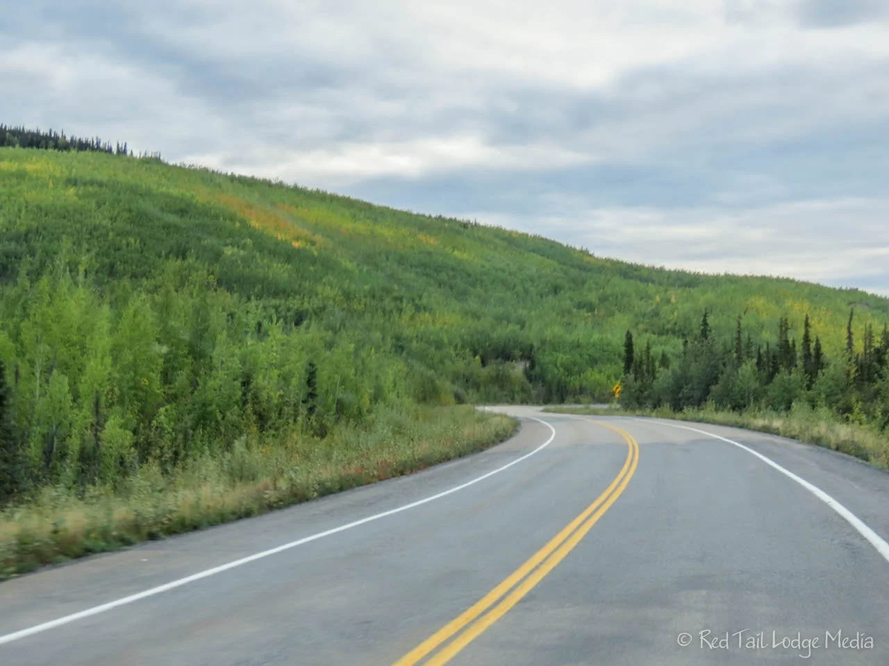
We got up early on Sunday so we could get an early start on our long drive. We heard reports that Tok to Destruction Bay is the roughest part of the Alaska Highway, with lots of pot holes, frost heaves, and road construction. Our destination for the day was Congdon Creek Campground, a Yukon government campground on Kluane Lake, which was first come/first serve. Our drive also included a border crossing and a change of time zones, so we lost an hour. Therefore, we were up by 6:30 am and on the road by 7:30 am. After topping off our gas tank, we started our trek towards the border.

Of course, it was raining again. Yes, the road was bad, but Keith didn’t find it as stressful as he imagined it would be. That being said, at one point, his hand started going numb, probably from gripping the steering wheel too tight. The hard part was not that the road was rough the whole time, it would be in sections. That meant the driver had to be really alert to notice the bumps, holes, and dips as they popped up. Having water standing in many of the pot holes didn’t help because you couldn’t see how deep the pot hole was or if it was just a puddle on the road. Luckily, there wasn’t much traffic on the road, so Keith used both sides of the road to swing around pot holes and rough sections. There also were plenty of breaks in the pavement where the road went down to dirt and gravel, we’re assuming because they are working on repairing those sections of the road. There was only one several mile section of road construction where we had to wait to follow a pilot car. It was a Sunday, so there was probably less construction going on than during the week.

We only made a few stops along the way, mostly at rest areas to use a pit toilet. The Mile Post came in handy because the rest areas were few and far between and sometimes not very well marked. We stopped at the Tetlin National Wildlife Refuge Visitor Center for one of our bathroom breaks. The center’s hours were 8 am to 4:30 pm daily, but the building was locked. There was a sign posted that they were hiring, so we don’t know if it was just closed that day, or all Sundays, or all summer due to staffing issues. Luckily, the pit toilets were open, which was all that we really needed.

A deck out behind the building has viewing scopes out over the landscape including numerous ponds. However, the ponds were so far away it was hard to make out anything. Ann thought she saw something like a deer on the shore of one of the ponds through the viewing scope, but by the time she went back to the van to grab her camera, she could no longer find the animal. Yes, it is hard to believe she didn’t have her camera on her in the first place.
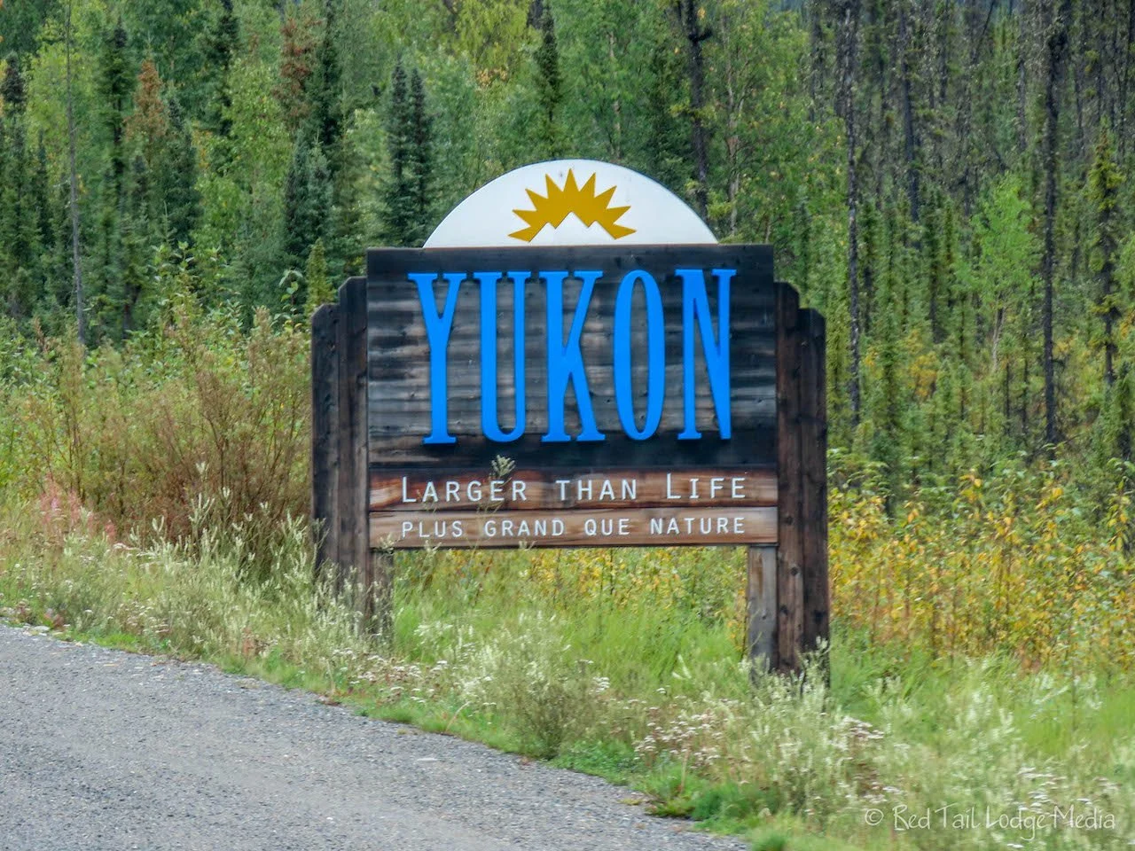
The border crossing went pretty smoothly. The border guard scanned our passports, brought up our ArriveCan info, asked us a few questions, and sent us on our way in a matter of a few minutes.

Our next stop was at Pickhandle Lake. There was a small rest area right on the shore of the lake. The sun poked out a few times while we were there. We didn’t spot any animals, no ducks, no loons, no swans, but the lake itself was a pretty sight. We are still amazed at how few animals we see in Alaska and the Yukon Territory. We keep seeing information about how well the animals hide and are camouflaged, but we’re not strangers to wild animals. To us, it seems like the density of animals for the same amount of land is less up here in the north compared to the lower 48 states. Or, perhaps, the animals are less accustomed to people and there are so few roads up here, that they stay away from the corridors where people are.

We’ve also noticed that trumpeter swans seem to be in pairs. When we saw them, there were usually two and only two of them in the same pond. Sometimes we would only see one by itself (or we missed seeing the other one) and only once have we seen three in the same pond.
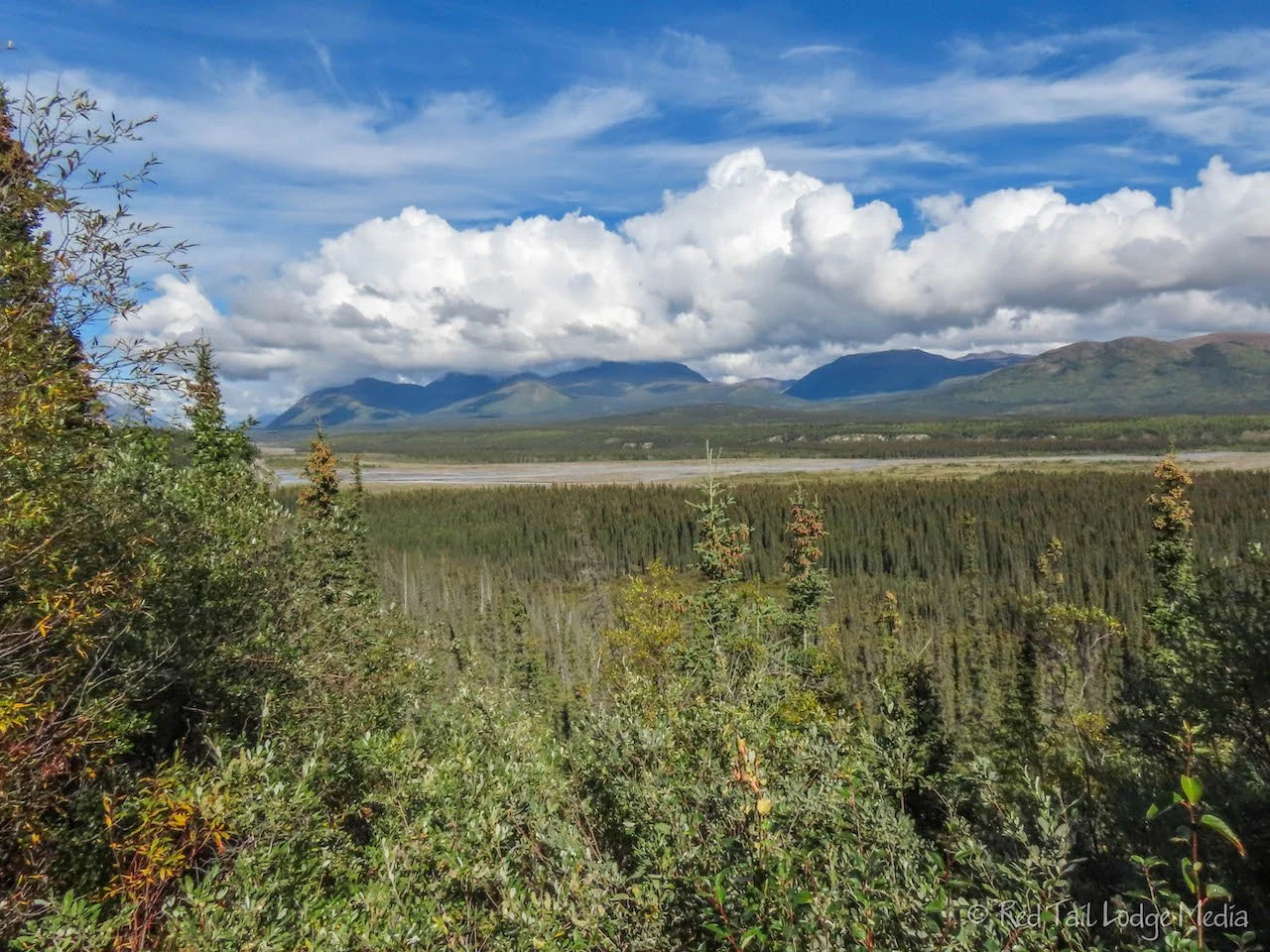
There were two viewpoints that we stopped at, but they were a little disappointing. The Mile Post claimed you could see the Icefield Ranges of the St. Elias Mountains, but they were hidden behind the clouds for us. The second viewpoint was the Kluane River Overlook which the Mile Post said you might be able to see bear and eagles feeding on the salmon in the river in late August through early September. We couldn’t spot any bear or eagles. The sign posted at the overlook said the salmon run in September. We may have been a little early. However, the river is so far away from the overlook that, even with binoculars, the bears would still be pretty small in your view.

Our plan was to get gas and groceries in Burwash Landing. The gas station there is unmanned. You enter a small building to pay via an automated machine, then fill up your tank. The building next to the gas station claimed to have groceries. However, there was a sign on the door “Sorry, we are closed”. Well, it’s a good thing we had some nonperishable items in our Red Tail Lodge (our camper van), so we won’t starve.

Not far from Burwash Landing is Destruction Bay which has a gas station and a convenience store, so we stopped there. The store had mostly nonperishable items, but also had things like bacon, eggs, frozen pizzas, ice cream, apples and oranges. Ann was hoping for some fresh fruit and vegetables. There was a sign on the freezer saying they had frozen vegetables, but there were none inside. We picked up some bacon, eggs, and an orange (the apples didn’t look very fresh to Ann). For a treat, we also each picked out an ice cream novelty.

Fresh fruit and vegetables will be available in a couple of days when we pass through Whitehorse. We had leftover soup for dinner and we could make pasta the following night, without an onion, which made Keith happy, but Ann not so much. Ann makes her own sauce from canned tomatoes, bacon and onion. In her opinion, the onion adds a lot of flavor and nutrition.

We reached Congdon Creek Campground, just a few miles past Destruction Bay, around 3:30 pm (Yukon time). We had no problem finding an open site, even one of the lake front sites. There were signs posted warning people that there were bears in the area and to enter at your own risk. The tent area was enclosed within an electric fence. We’ve already had a few encounters with bears (Denali National Park: Teklanika River, Alaska - August 4th to 8th, 2022) and have had instructions explained to us many times about what to do that we felt confident.

The sun was out, so we went for a walk along the rocky beach, with our bear spray. There is a trail that runs alongside the beach in the trees that goes out to an observation deck, but we felt more comfortable on the beach where we had better visibility. We weren’t sure how far the observation deck was. We turned around after about half a mile. We learned later that the deck should have been only half a kilometer away, so it must have been hidden back in the trees (or no longer there).

We didn’t see any bear during our walk, but we did see evidence of one. There were bear tracks on the beach, heading south. Right where the beach meets the trees, there was a long streak of bear scat, filled with berries.

We did see Dall sheep. At least we thought they were sheep. They were just white dots high up on the mountain slope on the far side of the lake. Every time we went down to the beach, we would notice where they were. Sometimes they would all be in one big bunch, probably protecting each other from the strong wind. At other times, they would be spread out over the slope, grazing for food more than likely. They were so far away that even through binoculars, they still looked like dots. You couldn’t even make out their legs.

After our leftover soup dinner, we strolled around the campground. There were still quite a few camp sites available. The loop we were in is next to the lake. The other loop is set back in the woods. The sites are rather spacious with half of them being pull through sites. The amenities included pit toilets, garbage, and free firewood. However, the water pump has a “boil for one minute” warning on it and there is no wastewater dump. There also is no cell signal, so come prepared.

It was a long day. We both were tired and went to bed early, despite losing an hour due to the time zone change.
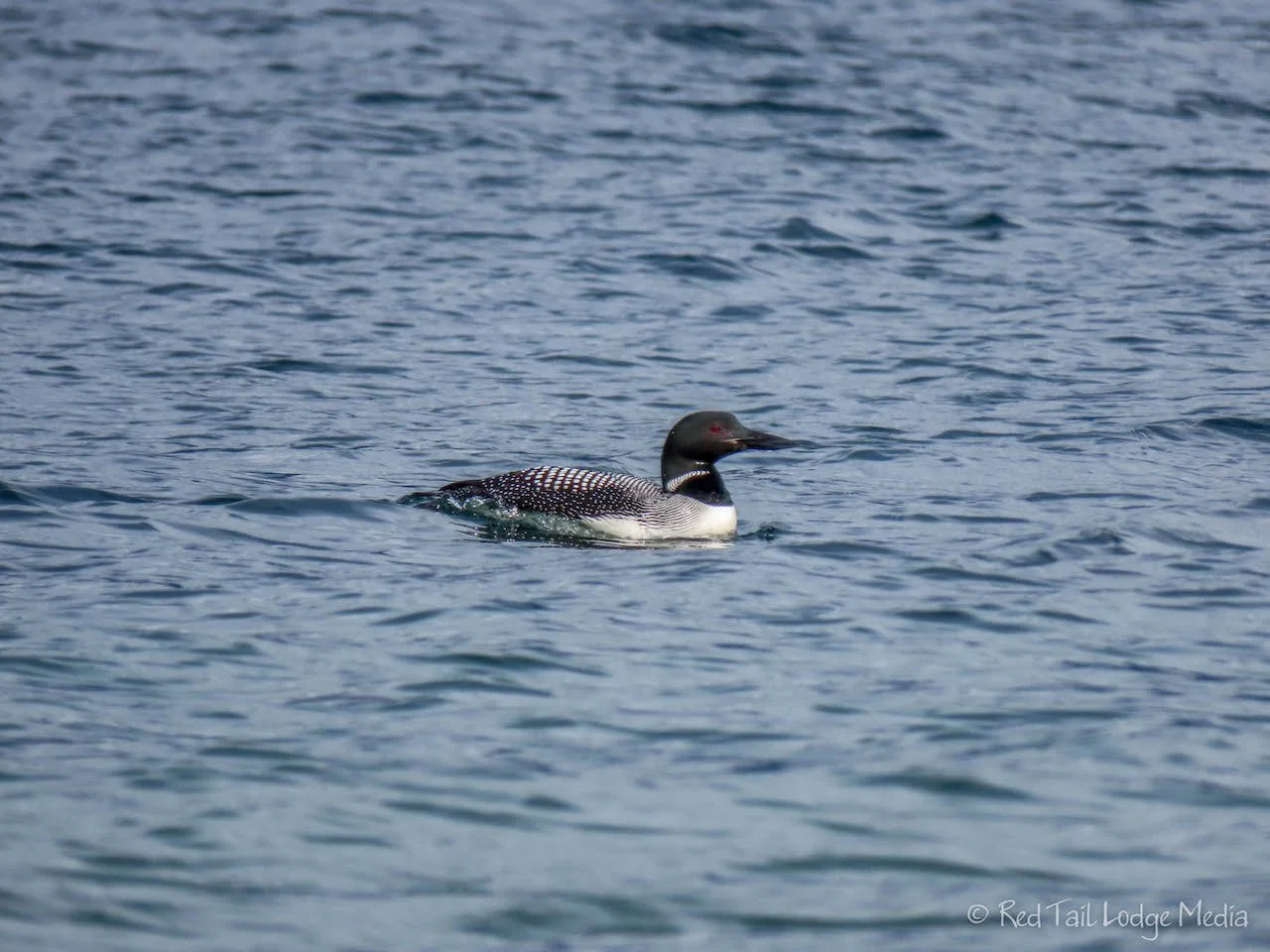
It was raining when we woke up Monday. We stayed inside our cozy Red Tail Lodge until the rain let up. By afternoon, the sun was poking out. When Ann walked down to the beach after lunch, four loons entertained her for a while by swimming somewhat close to shore, diving down under the water for their next bite.
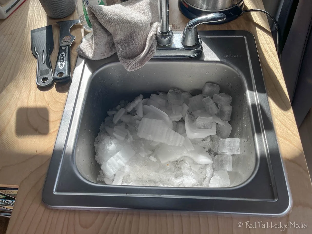
Since we had some time our our hands, Keith defrosted our small freezer. The frost had fully consumed the whole space surrounding our ice cube tray and carrots along with a thick coating of ice on the outside of the freezer. The chunks of ice he removed made a large pile in our sink. We didn’t think our freezer was big enough to hold all that frost.

Later in the afternoon we went for a long walk. Starting out along the beach, we went in the opposite direction from the day before, north to Congdon Creek. The creek is a braided creek, probably fed by a glacier high up in the mountains. We followed the creek bed to the highway, crossed the highway, then followed the creek bed a little further. We had to jump over the main water channel several times as we made our way up the creek, finding our way over the different meandering threads of water.
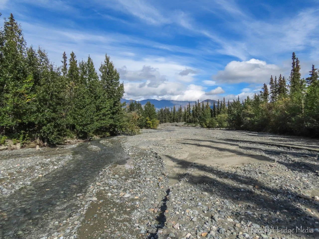
The trees started to close in on the banks of the creek bed when we decided to turn around and head back. It was starting to get a little harder to keep our feet dry and we were not in the mood to get our shoes all mucky. We were wearing our trail runners and not our hiking boots. And yes, we remembered to call out “Hey bear” every now and then so we would not surprise a bear.

By the time we returned to our camp site, we covered 3.4 miles in one hour and 45 minutes. It was hike number 37 of our 52 Hike Challenge for 2022.

We decided it was time for our annual campfire. We seem to only have one each year, mainly because we are too lazy to make one and don’t want to use up our water to put it out. However, this seemed like a perfect time. It was cool and windy outside, but not raining. We had a place to fill up our water the following day. The Yukon government provides free firewood in their campgrounds. However, the logs they provide are huge, too large to split with the small hatchet we had with us. Luckily, someone left a pile of partially split logs at our campsite. Perfect!

Keith split some of the wood into smaller pieces and had a fire going in no time. It was 7 pm. The sun had not set yet. It wouldn’t set until well after 9 pm. It would have been better to have a fire after dark, but we’re old, we like to go to bed at 10 pm. Even in the daylight, it was still relaxing to sit, carry on a conversation, and be mesmerized by the dancing flames. Yup, you guessed it, we didn’t have any cell service. We had plenty of wood to keep it going until 9 pm. After letting it burn down, we extinguished the remaining coals with water, and made it to bed by 10 pm.

Our first couple of days back in the Yukon Territory found us relaxing in a beautiful landscape. We were refreshed and ready to continue south on the Alaska Highway, excited to see what it would bring us next.
Check out our related video: Alcan: Kluane Lake, Yukon Territory
(Ann)