
Death Valley National Park, California - September 11th to 14th, 2024

Death Valley National Park is a very large park. It is known for being very hot, even in mid September. However, due to its large size and large variation in elevation, from 282 feet below sea level to 11,049 feet above sea level, you can escape the heat by going to a higher elevation. But plan on putting a lot of miles on your vehicle while you are in the park.
Wednesday we drove from Crowley Lake to Furnace Creek Campground in Death Valley. Along the way, we stopped in the town of Bishop, which we covered in our previous post (Mammoth Lakes, California - September 10th to 11th, 2024).
When we finally hit the road again, it was afternoon and we still had three hours of driving to get to the Furnace Creek Campground. We crossed into Death Valley National Park on route 190 from the west. From that point, we still had one and a half hours of driving left. Just inside the park is Father Crowley Vista Point, overlooking Rainbow Canyon. Rainbow Canyon used to be used by the military for low-altitude training for jet pilots. People could get a close-up view of the action from the overlook if they were lucky enough to be there at the right time. However, operations in the canyon have been suspended since 2019 when a jet crashed, killing the pilot (Lieutenant Commander Charles Z. Walker) and injuring several spectators on the ground.

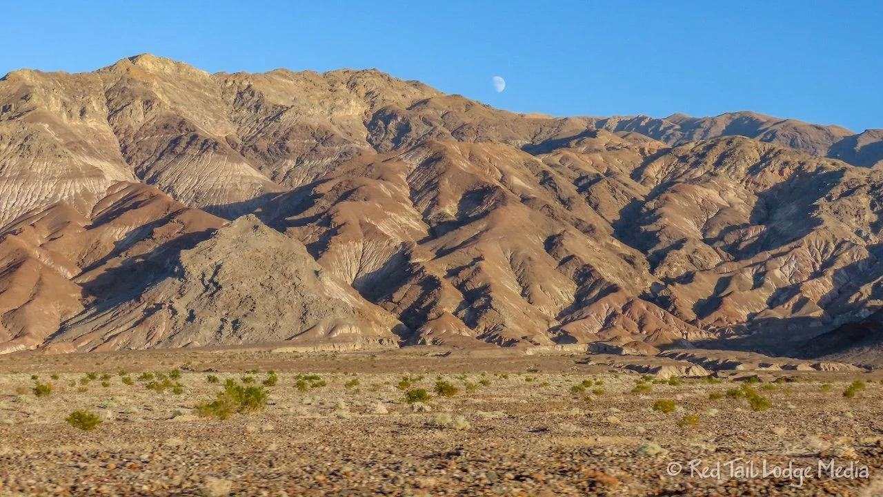
The drive along route 190 dips down onto the valley floor twice. We watched the temperature rise and fall as the elevation fell and rose. The temperatures were in the 80’s at the higher elevations and rose into the 100’s at the lower elevations on the valley floor. The highest temp we saw was 113 degrees. The only other stop we made was at Stovepipe Wells for gas. Stovepipe Wells is one of the four lodging locations within the park. It is about 30 minutes from Furnace Creek.

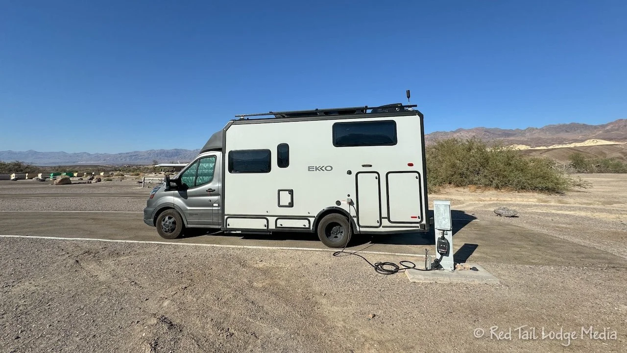
It was a little past 4 pm by the time we arrived at the Furnace Creek. When we pulled in, it was 110 degrees. Furnace Creek sits at 190 feet below sea level. No one else was in the campground, but as we were picking out our electric site, we saw that there was one site already taken, they were just out for the day. Most of the full hookup sites were pretty level. We pulled into one, plugged in and started running the AC. By the time we went to bed, two more RV’s showed up and, believe it or not, one tent camper.
After paying for our site back at the kiosk, we walked over to the visitor center at the far end of the campground. We managed to arrive before they closed at 5 pm. The park ranger at the desk was very helpful with information on what we should see and do during our three full days in the park. More importantly, he let us know what time of day to visit the different areas. He confirmed what we had observed on our drive in. Visit the areas at the lower elevations early in the morning, before the temperatures get above 100 degrees, then move up to the higher elevations in the afternoon. The ranger recommended starting the two hikes he mentioned for us right at sunrise.
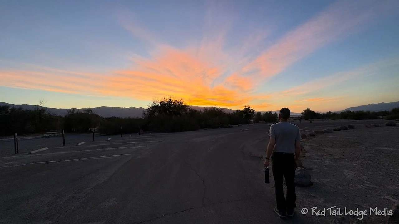
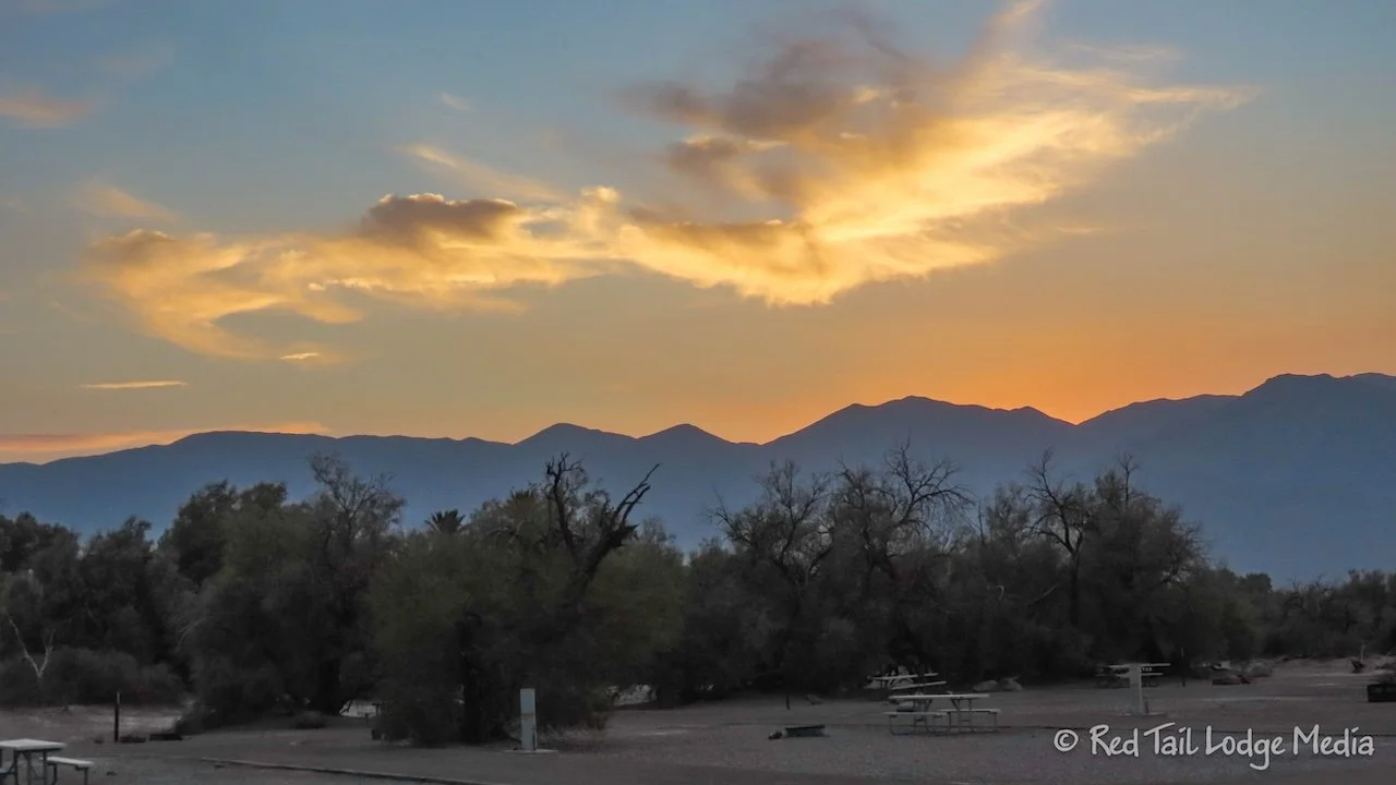
After sunset, we strolled the campground loops. It was still in the 90’s, but it felt tolerable without the sun shining on us. Even so, we took water bottles with us to make sure we stayed hydrated. For once, Ann did not feel compelled to close her rings that day. She was short of her exercise goal by 21 minutes and short of her move goal by 172 calories. Staying alive and preventing heat exhaustion seemed more important.

The ranger had told us that even though the humidity levels are low in Death Valley, it does not cool off at night like most deserts, due to its unique surrounding geography. The high mountains on the sides of the valley along with the heavy clay soils causes the hot air to keep circulating around in the valley, like a big clay convection oven.

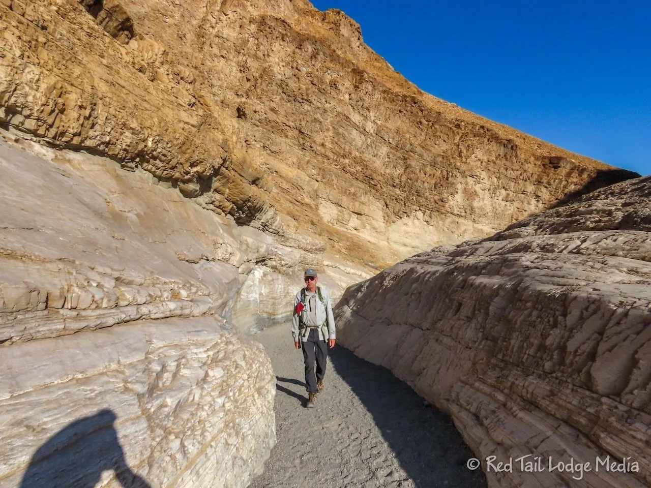
Thursday we got up early to go on a hike. The Golden Canyon Trailhead was only an eight minute drive from the campground. Our alarm was set for 6 am. After breakfast and paying for another night for our campsite at the kiosk, we arrived at the trailhead before 7 am. There were a few vehicles there, but we had plenty of empty spots to choose from.
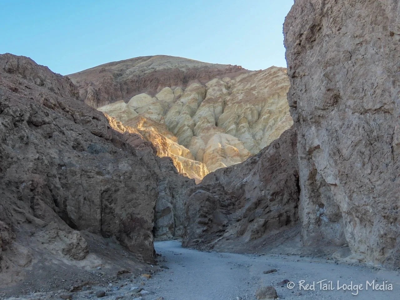
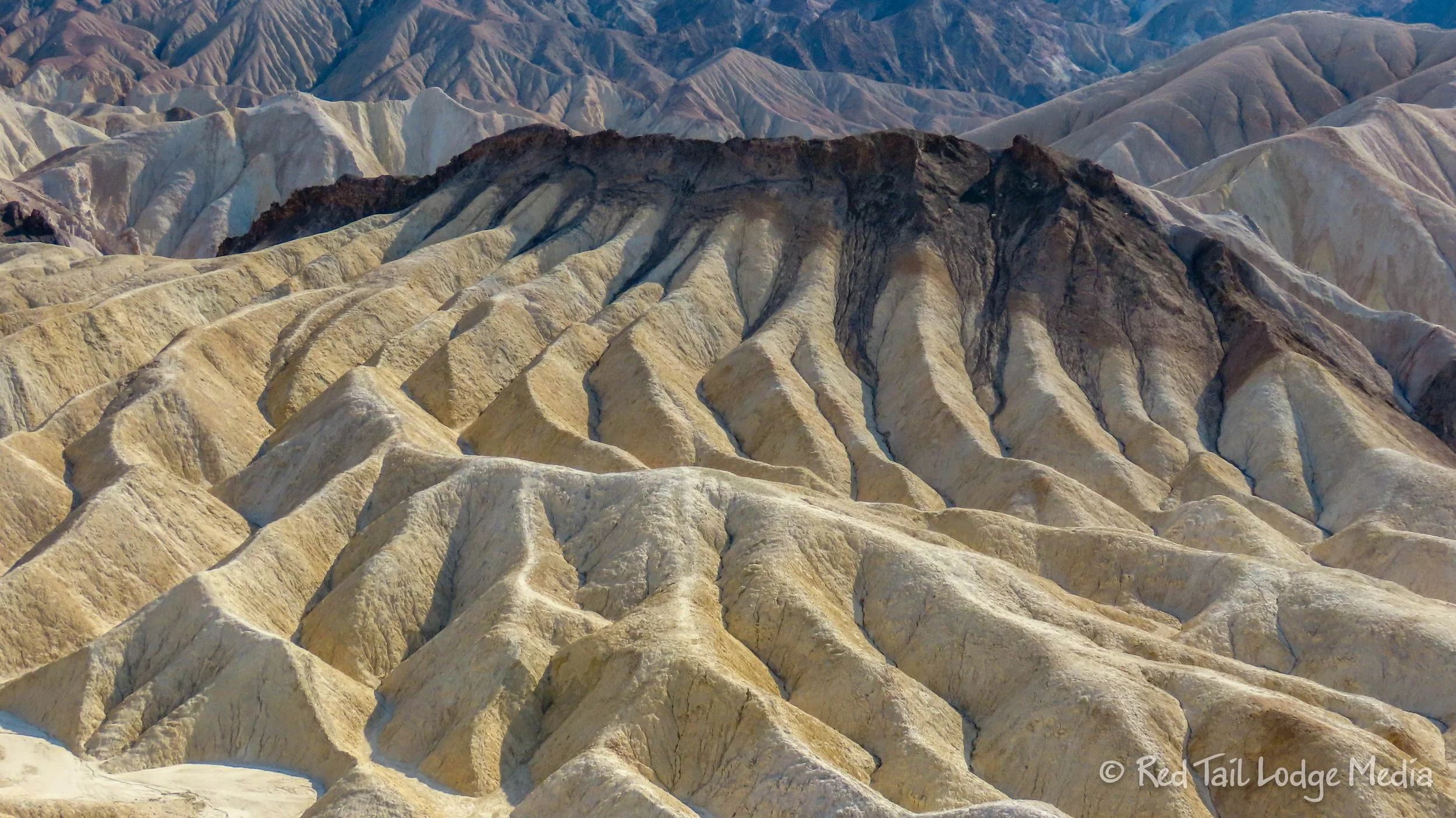
When we started the hike, the temperatures hadn’t crossed into the 80’s yet, but we knew that would quickly change. The hike, which the ranger recommended, was the Golden Canyon to Red Cathedral Trail. The trail follows along the bottom of a narrow canyon. Several smaller side canyons branch off. There is another trail that branches off that makes a longer loop. It also connects to a trail that leads up to Zabriskie Point.
After the trail split, the Red Cathedral Trail got a little narrower. There were a couple of places where you had to squeeze through with a little scrambling, but nothing too bad. At the end, the trail rises up with a stunning view out across the valley. The last little bit was steep with loose gravel, so it was a little slow going to get back down. We managed without slipping, but we took it slowly.

We were mostly in shade on the way up the canyon, but on our way back down out of the canyon, the sun was high enough to start lighting up the canyon walls. The rocky hillsides are much prettier when their varying colors are saturated with sunlight.
By the time we emerged from the canyon, we had gone 3.3 miles with an elevation gain of 591 feet in one hour and 48 minutes. It was our 61st hike for the year. As we were leaving the trailhead, we noticed that the temps were well into the 90’s.
There were three more things we wanted to see that morning. We headed straight for the lowest elevation before it got too hot.
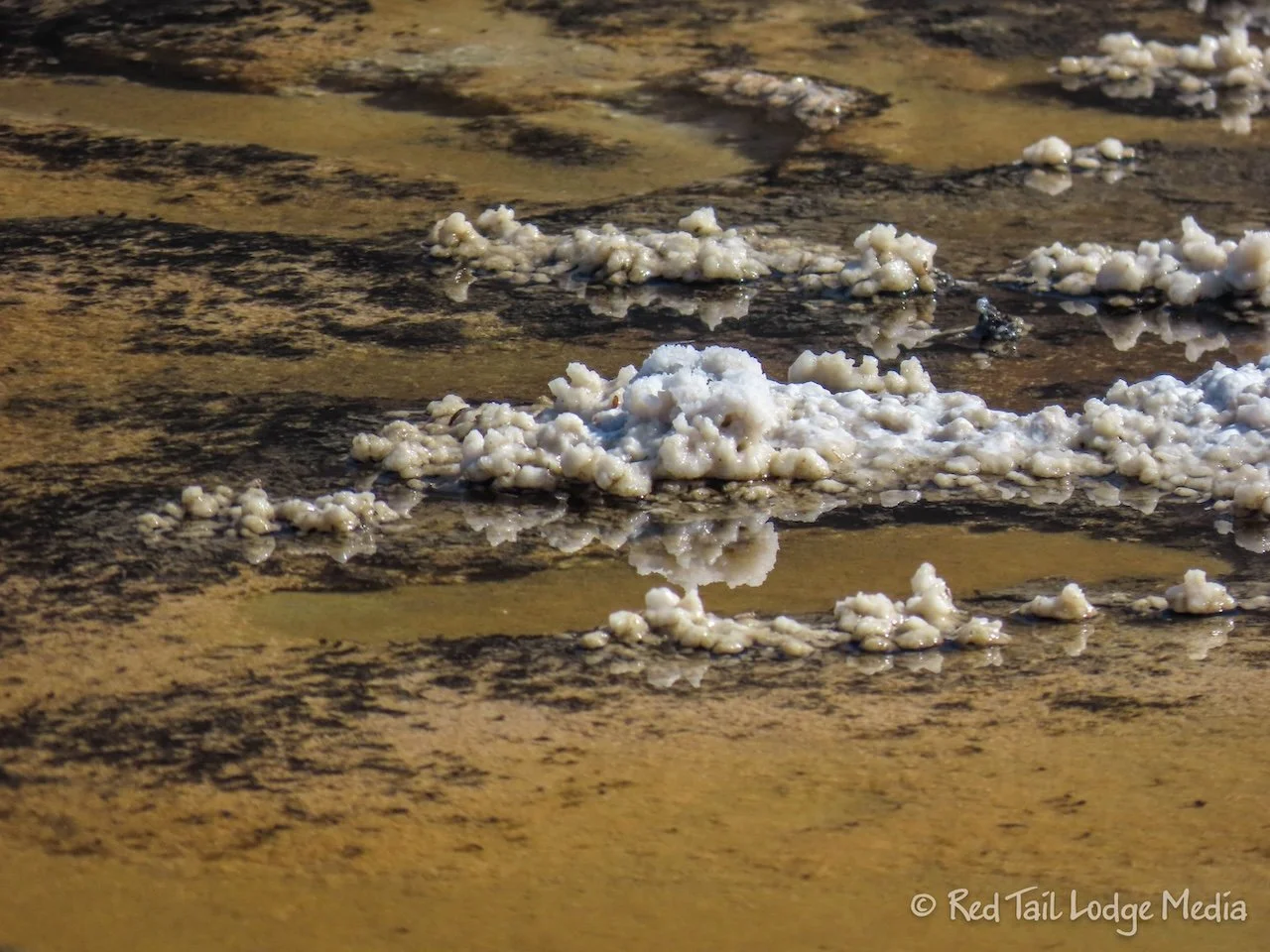
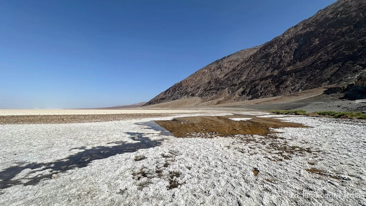
Badwater Basin sits at 282 feet below sea level. It is the lowest elevation in North America. A small pond of water from a spring sits right next to the parking lot. The water is what gave the basin its name. A surveyor in the area could not get his mule to drink from this pool so he wrote bad water on his map and the name stuck. The water is not poisonous, just very salty. There are creatures that live in the pond, such as the rare Badwater Snail.

The other attraction besides the “bad water” is the salt flats. You can walk out onto the salt flats here. Even though the temps hadn’t broken into the 100’s yet, we didn’t walk out onto the salt flats very far. The salt seemed to cling to the soles of our shoes, so we tried to stomp them clean before getting back into Red Tail (our Winnebago EKKO).

While we were at Badwater Basin, there was a couple from Minnesota who were having troubles with their rental car. When we arrived, we tried jumping their car with our NOCO Boost (paid link), but it still wouldn’t start. The couple continued to ask around for people with jumper cables. As most of the people there had rental cars, no one had cables. After we finished checking out the salt flats, we checked back with the couple. Another couple was giving it a try with their battery booster. After several attempts, the car finally started. Yay! We wish the Minnesota couple the best and hope they didn’t have any more issues with their rental.

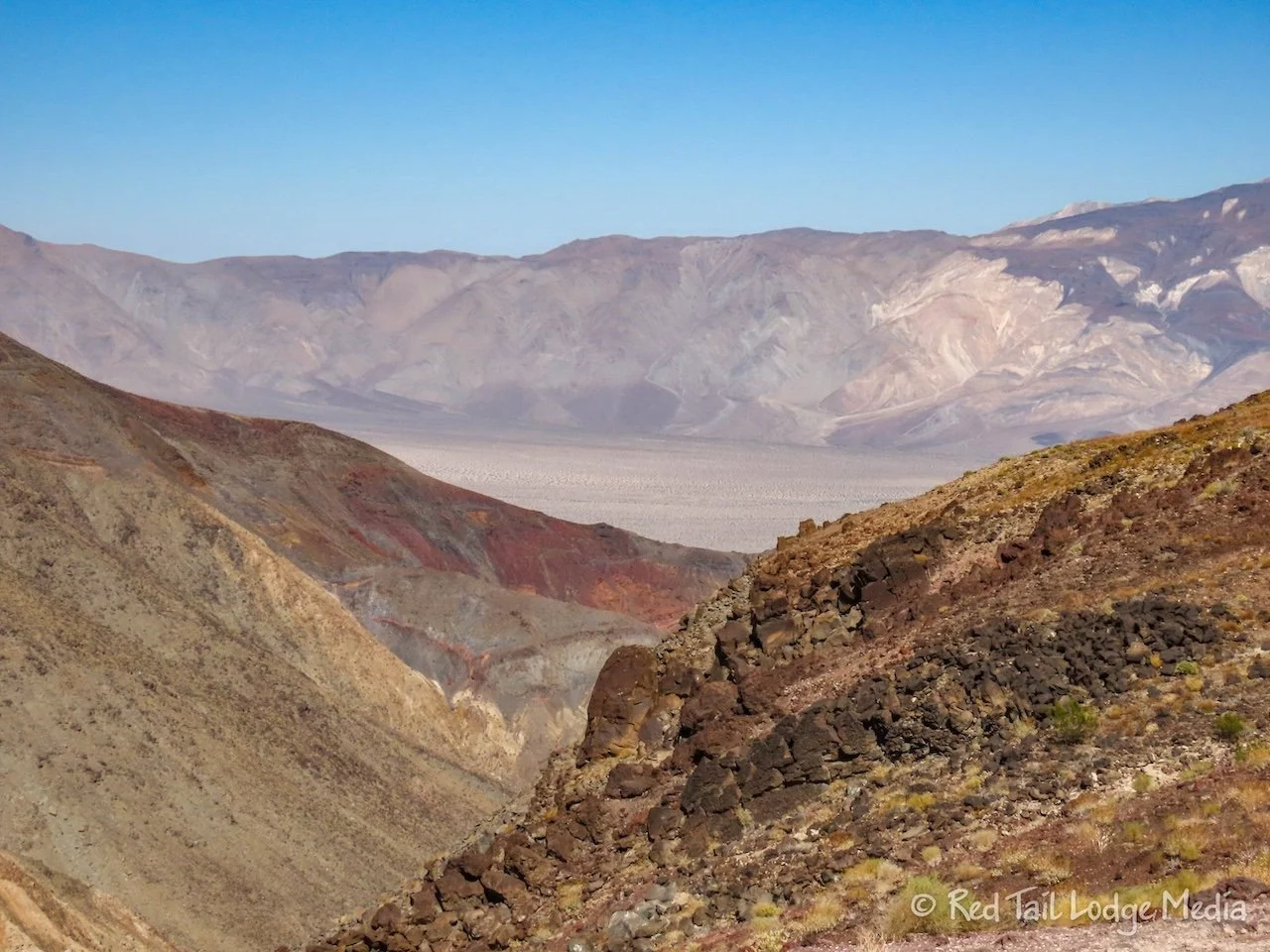
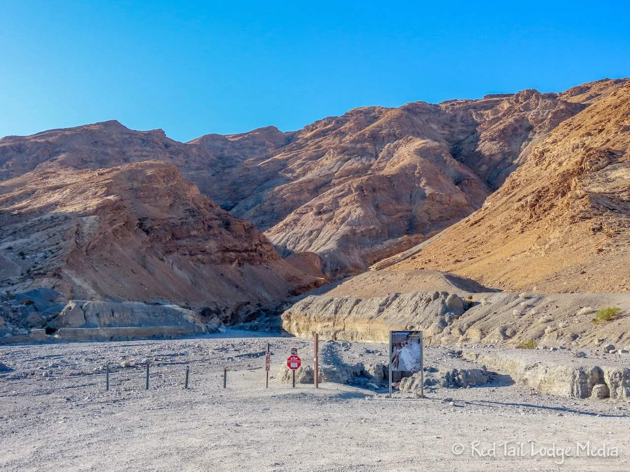
Our next stop was the Devil’s Golf Course. It is down a short, gravel spur road off of Badwater Road. The attraction is out in the salt flats, where the salt is eroded into jagged spires. The sign there said that the salt crystals make tiny pops and pings as the crystals burst apart due to the expansion and contraction caused by the heat. However, we didn’t hear anything.

Our final stop was at Artists Palette, along Artists Drive. Artists Palette is a viewpoint about half way along the five mile scenic drive. The drive is among the colorful rocks. At the viewpoint, you can wander among some of the most vivid colors.
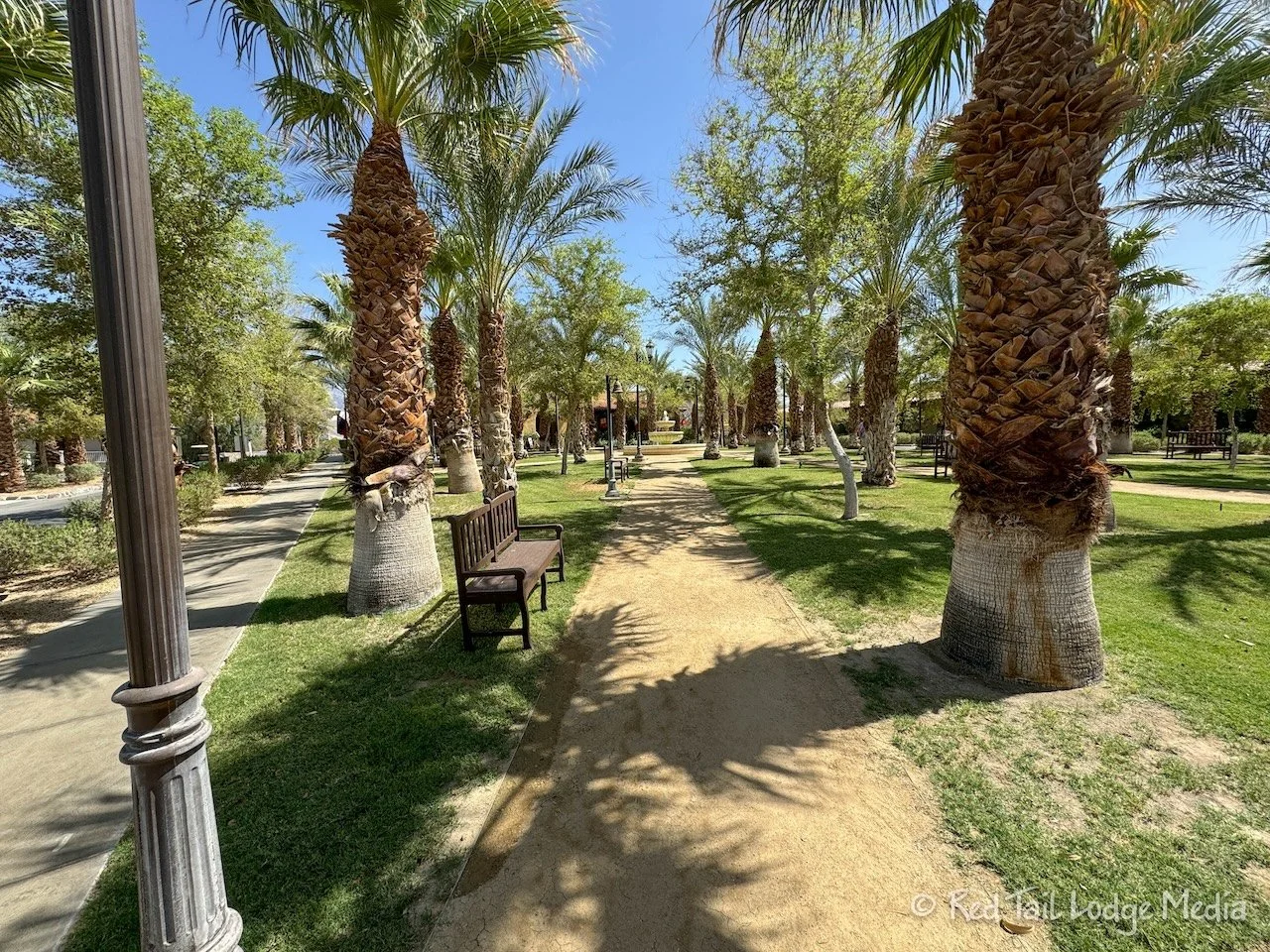
It was getting close to lunch time so we headed back to Furnace Creek. We were hoping to find a little cafe in the Ranch at Furnace Creek. The Ranch is a resort in the middle of an oasis. Lodge cabins are nestled among the palm trees. There is a general store and gift shop, an ice cream parlor, and a couple of restaurants. The Borax Museum is also located there.

We saw a little cafe but then noticed that it was only for employees. The Ranch 1849 restaurant was a buffet. We were looking for something a little lighter. The Last Kind Words Saloon was where we were planning on having dinner that evening and they didn’t open until 6 pm. So we just went to the Ice Cream Parlor for ice cream and house-made sodas. The Ice Cream Parlor was very cute. It was decorated lovely like an old fashioned ice cream parlor. Then we headed back to the campground to prepare lunch for ourselves. We had leftover chicken salad which was perfect.

We hung out at the campground, inside Red Tail with our air conditioner running. Since it was about 110 degrees outside, we could only get the temperature inside down to the low 90’s. But it was comfortable enough.
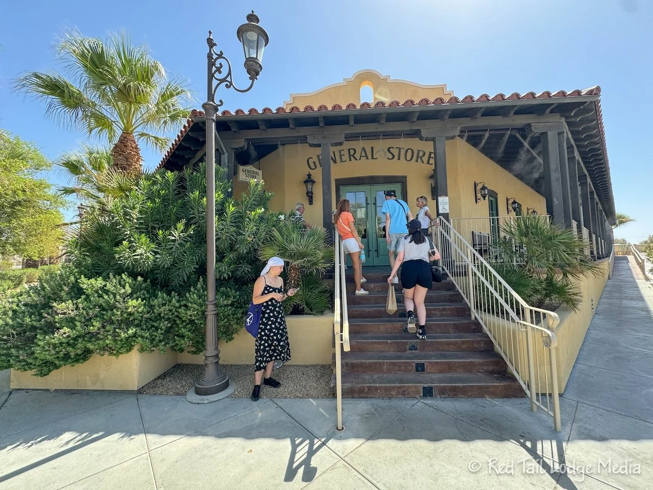
Around 5 pm, we drove back over to the Ranch for dinner. We knew the Saloon didn’t open for dinner until 6 pm, but we thought they opened at 4 pm for drinks. However, when we tried to walk in, they told us to come back at 6 pm. So instead, we bought a couple of cold Cokes from the General Store and sat in the rocking chairs outside. Did we say outside? Yup! The rocking chairs were alongside the building, in the shade, with misters drifting down on them. Believe it or not, the power of evaporative cooling made us feel very comfortable in the blistering heat, even more comfortable than back in Red Tail with the AC running.

The Saloon had a wonderful atmosphere just like the Ice Cream Parlor. The decor was very interesting, making us feel very welcomed. Dinner was delicious. Ann splurged and had the 6 oz filet while Keith had the ribs. For dessert, we split a prickly pear mousse. It was more food than we needed to eat, but we managed to eat most of it. We left with smiles on our faces.

Friday was another early morning to go on another short hike. This time the trailhead was half an hour away. Along the way, we stopped at the Mesquite Flat Sand Dunes to snap a few pictures in the morning light.
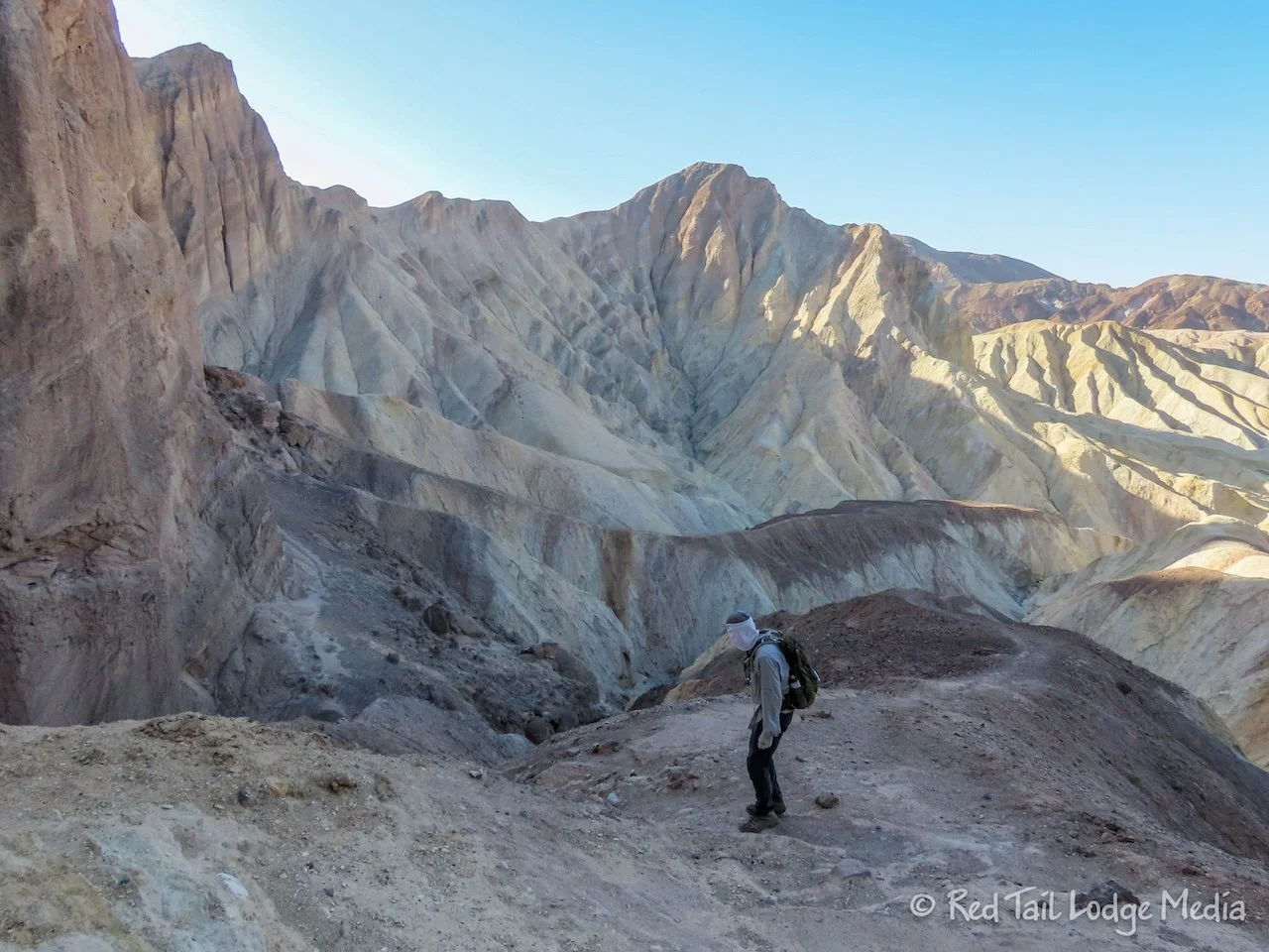
The Mosaic Canyon Trailhead was two miles up a gravel road heading south from Stovepipe Wells. We got a little later start than we did the day before, but we still managed to finish the hike before the temps got too hot.
We heard there was a little scrambling during part of the hike, so we didn’t bring our trekking poles. Mosaic Canyon was more of a slot canyon than Golden Canyon. There were sections where the rock was worn smooth by the flash floods that pass through the canyon. However, there were other sections where the canyon opened up pretty wide. There was one rock scramble that was a little difficult for us, but we managed. There is a detour up and around the first impassable spot in the canyon, which was well marked with arrows formed out of rocks leading the way.

The second impassable spot is the end of the trail. We sat down and enjoyed a snack before starting back. The way back was much easier, as the scrambles up some of the ledges were now downhill. Ann even slid down some of them, since they were smooth. They made perfect slides and made Ann feel like a kid.

We returned to the trailhead after covering 3.9 miles with an elevation gain of 1083 feet in two hours and twenty minutes. It was hike number 62 for the year. We also counted it as hike number 45 of our 52 Hike Challenge National Park Series.

From Mosaic Canyon, we drove up to the Wildrose Charcoal Kilns. The drive took about an hour. It was a beautiful drive that headed up into the mountains. We saw a lot of scat on the road. It looked like it was from some type of herd animal, big horn sheep perhaps? Then we came upon the animals, wild burros. They are escaped or abandoned animals from the Gold Rush period.

After passing through a CCC camp, the road eventually turns to gravel for the last two miles. It was a little bumpy, but nothing our rig could not handle.

The Wildrose Charcoal Kilns were built in 1877, they were used to make charcoal from the surrounding piñon pine trees. The charcoal was then used for the Modock Mine smelter about 20 miles away. The kilns were only used for three years.
The kilns are located at 6800 feet of elevation, which meant it was much cooler than the valley floor. So, instead of being 110 degrees, it was in the high 70’s. We decided to hang out there in the cooler temperatures before heading back. Keith took a nap. Ann edited photos. Then we made gazpacho soup for dinner and did the dishes before starting our one and a half hour drive back to the campground.

Along the way, we spotted some birds alongside the road. At first we thought they were quail. Ann snapped some pictures of them. They were birds we had never seen before. A little research revealed they were Chukar partridges. How cool!

We stopped in Stovepipe Wells to top off our gas. There is also a gas station in Furnace Creek, but, for some reason, the price of gas in Furnace Creek was more than a dollar more per gallon than Stovepipe Wells. You would think that all the gas stations inside the park would be about the same price, but they don’t seem to be.

We got back to camp after sunset, so even though it was still hot, it felt better without the sun. We quickly connected to the electrical hookup and cooled down Red Tail for the night.
We were getting tired of getting up so early every day, so we decided to start Saturday a little later. Our final hike in the park was an hour’s drive away, but it was shorter and at 2000 feet of elevation. So we got up at 7 am and were on the trail by 9:30 am.
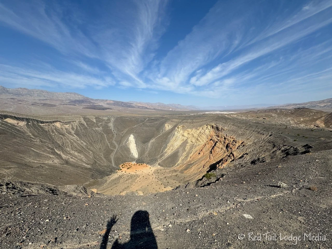
The hike was called Ubehebe and Little Hebe Crater Trail in AllTrails. The route circled the rim of a volcanic crater called Ubehebe. From the trail, you can also see Little Hebe, a smaller crater next to Ubehebe. The two craters are both explosion craters. Rising magma turns ground water into steam until there is enough pressure to cause an explosion. Ubehebe is the largest explosion crater in the area. It is half a mile in diameter and 500 feet deep.

Walking around the rim gives you a sense of the scale of the crater. You are also sitting relatively high compared to the surrounding landscape, so there are good views out away from the crater as well. If you want to shorten the hike by half, you can take a trail from the parking lot over to Little Hebe via part of the rim of Ubehebe. We didn’t go over to the rim of Little Hebe, as we felt we got a good view of it from the rim hike of Ubehebe. Our hike was 1.8 miles with an elevation gain of 374 feet which took us just over an hour to complete. It was our 62nd hike for the year.

On the way back, we stopped halfway at Stovepipe Wells for gas and lunch. The Saloon at Stovepipe Wells has simple sandwiches, pizza, and hot dogs. But more importantly, it has air conditioning which is what made it sound appealing to us.

Our original plan was to drive down to Dantes View and hang out there during the heat of the day. It would be cooler there, since it sits at 5000 feet of elevation. However, Dantes View is an hour’s drive from Furnace Creek, in the opposite direction. That would have meant a total of four hours of driving for the day. That’s as much as we like to drive on a travel day. We were getting tired of all of the driving and we had a long travel day the following day, so we decided to skip Dantes View.

Instead, we checked out the Harmony Borax Works, which is just north of Furnace Creek, and the Borax Museum in Furnace Creek. Death Valley is home to several types of mining, including gold, lead, and copper. But one of the most profitable mining operations in the area was borax. The borax was scraped off the salt flats, then refined to separate the mineral from the mud and salts. The borax was then loaded up onto 20-mule team wagons to haul the 24 tons of borax the 165 miles to the railroad station in Mojave, taking ten days. Harmony Borax Works is the ruins of a borax refinery.

The Borax Museum is an outdoor collection of artifacts, including all kinds of machinery along with a train engine.

In between the Harmony Borax Works and the museum, we cooled off inside the Ice Cream Parlor and enjoyed more ice cream and housemade sodas. While we were there, Ann got a phone call from Stovepipe Wells. Apparently, she left her purse at the Saloon. So after the museum, we drove back out to Stovepipe Wells to retrieve it. That was another hour of driving, making our total driving hours for the day over three hours. So much for trying to reduce our driving time!
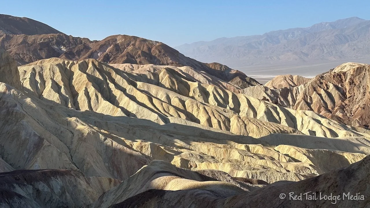
On the way back, we drove up to Zabriskie Point to take in the view. We were hoping it would be cooler up there, but it wasn’t that much different than in Furnace Creek. So we headed back to camp for dinner. While we were at Zabriskie Point, we turned on the house air conditioner. It seems like our solar and alternator charging could keep up with the draw of the AC and then some while we were driving down the road. It was so nice to arrive at camp without having to wait for the RV to cool down as it was already a comfortable temperature inside.
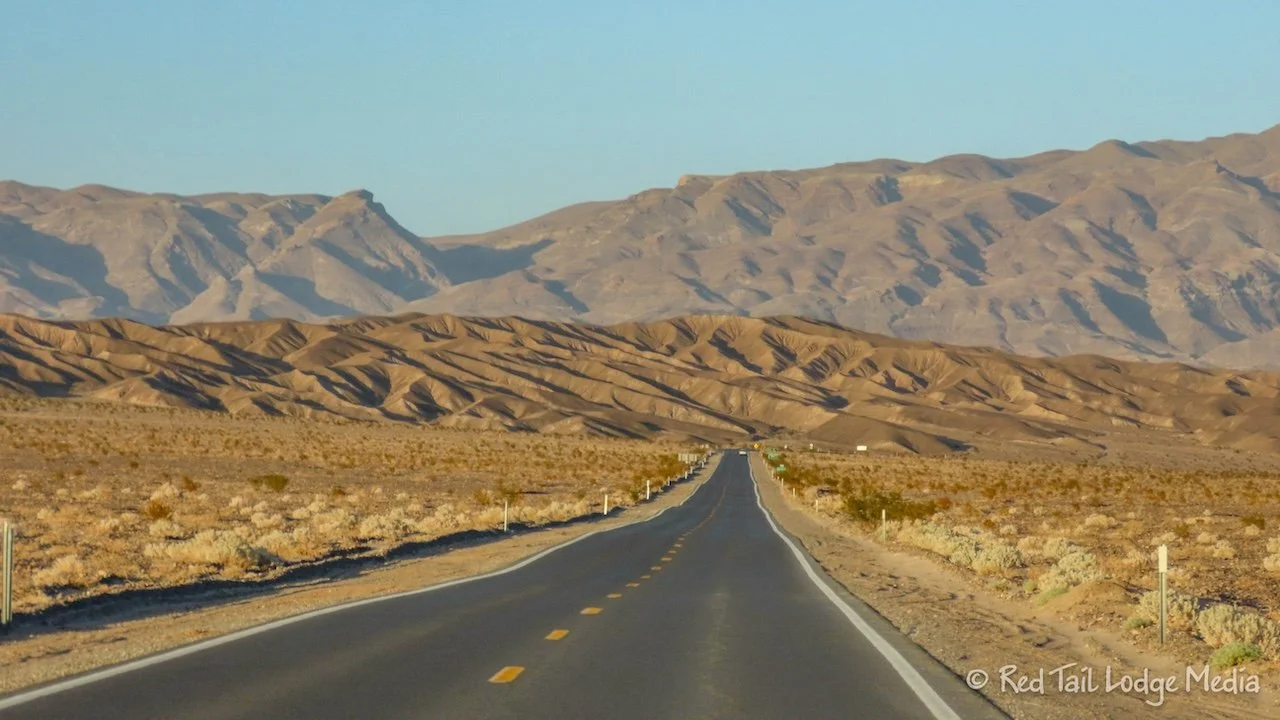
Death Valley is the largest national park in the lower 48 states, so it requires a lot of driving to see most of it. Furnace Creek is centrally located so you can span out from there. Keep in mind that many of the attractions are an hour to an hour and a half away. Badwater Basin, Ubehebe, Scotty’s Castle, and Dantes View are an hour away. Wildrose Charcoal Kilns are an hour and a half away. We skipped Dantes View and Scotty’s Castle. Scotty’s Castle has not reopened since the flash flood in 2015 that caused extensive damage. They are hoping to reopen it in the fall of 2025.
After dinner, we took showers. There was no need to turn on the propane nor the water heater, as the water in our fresh water tank was already a comfortable warm temperature. Taking a shower was so refreshing.
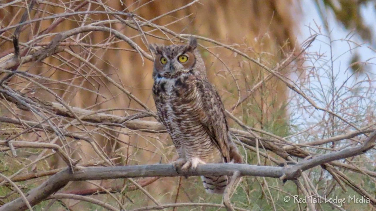
While Keith took his shower, Ann walked the campground loops with her camera. During our stroll of the campground the first evening we were here, we saw a couple of owls. For some reason, Ann didn’t have her camera with her that first evening and the owls were too far away to get a good shot with our phones. So she was hoping to find the owls again. Success! Only one tree over from where we saw the owls the first time was one of the owls. This time she got some good pictures of it. She believes it was a great horned owl, although a long-eared owl looks very similar.
Death Valley surprised us. Its terrain and wildlife is a lot more varied than we expected. We thoroughly enjoyed the beauty of the different landscapes and learning about the history of the area.
Check out our related video: Death Valley National Park, California
(Ann)