
Wheeler Geologic Area, Colorado - August 19th to 23rd, 2023

We are not big backpackers. It’s not the backpacking itself that we enjoy, it is visiting places that we could not easily get to any other way. Wheeler Geologic Area is one of those places. From 1908 to 1950, it was Wheeler National Monument, the first national monument in Colorado. But due to its remote location, it was downgraded from a national monument to Wheeler Geologic Area of the Rio Grande National Forest.

Saturday we drove from Cimarron Canyon State Park in New Mexico to Hanson’s Mill Campground in Colorado. It was a day earlier than our original plan, to give us more time to acclimate to the elevation before starting our backpacking trip. It was a longer drive for us, over four hours, but we broke it up.

First we stopped in Eagle Nest at a convenience store to pick up some needed items for our backpacking trip. We needed spare batteries for our headlamps and ziplock bags to store our garbage. Eagle Nest is not far from Cimarron Canyon, in a high valley with a beautiful lake.

Most of the drive was gorgeous scenery. Our route followed the Rio Grande River off and on. We went through the cute, albeit touristy, town of Red River in New Mexico. In Colorado, we stopped for a bathroom break at the gas station in San Luis. The town boasts that it is the oldest town in Colorado. The charming gas station was built in 1926. Of course we noticed that they served hand dipped ice cream. I can’t believe I’m saying this, but we felt it was too early in the day for ice cream, so we passed it up and only picked up a couple of Cokes. The Stations of the Cross Shrine, up on top of a hill, can be seen from a distance as you approach the town.

We were in familiar territory by then. After turning onto US 160 heading west, we passed by the turn off for Great Sand Dunes National Park (Great Sand Dunes National Park - July 16th to 19th, 2020), then by the Base Camp campground we stayed at while visiting the wildlife refuges for the sandhill cranes (Alamosa, Colorado - October 10th to 13th, 2020).

In Alamosa, we stopped at the Visitor Center to have a picnic lunch. Usually visitor centers have bathrooms and enough parking for RV’s. After lunch, we stopped by the Tractor Supply to top off our propane tank. They are usually reasonably priced and charge by the pound, not by the tank. We still had one full tank, but the other one was down under 20%. We hadn’t filled up propane since we were at Mammoth Cave, about two months prior (Mammoth Cave National Park, Kentucky - June 16th to 19th, 2023). We didn’t go through much propane after we stopped running the furnace. We also didn’t cook much during the really hot weeks. At other times, we cooked with the induction cook top (paid link) and Instant Pot (paid link) since we usually had electrical hookups during the summer. But we’ve started using our furnace again and there are more campgrounds with no hookups, so we thought it was wise to make sure we had plenty of propane.

Before heading up to Hanson’s Mill Campground, we continued up US 149, the Silver Thread Scenic Byway, to Creede, to the Forest Service Ranger Office. Hanson’s Mill Campground is disperse camping in the Rio Grande National Forest. Since it was a Saturday, we wanted to know what our options were if Hanson’s Mill was full. We also got the scoop on the 4WD road that leads from Hanson’s Mill to the Wheeler Geologic Area. The 4WD road is normally a pretty rough road, but it is washed out, so they have closed it for repairs. The only way into the Wheeler Geologic Area currently was by foot or on horse, via the East Bellows Creek Trail, the one we were planning to hike.

We tried to dump and fill our tanks in Creede. The dump station listed in AllStays was currently closed until further notice. Ann called the Creede Chamber of Commerce and they told her the closest RV dump was back in South Fork, about 20 miles back the way we came in. So back to South Fork we went. We didn’t mind too much traveling that same stretch of road three times, because the scenery was gorgeous.

The RV dump was at the Rainbow Groceries store. It was free, but the fresh water was closer to the dump than we would have liked. The hose for rinsing at the dump was connected to the main hose via a Y connection, which was a short distance from the actual dump. We sprayed the Y connection with a vinegar solution and added chlorine to the water as we filled our tanks. When we were done filling, we sprayed all our fresh water hoses and connections with the vinegar. We tried our best to be as sanitary as possible. Not the ideal situation, but better than not having water.

We bought a few items at the grocery store to show our appreciation of providing a free RV dump. The little store was actually pretty impressive. It had a nice selection of quite a variety of food, a lot of what we normally buy. There was also plenty to pick from if you need to stock up for a backpacking trip, from Knorr and Idahoan packets to hot chocolate, and oatmeal packets to granola bars. In addition, we filled up our gas tank at the associated Rainbow Express.

Then we drove back up the highway towards Creede again, for about 14 miles before turning off on Pool Table Road to reach Hanson’s Mill Campground. Pool Table Road is a dirt, forest service road, but it is in good shape, so 4WD and high clearance is not needed. However, it is steep, winding, and a little bit of a washboard, so we wouldn’t recommend taking a large rig up the road. The speed limit is only 25 mph, but we only felt comfortable going somewhere between 20 and 25 mph.
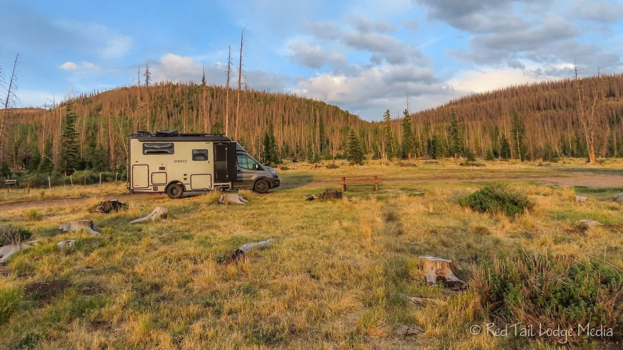
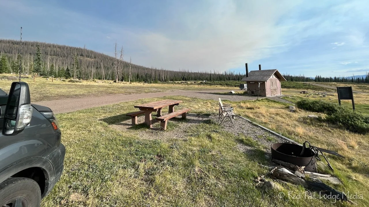
The road goes about ten miles before reaching the campground area. It is not much of a campground. The road makes a loop at the end, with a vault toilet in the middle. There are two picnic tables and one fire grate. It took a while to figure out a spot to set up which was close to level, with the help of our GoTreads. But the area is a wide open field with fantastic views of the surrounding mountain peaks. Dried up cow patties decorated the area, but luckily none of them were fresh. However, they were probably the cause of the dense population of flies and bees. We would hear them buzzing all around us, but they seemed to leave us alone.

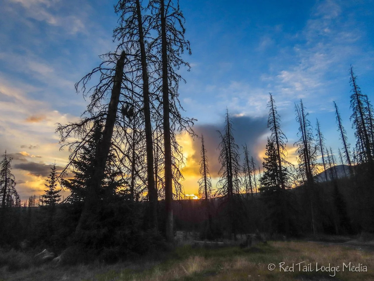
Sunday, we went on a short hike to get some exercise and to test that our bodies were handling the elevation. We also wanted to check out the creek crossing to see what it was like. So we hiked East Bellows Creek Trail to the creek crossing, a little over two miles down the trail. It was half the mileage, half the elevation gain and half the pack weight that we would be doing the following day. The creek crossing didn’t look too bad. There were rocks to help you cross, but we may slip or lose our balance and get our feet wet. The water looked like it was only about ankle deep.
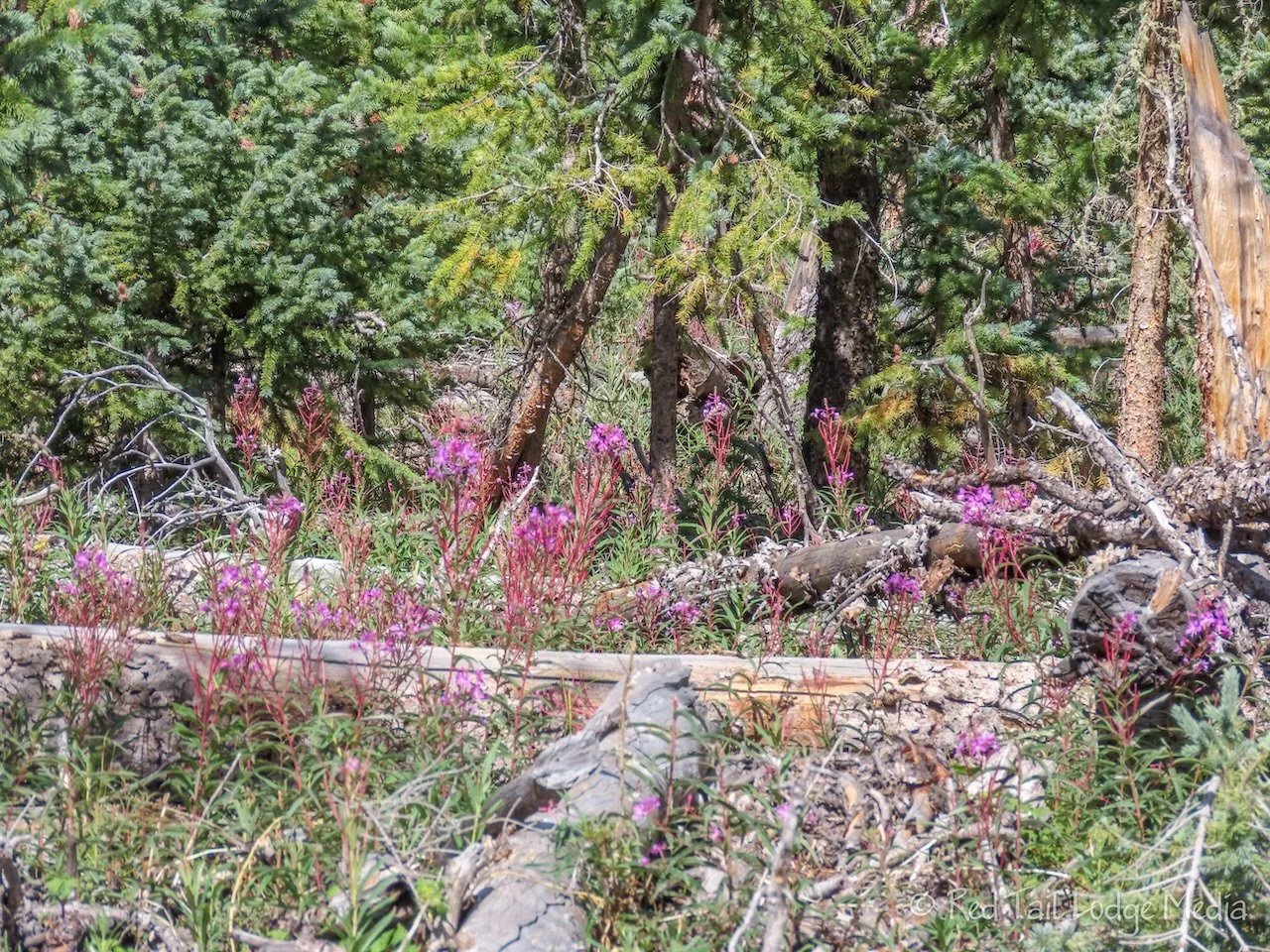
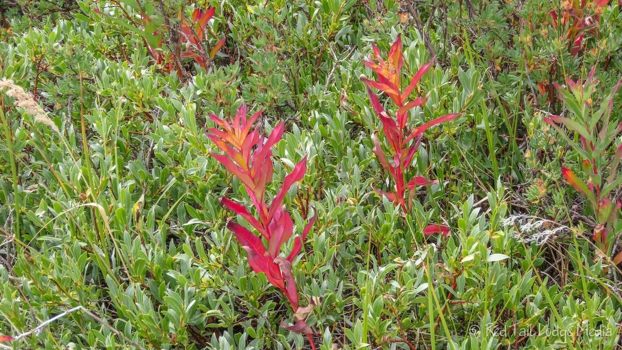
The trail up to that point was pretty. There were a variety of wildflowers along the trail, even though it looked like autumn was starting to creep in at that elevation. One flower looked like fireweed, the plant we saw so often the previous season in Canada and Alaska. (Fairbanks, Alaska - August 15th to 19th, 2022).
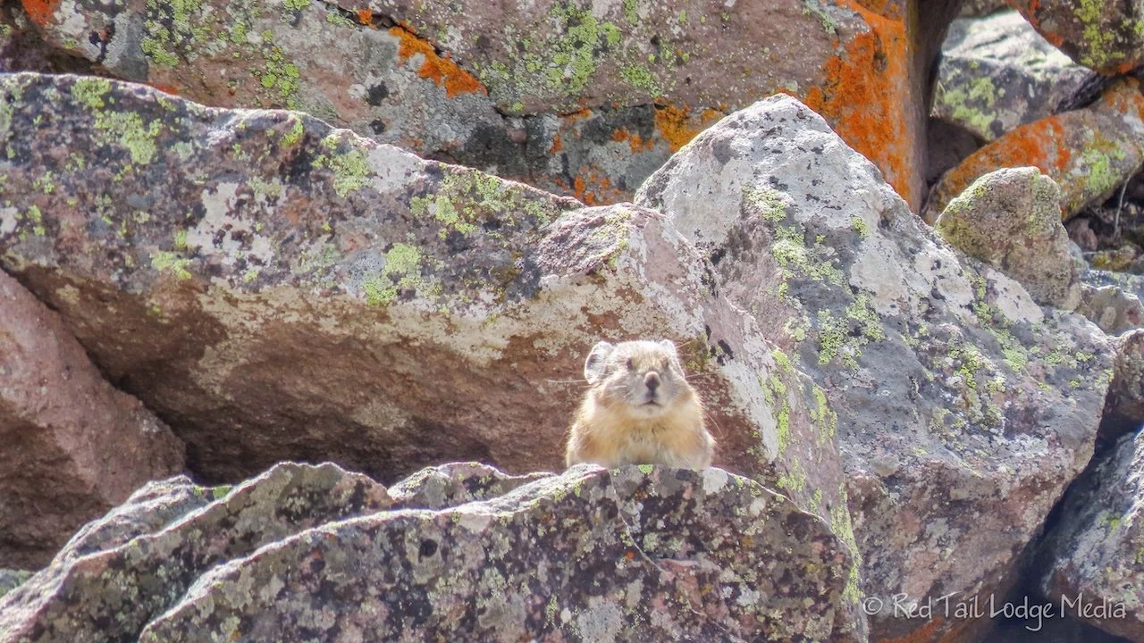
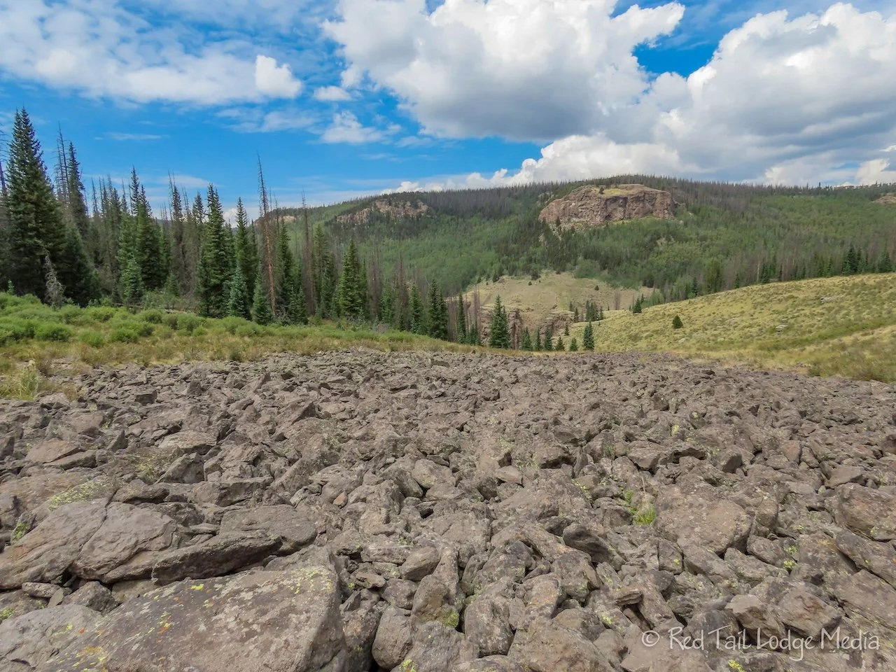
The creek cut through a steep, rocky canyon. The trail crossed through a few boulder fields before making its way down to the creek. Boulder fields are prime habitat for pika and marmot. We heard some pika at a couple of the boulder fields, but only spotted them once. We didn’t see any marmot, but we were looking for them.
By the time we returned to the campground, we had gone 4.7 miles with an elevation gain of 699 feet in about two hours and 48 minutes. It was number 43 of our 52 Hike Challenge for 2023.

The rest of the afternoon, we finished prepping our backpacks for the next day. After our hike, Keith was feeling pretty confident about the backpacking trip. However, after he finished loading his pack and felt how heavy it was, his confidence faded. Ann, having been a competitive athlete as a kid, was more confident, but perhaps overly so. She was used to pushing her body to its limits. She reassured Keith that we had all day to hike the seven miles to our tent site. We can take our time, taking as many breaks as needed. However, Ann was more concerned about staying warm. We heard from a couple who was hiking out after spending two nights out on the trail. They said they had frost on their items in the mornings. That meant that the temperatures were dropping below freezing overnight. Ann’s toes are sensitive to the cold, but she packed plenty of socks and foot warmers that should keep her from getting frostbite.
While we were making dinner, Keith noticed a plume of smoke to the south of us. We could smell the smoke in the air. Uh, oh! Is there a wildfire nearby? Keith went over to a neighboring camper, Chess from Santa Fe, to see what he thought. Keith managed to get enough of a cell signal from our weBoost (paid link) that he was able to bring up some info on the Inciweb. The Quartz Ridge Fire was burning about 50 miles south of us, about 1500 acres. We kept an eye on the smoke while we ate our dinner. Chess came over and we studied the maps and what information we could find about the fire. Before the sun set, the smoke plume seemed to be breaking up. Hopefully the smoke will stay away so we don’t have an issue as we breathe heavily during our hike the next day. We felt safe enough to sleep comfortably that night. We’ll see what the smoke looks like in the morning.

When we woke up Monday morning, the smoke was gone to our relief. Keith had his morning coffee and Ann had her usual breakfast. As we were about to hit the trail, Keith noticed the tip of his trekking pole had come off. Since we were still at Red Tail (our Winnebago EKKO), he quickly pulled out the superglue and fixed it. Then we were on our way.

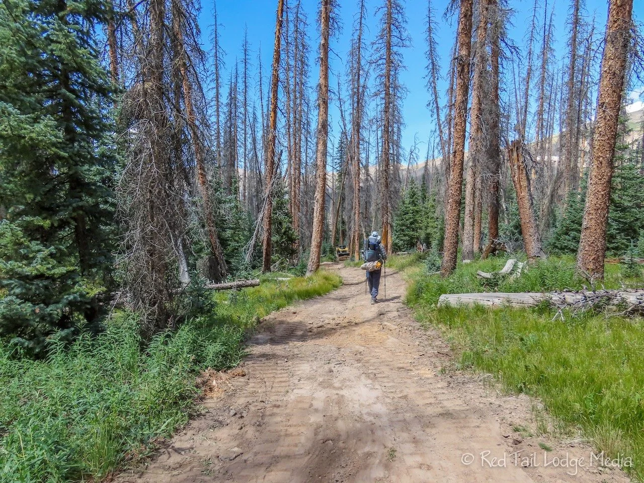
We were on the trail just a little past 9 am. A person on horseback and a solo day hiker started the trail just before us.
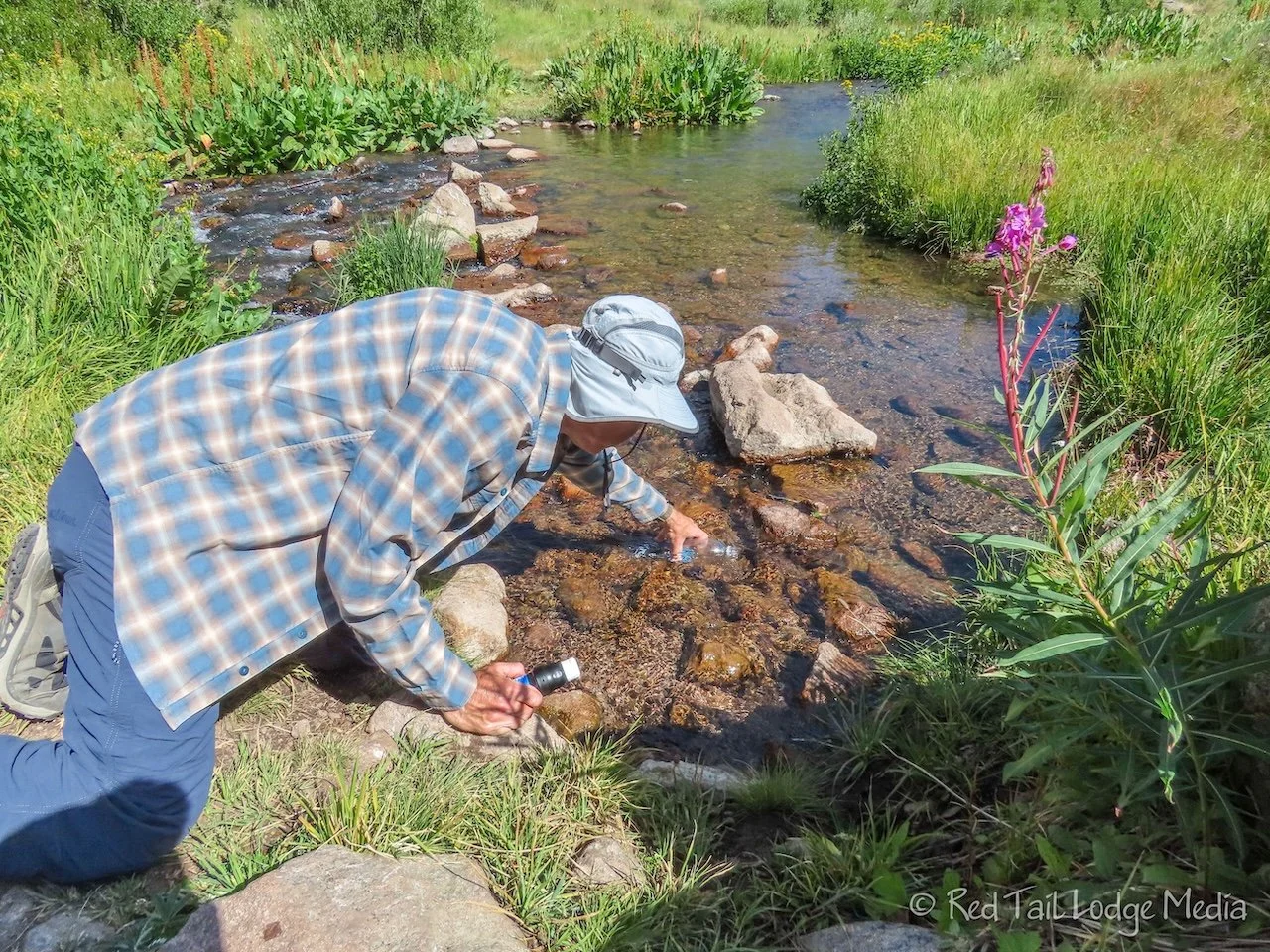
When we reached the creek, we stopped for a snack and to refill our water. We heard the next place to get water is just inside Wheeler Geologic Area, about six miles from the creek. We started with two liters of water and made sure we had two liters again before leaving the creek.

We each had water filters with us, the Sawyer Squeeze (paid link). We had used the Sawyer Micro-squeeze (paid link) when we backpacked during Season One: Crisscrossing the Country. Keith preferred to fill a Smart Water bottle with the unfiltered water and attach the filter directly to it. Then he would either squeeze the filtered water into another bottle or drink directly from the filter. Ann preferred to fill the bag that came with the filter with the unfiltered water, then squeeze it through the filter into her water bottles. At least that is what she did during Season One. The bag that came with the Squeeze seemed smaller (16 oz instead of 32 oz) and didn’t want to expand much. When she tried filling it in the creek, she could only get about 250 ml of water in it at a time. That was a little too painful, so she switched to filling her bottles by squeezing water from Keith’s Smart Water bottle. (We now see that the Squeeze comes with two 32 oz bags instead of the 16 oz bag).
To cross the creek, Ann changed into her Teva’s and rolled up her pants. Keith, who didn’t want the extra weight of sandals on his pack, just took off his socks, put his hiking boots back on without socks, and rolled up his pants. Some of the rocks crossing the stream would move as we stepped on them. Keith made it across without getting his boots wet while Ann, since she had sandals on, opted to step on one rock slightly under water, since it looked like the safer option.
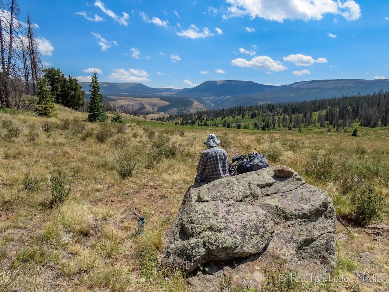
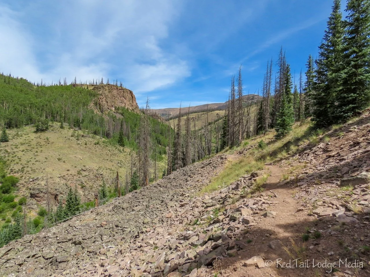
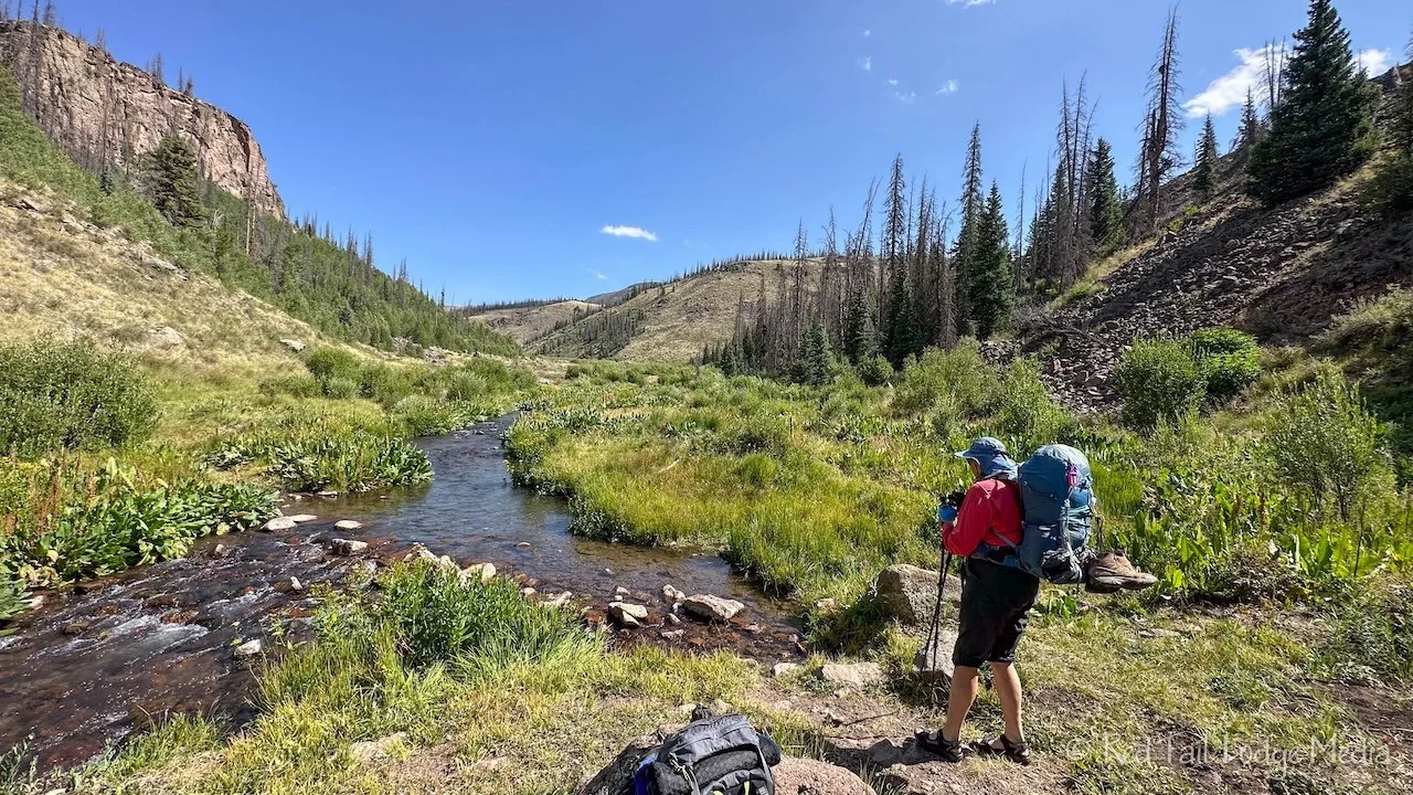
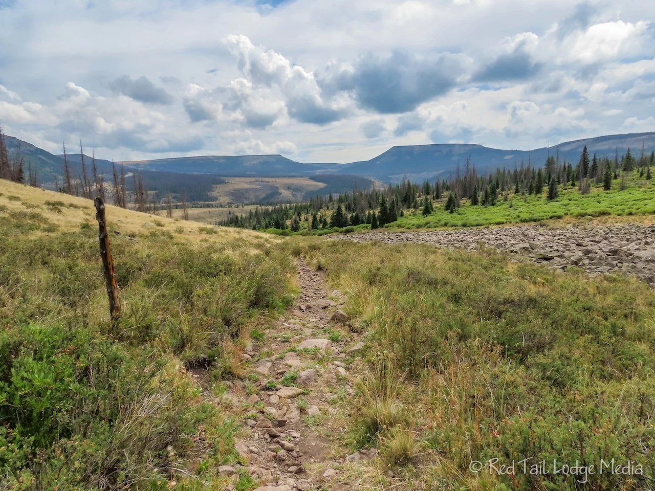
The trail is mostly downhill to the creek, but then it heads up 1000 feet during the next four to five miles. The trail followed alongside the creek for a little while, passing through a few more boulder fields before taking a left turn up a small canyon. It rises out of the canyon, crossing through woods and wide-open meadows. At about mile four, there was a large boulder where we stopped to eat our lunch. The boulder provided a nice place to sit with views out across the mountain valleys.
The trail then descends and joins the 4WD road for the last mile and a half to the Wheeler Trailhead. When we reached the 4WD road, we passed a couple who was hiking out. They had hiked in the evening before and spent the night at the Wheeler Trailhead. They recommended we hike the full Wheeler Loop Trail the next day.
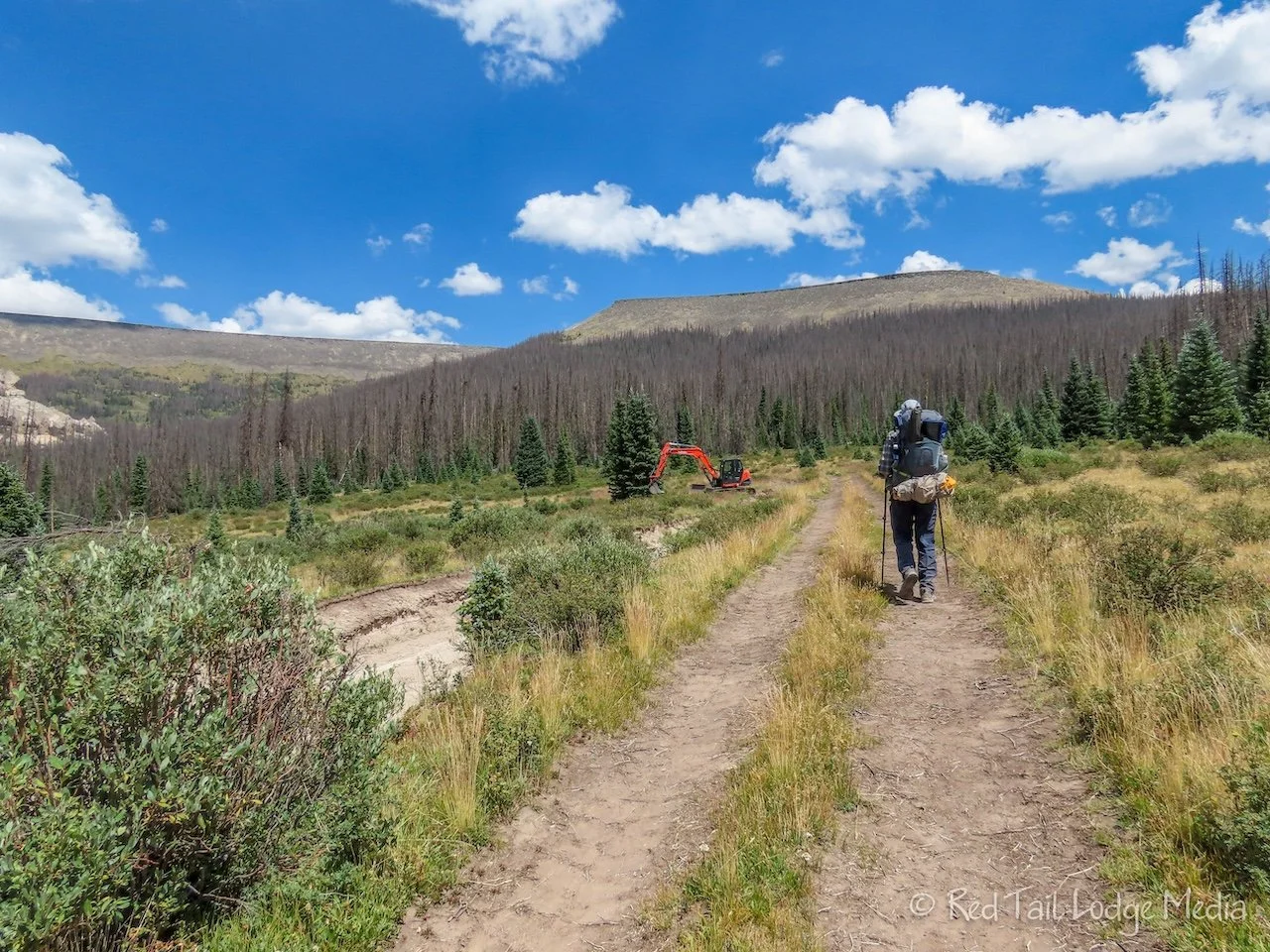
Along the 4WD road, the Forest Service was working on repairing the damaged road. It seemed odd to see a bulldozer so far out in the wilderness.
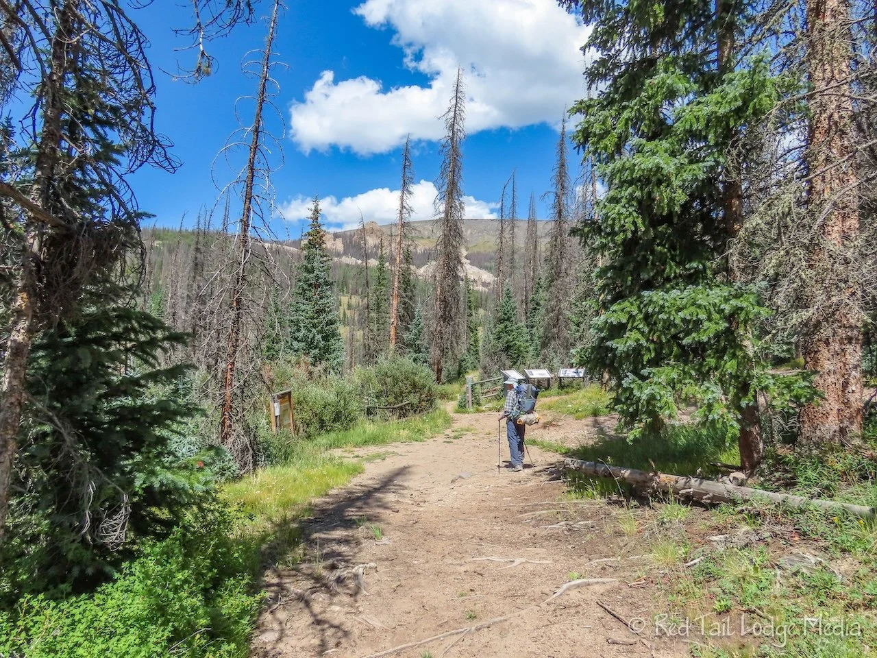
We reached the Wheeler Trailhead at about 2:15 in the afternoon. The 7.3 miles with an elevation gain of 1142 feet took us five hours and 15 minutes to complete. It was hike number 44 of our 52 Hike Challenge for 2023.

There was no one at the trailhead. We had already passed the horse rider and the day hiker heading back out on the trail. We saw no one else the rest of the day, other than the road construction crew. Thankfully, they packed up for the day just a couple of hours after we arrived at camp. Then it was just us, nature, and quiet.

The hike in with our heavy packs wore us out. We sat down, had another snack, and relaxed for a little while before setting up camp. It was about a ten minute walk down the trail into the Wheeler Geologic Area to the water source, a nicely flowing stream crossing the trail. After fetching water, we set up our tent. Then we relaxed some more before making dinner. Even though it had been four years since we backpacked, it took us no time at all to remember how to set up the tent and use our backpacking stoves (paid link).

After dinner, we hung our bear bags from a tree. It took several tries, but we finally got it around a pretty sturdy branch on a dead tree. The one advantage of camping two nights in the same place is that we only had to get the rope over the branch once. It was easy to take the bags down and put them back up as we left the rope hanging around the branch.
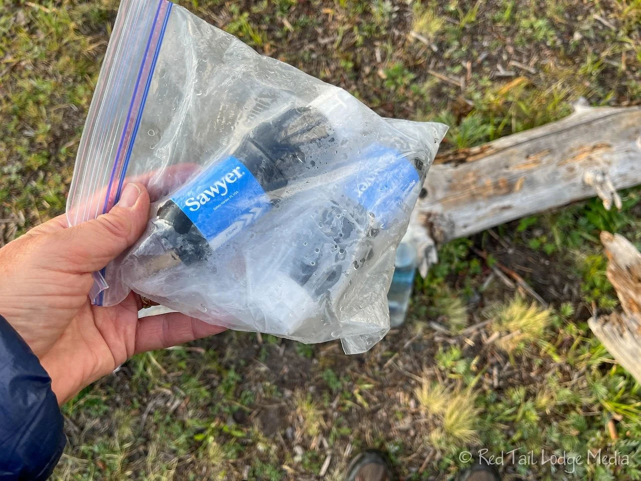
After sunset, there wasn’t much to do, so we turned in early for the night. As an extra precaution, we put our two water filters in a ziplock bag and stuck it inside Keith’s sleeping bag. The water filters are ruined if they get frozen. We weren’t sure if it was going to get down below freezing that night, but we didn’t want to take any chances. We were dependent on those filters for water.
The temperatures dropped as the night progressed. At one point, Ann had all the layers on that she had brought (except for her rain gear) and her feet were still a little cold. They weren’t dangerously cold. It just made it uncomfortable to sleep. However, they eventually warmed back up. She thought about getting out some toe warmers, but she wasn’t sure how they would function. They are designed to be oxygen deprived, like in a shoe or boot, so they release their heat slowly. If she just stuck them under the covers or under her socks against her feet, would they get too hot? Hiking back out with burnt feet didn’t sound like something she wanted to experience.

Tuesday morning, we were up with the sun, at about 6:30 am. The temperatures quickly rose up into the 50’s or 60’s. By the time we finished our breakfast, we had taken off our puffy coats and only had a light warm layer on top of our hiking shirts.

We were in no hurry. Our only plans for the day were to hike the Wheeler Loop Trail. The construction workers showed up at 9 am and we were on the trail before 10 am.
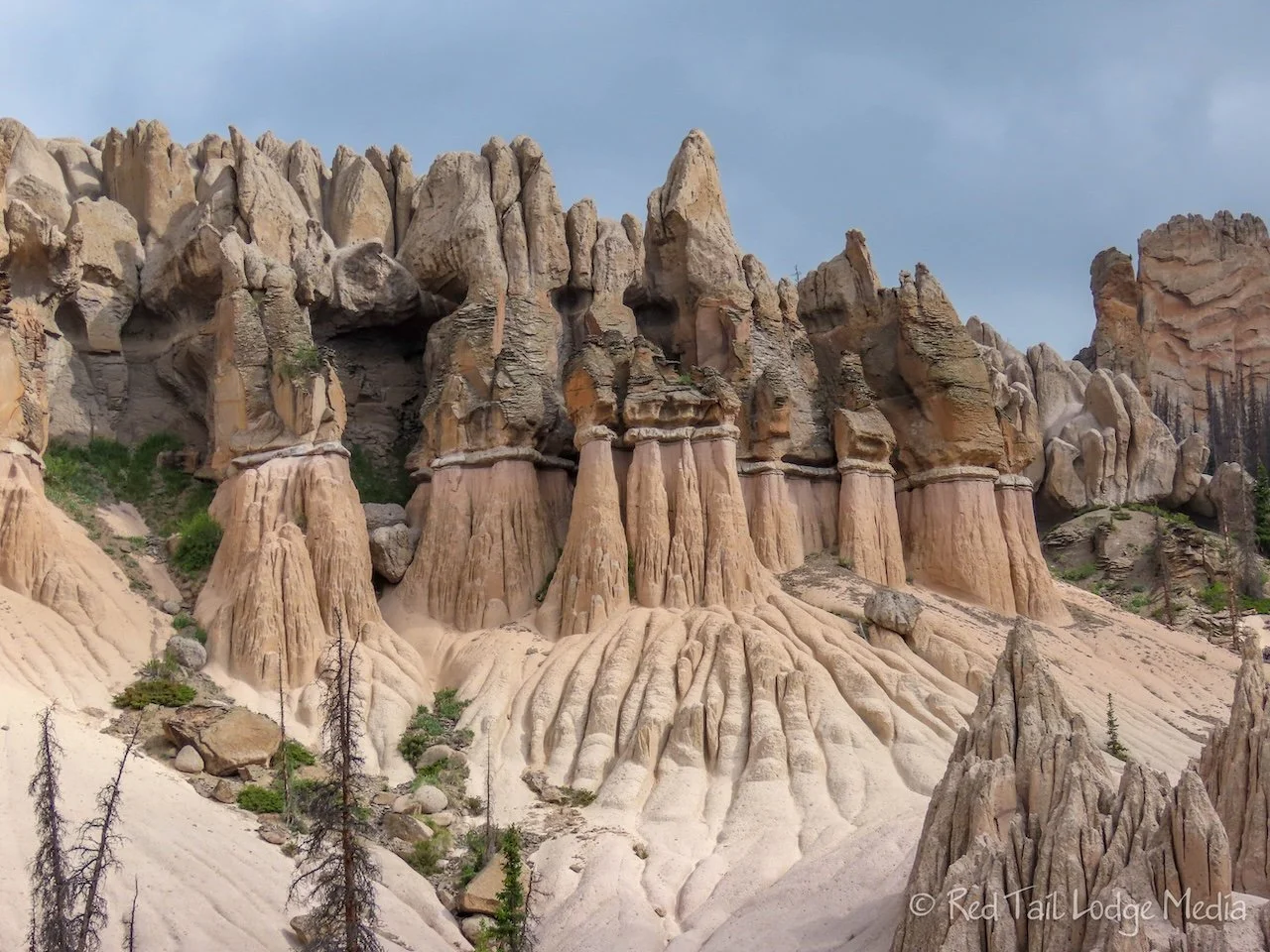
The Wheeler Loop Trail circles the Wheeler Geologic Area. Only foot and horse traffic is allowed inside the geologic area. Camping is not allowed within the area. We took the loop in the clockwise direction. The first great view we reached was the best view of the rock formations, the view that Ann had seen pictures of before. It was why we were there. Ann had heard about the area about four years ago and had been trying to work a visit into our travel itineraries ever since. The rock formations were impressive, but not as much as Ann had built up in her mind over four years. Keith enjoyed the formations, but he didn’t think it was worth the long backpacking trip just to see them.

The loop continues up behind the formations and then circles down below them. We’re not sure which direction of the loop is better. If you want to save the best view of the formations for last, then take the loop in the counterclockwise direction. However, seeing the best view first gave us an overview which provided context for circling around them. The loop is steep and hard, so you can just go to the best view, sit at the bench to enjoy it, then hike back the way you came. This is probably a good option for those who are hiking all the way in from Hanson’s Mill as a day hike. But we found the other views interesting as well. Of course, we had all day to enjoy it.
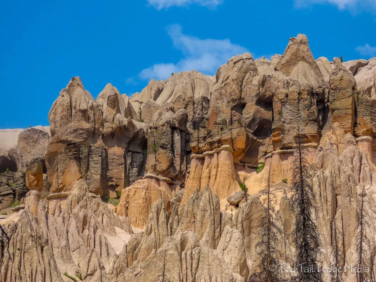
The day started out overcast, but the sun peaked out a view times so Ann could get some nice photos of the formations. From our camp site, the Wheeler Loop Trail was about 3.8 miles long with an elevation gain of 971 feet which took us four hours to complete. We counted it as hike number 45 of our 52 Hike Challenge. We were back at camp by 1:30 pm. The construction crew had taken their equipment and left. They were probably working further back up the 4WD road, out of sight and out of earshot.

We then had the rest of the day to relax. We spent hours doing absolutely nothing. The sun came out in full force in the afternoon. We spread out a tarp, laid on our backs, and watched the clouds float by. It reminded Ann of her childhood, laying in a lounge chair by the pool, staring at the sky.

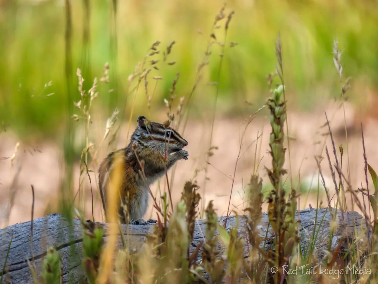
We had no cell signal. Keith had downloaded some podcasts on his phone, but we didn’t want to waste the battery power to listen to them. We had a battery pack (paid link) with us, but still decided not to turn on electronics. It was nice to do absolutely nothing for a change. As we laid on our backs, we watched the flies and bees buzzing over our heads. They seemed to have no purpose to their flights.

OK, Ann finally couldn’t resist to grab her camera and take advantage of the sunshine. She wandered around the camping area, chasing butterflies, bees, and wildflowers for photos.
Close to dinner time, a woman came out of the geologic area, starting her hike back. She was the only person we saw that day besides the construction crew. She must have sneaked by us when we were dozing on our tarp.

A single mule deer visited several times. She was heavily scarred, so we know it was the same one every time. The deer skirted by our camp site a couple of times the first day we were there. She got bolder and bolder. While we were eating dinner on Tuesday, she slowly came towards us. She wasn’t aggressive, but she came uncomfortably close to us, so we scared her off. She was either very curious or other people have been feeding her. Wild animals are unpredictable. So even though the deer seemed harmless, she could do some serious damage to us if she got spooked.

After we had cleaned up from dinner, a light rain shower came through. It was heavy enough that we retreated to our tent, not wanting to get wet. Then we came back out in time for the sun set before returning to the tent for the night.

At about 11:30 pm, another rain shower started. This one was a little harder. As Ann laid there listening to the rain drops on the tent, she felt a drop of rain on her face. Wait! It shouldn’t be raining inside the tent! The tent was not only leaking in one spot, but dripping from all of the seams. It was no longer waterproof. The area at our feet was pretty wet. We quickly grabbed all the items we didn’t want to get wet into our dry bags (compactor bags), except for the clothes we had on and our sleeping bag and quilt. Luckily, the rain didn’t last long.

OK, what do we do now? We decided to pull out our tarp, the same one we had been laying out on earlier that day. After draping it over the top of the tent, we secured it with spare rope that Keith had brought with him. The tarp was not quite as big as the tent, but it should help keep us from getting soaked if it started to rain again. It never did rain again and somehow we managed to stay warm enough despite the damp sleeping gear.

Wednesday, we again got up with the sun at 6:30 am. This time we set an alarm, but we were awake by then anyway. We wanted to get an early start on our hike back out. Rain was predicted in the afternoon, so we wanted to get back to Hanson’s Mill before then. While we ate our breakfast, we spread out the wet and damp items, trying to dry them some before we packed up. As we were packing up, our deer friend walked through our camp site one last time, as if to say good-bye. After one last trip to the stream for water, we were on trail just after 9 am, with two liters of water each.

Our packs still felt pretty heavy, but not quite as on the way out. They were minus the food we had eaten and perhaps we were getting more accustomed to the weight. Keith’s backpack no longer fit him properly. He had his waist belt cinched as tight as it would go, with the two buckles touching, but he still needed it a little tighter to take all the weight. So his back was hurting.

The first mile and a half was uphill, but we made pretty good time. Our legs were somewhat fresh. The skies were overcast, so Ann didn’t take many pictures. Besides, she had already taken pictures along the trail on the way in to Wheeler.

The next four miles were downhill and we were going a pretty good clip. Only a few rocky stretches slowed us down a little. We stopped again at the same large boulder as on the way in to get our packs off and give Keith’s back a break. This time we had a snack instead of lunch. Well, the only difference between our snacks and lunches on trail is how long we stop and how much we eat. The food stays pretty much the same, granola bars, Lärabars, nuts, cheese sticks, and meat sticks.

From the boulder, we continued downhill to East Bellows Creek. The pika were active in the boulder fields along the way. We even spotted a marmot in one of the boulder fields this time. That made Ann happy. Four people on horseback passed us as they headed out to Wheeler. Then we passed a couple hiking out for the day.

We managed to cross the creek again without getting our feet wet. After crossing the creek, we stopped for lunch. Keith was ready to get his pack off for a little while.
Just as we left the creek, a couple with some dogs arrived. They were only hiking from Hanson’s Mill to the creek and back that day. Then it was a final push back to Hanson’s Mill, two and a half miles uphill.

Keith’s back was really bothering him, so we just put our heads down and pushed hard. We had a pretty good rhythm going. We stopped every 15 minutes for a water break, like we normally do. When we had about one mile left, our legs started giving out. They had enough. Our pace slowed down, but we kept going. It was such a relief when we reached Red Tail. We dropped our packs, plopped down in our camp chairs, and sat there, drinking water and staring out into space. We made it well before 2 pm.
We covered the 7.3 miles of 1007 feet of elevation gain that day in four hours and 36 minutes. It was hike 46 of our 52 Hike Challenge. That’s almost 40 minutes faster than it took us to hike out to Wheeler. The difference was slightly lighter packs, Ann took less pictures on the way back, and Keith’s hurting back motivated us to keep a faster pace.

After about an hour, we decided we better start getting our gear put away. We laid out the damp items to let them dry. Luckily, the predicted rain never showed up. Taking showers in Red Tail made us feel refreshed, even though we had to be careful about how much water we used. Our fresh tank had to last us until we left the following morning. There was no water source near Hanson’s Mill and we definitely were not about to hike back down to East Bellows Creek!

After dinner, the four horseback riders returned from the trail. We talked with them a little bit. We were concerned about the couple we had passed earlier on the trail. They didn’t seem like they had enough supplies with them to hike all the way out to Wheeler and back. One of them was carrying a small backpack, but they were both carrying camelbacks for water. The riders said they had passed them and said the couple had given up and were heading back. They asked the couple if they had enough water and they said they did. The riders also thought the couple didn’t look properly prepared. The license plate on the car at Hanson’s Mill indicated they were from Missouri, so they probably were not used to the elevation either.
We kept a watchful eye, waiting for the couple to return from the trail. One of the horse trailers with two of the horses left, but the other one stuck around. That made us better, because we’re not sure what we could have done if the couple didn’t show up before dark. We were in no shape to head down the trail to look for them. We don’t know if the people with the two horses were waiting around for the couple or they were already planning to spend the night. The couple didn’t look like they had enough gear with them to survive the night out on the trail. We suppose we would have used our Garmin InReach (paid link) to send an SOS via satellite if the couple didn’t return by dark.

The couple finally returned after sunset, as the light was starting to fade. They looked pretty exhausted. Ann went over to ask if they needed anything, but they said they had plenty of water and food in their cooler. One of the horseback riders came over and talked with the couple briefly. Then the couple left in their car pretty quickly. Hopefully they were OK.

It was nice to see people looking out for one another. That was one of the advantages of being in a remote location on a trail with very few people. Everyone knew who was on the trail and knew that help was a long ways off. So they looked out for one another, hoping that someone would do the same for them. If this had been a busy trail, no one would have noticed the ill-prepared couple.

Is Wheeler Geologic Area worth backpacking to? That’s up to you to decide. Although it was the reason we were backpacking, we enjoyed the experience of our backpacking trip more than the destination. There is just something very rewarding about carrying everything you need on your back, being disconnected from the outside world, and immersing yourself in nature.
Check out our related video: Wheeler Geologic Area, Colorado
(Ann)