
Squamish, British Columbia - May 27th to 28th, 2022
We love to hike, but we normally don’t seek out challenging routes. There are several fantastic hikes in the Squamish area, some more challenging than others. Some last minute changes to our plan gave us more than we were looking for.

Friday we headed back to the mainland. From Rathtrevor Beach Provincial Park, we needed to take a ferry from Nanaimo to Horseshoe Bay. We reserved a spot on the 9:30 am BC ferry, so we had our alarms set for 6 am. It was over 30 minutes to drive from Rathtrevor Beach to the Departure Bay ferry terminal in Nanaimo. The instructions were to arrive anywhere from 30 minutes to 2 hours ahead of the scheduled departure. After eating breakfast, we packed up and dumped our gray water on the way out of the campground. We managed to arrive at the ferry terminal about 8 am. There was still room on the 8:25 am ferry, so they put us on that one instead, and refunded some of our money as well. Great!

The weather was pretty nice on the hour and a half ferry ride. The sun was shining with only an occasional dark cloud passing overhead. It was rather chilly, though. The ferry seemed a little bit smaller than the one we rode on from Tssawassan to Swartz to get to Vancouver Island, but not by much (Victoria, British Columbia - May 16th to 18th, 2022). There was a sun deck with a seating area that had some walls to protect you from the wind. We sat on the benches out of the wind most of the time, then, when we saw something we wanted to take a picture of or look at, we would walk out to the railing, then duck back in to warm back up.
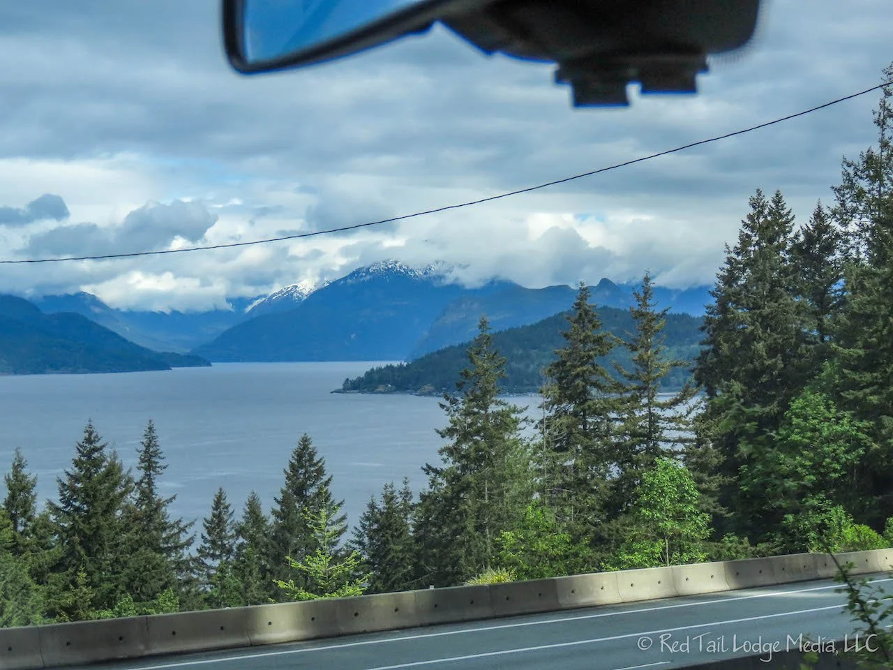
When we arrived at Horseshoe Bay, we started driving north on highway 99, the Sea to Sky Highway. Our destination for the day was Stawamus Chief Provincial Park campground near Squamish. We did not have reservations because the campground is first come/first serve. Being Friday, we were a little concerned about getting a site.

We did make a couple of stops along the way. On Google Maps, Ann saw there was a waterfall not far off the highway. It was called Crystal Falls. We turned off on this little, narrow, steep, windy, dead-end of a road. There was room for about two cars to park at the trailhead. Keith was not that excited about trying to turn our van around on the steep little road. A short little foot path went up to a small waterfall. It was a nice little waterfall, but we’re not sure it’s really worth the stop.
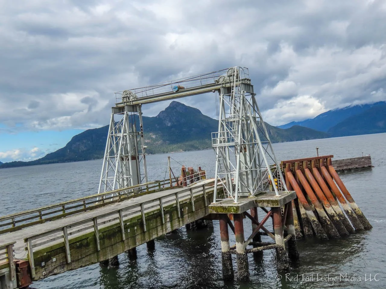
The second stop was at Porteau Cove Provincial Park to have a picnic lunch. Porteau Cove is a marine park, right on Howe Sound, with water sports and scuba diving being the main draw. There are some shipwrecks and underwater sculptures for the scuba divers. A kite surfer and a wind surfer were out on the water while we were there. Ann originally tried to reserve a campsite here, but she did not click fast enough when the reservations opened up. There are not that many sites and they book up in fractions of a second. What drew her to this park was a campground review that talked about sea lions putting on a show for the campers during their stay there. Ann has never seen sea lions up close in the wild before. While we were eating our lunch, we could hear some sea lions barking. It sounded like they were out at the end of the pier, which looked like it was a ferry dock at one time. However, the public is not allowed to go out all the way to the end of the pier and the sea lions were nowhere in site. Better luck next time.

We arrived at Stawamus Chief Provincial Park around 12:30 pm. We had no problem finding an open camp site. After passing the parking lot for the walk-in tent sites. We came to a row of ten vehicle sites lined up along the camp road. Assuming there were only ten sites to choose from, we snagged one and went back to the self-registration board to pay for our site. After we paid, we then found out that what we thought was a turn around that went around a group of trees, was actually a road that went back into the woods with another 42 vehicle sites. Call it sour grapes, but our site had a view and was better for solar charging. We’ve been camping in lush woods for several weeks now, being out in the open was a nice change.

The camp sites were pretty basic. They had enough room to park a 20 foot vehicle, but that was it. No picnic table, no fire ring, and no room for a tent unless you can squeeze one in the gravel parking area with your vehicle. However, there were a few picnic shelters with picnic tables for cooking, sitting, and eating. The pit toilets were well-maintained and there were fresh water spigots available, but no dump station. The strange thing was that they charged per person per night instead of per vehicle. However, it was pretty cheap. Ten dollars (Canadian) per person per night. The biggest advantage of all was having access to the hiking and rock climbing trails without having to worry about the parking lots filling up.
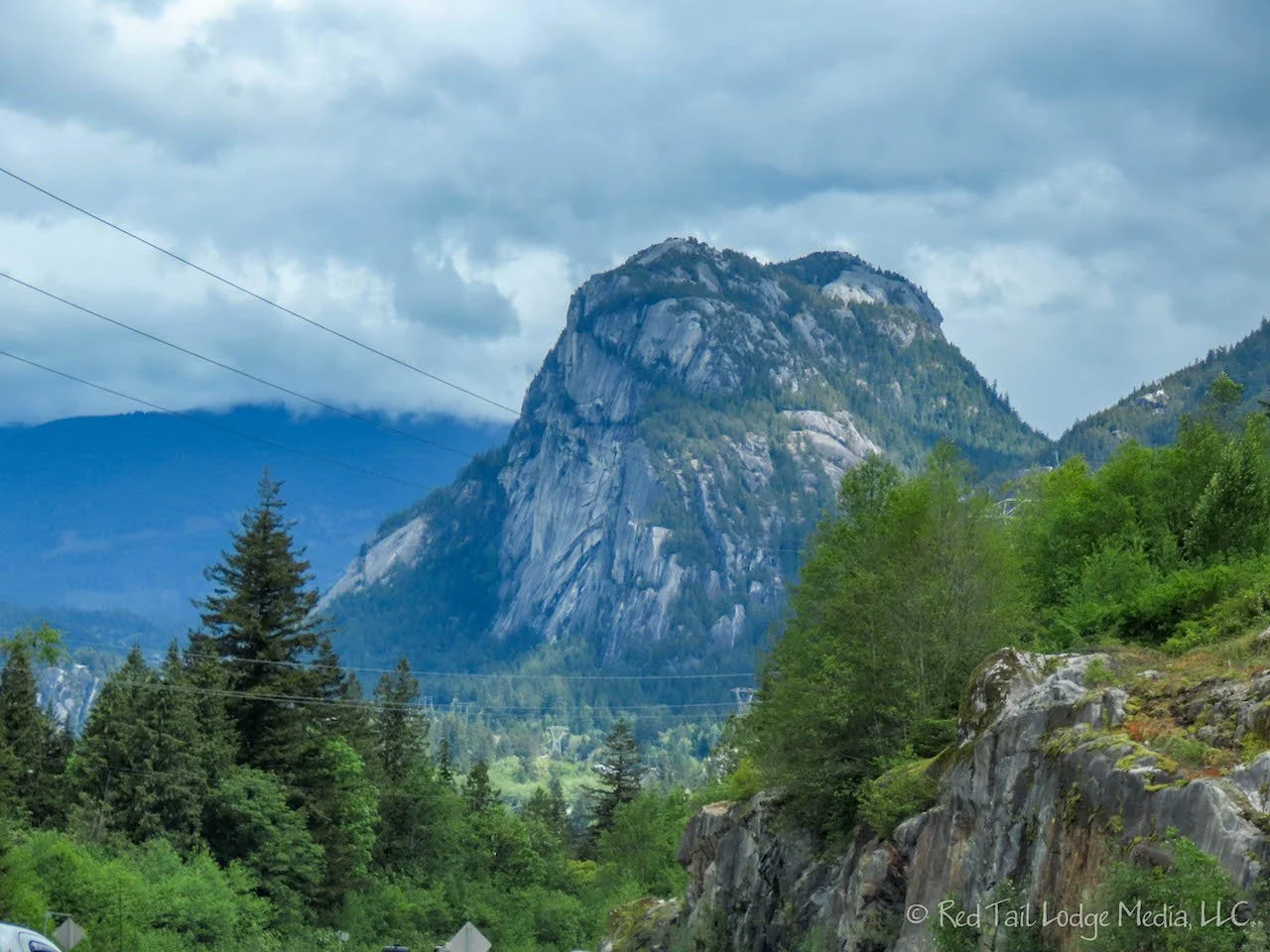
Our plan was to hike the Stawamus Chief Trail the next day. Stawamus Chief is one of the largest granite monoliths in the world. The sheer rock face visible from the highway is popular with rock climbers. The steep and rugged hiking trails go up to three peaks on the back side of Stawamus Chief.
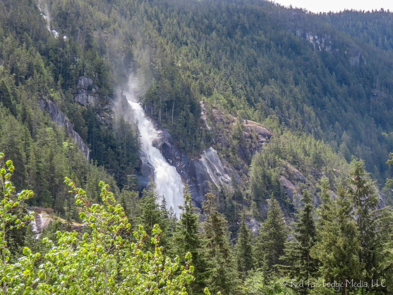
Adjacent to Stawamus Chief Provincial Park is Shannon Falls Provincial Park. Straddling in-between the two parks is the Sea to Sky Gondola. The large, dramatic falls are visible from the gondola parking lot. You can get up close and personal with the falls by driving to the parking lot in Shannon Falls Provincial Park and walking a short trail to the falls. However, the Stawamus Chief campground is not that far away and there was a trail leading from the campground over to the falls as well.

Since we had an afternoon available to explore, we walked over to the falls. To get to the falls, we started out on the Stawamus Chief Trail, then turned onto the Sea to Summit Trail which brought us over to the Sea to Summit Trailhead near the base of the gondola. The trail then continues on to the Shannon Falls viewpoints. There are three viewpoints. Most of the people head straight to the middle viewpoint with a great view near the base of the roaring falls. A second trail leads down to a slightly lower viewpoint which includes a little more of the raging stream. A third trail leads up to a higher viewpoint, where you can stand in the the overspray of the falls. All three viewpoints are fantastic. We cannot think of a waterfall that we’ve been to that is more impressive than Shannon Falls, other than Niagara Falls. These falls are definitely something not to miss when in this area.

On the way back, we stopped to check out the gondola. We were not planning on riding the gondola since we had reservations for the Peak-to-Peak Gondola in Whistler on Sunday. There was a food truck at the base of the gondola called the Praguery, which sells chimney cake treats. This was similar to something we had in Erfurt, Germany called a Baumstriezel (Germany Day 12: Erfurt & Schloß Wartburg). Praguery fills their chimney cakes with all kinds of different goodies. Ann chose Marie’s, with dark chocolate, berries, and soft serve ice cream. Keith had the Mr. Strudel with apple pie filling and soft serve ice cream. They were both delicious!
By the time we returned to the campground, we had only gone 2.4 miles with an elevation gain of 350 feet in about an hour and a half. A nice afternoon stroll.

After dinner, we wandered over to the Stawamus Chief rock face to watch some of the rock climbers. Near there was a pedestrian bridge over the highway to a rocky hill next to Howe Sound. We walked across the bridge and found there was a trail. We weren’t sure where it went. A couple came behind us who started up the trail. We asked them where the trail went. They told us it went up to the top of the hill, with a few scenic views along the way. So we ventured up the trail behind them. It was a little bit of a scramble in a few spots, but there were some nice views of Stawamus Chief and of Howe Sound. We weren’t really planning on hiking that evening, but the short trail, maybe half a mile round trip, was worth the effort.
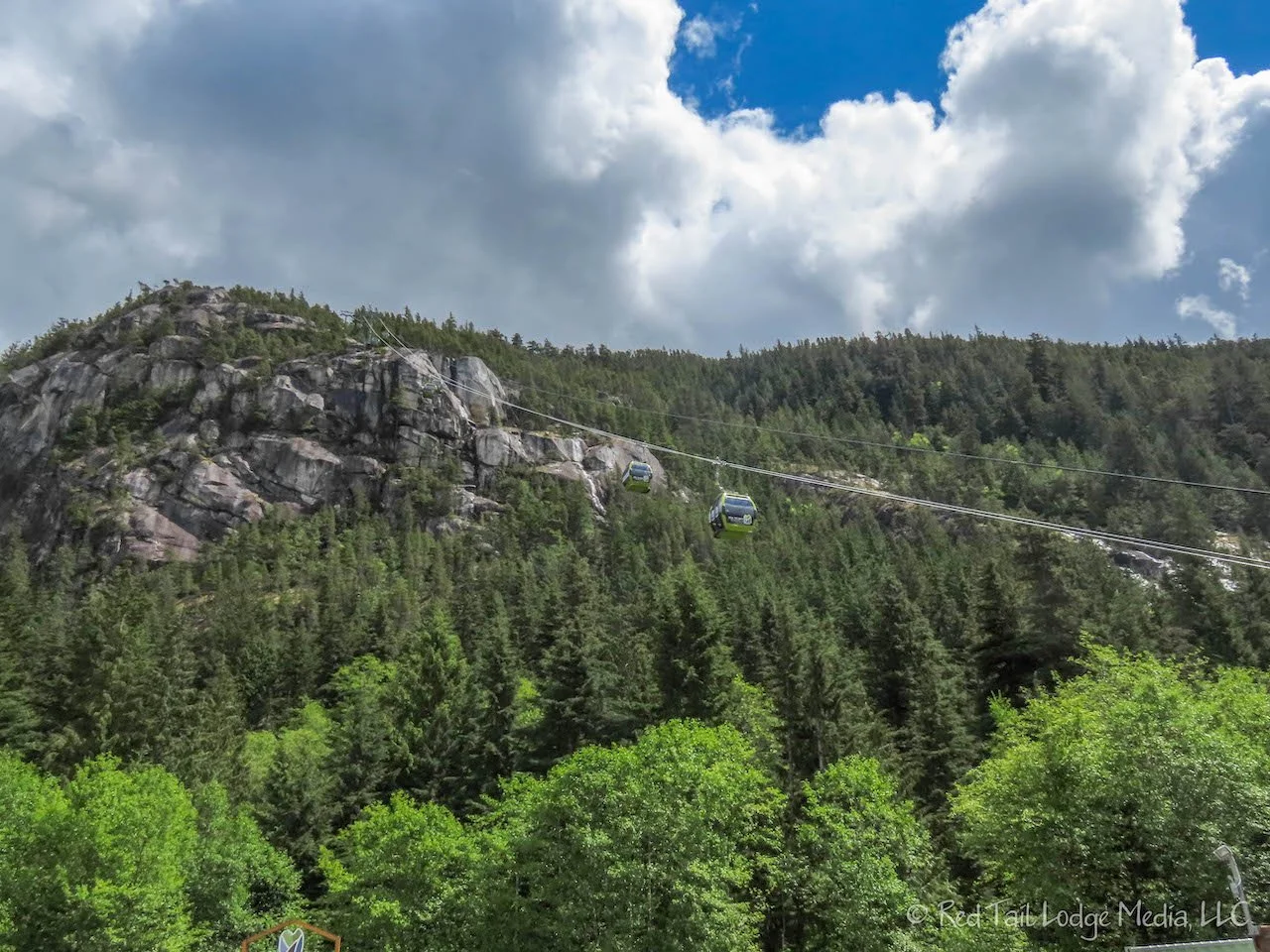
As we were eating breakfast and drinking our morning coffee on Saturday, we read the detailed description of the Stawamus Chief Trail in AllTrails. It talked about the route from the first to second peak is actually a climbing route, with signs indicating a harness should be used, and only hikers with climbing experience should attempt it. That is definitely not us! The day before we had seen a “Sea to Summit” trail that started from the base of the gondola going all the way up to the top of the gondola, sharing some of the trail with the Stawamus Chief Trial. Reading the description of the trail on the gondola website sounded more suitable for us. It was 6.5 kilometers or 4 miles, one way, rating it as an intermediate/advanced trail with some steep and challenging sections. And if we decide to only hike up, we can take the gondola down for only $20 per person. That sounded like a better plan.
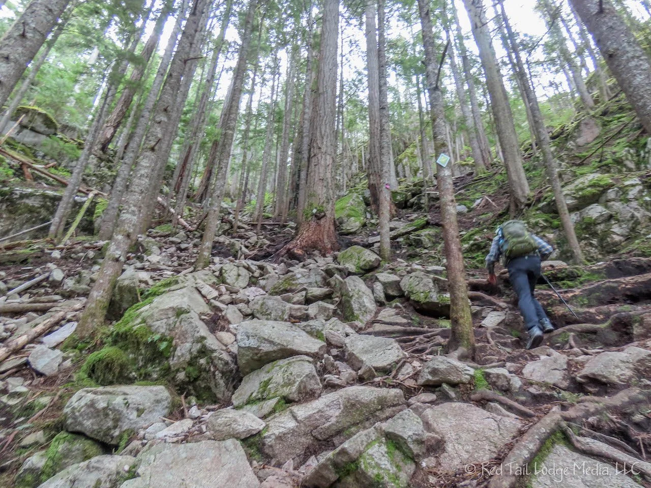
We were expecting the trail to be steep. Since Stawamus Chief Trail was a 2000 foot elevation gain, we were expecting the Sea to Summit Trail to be similar. We don’t know why we didn’t look at the elevation gain closer. Of course, on the gondola site, it listed the elevation gain in meters instead of feet, and we didn’t think to convert it. It was 918 meters, or 3012 feet. That’s more than we normally hike, but we’ve done that elevation before on day five of our Grand Canyon Rim-to-rim backpacking trip (Day Five Below Rim: Grand Canyon - Sep 20, 2019).
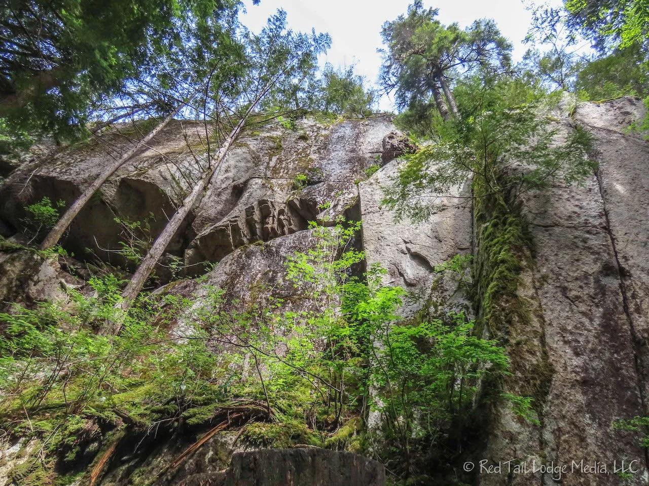
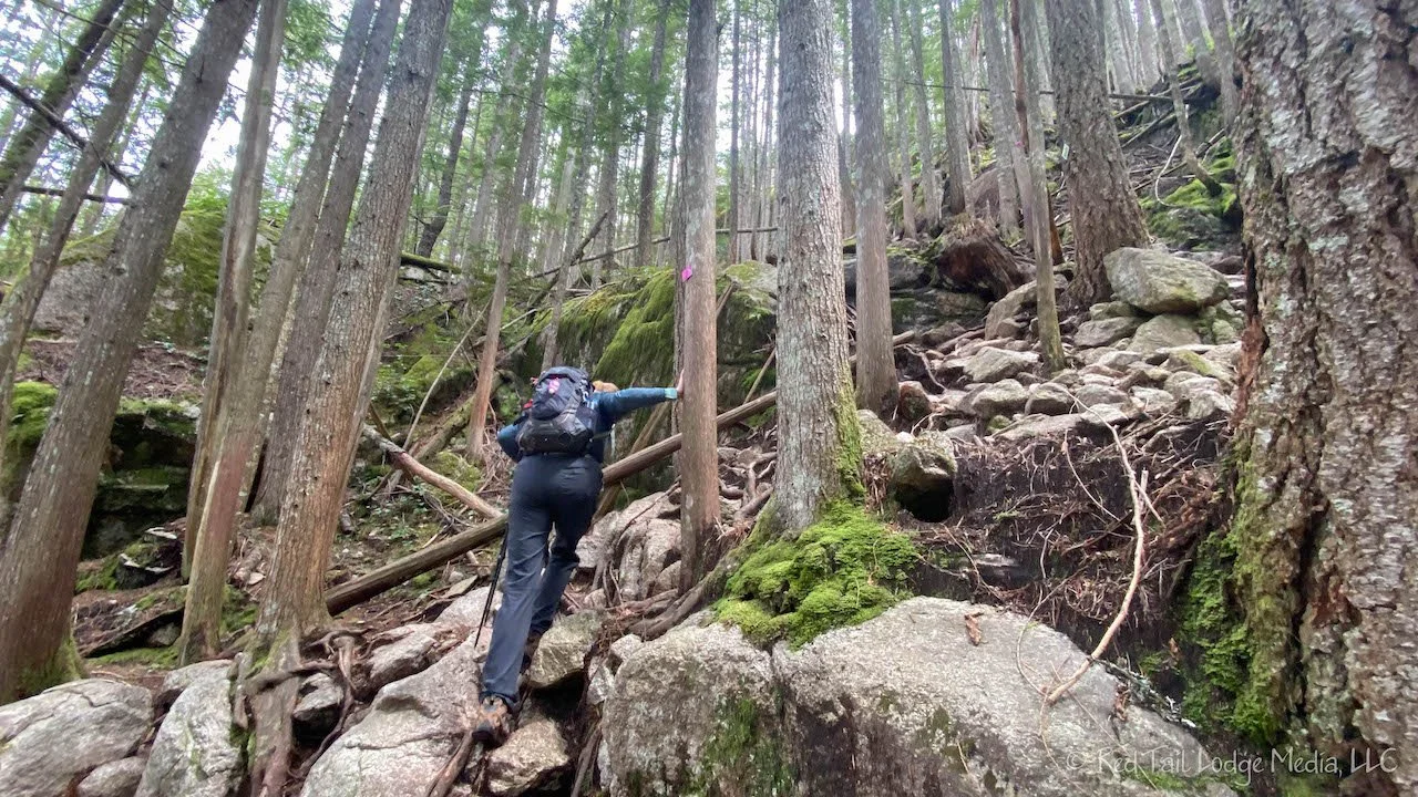
The trail started out with a lot of steep stairs. We can handle that. After the trail splits off from Stawamus Chief, the trail was pretty easy, but not for long. It quickly became one long scramble after another. When we weren’t scrambling up boulder fields, we were scrambling up tangles of tree roots. There were some breaks between the scrambles, but they didn’t seem very long. In a couple of places there were ropes and chains to help assist you through the tricky spots. It was definitely a workout.

At about 2.5 miles or 4 kilometers into the hike, there is a nice open rock face with a view where everyone seemed to sit down and take a break. We decided to take a break as well. A nice German family we met earlier on the trail was just finishing up their rest break when we arrived at the rock face. We had taken their picture for them earlier, so now we asked them to return the favor and take our picture.
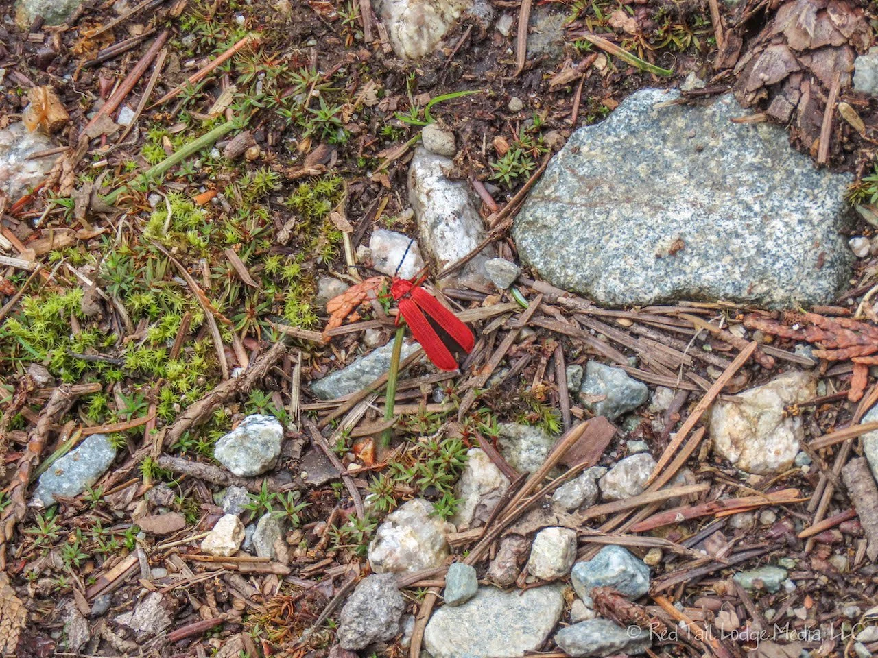
For some reason, we thought the trail was 7.5 kilometers long, probably from a sign we had passed. So we thought we were only about half way to the top. We had already decided that there is no way we were hiking back down. We were definitely taking the gondola. After eating our granola bars and apple, we returned to our climb up the mountain.

When we were 2.3 kilometers from the summit, the trail split. If you continued on the Sea to Summit, the sign warned that there were steep and challenging sections ahead requiring fixed ropes to assist you. Or you can take the Shannon Basin Loop trail which is easier, but it is 3.5 kilometers, adding 1.2 kilometers (or almost another mile). The sign for the Shannon Basin Loop also said “Recommended route if tired”. Are we tired? Yup. Are we taking the easier, but longer route. Most definitely!
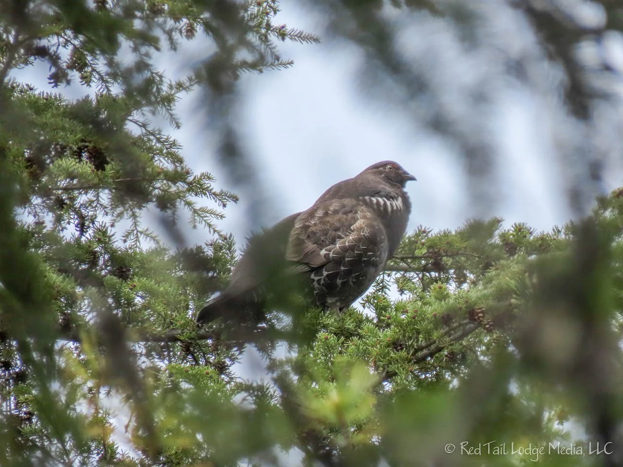
The easier route was a wide forest road with several switchbacks, but we made much better time on it. Our muscles were thanking us as well. As we walked along, we heard a deep, low vibrating sound. Keith thought it might be an owl. Ann thought is sounded more like something rubbing a hollow log. We heard it a few times, coming from a few different directions until Ann spotted it up in a tree. It was a large bird, but not an owl. She managed to get a picture of it and believes it is some type of grouse, possibly the Spruce Grouse.
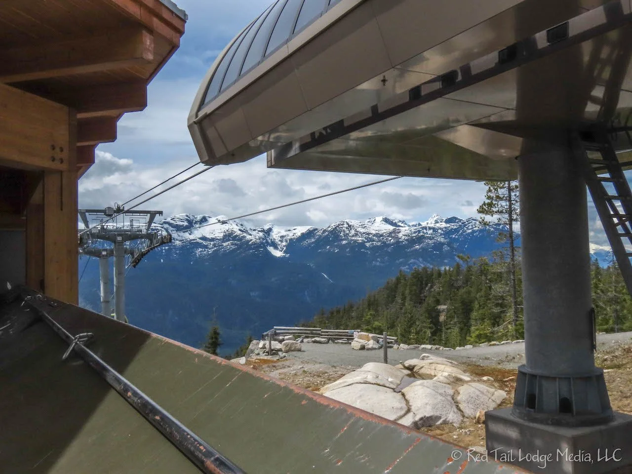
By the time we reached the gondola summit station, we had gone 6 miles with an elevation gain of 2956 feet in five hours. Our stats are a little bit off from the complete Sea to Summit Trail because we left from the campground and not the base of the gondola. We made up the difference in elevation gain when we walked back to the campground after taking the gondola back to the base. The hike counted as number 15 of our 52 Hike Challenge for 2022.
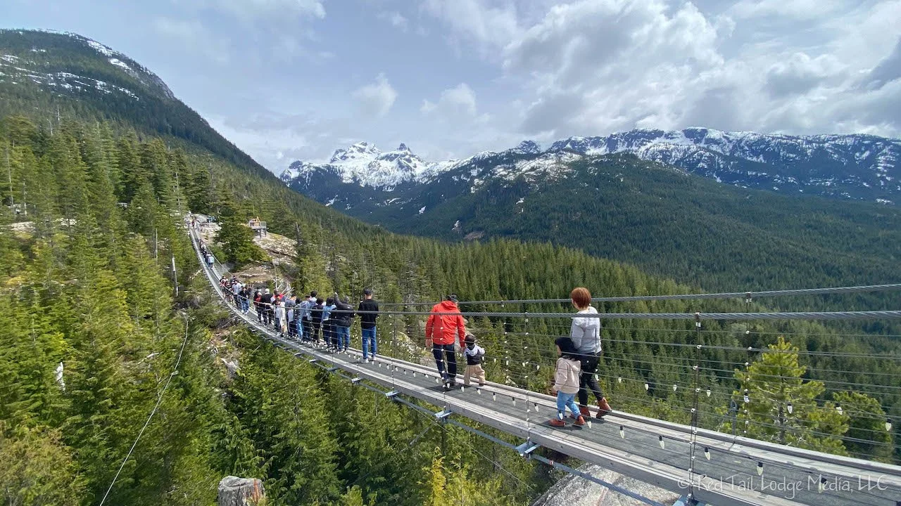
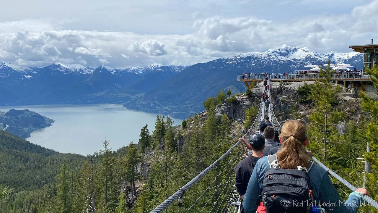
Before we took the gondola down, we relaxed at the summit lodge. There was a suspension bridge over to another viewpoint. They were going to shut it down in a few minutes for a wedding ceremony, so we walked over the bridge and back while it was still open.
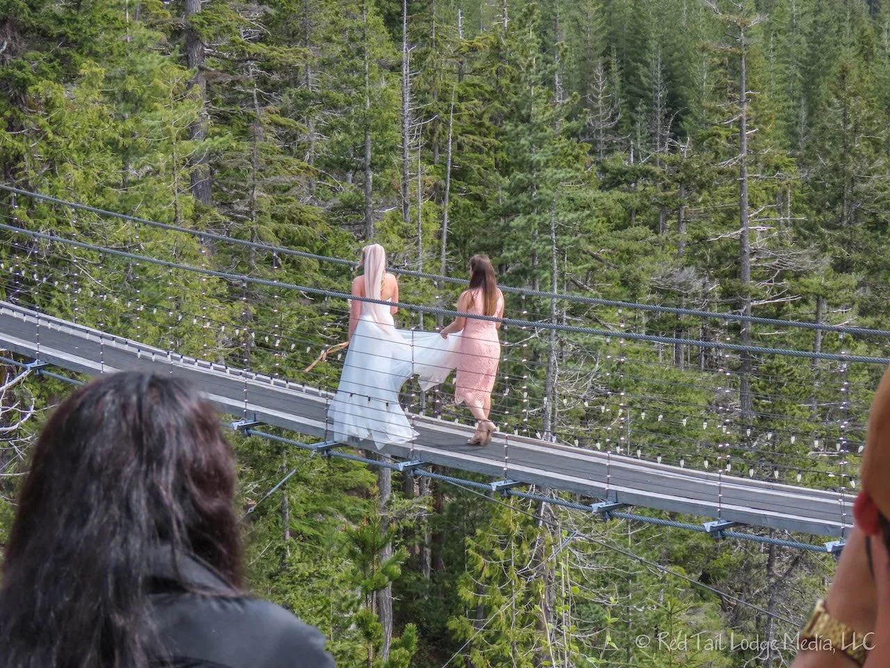
Then we sat down to enjoy some cold beverages and a couple of North Shore Smokey Dogs. We’re not sure what they were, but they tasted like a smoked sausage. They were served on a tasty bun. It felt wonderful to sit out on the deck in the sunshine, enjoying our refreshments, and watching the wedding party procession cross over the suspension bridge. Before we left the summit, we ran into the lovely German family again. They had taken the harder route. It sounded like the older two would have liked taking the easier route, but the younger two picked the more challenging route.
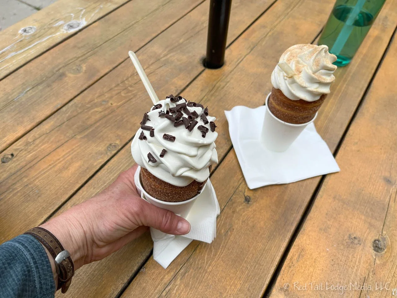
When we departed the gondola back down at the base, we had to visit the Praguery again. That definitely hit the spot. It was time for dinner by the time we returned to the campground. However, after all of our treats, we really weren’t that hungry despite the strenuous hike. So we just ate salads for dinner and called it a day.
Had we known how difficult of a hike the Sea to Summit trail was ahead of time, we probably would not have hiked it. However, we did really enjoy the hike, despite pushing our bodies harder than we had planned. But we’ll definitely research our hikes a little better in the future.
Check out our related video: Squamish, British Columbia
(Ann)