
Shenandoah National Park, Virginia - October 17th to 23rd, 2021

The main attraction of Shenandoah National Park is Skyline Drive which snakes along the spine of the Blue Ridge Mountains. The scenic Skyline Drive is only a little over 100 miles long with a speed limit of 35 mph. Some people compete the drive in one day, but we recommend taking more time than that, especially if you want to stop at the overlooks to enjoy the views or go on one or more of the wonderful hikes inside the park. We wanted an in-depth experience and spent six nights camping within the park, two nights in Matthew Arms Campground, two nights in Big Meadows Campground, and two nights in Loft Mountain Campground.
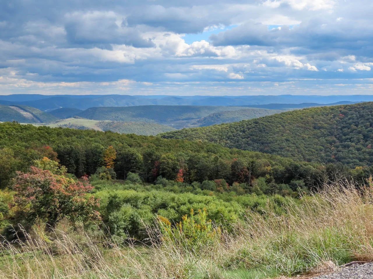
We were coming from our friends’ house on Deep Creek Lake in Maryland. They filled us up with more delicious food on Sunday before sending us on our way. We didn’t leave until afternoon, so most of the rest of the day was spent driving. Our destination was Matthew Arms Campground in Shenandoah National Park on Skyline Drive. We stopped at a scenic overlook in West Virginia. The trees there were just starting to turn colors.
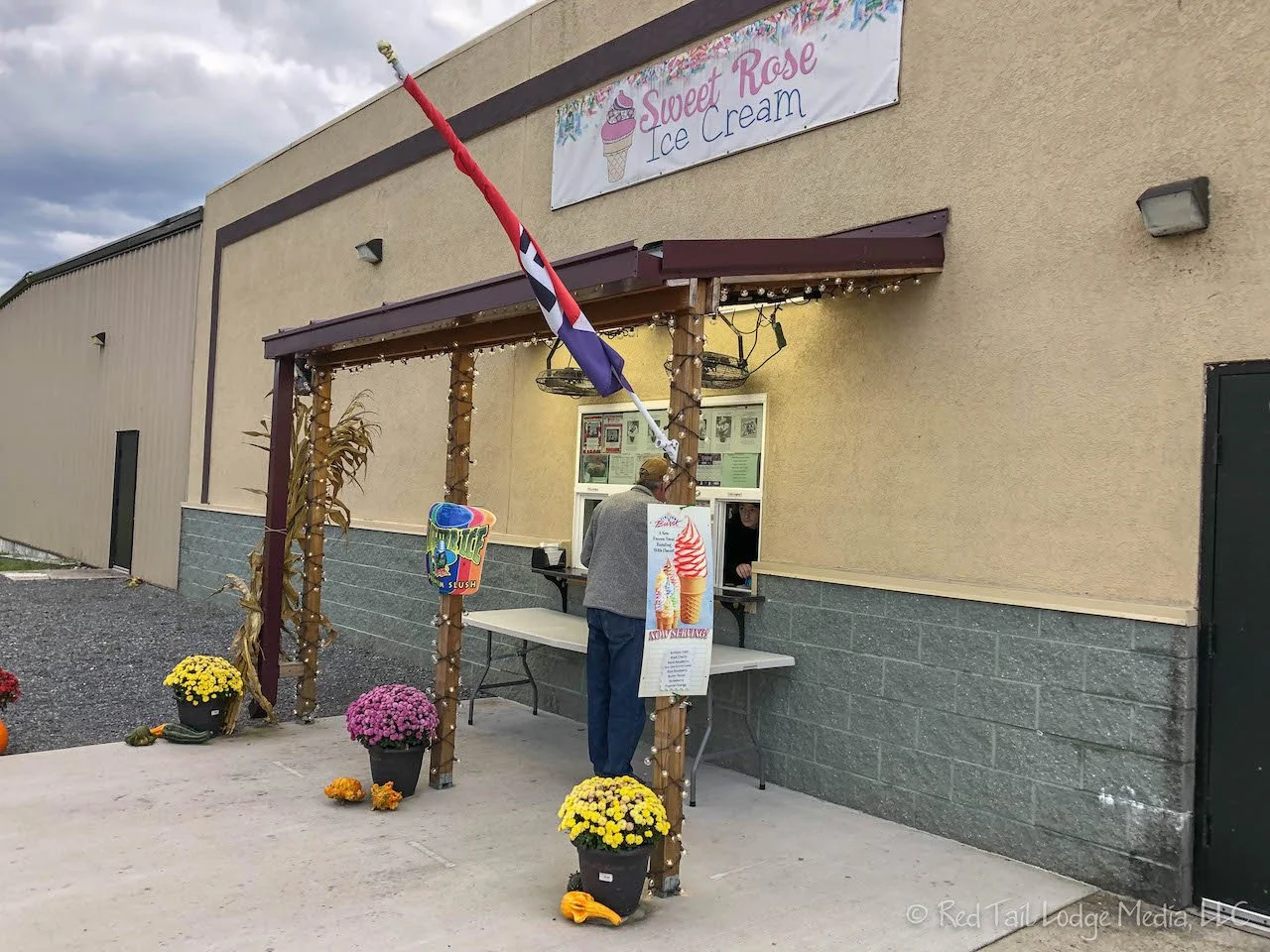
Of course we stopped for ice cream. The Sweet Rose Ice Cream shop in Moorefield, West Virginia only served soft serve, so we both had chocolate malts. The malts were so thick, you had to eat them with spoons. They were pretty tasty, though.

We pulled into our camp site just as the sun went down. Our site was not very level, so we turned our bed around so we could sleep with our heads higher than our feet. It was also a pretty chilly night, so we turned on our Espar heater. We were nice and cozy inside our van.

Since we arrived late in the day on Sunday, we did not stop at any of the overlooks on Skyline Drive on our way to the campground. So on Monday, we drove back up north to the visitor center. The ranger there gave us some nice recommendations for hikes. Two of them could be reached from the Mathews Arm Campground and one was on the way to Big Meadows, where our campground reservations were for Tuesday and Wednesday nights.
On the way back to the campground, we stopped at about half of the overlooks. Most of the trees were still green. We’re guessing that peak fall color was about two weeks away yet.

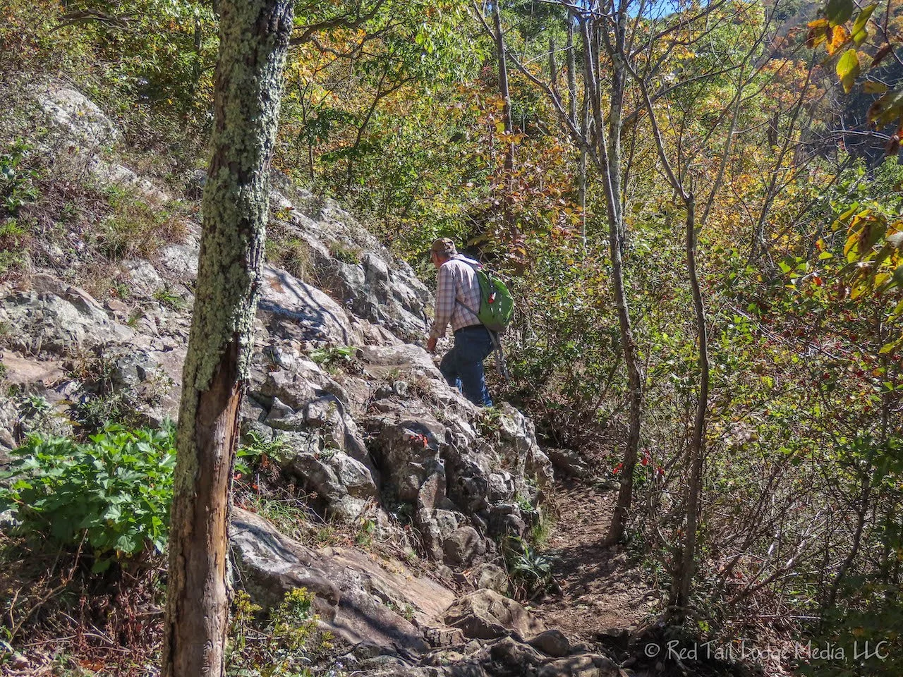
The hike we chose for Monday was the Overall Run Falls Hike. We left from the trailhead parking lot next to the campground, taking the Traces Trail to Tuscarora-Overall Run Trail. There are two falls near each other, the Upper Overall Run Falls and the main Overall Run Falls. The main falls are much taller than the Upper falls. However, being autumn, there was not a lot of water flowing over the falls. They were still beautiful, but we could only imagine how spectacular they must be in the spring.

The ranger told us there was a nice overlook past the waterfalls, just past the switch backs. We passed that information on to a hiker who passed us on the way to the falls. After viewing the falls, we decided to go down the trail a little further to see if we could find the overlook. We had started the hike a little late in the day and figured we needed to turn around in the next thirty minutes to make sure we returned before dark. We asked a couple coming up the trail in the opposite direction if there was an overlook and how far it was. They said there was no overlook that they saw. The trail just descends down to the bottom of the canyon, about a 45 minute hike down. With that information, we turned around and headed back up. We must have misunderstood what the ranger was trying to tell us. As we made it back to the falls, the hiker we spoke to earlier was coming back up the trail. He had gone all the way to the bottom of the canyon. He did not find an overlook either. We apologized for sending him on a wild goose chase.

On the way back, we took the Mathews Arm Trail which took us to the closer end of the campground than where we had started. The footing on Mathews Arm Trail was a little better than the Tuscarora-Overall Run Trail, so we made better time on the way back, even though it was uphill most of the way. We made it back to our camp site well before dark.

Our hike for the day was 5.6 miles with an elevation gain of 1407 feet which we completed in two hours and 45 minutes. It was hike number 49 of our 52 Hike Challenge and hike number 22 of our National Park Series.

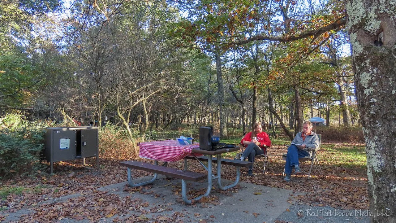
As we were sitting in our camp chairs at our camp site, drinking our after-hike Cokes, we looked up at the trees above us. There were a few trees, right in our camp site, that had better fall colors than anything else we had seen all day. Of course RB pulled out her camera to get some shots of the bright reds and yellows up against the pretty blue sky.

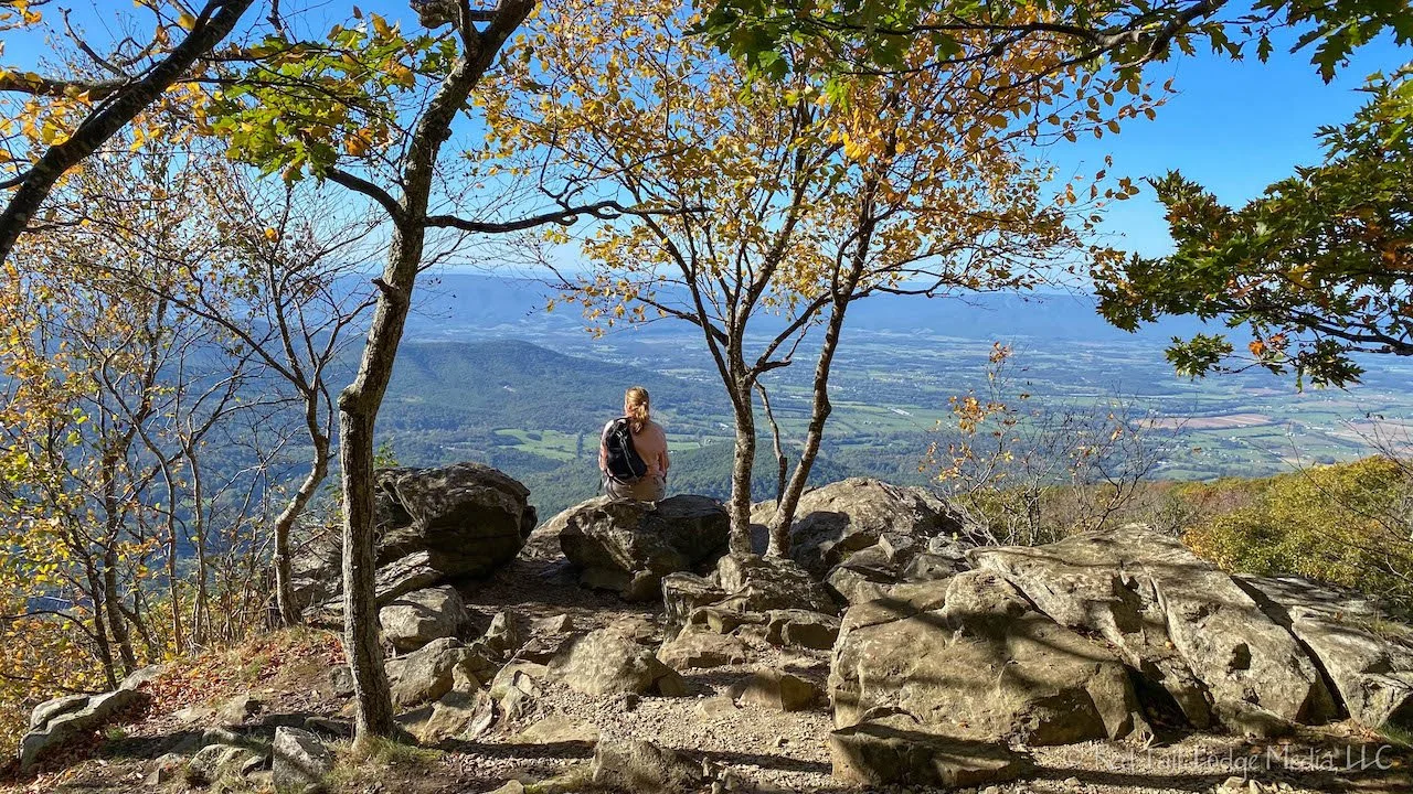
The other two hikes the ranger suggested were the Sugar Loaf Loop and Marys Rock. We chose Marys Rock since it was on the way to our next campground. The hike to the summit of Marys Rock starts from the Panorama parking area, you follow the Appalachian Trail for 1.7 miles to the summit.

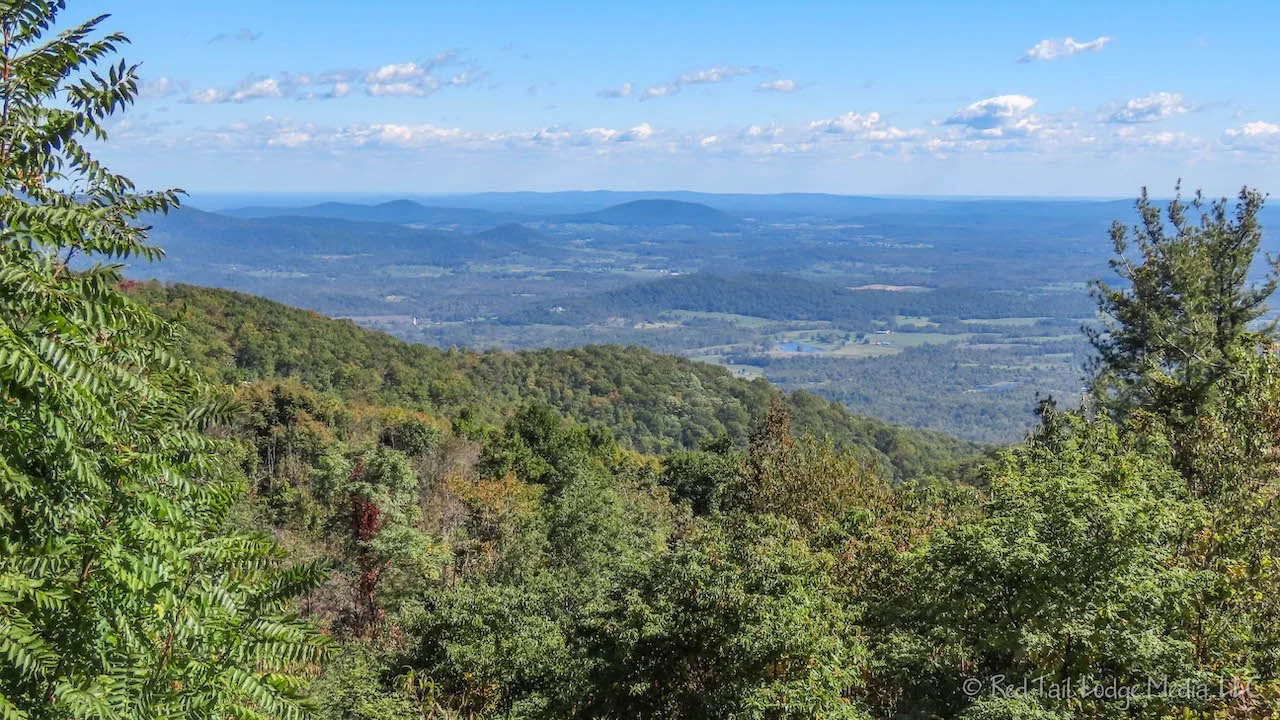
The views from the summit were gorgeous. It must be pretty spectacular once the trees take on their autumn glory. The summit is at 3494 feet. The total mileage for our hike was 3.8 miles with an elevation gain of 1198 feet which took us two hours and 25 minutes to complete. It is hike number 50 of our 52 Hike Challenge.

From Panorama parking area, we drove down Skyline Drive to our next campground, Big Meadows. We stopped at several of the overlooks along the way. Big Meadows is a large complex with a lodge, cabins, store, gas station, restaurant, and visitor center in addition to the large campground.

We stopped for gas and food before heading back to our camp site. The restaurant next to the gas station was serving takeout. Right Buddy (RB) had a blackberry cobbler with hand dipped blackberry ice cream on top. It was delicious! Left Buddy (LB) had a chocolate shake which he said was OK.
The building next to the campground registration office sells firewood and a few grocery items in addition to housing coin showers and coin laundry. Our camp site was nestled in the trees near the walk-in tent sites. It was in the “no generators allowed” area. In the middle of the night, we heard strange animal sounds that we could not identify. LB thought it sounded like an owl, RB thought it sounded somewhat like a coyote. RB tried to record it on LB’s iPhone which was next to our bed, but the sound was too far away by the time she started recording.

Wednesday morning we drove over and hung out by the visitor center. There was no cell signal in the campground, but there was a weak one by the visitor center. We both needed to get some emails out. The signal was not strong enough to upload a video. That will have to wait until another day.

While we were there, we talked to a ranger to get more hiking recommendations. We told him we were looking for multiple short hikes, around three miles long or less. He suggested the Dark Hollow Falls, Bearfence Rock Scramble, South River Falls, Doyles River Falls, and Blackrock Summit. We had driven by the trailhead for Dark Hollow Falls on the way into Big Meadows the day before. The trailhead is not far from the visitor center. The trailhead parking lot was packed and overflowing. Hiking on a crowded trail did not appeal to us, so we decided to hike to Lewis Falls from the campground instead. The ranger said that the views of Dark Hollow Falls are better than Lewis Falls, but it is still a great hike.
We saved Bearfence Rock Scramble and South River Falls hikes for on our way to Loft Mountain Campground the next day. Doyles River Falls can be reached from the Loft Mountain Campground. The Blackrock Summit is on our way out of the park after camping at Loft Mountain.

After lunch, we hiked to Lewis Falls. We started from the campground amphitheater. After a short distance on the Appalachian Trail (AT), we turned onto Lewis Spring Falls Trail. It descends most of the way to the falls. The trail is mostly in the woods, with some views of the valley and surrounding mountains every now and then. The falls are at the end of a short spur trail. First you come to a rock outcropping at the top of the falls. The trail continues across the stream and over to a viewing platform, where you can see the tall waterfall plunging down to the depths below.

After the falls, the trail climbs steeply with switchbacks up to meet the AT again. For a short while, the AT follows a gravel service road before making a left turn back into the woods. The trails are well marked, but somehow we missed the left turn. Luckily we checked our maps shortly after that and realized we were off our intended route. We backtracked and got back on the AT.
Before returning to the campground, we took another short spur trail off the AT to the Blackrock Overlook. This is not to be confused with the Blackrock Summit we were planning to do a couple of days later. There is a similar view from the AT, but the spur takes you up higher to a rock outcropping which makes the views across the valley more spectacular. The spur is definitely worth the trouble.

During our hike, we left our van in the parking lot at the picnic area near the amphitheater so it could sit in the sun. Our batteries needed to charge and sitting in the shade of our campsite was not helping. After our hike, we decided to leave our van parked in the sun a little while longer while we took showers. The showers are next to the picnic area, so it was also more convenient than walking up from our campsite. Showers were $2.50 for five minutes. That seemed a little pricey, but the showers were nice. Each shower was in a separate enclosure in the building and was nicely tiled. It looked like an attendant was cleaning the showers often, perhaps between each user.

Back at our campsite, we made dinner as the deer wandered through the campground. We were surprised at how many deer we saw during our stay at Big Meadows. We did not see any deer at Mathew Arms campground. You would think that Big Meadows, with its large complex of buildings, larger number of campsites, and more people would have less wildlife roaming close by. But perhaps they are just more accustomed to people being around and are not so easily scared off.

On Thursday, we moved campgrounds, from Big Meadows to Loft Mountain. We first stopped at the Big Meadows visitor center to try to send a few emails. However, the cell signal was weaker than the day before. Further south on Skyline Drive, we stopped at an overlook which had a slightly better cell signal. We stayed there for awhile and took care of some personal business. By the time we wrapped that up, it was lunch time. The Lewis Mountain Picnic Area was not far away, so we drove over there for a picnic lunch and to use the restrooms. At the time, the restrooms were the top priority since the overlook where we were hanging out did not have any. The picnic area was nice, a large field with picnic tables along with enough trees to give you shade if you wanted it and sunshine if you needed to warm up. It was a cool day, so we chose a picnic table in the sun.

From the picnic area, we back tracked a couple of miles to the Bearfence Mountain parking lot to go on a hike. The Bearfence Rock Scramble Hike is only 1.4 miles long, but it took us about an hour and twenty minutes to complete. The park info says the elevation gain is 311 feet, but RB’s AllTrails app recorded only 253 feet. The east side of the loop is the rock scramble while the west side of the loop follows the Appalachian Trail (AT). If you don’t want the rock scramble, you can take a lollipop route instead of the loop which follows the AT longer and avoids the rock scramble. The lollipop route goes to the 180 degree viewpoint, while the rock scramble loop also includes a 360 degree viewpoint.

The rock scramble was challenging, but fun. It did not seem very dangerous as there were not steps drop offs next to the trail. RB thought the 360 degree view was the best view we had seen so far in the Shenandoah National Park.

Since it was getting late in the day, we decided to skip the South River Falls hike that we had planned. Instead, we drove south along Skyline Drive to the Loft Mountain Campground, stopping at a couple of the overlooks along the way.

When we arrived at the campground, LB decided to try to run the wire for hooking up our fridge to the DC circuits. We are currently running the fridge on AC power. However, that means we need to have the inverter on all the time, which drains a small amount of power and is less efficient. The wire needed to run from the DC fuse block in the electrical cabinet, under the gear slide, and over behind the fridge on the opposite side of the van. It was pretty easy to pull the gear slide out and run the wire. LB bundled the two wires together using electrical tape. Then he crimped on a couple of connectors on the end near the electrical cabinet. Unfortunately, the connectors were too large to put into the positive side of the fuse block. He did manage to connect the black wire to ground. But the biggest problem was that the length of ten gauge wire that he had ordered was a few feet too short and would not reach the fridge. Bummer!

Friday morning we drove over to the Doyles River Trailhead parking lot to go on a hike. It was close enough that we could have hiked from the campground, but that would have added a couple of miles to the hike. We felt like going on a shorter hike than that. Besides, we needed to find a good cell signal and let our solar panels get some sun to charge our batteries. The parking lot had a great Verizon signal that RB was able to upload the next video in less than half an hour.

Our hike was down to a couple of falls along the Doyles River. This route did not share any of the Appalachian Trail (AT), but we did cross the AT trail. On the way down to the falls, we took a little spur trail over to a cabin just out of curiosity. The cabin belonged to the Potomac Appalachian Trail Club (PATC) and was only for members. It looked like a nice place to stay. Back where the spur trail split off from the Doyles River Trail, there was a mountain spring. However, posted signs said to boil the water for a minute before drinking it.

Unlike many of the trails we had been on recently, the trail was pretty easy footing most of the way. That gave us the luxury of looking around at the scenery around us since we did not need to concentrate on where we were placing our feet. It wasn’t long before the trail met up with the Doyles River and followed alongside it. The running water trickling next to us was a calming sound and soothed our souls. First we came across a small waterfall that we thought was the Upper Doyles Falls, but a short distance later we came across the more impressive Upper Falls. About a quarter of a mile later are the main Doyles Falls which were even more impressive. We sat down on a boulder within view of the falls and ate our lunch, listening to the rushing water.
The hike was not very challenging and the scenery was not spectacular, but RB thought it was her favorite hike in Shenandoah National Park. Perhaps it was the timing of the hike that made it feel so good. It was peaceful and just the type of hike we needed after all of the challenging hiking we had been doing the past month.

The hike back to the parking lot was all uphill. RB noticed that she was breathing harder and sweating so much more than LB. In fact, she had been noticing that over the past month. She used to be in better shape than LB, but now it seems like he is in better shape than her. When did that happen?

Our hike clocked in at 3.6 miles with an elevation gain of 1079 feet which we completed in two hours and 15 minutes. This was hike number 51 of our 52 Hike Challenge.

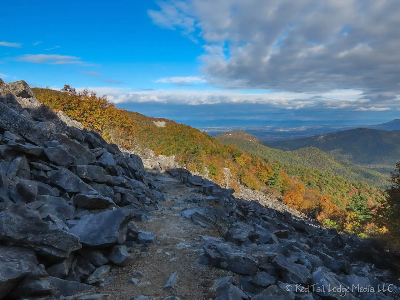
After the hike, we drove over to the Wayside across from the campground so we could use the restrooms and buy a couple of Cokes. Then we drove back to the overlook just across the road from the Doyles River parking lot. The view from the overlook was one of the better overlook views we had seen in days. The autumn colors were pretty good from there. It was a great location to sit and catch up on work and personal emails with a good cell signal in wonderful surroundings.

On the way back to the campground, we stopped at the campground store looking for ice cream. They didn’t have ice cream, but they did have a f’real milkshake machine. We never had one before, but remembered that our daughter told us she like them. So we gave them a try. They were not the best milkshakes we’ve ever had, but they satisfied our ice cream cravings.

Back at the campground, LB defrosted our freezer while RB worked on a video. Our freezer is not very big, but it was getting so small due to all the frost that the two ice cube trays barely fit. We had not defrosted it all season, so it was overdue.

Saturday was a long travel day. Well, it was a longer drive than we had done in a while. From Loft Mountain, we headed south on Skyline Drive which then turned into the Blue Ridge Parkway. Shenandoah National Park borders Blue Ridge Parkway National Park. Our destination for the day was our friends Joe and Joy’s house on Smith Mountain Lake, just east of Roanoke, Virginia.
Not far from Loft Mountain, we stopped at Blackrock Summit Trailhead to hike up to the summit. It is a short hike, just a little over a mile round trip. The footing was also easy along most of the trail. The route is a loop. We headed out the service road and came back the Appalachian Trail. The two trails parallel each other.

When we reached the summit, there was a Cub Scout troop there. To reach the actual summit, a short rock scramble was required. The trail is great for groups of people who want to hike together since the service road is wide. It is also great for kids. The trail encircles three sides of the summit, so kids can scramble on the rocks without fear of falling off a drop off or steep edge. They could still get hurt on the rocks, but it’s safer than the Bearfence Rock Scramble Trail we went on earlier in the week.

There were great views from the summit. However, if you didn’t want to scramble up the rocks, the view from the trail was almost as nice as the true summit.

When we returned to the trailhead around 10 am, a couple of cars were waiting for parking spots to open up. It was a Saturday and we’re glad we got an early start so we didn’t have any problems getting a parking spot a little bit after 9 am. Now it was time to move on to the Blue Ridge Parkway.

We were so glad we spent so much time in Shenandoah National Park. The park has so many wonderful trails that it would take a lot longer to explore them all. However, we feel we got a good taste of what the park has to offer in the time we had. Most people don’t have that much time to spend in the park. They would still have a great experience is less time, but, if you love to hike, it would take weeks to run out of things to do.
Check out our related video: Shenandoah National Park, Virginia
(RB)