
Sequoia National Park Revisited - May 23rd to 30th, 2024

There is just something special about our National Parks that keep us coming back, even to ones we’ve been to before. Sequoia National Park in California is no exception. Our first visit to Sequoia was too short. This time we spent a little more time there and explored new areas of the park.
Thursday we drove from Pyramid Lake to Sequoia National Park. Starting out, we headed out of the mountains, down to the valley floor. Once we turned off interstate five, onto route 99, we were surrounded by farm land, pasture land, but mostly orchards. In the median of the highway were white and pink flowering bushes all the way to Bakersfield. More highways ought to landscape like that. It was so much nicer to see the pretty bushes instead of the oncoming traffic on the other side.
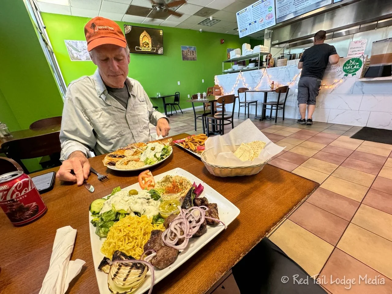
We stopped in Bakersfield for groceries and gas. From there we got onto a smaller highway, route 65. That was more to our liking, smaller roads, less traffic, and less trucks. In Porterville, we stopped for lunch at Kabob Land. It was a small little place and the parking was a little tight, but the food was great. Keith had the gyro schwarma sandwich with fries while Ann had the lamb kebob plate which came with hummus, pita bread, salad, and rice. Even Keith’s sandwich came with hummus and salad. It was more food than we normally eat, but we’ll just have a light dinner to counteract that.

During one short section of the drive, there was the most dense concentration of oil wells that we’ve ever seen. It didn’t last long and we were soon surrounded by orchards again.
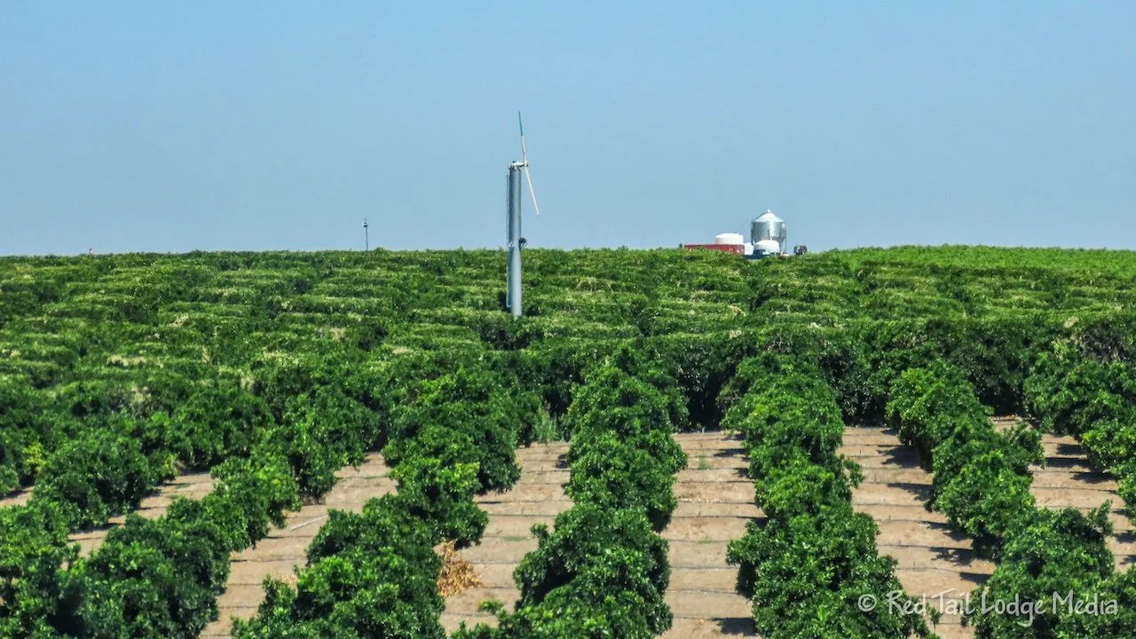
Out in the orchards were what looked like windmills. A little research revealed that they were wind machines or frost fans. They mix the stratified air in oder to increase the air temperature a few degrees to hopefully prevent the trees from freezing. You learn something new everyday.

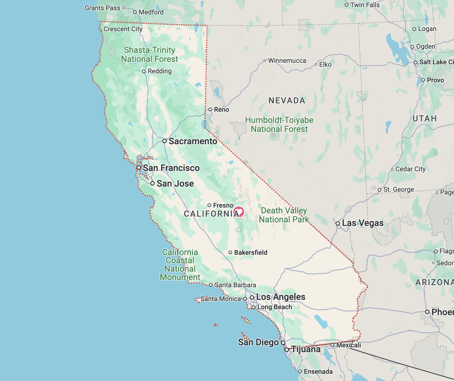
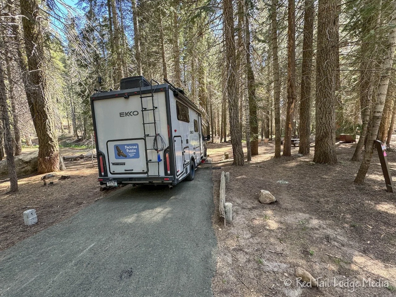
After we turned onto route 198, we passed by Lake Kaweah then entered Sequoia National Park and started climbing in elevation. Three Rivers is only at an elevation of about 800 feet. By the time we reached Lodgepole Campground, we were at 6700 feet. The 6000 foot climb meant that the road is steep and winding. The ranger at the entrance station asked how long our RV was. The recommended limit on Generals Highway (route 198) is technically 22 foot, but the ranger said we should be OK with 23 feet, as long as we were cautious and drove slowly.

The climbing road was beautiful. Most of the way, it follows alongside the raging Kaweah River. They have been doing road repairs along the Generals Highway and there was one small section left which was down to one lane. Warnings on the park website said to expect up to a 30 minute delay for construction. However, we hit the traffic light at the one lane section perfectly, barely stopping before it turned green, so no delays for us.

After settling into our camp site, we went for a walk. First we checked out the little market. We remember getting an ice cream treat there the last time we were in Sequoia (Sequoia National Park - June 30 to July 3, 2019). The market still sold them, “It’s-It”. It is a traditional San Francisco treat. A scoop of ice cream between two oatmeal cookies, all covered with dark chocolate. We bought two of them to have later that evening after dinner, one with vanilla ice cream and one with mint.

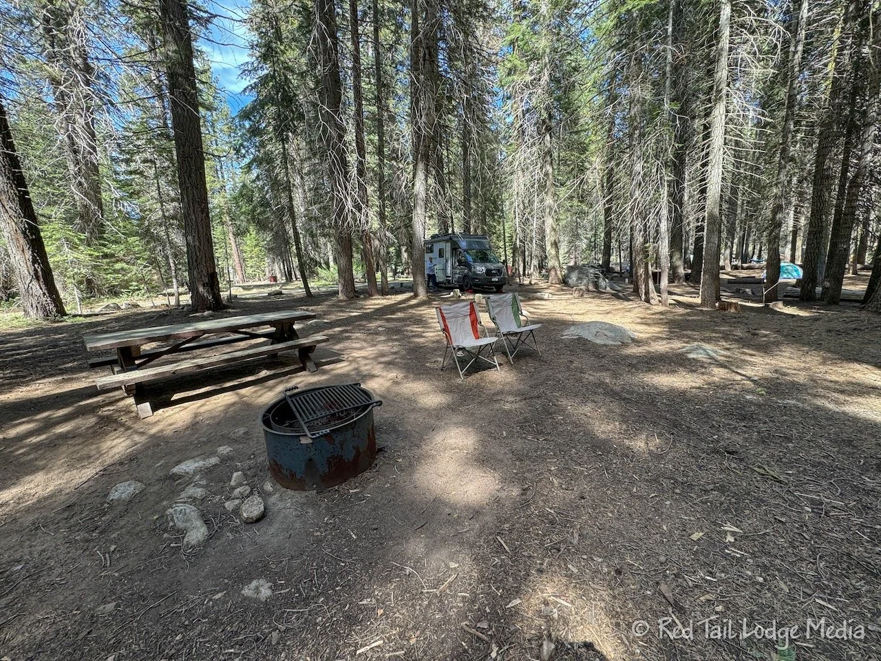
For exercise and scenery, we walked all the loops of the campground. It was larger than we thought. We covered 2.9 miles with an elevation gain of 237 feet in an hour and eight minutes. That’s almost a hike.

Friday we went on a real hike, right from our campsite. The Lodgepole Trail goes from the Lodgepole Campground over to Sherman’s Tree. It is about three miles each way. Most of the way, the trail follows an old road bed, so it is nice and wide. There were still patches of snow alongside the trail. At some points, a small stream was created down the middle of the path from the spring runoff.

There was no one else on the trail until we joined the paved Sherman Trail that heads down to the General Sherman Tree from the parking lot. It turns out there was probably a good reason that no one else was on the trail. After about a mile or so in, the trail crosses a stream.

The water level of the stream was pretty high. The way across was on top of boulders and piles of logs. It was a rather sketchy crossing. If it had been closer to the trailhead, we probably would have turned around. Ann was glad to have her trekking poles. She would not have attempted the crossing without them. Keith only had one pole with him. Ann offered to hand him one of hers, but he didn’t want it. We both made it across without getting hurt and without getting wet.

The water was somewhat shallow near the crossing and the current was not very strong there, as it looked like part of the stream was diverted through a culvert. If one of us did fall in, we probably wouldn’t have been swept down stream. However, we probably would have gotten hurt, either on the rocks or on the stubs of branches sticking out on the logs. The current quickly increased just a few feet downstream. If we weren’t able to catch ourselves and get out of the water and were swept downstream, we probably would not have survived. It’s not a stream crossing we would care to repeat.

No one was on the Lodgepole Trail, but there were lots of people on the Sherman Trail and the other trails in the Giant Forest. The General Sherman Tree is the largest tree in the world, by volume. There was a line of people waiting to get their picture taken in front of the tree with the sign. We didn’t feel the need to wait in line, opting to just observe the tree from the path that encircles the base of the tree.

We sat down on a nearby bench to enjoy our snack, then headed over to the bathrooms by the shuttle stop. The free shuttle service had started just the day before for the season. We could have taken the shuttle from there back to the campground. However, we still had some miles left on our legs and wanted to spend more time in the Giant Forest.

We continued our hike on a series of trails over to the Giant Forest Museum. The Congress Trail took us to a short section of the Alta Trail before turning onto the Rock Rim Trail that led us most of the way to the museum, where it joined the Hazelwood Nature Trail. The Congress Trail was paved and was where most of the people were. Once we turned onto the unpaved trails, we only saw three other people until we got close to the museum and the trail joined the paved Hazelwood Nature Trail.

The Rock Rim Trail was a little closer to the Generals Highway than we would have liked. However, it also has a lovely waterfall at the creek crossing which makes up for the faint highway noises. This creek crossing was also much more manageable.
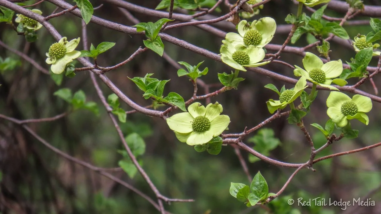
The dogwoods along the Hazelwood Nature Trail were in full bloom, adding their beauty to the already scenic trail.
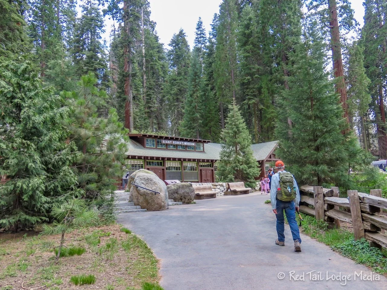
When we reached the Giant Forest Museum, we had gone 6.8 miles with an elevation gain of 817 feet in four hours and 15 minutes. It was hike number 19 of our 52 Hike Challenge for 2024.

From the museum, we took the shuttle bus back to the Lodgepole Campground. At the Lodgepole Visitor Center, we asked about the trail from the Wuksachi Lodge back to Lodgepole. Our plan was to have dinner at the Wuksachi Lodge, taking the shuttle there and possibly hiking back, since the shuttles stop running around 6 pm. However, it looked like the trail had a creek crossing, so we wanted to make sure it wasn’t as sketchy as the one on the Lodgepole Trail. According to the ranger, the water crossing on the Wuksachi Trail is probably sketchier than the one on Lodgepole this time of year. OK, no thanks!
Wuksachi Lodge is about 2.5 miles up the Generals Highway. We asked about riding bikes on the road. The answer was that they were allowed, but not recommended. The highway is narrow with no shoulders. We also could walk the road, but, again, we would have the same issue with traffic.

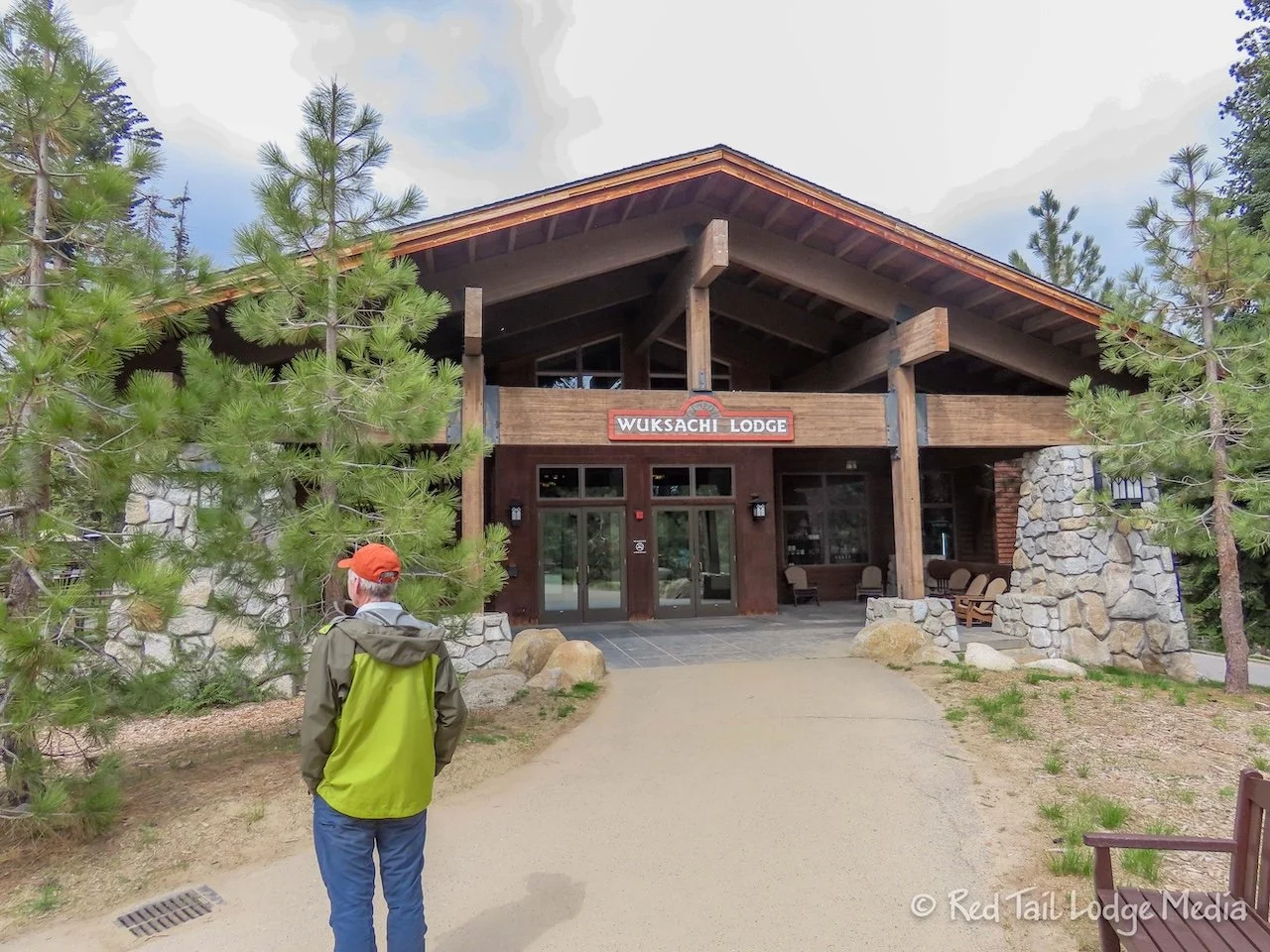
It was only 3 pm, so we decided to have an early dinner at Wuksachi and take the shuttle bus both ways. We dropped off our hiking gear at Red Tail (our Winnebago EKKO), changed out of our hiking boots, and walked over to the shuttle stop. The shuttles to Wuksachi don’t run as often as the shuttles to the museum, only about once every 30 minutes, so we had to wait a while to catch one.
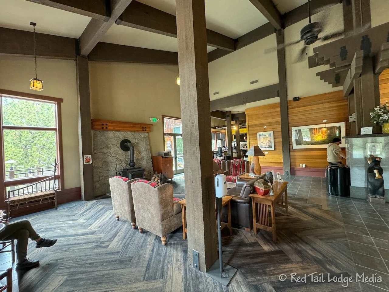
The Wuksachi Lodge was nice, but not as nice as we imagined. We were expecting something a little more grand, like the lodges at Yellowstone or the Grand Canyon. The restaurant didn’t open until 5 pm. We didn’t ask if you needed reservations and, if so, were there any openings. We felt that we wouldn’t be done with dinner in time to catch the last shuttle back.

In addition to the restaurant, there was a Pizza Deck. There were tables out on a deck on the side of the lodge. An order window allowed you to order pizzas, soup, salads, and sandwiches along with alcoholic and non-alcoholic drinks. We opted for the Pizza Deck. They said the pizzas were 12 inches, so we each ordered one. Keith had a beer while Ann drank soda. The pizzas seemed larger than 12 inches. We could only eat about half of the pizza. We should have just ordered one and split it.
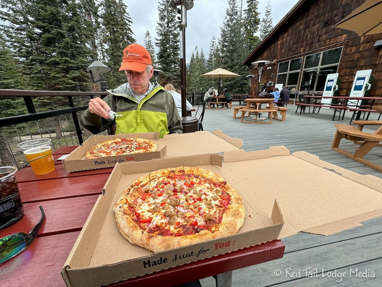
The temperatures were in the 50’s. We were not quite dressed warm enough to be sitting outside. There were heaters on the deck, but only one was turned on. Several people attempted to turn some of the other heaters on, but were unsuccessful. Our clothing was probably still a little damp from our hike, which wasn’t helping. We both had a thin warm layer on along with our rain jackets. Puffy coats would have been more comfortable, but those were back at Red Tail. Luckily, Ann had her headband and light gloves with her. She was able to stay just barely warm enough.

By the time we finished our meal, we really weren’t in the mood to explore the area around the lodge. Besides being cold, our legs told us they had walked far enough that day. So we had plenty of time to catch a shuttle back to Lodgepole. We were back at Red Tail by 5 pm. After warming up with a cup of hot chocolate back inside our rig, we were as good as new again.

Our original plan was to stay in Sequoia for five days, then five more days in Kings Canyon. However, due to road construction, road closures, and late campground openings, we didn’t get the campground reservations we were hoping for. We managed to get two nights in Lodgepole, then had to find somewhere else to camp for two nights, then come back to Lodgepole for three nights followed by three nights in Stony Creek, a National Forest Service campground between Sequoia and Kings. We’ll cover the two nights that we had to leave the park, Saturday and Sunday, in our next blog post about Hensley Lake.

Monday we headed back to Lodgepole Campground in Sequoia from Hensley Lake. Along the way, we stopped in Fresno for gas, groceries and to pick up our Starlink dish. We sat in the Best Buy parking lot while Keith unboxed the dish and set up our account. He wanted to make sure everything worked before we left. After getting connected, there were several software updates that needed to be downloaded.

In the meantime, Ann was a little bored. So she walked over to Target to get a bottle of Coke. Then she decided it was close enough to lunchtime and fixed herself a meal. Keith finally got everything set up, then ate his own lunch. By the time we left, we had been there over an hour.
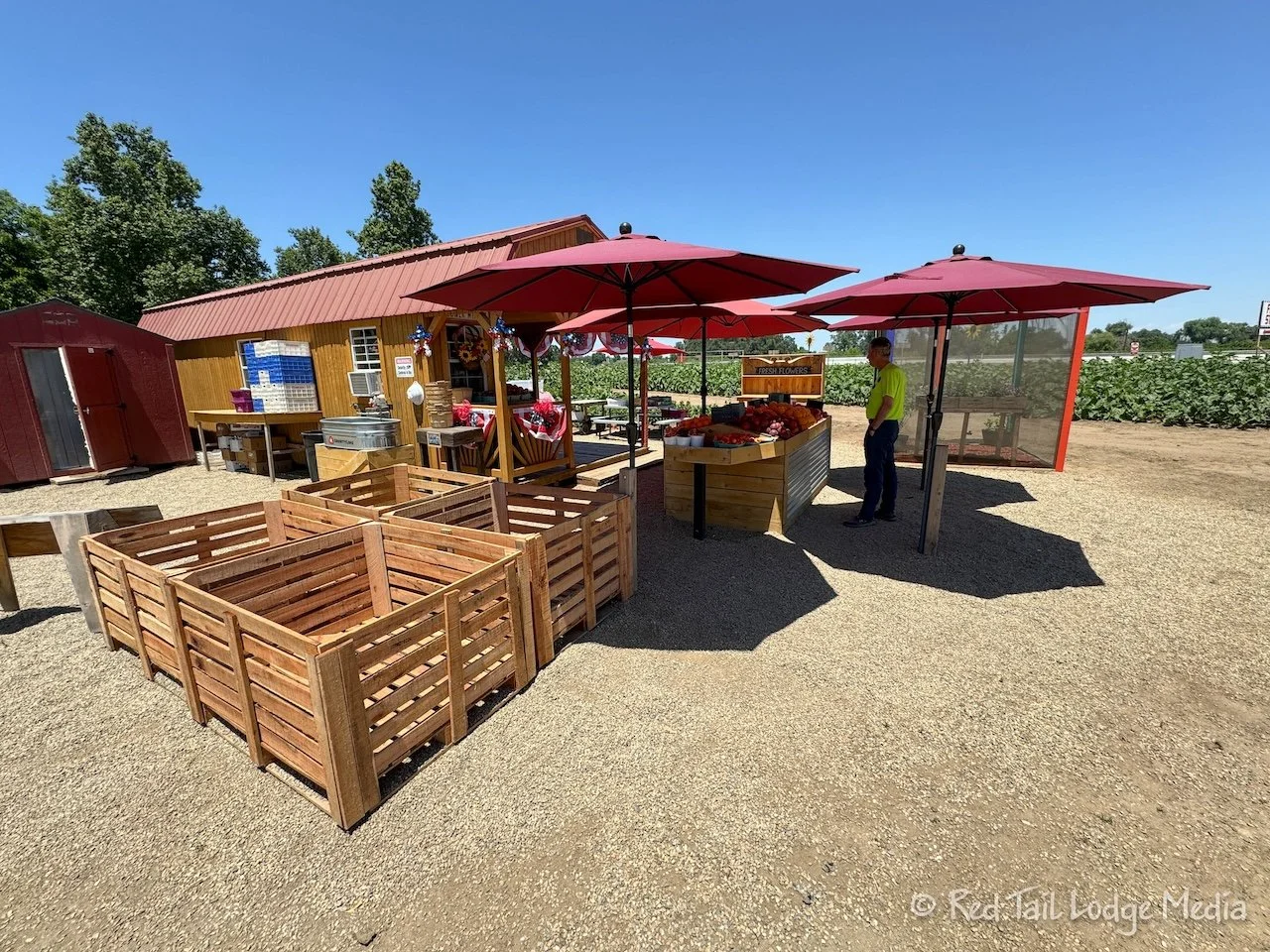
The only other stop we made was at the Sunflower Farm Stand along highway 180. We felt we couldn’t drive through all those orchards and farm land and not pick up some fresh, local produce. It was strawberry and cherry season, so we bought a basket of each. Then, Ann couldn’t resist also getting a jar of strawberry and blueberry jam.

By the time we set up camp, it was almost 3 pm. We hustled and got ready for a hike. Part of the agreement for picking up Starlink was that we would save time for a hike that same day. Ann wanted to do the Tokopah Falls Trail which starts right from the campground. The trailhead sign said it was 1.7 miles to the falls, but we clocked it as being over 2 miles. Plus our campsite was about a quarter of a mile or so from the trailhead. By the time we returned to our campsite, we had gone 4.8 miles with an elevation gain of 653 feet. So what we thought would only take us two hours, ended up taking us three. We counted it as hike number 20 of our 52 Hike Challenge for 2024.

As a precaution, we had brought along our headlamps, but that was intended for an emergency situation, like a sprained ankle, when we might be out on trail much longer than we expected. We didn’t think we would be hiking slow enough to need them. We returned by 6 pm, with plenty of daylight left in the day. However, as we started out on the trail, there was a Search and Rescue (SAR) team heading up the trail, with a pair of crutches in hand. About a mile into the hike, we came across the group of hikers the SAR team was helping. A young woman must of injured her ankle and was going to use the crutches to hobble the mile back to the trailhead. That didn’t sound like fun! One of the other women in the group looked familiar. We had seen her earlier on the trail. She must have been the one to hike the mile out and get help, then returned that same mile to her hiking group. It is for those types of situations that we carry a Garmin InReach (paid link) with us. If we would have come across the group earlier, before they sent someone ahead for help, we could have sent on SOS for them. Somehow, they managed to return to the trailhead by the time we returned on the trail, because we didn’t come across them on our way back.

The Tokopah Falls Trail was beautiful. It follows alongside the Marble Fork Kaweah River the whole way. Rocky mountain peaks tower overhead. The river was raging this time of year from the snow melt. You pass several impressive waterfalls along the way. The water was even flowing across and along the trail in some areas, so we had to cross water several times, but they were not too sketchy. The water was not flowing fast over the trail and it was only ankle deep at the most. So, as long as you didn’t fall and get hurt on the rocks, the worst thing would be that you got your feet wet.

A mule deer scurried past us. We saw several marmot climbing around on the boulders. Ann thought she caught a glimpse of a quail or ptarmigan before it quickly scrambled over and behind a large rock.

The trail gets pretty rocky near the end. We would recommend hiking poles for balance among the rocks, although many people were managing without poles. Poles would also help during the water crossings.
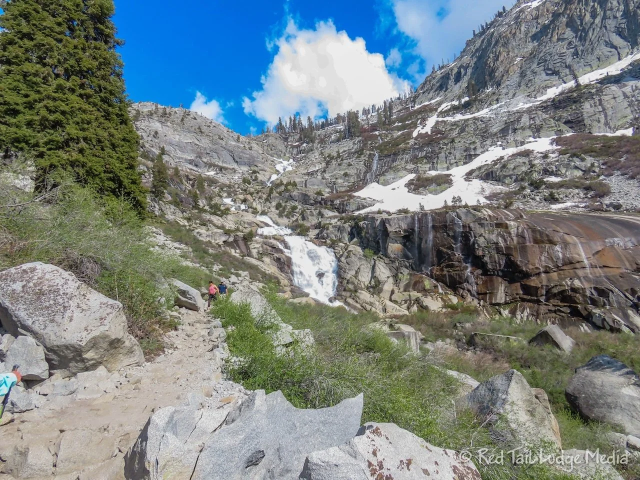
Then there is the highlight of the trail, the Tokopah Falls. You start seeing it in the distance. It is a tall waterfall, cascading down the steep cliffs of the mountain in front of you. In fact, the better views of the whole falls is before you reach the end.

At the end, you can only see the last, large section of the waterfall, as you are too close to see the upper sections above you. However, you get a real sense of the power of the falls when you are up close. You can feel the spray of the water. It is a very impressive sight, at least when we were there. We’re not sure what it is like in the fall, after the rush of the spring melt is gone.

After dinner, we went to the ranger program at the amphitheater. It has been a few years since we’ve been to one. It seemed like many parks stopped having ranger programs in the campgrounds when COVID hit, and many of them were slow to bring them back, probably due to staffing issues. We wanted to make sure we supported the programs, so we went. We were glad to see there was a decent attendance.

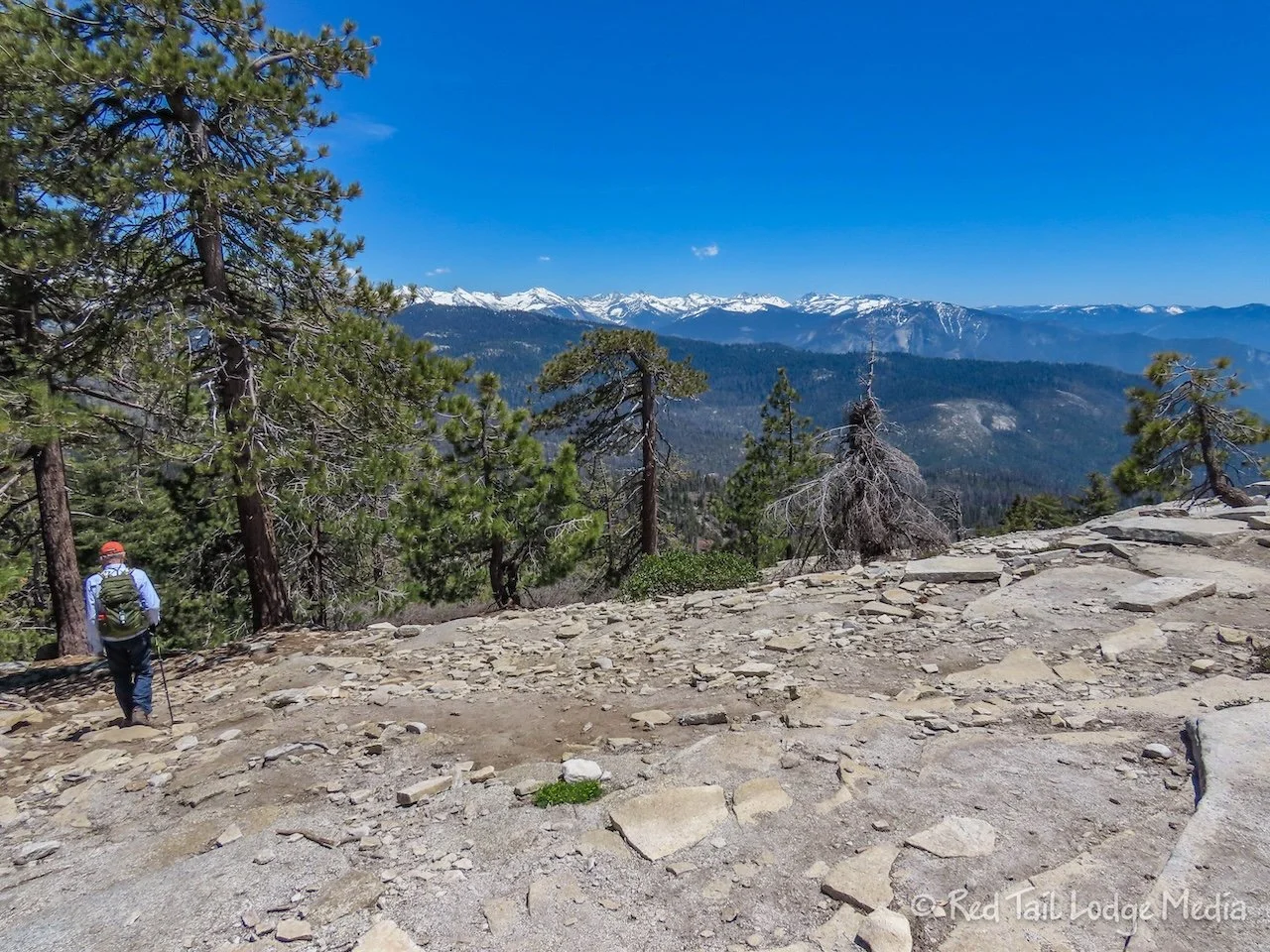
Tuesday we went for a hike in the Crescent Meadow area. It took two shuttle buses to get there. One took us from the campground to the Giant Forest Museum. From there, we hopped on a shorter bus that drove us up past Moro Rock and to Crescent Meadow. Most people got off at Moro Rock, to climb up to the top, for wonderful views of the mountain valley. We did that hike the first time we were at Sequoia during Season One (Sequoia National Park - June 30 to July 3, 2019). We also hiked around the meadows last time. But this time we picked out a route that combined mountain valley views with the meadows. It is called Bobcat Point and Eagle View via Sugar Pine and Crescent Meadow Loop.
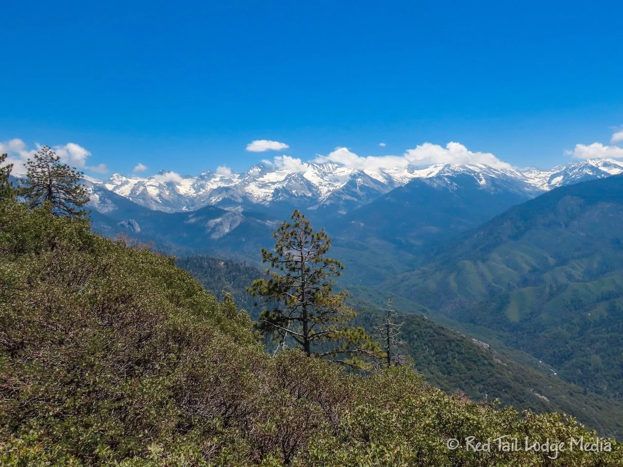
We could see the people on top of Moro Rock from both Bobcat Point and Eagle View. From what we remember, the view from Eagle View was even more stunning than from Moro Rock. Our shuttle driver said that it looked like it had snowed on the mountain peaks overnight, which added to the beauty. If you’ve never hiked Moro Rock, it is worth the climb. In addition to the views from the top, it is an interesting route up the rock. However, if you’ve already done that hike, or are afraid of heights, or don’t like crowds, then we recommend Eagle View.

There was a stream crossing along the Bobcat Point Trail on the way to Bobcat Point, but it was not too sketchy, just a walk across a log.
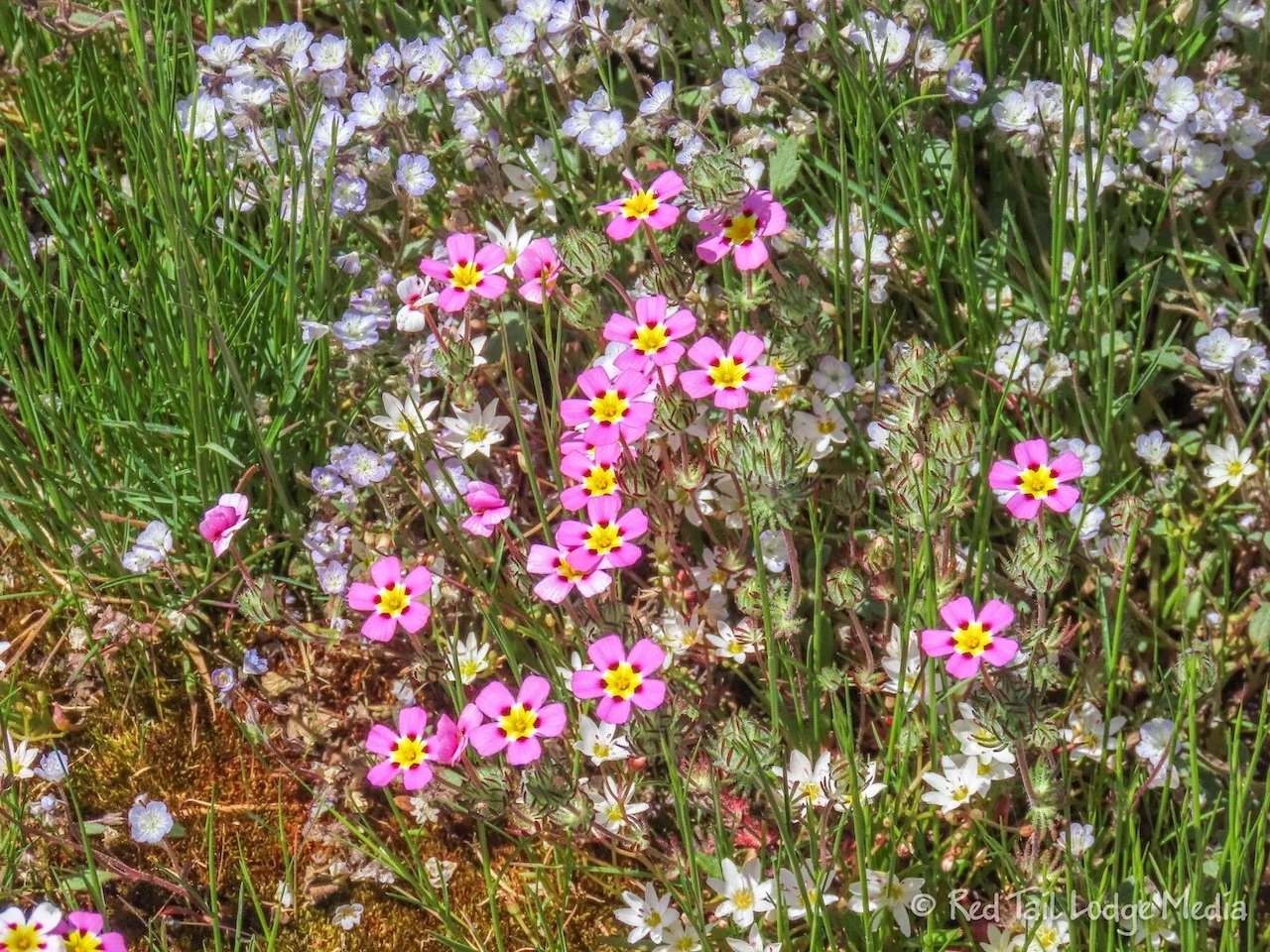
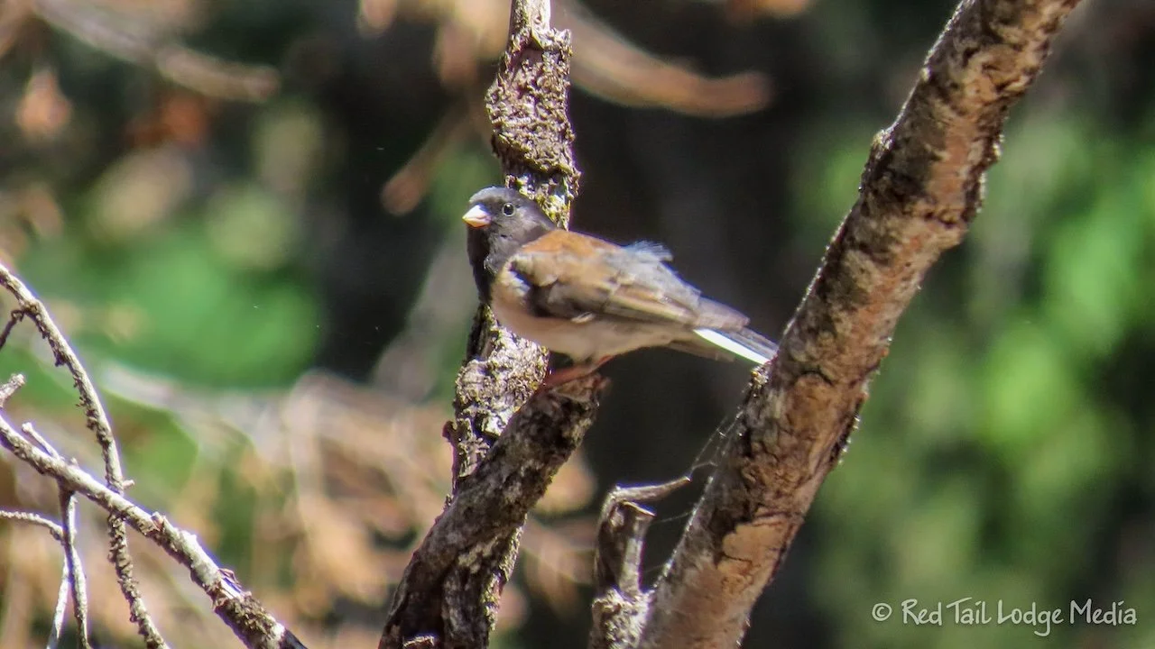
There were wildflowers everywhere along the trail. A wildfire had gone through the area a couple of years ago, which opened up the forest floor to more sunshine, which allows more plants and trees to sprout and bloom. A constant variety of bird song drifted down from the tree tops.

We deviated from the route in AllTrails a little. Instead of dropping down to the Crescent Meadow Trail from the High Sierra Trail, we stayed on the High Sierra Trail from Bobcat Point to Eagle View. We saw that the Crescent Meadow Trail was paved at that point and we preferred to stay on dirt trails. However, it might have been the more scenic route, as that portion of the High Sierra Trail was just a nice trail through the woods. It was below the ridge line, so we lost the view of the mountain valley.
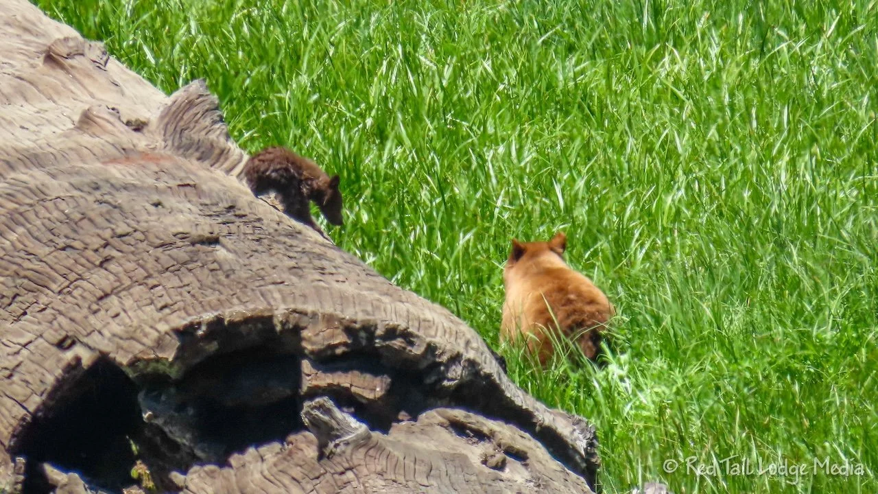
The other deviation was returning from Eagle View, where we descended down to the Log Meadow Trail instead of taking the Trail of the Sequoias. This turned out to be a good decision. As Log Meadow came into view, we spotted a light brown blob in the meadow. It was a mama bear! A little cub was nearby. After taking a couple of pictures, we hiked down closer to the meadow, where we paused to watch the bears some more.

They put on quite a show for us. The baby bear climbed all over a large log, then hopped along in the grasses, while mama grazed nearby. Then they went closer to the trail on the other side of the meadow. While baby bear climbed a tree, mama ripped open the trunk of a fallen tree to eat the bugs inside. There were people watching the bears from the trail on the other side of the meadow. In our opinion, some of them looked a little too close to the bears. But the bears didn’t seem to mind. We normally use the rule of thumb, where you hold out your hand at arms length. If you can cover up the animal completely with your thumb nail, then you are a good distance. But, an even better rule is if your presence changes the animal’s behavior, you’re too close.

We continued the route past Tharp’s Log and Chimney Tree. Tharp’s log is a fallen Sequoia Tree that Hale Tharp turned into a home when he was raising cattle in the area in 1861. The Chimney Tree is a burned out Sequoia tree, where you can walk inside and look up the hollowed out trunk to see the sky.

The Crescent Meadow Trail brought us along the far side of the meadow back to the trailhead. At that point, the Crescent Meadow Trail was dirt and no longer paved. By the time we returned to the trailhead, we had gone 4.1 miles with an elevation gain of 617 feet in three hours and 20 minutes. It was hike number 21 of our 52 Hike Challenge for 2024.

At the trailhead, we learned from some other hikers that the mama bear had bluff charged some people on the trail. The people were a little too close and the bear apparently wanted to cross the trail. She snorted and raised up on her hind legs. Other people were yelling instructions to the ones that were being challenged. Don’t run. Make yourself look as big as possible. Slowly back out of the way. Luckily, no one was hurt.
On the shuttle ride back to the museum, there was a traffic jam at Tunnel Log. Vehicles (less than 22 feet long and less than 8 feet tall) can drive through the Tunnel Log. Most people stop their vehicle in the tunnel for a photo op. There is a bypass around the Tunnel Log that the shuttle and other vehicles take. However, the road is narrow and there were so many vehicles waiting for their turn to go through the Tunnel Log, that no other vehicles could get by. The shuttle drivers radioed for park ranger assistance. We sat there for over ten minutes waiting for the traffic jam to clear up. According to our first shuttle driver, the previous Saturday and Sunday was even worse. We’re glad we left the park for most of the holiday weekend to avoid the crowds.

Back at camp, Keith worked on finding a place to store our new Starlink dish. It fit perfectly next to our laundry basket under the passenger side bed. First he removed the vertical strip of wooden trim of the cabinet opening to make it easier to get the dish in and out. Then he attached a short strip of aluminum angle along the front edge to keep the dish from sliding sideways. Then he attached a bracket at the top to keep the dish from tipping backwards towards the laundry basket. Finally, he attached a velcro strap between the metal angle and the dish to secure it in place. Not bad for just using parts and bits we had with us. No run to a home improvement store needed.
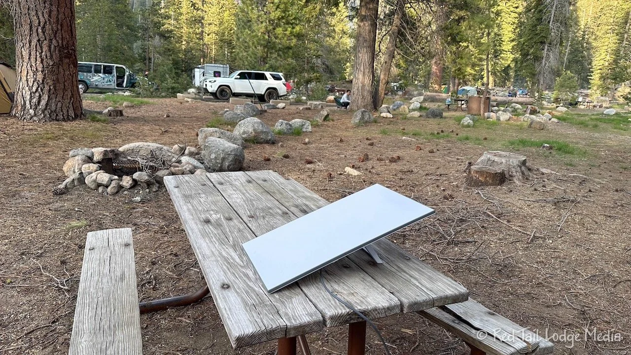
Despite the trees in the campground, we were able to get a good connection with the Starlink. Even though the connection was dropping about once a minute, it was so fast while it was connected, that you could hardly notice the 10 to 15 second drops. Speedtest was reporting a throughput of 321 Mbps down and 27 Mbps up. We could get used to that!

Wednesday was a light hiking day. We took the shuttle over to the Giant Forest Museum and took a couple of short trails from there.

The first trail was the Big Trees Trail. It is a flat, paved, accessible trail that loops around a meadow that is lined with Sequoia Trees. It is a popular trail, but it didn’t seem too crowded the day we were there. From the museum, the trail was 1.3 miles with an elevation gain of 102 feet. We were back at the museum in less than 45 minutes.

The second trail was the Sunset Rock Trail. There are not many Sequoias on the trail, but we had the trail all to ourselves. There were wildflowers galore all along the trail. We watched a deer settle down in a spot behind a Sequoia tree. A woodpecker was pecking away on a dead tree trunk. At the end of the trail is a nice panoramic view, not as stunning as Bobcat Point or Eagle View, but still nice. Sunset Rock was just a little longer than the Big Trees Trail, clocking in at 1.7 miles with an elevation gain of 141 feet which we completed in less than an hour. The trails were so short that we didn’t even count them towards our 52 Hike Challenge.

We were back at camp by 3 o’clock in the afternoon. It was laundry day and we were hoping the machines at the campground wouldn’t be busy in the afternoon. When we arrived with our two loads, two of the three machines were taken. Luckily, the open one was the large one, which took both our loads. While we were there, several more people arrived, doing just one load, so no one had to wait very long.

While Ann did the laundry, Keith worked on running the cable for Starlink through the cable box on the roof of Red Tail. He ran a cable through the box, into the cabinet above the driver side bed and over to the area between the beds, where he planned to mount the router. He coiled up the other end of the cabe and attached it to the ladder going up to the roof. That way we could attach it to the dish on the ground. A small drawstring bag was added on the end of the cable to protect the connection from dirt. This was just a temporary solution, as he ordered parts for a more permanent one that would allow us to disconnect the cable from the box on the roof.

Thursday was a short travel day, a very short travel day. We were just moving from Lodgepole Campground in Sequoia National Park to Stony Creek Campground in the Sequoia National Forest, just 20 minutes down the road. We wanted to camp inside Kings Canyon National Park, but got tired of waiting to see if any of them were going to open up in time for our visit. Just to make sure we had a place to camp, we reserved Stony Creek, while there were still spots available. Even at the end of February, we couldn’t get three nights at the same site, so we switched sites for the third night.

Since we weren’t going very far, we took our time in the morning before leaving. As we were sitting outside eating breakfast, a herd of deer strolled through the campground. They seemed to like licking the campfire grates, perhaps getting little pieces of food or grease that was left behind. We dumped and filled our tanks before heading down the highway.

Along the way, we stopped at the Little Baldy Trail for a hike. By the time we got there, it was time for lunch. So we ate in Red Tail before hitting the trail. Little Baldy is a series of switchbacks through the forest up to a granite dome with 360 degree panoramic views of the surrounding area. It was enough of an incline to get our hearts pumping.

Near the top, there were still patches of snow providing some runoff that trickled across and sometimes down the middle of the trail below. So there were a few muddy sections along the trail, but nothing too bad. A downed tree across the trail gave us the opportunity to get on our hands and knees to crawl under it, making it feel like a real adventure.

Chipmunks and a marmot quickly darted to their hiding places as we approached. A constant variety of bird song rang from the tree tops, but we rarely caught glimpses of the birds themselves. As we neared the top of the trail, we heard what we thought was a grouse. He kept up his repetitive call the whole time we were in ear shot. We stopped near the clump of trees that the sound seemed to be coming from. Scanning the trees, even with Ann’s powerful zoom lens, we could not see the bird. On the way back down the trail, we noticed that there was another grouse answering the first one’s call. Again, we did not catch sight of either bird.

At the top of the trail, we sat down on the dome to enjoy the view. We thought it would be obvious to see sequoia trees from above, but either most of them were out of sight, over the next ridge, or they didn’t stand out that much. We thought we saw a clump of them in the direction of the Lost Grove.
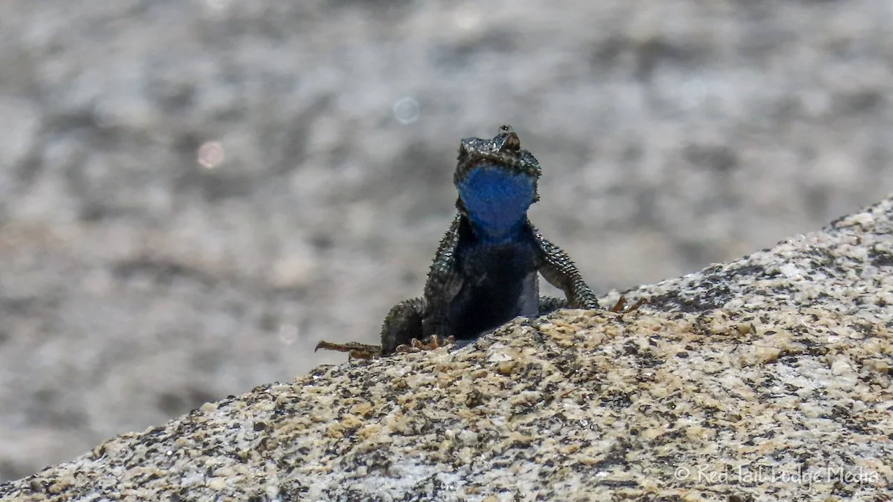
As we sat there, a lizard also kept us entertained. He would dart across the granite, taking refuge in small clumps of wild flowers which had taken hold in small crevices.
By the time we returned to Red Tail, we had covered 3.6 miles with an elevation gain of 737 feet in two and a half hours. It was hike number 22 of our 52 Hike Challenge for 2024.

After the hike, we stopped at the Lost Grove, just a few more minutes down the road. The grove is right by the highway, so it was a quick stop just to get out to look at the trees. By this point, we had seen quite a few Sequoia trees so we didn’t linger long.
Stony Creek Campground is right next to the highway, but the dense woods of fir trees muffles the traffic noise. The sites are nicely spaced, further apart than at Lodgepole campground. However, the sites were not very level. Our one corner was off level by 14 inches. After stacking the GoTreads on top of two-by-sixes, we managed to only be off level by a little less than 9 inches in one corner, 5 inches in another corner, and three inches in the third corner. We’ll just have to live with that. At least we turned the RV around so that we would be sleeping with our heads higher than our feet.
There was no cell service at all, neither Verizon nor AT&T. There were too many trees to get a Starlink connection. Keith tried.
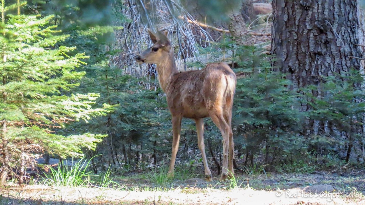
While he was putting away the Starlink equipment, half a dozen deer came by. His back was turned, so he didn’t notice the deer as they were grazing about ten yards behind him. It wasn’t until he walked about 20 yards over to where Ann was stretching out and she told him to turn around, that he finally saw the deer.

We sat outside for a while in the evening, listening to the birds and the sound of the little creek flowing behind our site. The herd of deer passed through the campground several times while we sat there. It was a very peaceful setting. Every day should start and end with a deer visit.

Sequoia National Park will always be special to us. It has a wonderful feel to it. Yes, the park has the biggest trees in the world and yes, they are impressive. But there is just something about the park that feels remote and wild, despite all of the people visiting the park with you. During our first visit, we saw a bear for the very first time in our lives. This time we saw a mama and her cub. Yes, we’ll return again.
Check out our related video: Sequoia National Park Revisited
(Ann)