
Pacific Rim National Park, British Columbia - May 23rd to 24th, 2022
The weather can’t always be perfect. Sometimes exploring an area in the rain gives a different perspective. We didn’t let a little moisture keep us from enjoying the wonders of the Pacific Rim National Park on Vancouver Island.

Well, the good weather didn’t last. Monday was cool with occasional rain showers. It didn’t bother us a whole lot since we were driving from Elk Falls Provincial Park over to Pacific Rim National Park on the west side of Vancouver Island. The sun was actually shining most of the time.

The drive over to the west coast on route 4 was beautiful. The highway goes right alongside the beautiful Cameron Lake. Just at the west end of the lake is MacMillan Provincial Park, home of the Cathedral Grove. We stopped to take a stroll through the old tree grove. The trails are two main loops, one on each side of the road. Both trails combined are about one mile. Parking is limited. We were there at about 10 am and got a spot. As we were leaving, the parking areas on both sides of the road were full and people were pulled off waiting for a spot to open up.

The trails loop around a lush forest of large Douglas fir and western red cedar trees, both living and laying down across the forest floor. The decaying old trees provide a nutrient rich environment for new plants to grow. We saw one large tree stump with a young tree growing on the top of it, with its roots going down the hollowed out center of the stump to reach the ground. In addition to the large trees, the other plants seem to grow much larger here than we’ve seen elsewhere. Walking through the landscape has a prehistoric somewhat Jurassic Park feel.
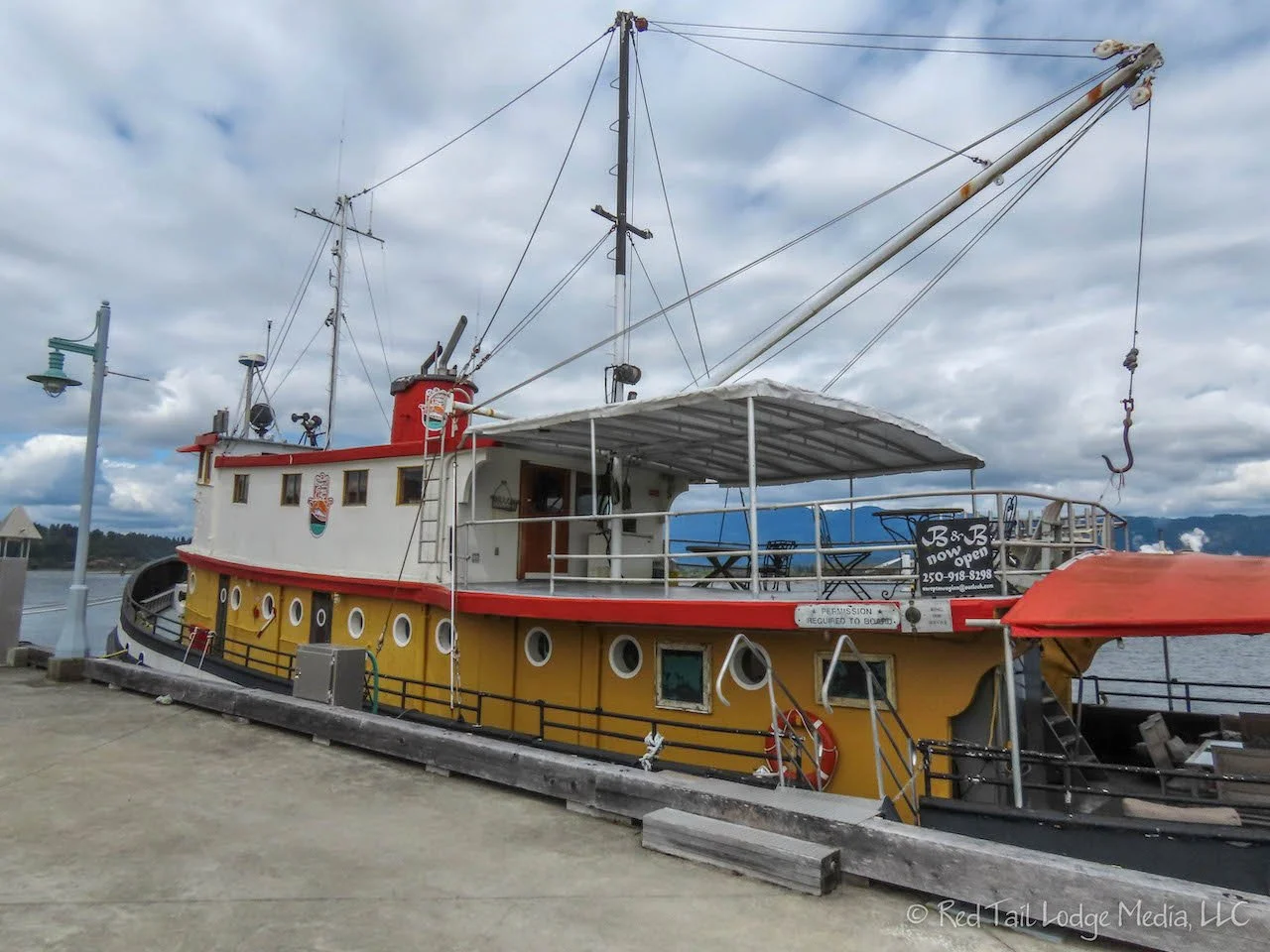
For lunch, we drove into the town of Port Alberni to have a picnic. Most of the town has an industrial feel to it, probably due to the large lumber and paper mill in town. We drove down to the Harbor Quay which was a cute little area of shops next to the wharf. It was too cold to eat outside, especially since dark clouds had rolled in and there was a strong, stiff breeze off the water. After eating, we walked around the quay. A boat docked at the port was actually a bed and breakfast, called Swept Away Inn. Stairs led a couple of stories up to a viewing platform, where you could take in more of the view and the cold from above. The harbor was surrounded by snow-capped mountains.

Despite the cold, Ann opted to have an ice cream cone from Harbor Scoop while Keith had a chai latte. The sun came out just in time to keep Ann warm, plus we were protected from the wind in the little shop courtyard.

The rest of the drive over to Pacific Rim was through the scenic mountains. We never realized how many large mountains there are on Vancouver Island. The mountain range stretches north to south through the center of the island. There was road construction along the highway which we had to wait for, but it wasn’t too bad. Besides, we were not in any hurry.
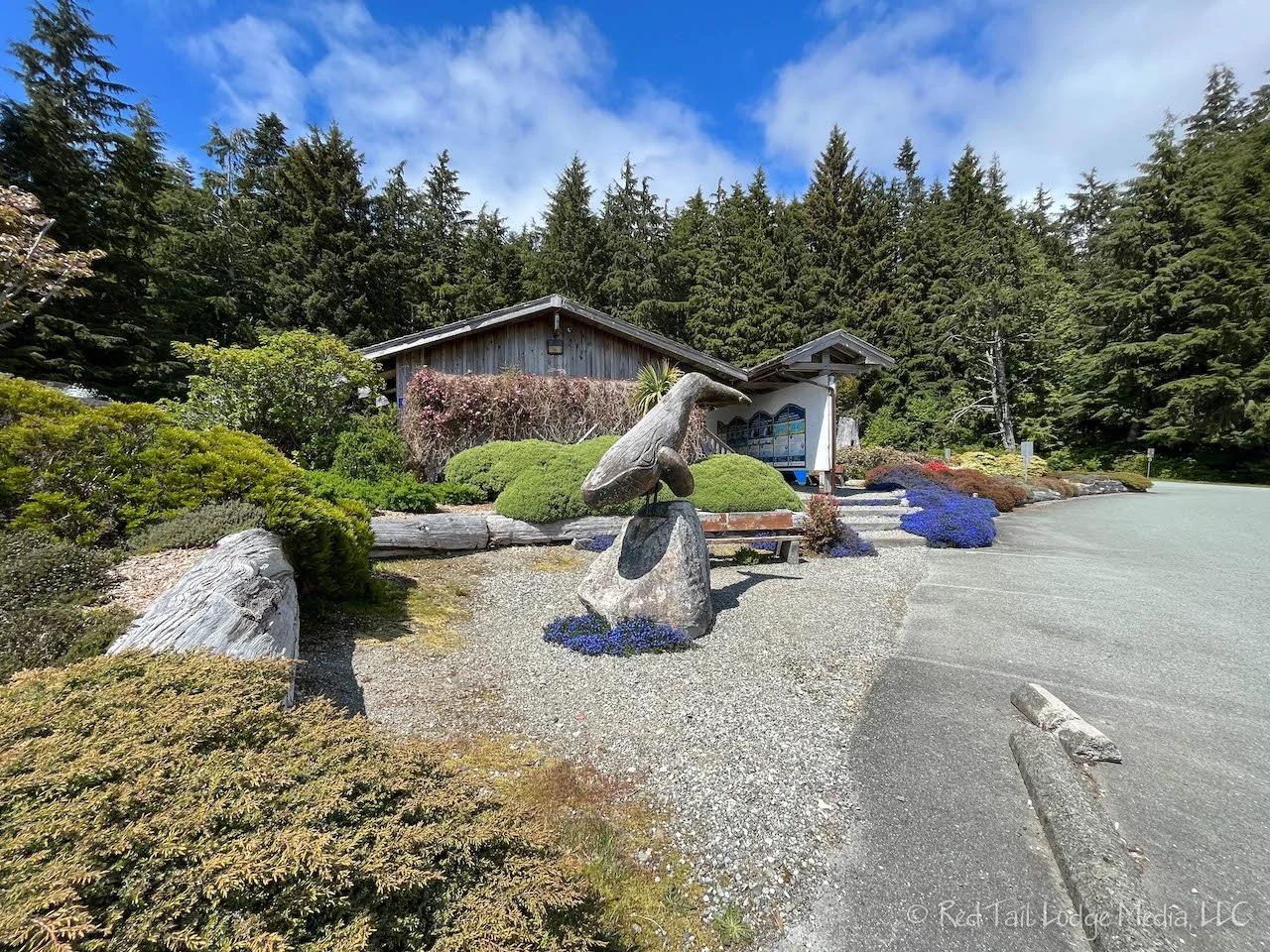
Before heading to the campground, we stopped at the Pacific Rim Visitor Center. There are palm trees in the landscaping around the building. We’ve noticed palm trees a few times around Vancouver and Vancouver Island. This seemed odd to us since we always associate palm trees with a more tropical climate. Evidently, they can grow fine here as well. We’re not sure if they are native to the area, but they seem to be pretty healthy here. At the visitor center, we purchased our Parks Canada Discovery Pass for a family, which gives up to seven people in a vehicle entry into all of Canada’s national parks for a full year. For two adults, it pays for itself if you spend more than seven (consecutive) days in a national park. Since we were planning on visiting Jasper and Banff National Parks on our way back from Alaska, the annual pass made sense for us.

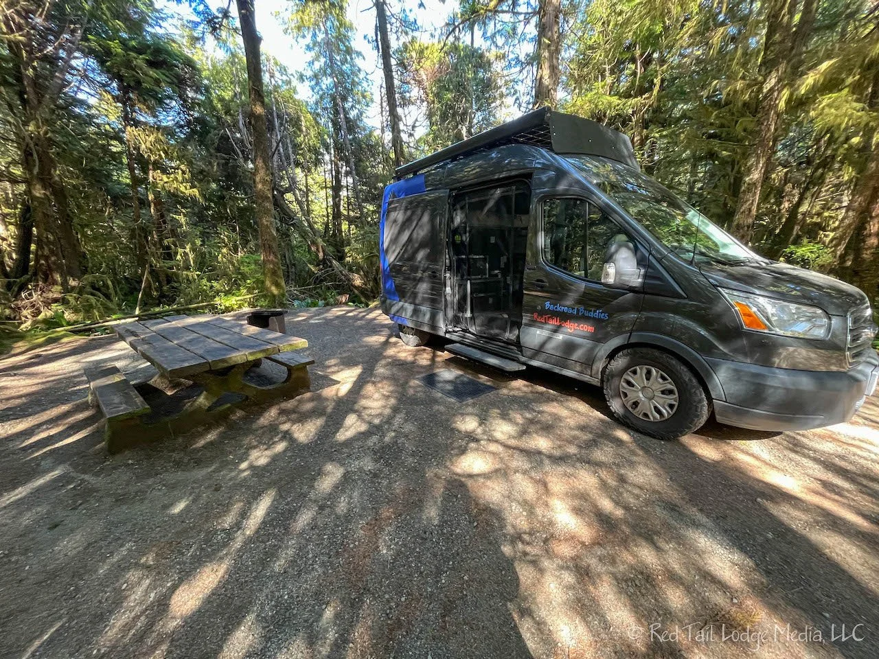
It was about 3 pm by the time we were checked into the Green Point Campground inside of Pacific Rim. The campground has a couple of short trails that take you down to Long Beach and Combers Beach. We headed down to Long Beach since it was still low tide and it was not quite time to start making dinner.

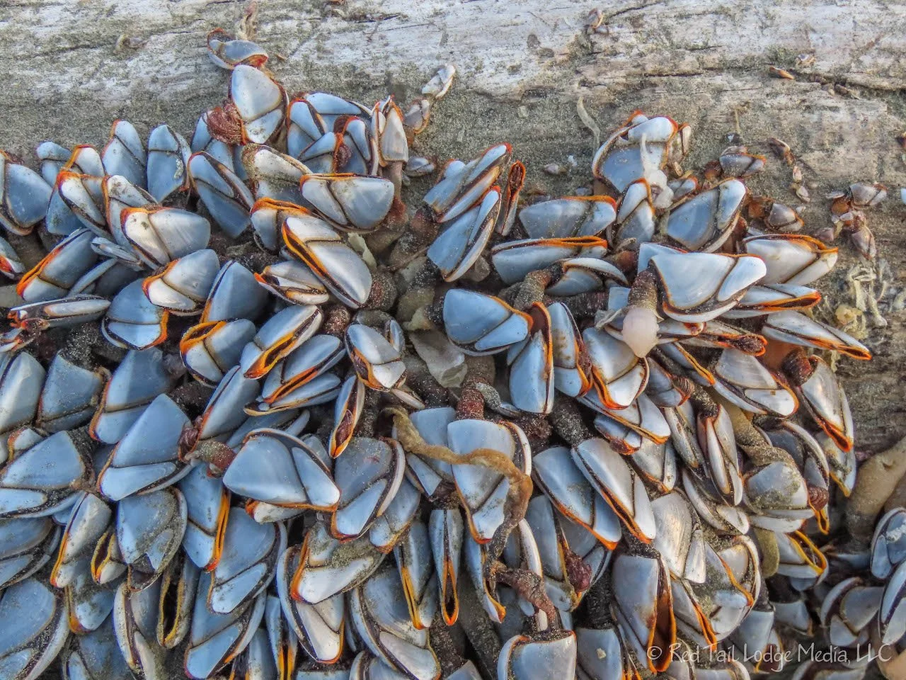
Long Beach, especially at low tide, is a really wide, sandy beach. The sea looked pretty rough, with large waves constantly crashing on the beach. There were a group of rock outcroppings near the end of the beach delineating it from Combers Beach. We climbed around on the rocks to check out the little tidal pools.
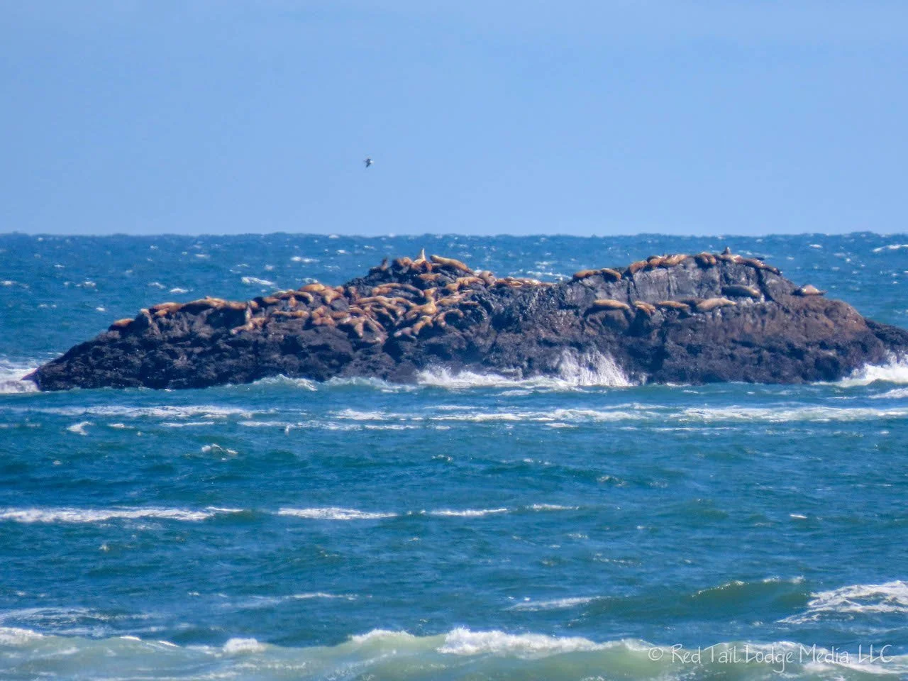
There was a metal post sticking out of the top of one of the rocks, so we climbed up to it to see what it was. There was a sign next to it talking about the sea lions on the rocks less than a mile offshore. With our naked eyes, we could see something on those rocks, but not make out what they were. Zooming in with Ann’s camera, we could barely make out that they were indeed sea lions. We’re guessing the metal pole used to have a viewing scope on it so people could see the sea lions.
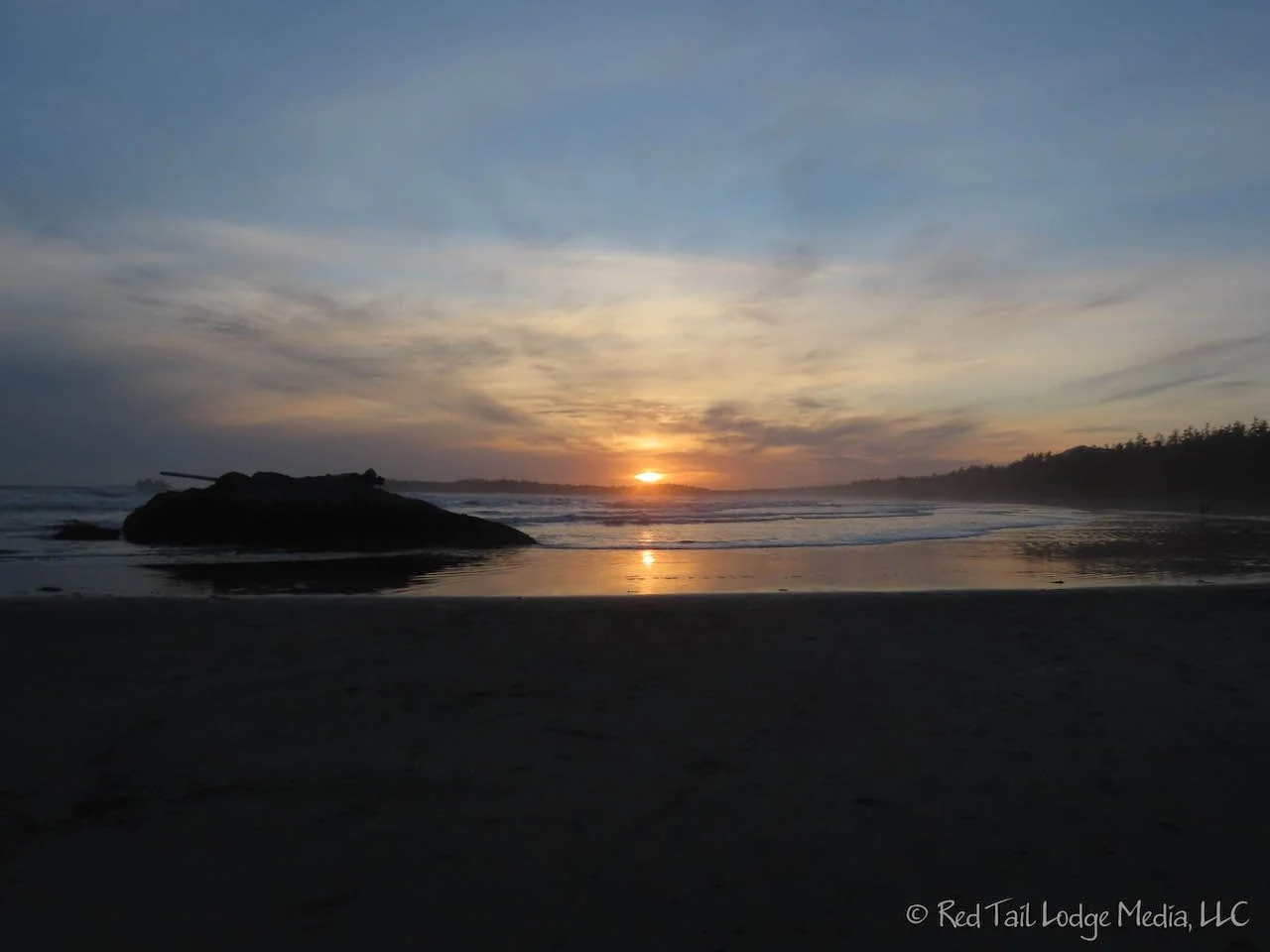
Back at our camp site, we made dinner and ate inside the van again. It may be awhile before the weather is good enough to hang out outside again. However, later that evening, we bundled up and walked back down to the beach to see what high tide looked like and to watch the sun set.

The sun did not set until after 9 pm. We were wondering if the high tide would swallow up all of the sandy beach since it was pretty flat. However, there was still plenty of beach left. This time we brought our binoculars to get a better view of the sea lions. Most of the sea lions had left the rocks, but there were a few stragglers left.
It was raining when we woke up Tuesday morning. We wanted to explore Pacific Rim National Park by hiking. There are not any long hiking trails in the park, so we decided to do several short ones. Since it was raining, we decided to start with the Rain Forest Trail, since it seemed rather appropriate.

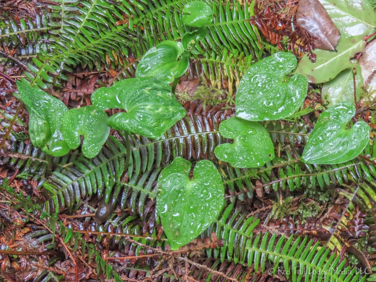
Either it stopped raining while we were on the trail, or the forest canopy was too thick to let the rain reach us. The Rain Forest Trail was just like it sounded, with large western red cedar and Douglas fir trees. The ground was a lush tapestry of dead tree logs, large ferns and other large plants. We recognized one of the plants as something we saw near the Beaver Pond in Stanley Park in Vancouver the week before. However, the ones we saw along the Rain Forest Trail were more than twice the size of the ones we saw in Vancouver (Vancouver, British Columbia - May 12th to 15th, 2022).

A variety of bird songs filled the air. Ann was a little frustrated that she could hear all these different birds, but had troubles spotting any in the tree tops so far from the ground.
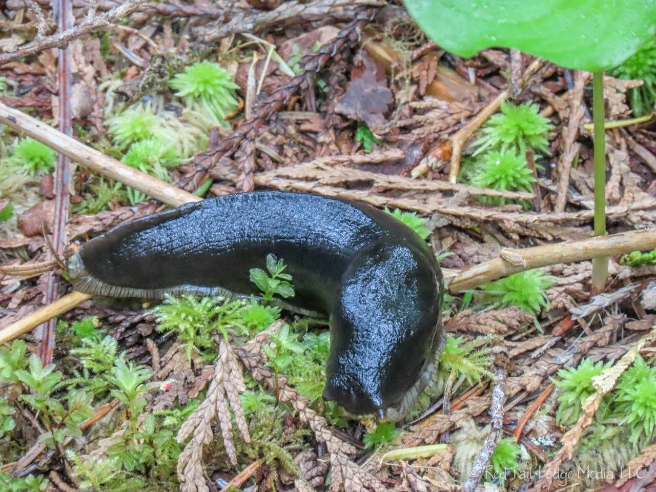
Large banana slugs appeared almost motionless on the ground. The ones we saw were about three to four inches long, but they can be as big as nine or more inches, one of the largest terrestrial slugs in the world.

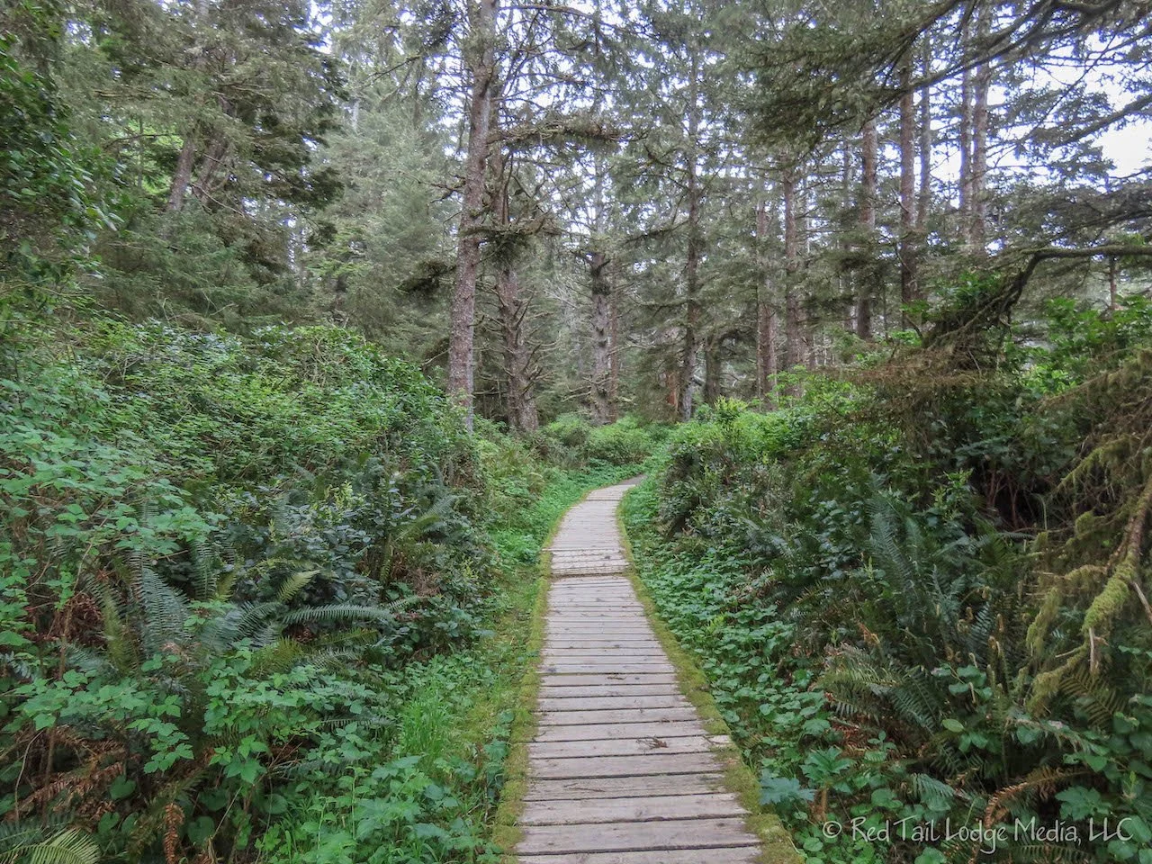
The trail is two loops, one on each side of the road, each about a mile long. The trail is mostly a boardwalk, which helps with navigating over the wet ground and tangle of roots and logs. Signs are posted along the trail which explain different aspects of the rain forest.

At one point, we let a small group of people pass by us (the boardwalk is rather narrow) and they said “merci” in French. We had forgotten most of the little bit of French that we knew at one time and could not remember what the proper response should be. We should brush up on our French since we are in a country with two official languages, French and English. By the way, we looked up the response. It’s “de rien”. Most of the signs and product packaging in Canada are in both French and English. On the tortilla chip bag we bought, there was the word “Restaurant” with the word “Style” written both above it and below it. We’re assuming “Style Restaurant” is the French, and “Restaurant Style” is the English, using the same “Restaurant” for both.

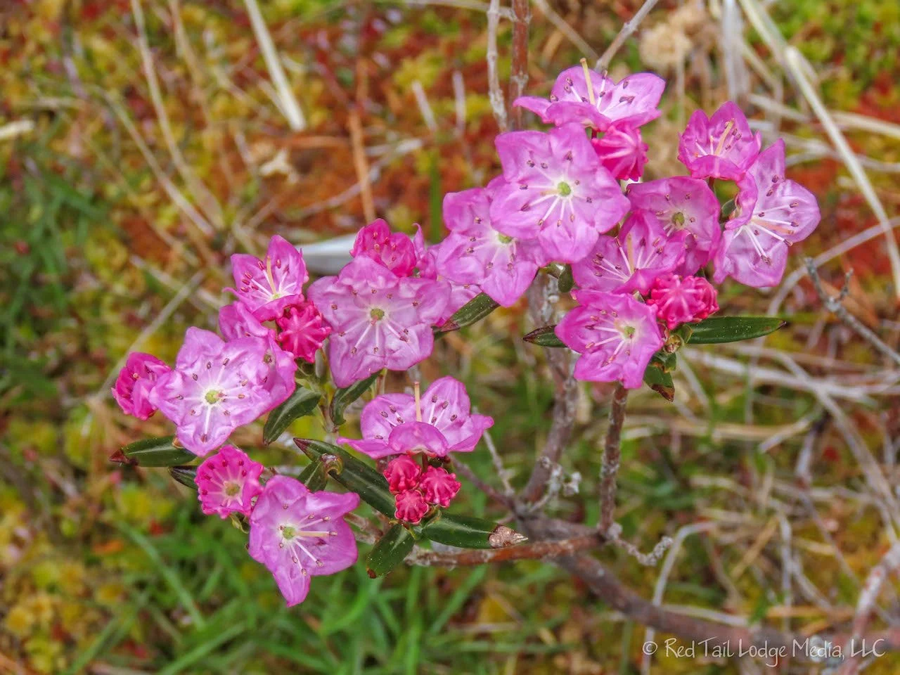
The next trail we hiked was the Shoreline Bog Trail. It is also a boardwalk, about half a mile long. We thought it would be pretty similar to the Rain Forest Trail, but we were wrong. The bog trail is very open and exposed. The plants surrounding the trail were totally different from the Rain Forest Trail. Instead of big, tall cedars and firs, there were short, stubby little pine trees and a few scrubby little cedar trees. The ground was like a fuzzy carpet of greens, browns, and oranges. The foliage of the trees was only near the top, so they looked like pompoms, reminding us of trees from Dr. Seuss books.
Our last hike of the day was a combination of the Nuu-Chah-Nulth Trail and the South Beach Trail. The Nuu-Chah-Nulth Trail is about two miles each way from the southeast end of Wickanninnish Beach at the Kwisitis Visitor Center over to Florencia Bay. Not far from the visitor center, the South Beach Trail branches off to the south to a small beach. We first went over to Florencia Bay and took the South Beach Trail on the way back.
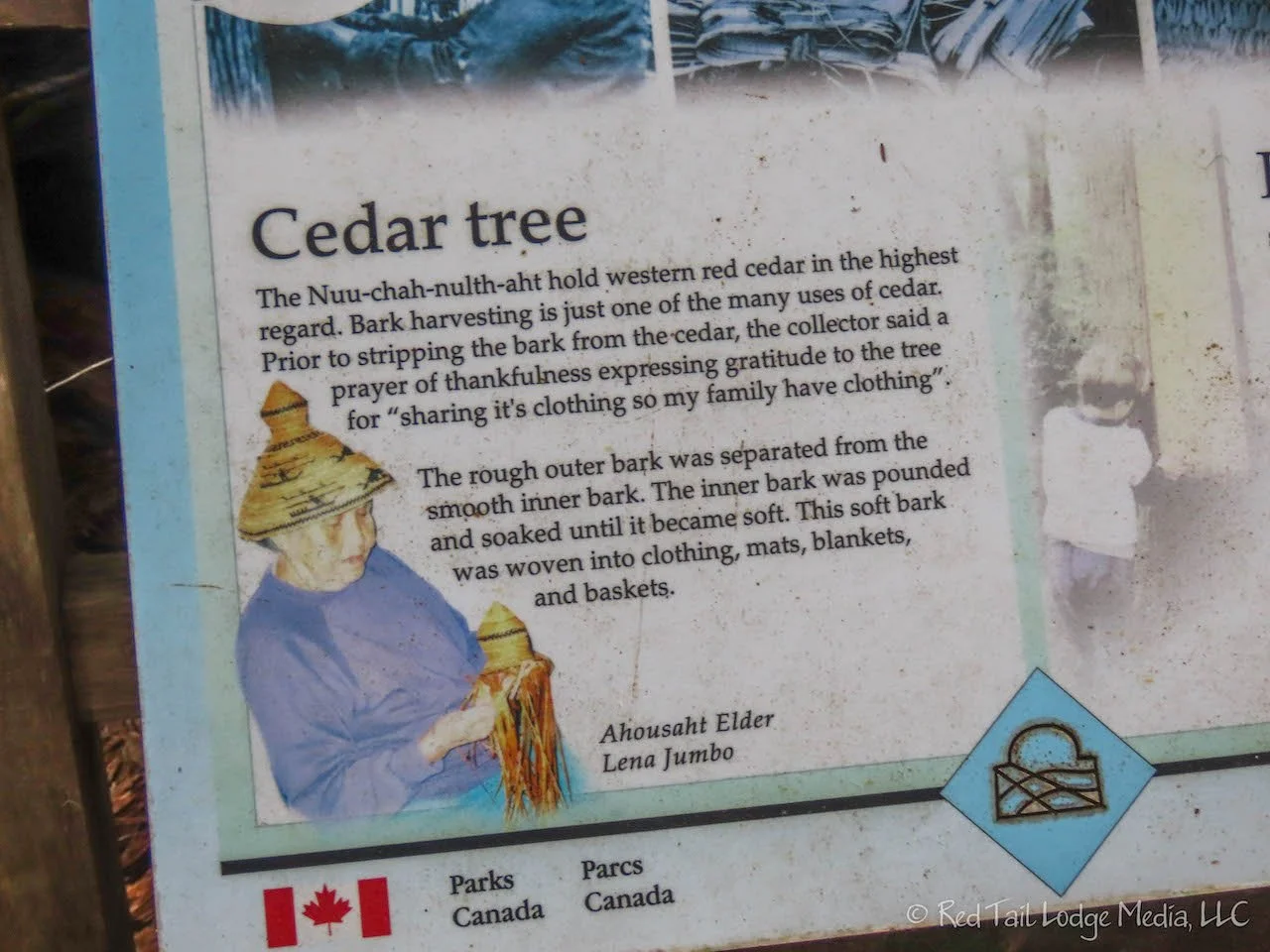
The Nuu-Chah-Nulth Trail has interpretive signs along the trail, explaining the culture and values of the Nuu-Chah-Nulth people of the area. The trail is mostly a boardwalk through the forest. The boardwalk has new sections and old sections and various stages of age in-between. Watch out for loose, rotting, and missing boards along the way so you don’t trip. We’re sure the boardwalks must be a constant maintenance issue for the park service as the high moisture probably decays the wooden boards quickly.

Close to Florencia Bay, the boardwalks disappear from the trail and you are left with tree roots and a mucky trail to negotiate through. Yes, even the old, decaying boardwalk is easier to negotiate than the trail without a boardwalk. Even though the trail was muddy, it was not the type of mud where you sink down deep nor did it cling to your shoes. It was more like spongy peat moss.
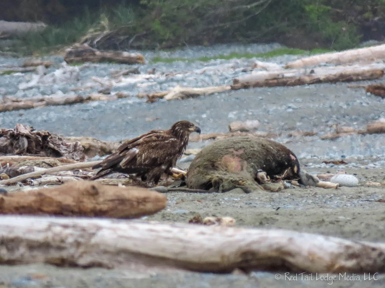
When we reached Florencia Bay, we ventured down the sandy beach a ways. Then we spotted a large eagle swooping down to the beach. About 100 yards from us, there was a dead sea lion among the driftwood. The eagle, which we believe was a golden eagle, had settled in for a feast on the meat. We stood there, keeping our distance, and watched him for a little while. Luckily, Keith had brought his binoculars so we could both observe the eagle from a distance. Ann took some pictures and some video with her camera zoomed in. Hopefully she was able to hold the camera steady enough so the video isn’t too shaky.

Back at South Beach, it was just after low tide, so we scoped out some of the tidal pools. There were sea urchins, snails, small fish that were perfectly camouflaged with the sand, and a couple of tiny crabs.
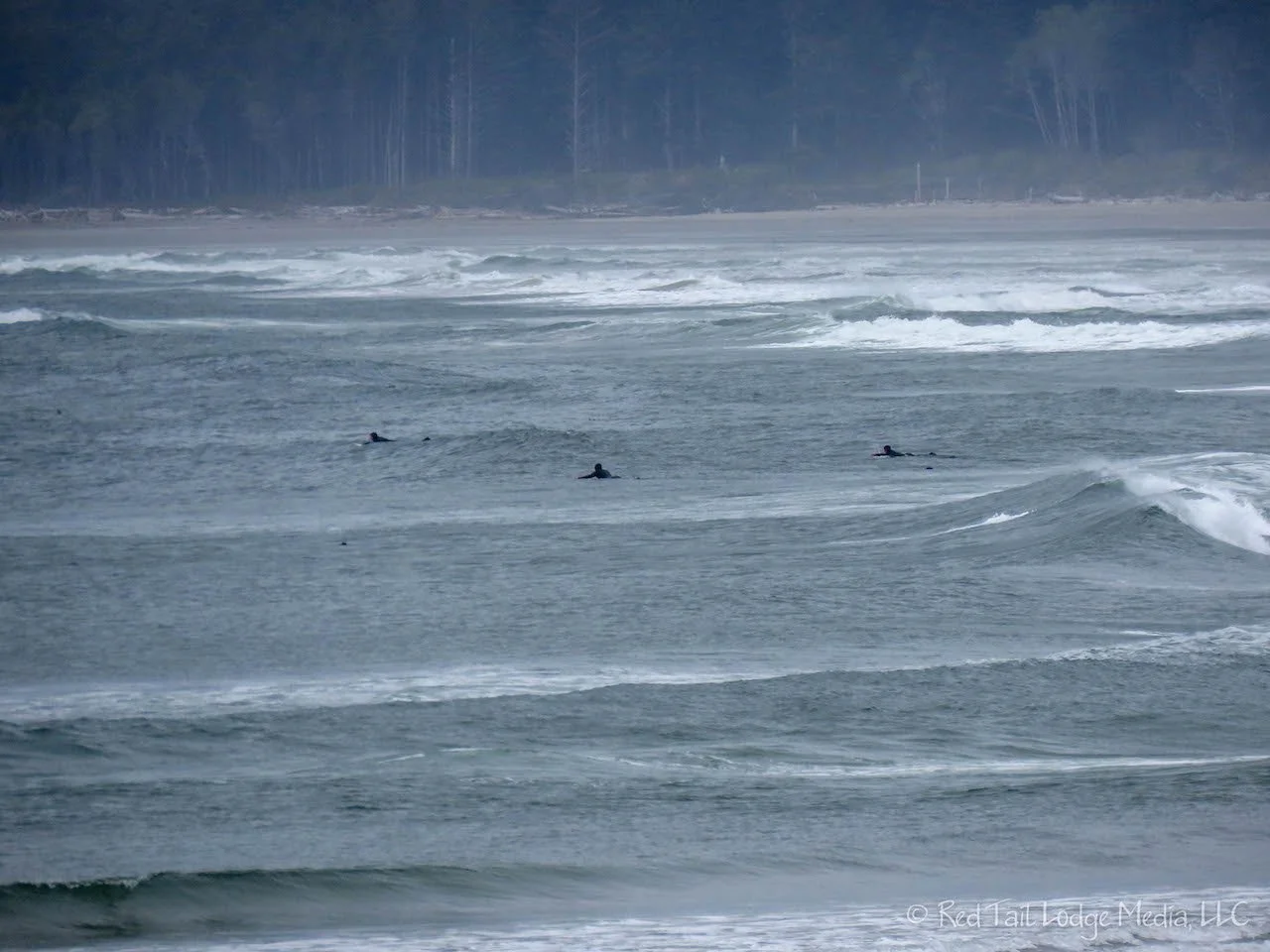
As we returned to our Red Tail Lodge parked near Wickanninnish Beach, we could see four people out on the ocean surfing. It just seemed to us to be way too cold to be surfing. It was barely 50 degrees outside and we’re sure that sea water was pretty cold as well. We know they have wet suits on, but how warm do those suits actually keep you? Brrrr!!!!

OK, we felt we got a good sampling of what Pacific Rim has to offer, so we headed back to the campground for dinner. Totaling up all the hikes from the day, we completed 8.3 miles with an elevation gain of 1047 feet in just over five hours. We counted the combination of trails as hike number 14 of our 52 Hike Challenge for 2022.
Since we had electrical hookups for a change, we decided to test out the firmware upgrade to our GoPower! Inverter/charger (paid link). We had already changed the charge rate setting from 30% back up to 80%. We plugged in to shore power and left the charger on. Then we tried using some appliances that drew a lot of power, like the Instant Pot (paid link), the electric tea kettle (paid link), and the water heater (paid link). Everything seemed to work fine. Our batteries even came back up to a full charge. It wasn’t an extensive test, but so far so good. The real test would be to run the air conditioner all day or night with the charger on while plugged in. However, we’re not sure we’ll run into that situation this season since we’ll be in cooler climates most of the summer.
It is easy to see what attracts people to the Pacific Rim National Park. Even in the rain, the variety of scenery, terrain, and wildlife entice you to continue beyond the next tree along the trail, around the next rock, or to the next tide pool, just to see what you might find.
Check out our related video: Pacific Rim National Park, British Columbia
(Ann)