
Pacific Marine Circle Route, British Columbia - May 19th to 20th, 2022
Taking the most direct route to a destination is not necessarily the best way to get there. Discovering little treasures when taking the path less traveled can be more fun than the destination. The Pacific Marine Circle Route is not a spectacular destination, but it is a great way to explore the southern tip of Vancouver Island.
On Thursday, we moved from Goldstream Provincial Park to Gordon Bay Provincial Park. If we went directly there, it would only be a one hour drive. Instead, we spent all day driving the Pacific Marine Circle Route to get there.
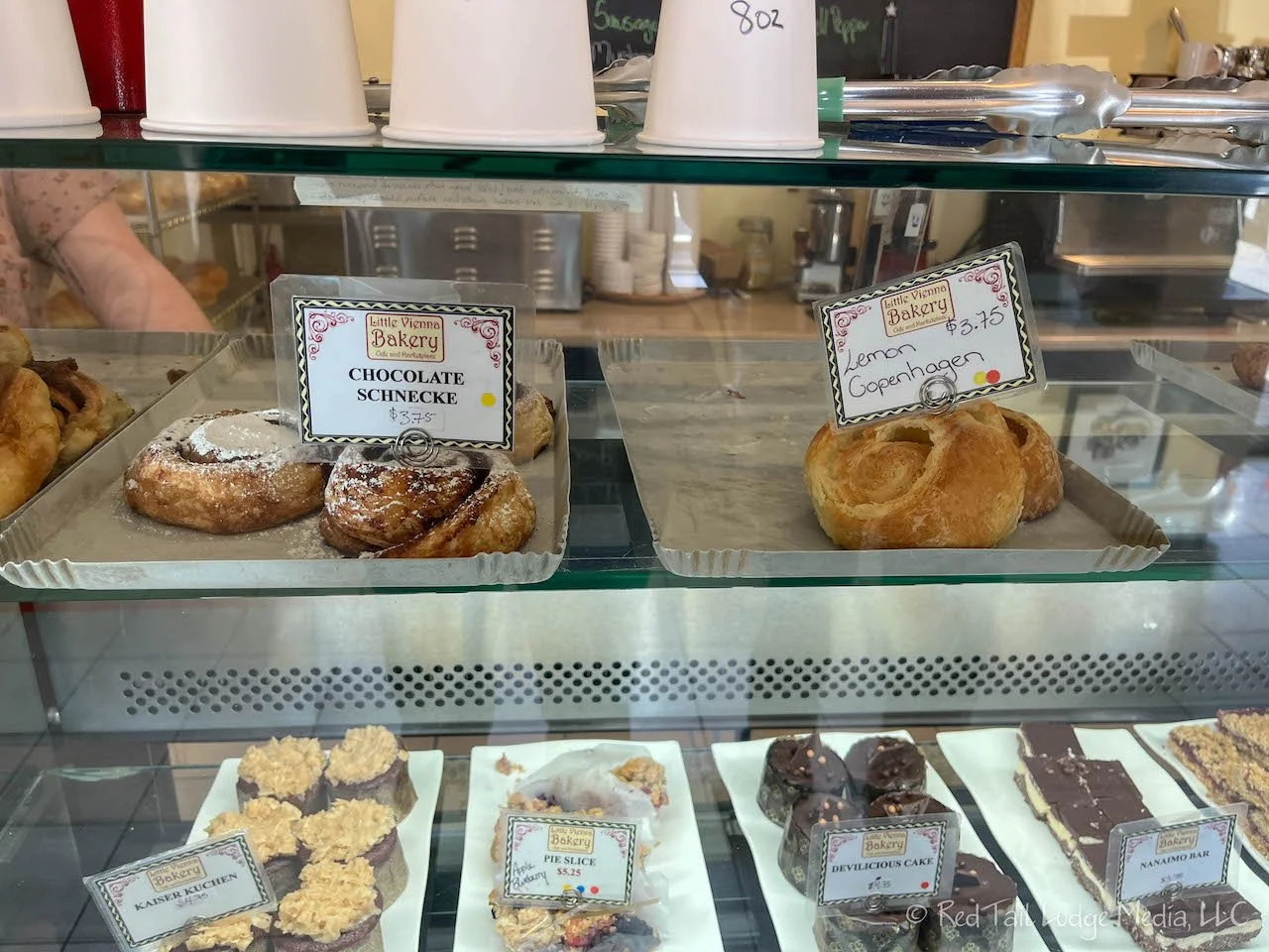
From Goldstream, we headed south to pick up highway 14, which took us southeast to Sooke. This was our first stop for the day. There was a bakery called Little Vienna Bakery, Cafe & Marketplace that caught our eye. They had lovely looking pastries. We smiled when we saw the items labeled Cinnamon Schnecke and Chocolate Schnecke. They looked like cinnamon rolls and Schnecke is the German word for snail, which seems like an appropriate name. However, they also had a Lemon Copenhagen which had a similar shape. We’re not quite sure why that was not called a Schnecke as well. Ann chose the Lemon Copenhagen while Keith had a croissant with raspberry jam. The lemon treat was very light and refreshing, not too sweet. Keith noticed the London Fog listed as a beverage on the menu. We were not familiar with what a London Fog is, so he asked. It is an Earl Grey tea with vanilla flavored steamed milk. He had a latte instead, but Ann decided to give the London Fog a try. It was very tasty!
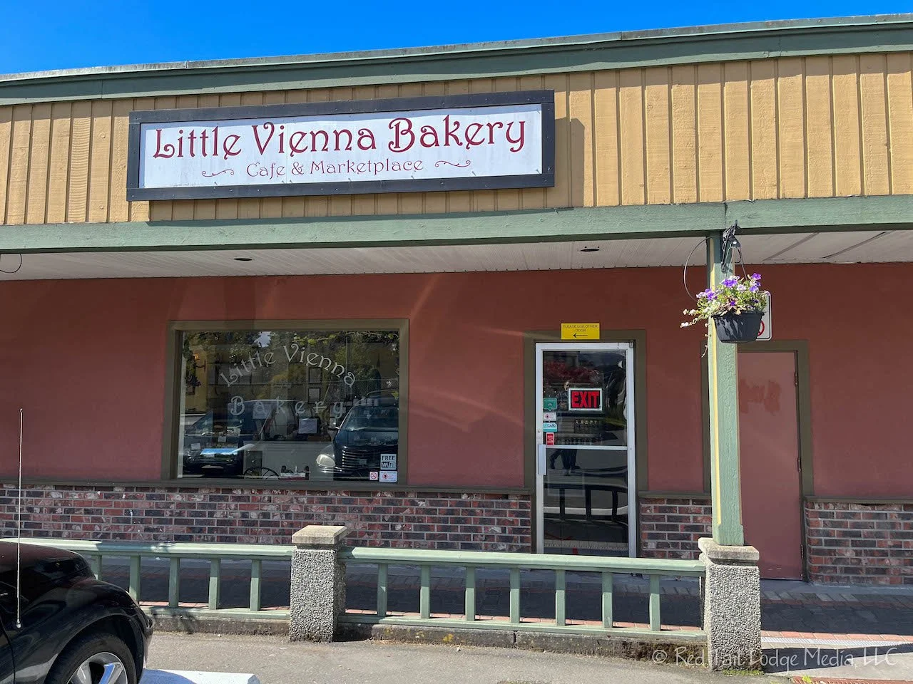
While we were in the bakery, someone apologized to us for coming within six feet of us. Since we’ve been in Canada, we’ve noticed that the people here were following more COVID protocols than we currently were in the States. More Canadians were voluntarily still wearing masks along with giving people their space. The bakery had one door marked to enter, arrows on the floor to control the flow around the bakery, and lead you out a different door.
Before we left Sooke, we topped off our gas. There were not any gas stations listed on the rest of the route for the day, so we wanted to make sure we had plenty. Another thing we have noticed in Canada, is that there is no price difference between gas stations. The prices seem to change from day to day, or sometimes from morning to evening, but all the gas stations along the street have the same price posted. Usually in the States, prices vary from station to station.

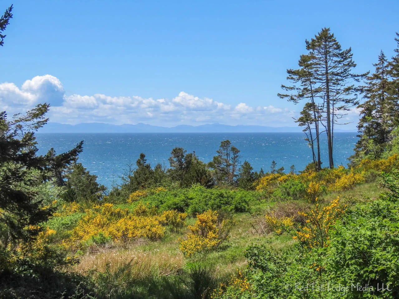
From Sooke, we continued on highway 14, which now followed along the southwest coastline of Vancouver Island. On Google Maps, there was a point along the road labeled Gordon’s Beach with a camera symbol, indicating a viewpoint. We tried to follow Google’s directions, but it wanted to take us down a road that didn’t exist. There was a little pull-off there, but there were several road construction vehicles parked there. We parked there anyway and followed the path past the concrete barrier down to the coastline. We were actually past Gordon’s Beach, we believe just past the bridge over Tugwell Creek. If we look on Google Maps now, the Gordon’s Beach viewpoint has moved and is now on the actual beach. However, the little trail we went down was nice, lined with bushes covered with vibrant yellow blossoms. We came out onto a rocky beach, where the creek flowed into the ocean. It was a pretty little spot, even though it was not Gordon’s Beach.

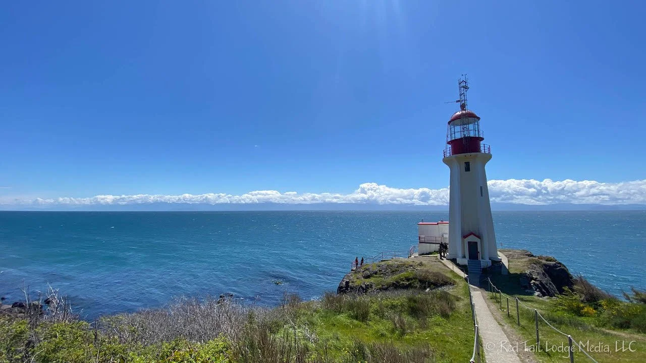
Our next stop was the Sheringham Point Lighthouse. We made the mistake and put in the directions to the lighthouse itself instead of the Sheringham Lighthouse View Trail. Google tried to take us down some private roads and we had to turn around, going back to the highway and follow the correct directions. The road you want to turn on is the Sheringham Point Road, right where the Shirley Delicious Cafe is located. The narrow, one lane road leads you down to a small parking lot at the trailhead. From there, it is a short, but steep walk down to the lighthouse. The lighthouse is situated on a dark, rocky shoreline. It is definitely worth a visit.
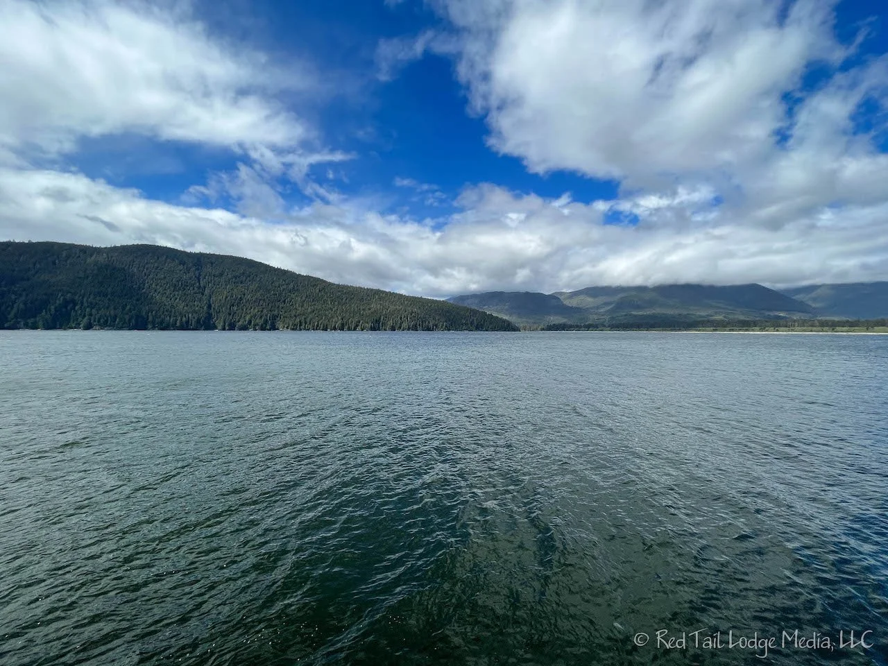
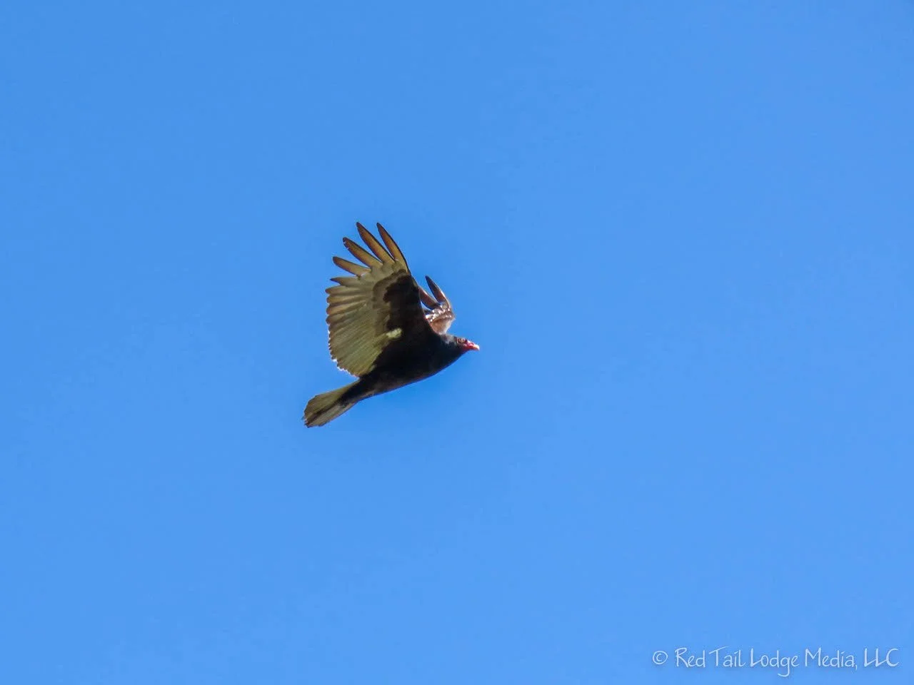
Next on the agenda was Port Renfrew. Ann had read somewhere that it was worth walking out on the boardwalk pier for the view. We weren’t exactly sure where the pier was, but the town is not very big. We drove down to the Wild Renfrew Seaside Cottages and found the wharf. From the end of the dock, there were nice views out over Port San Juan. Ann spotted a bald eagle and a loon while looking around at the view.
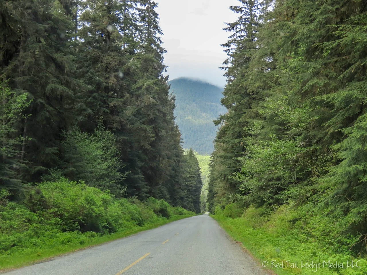
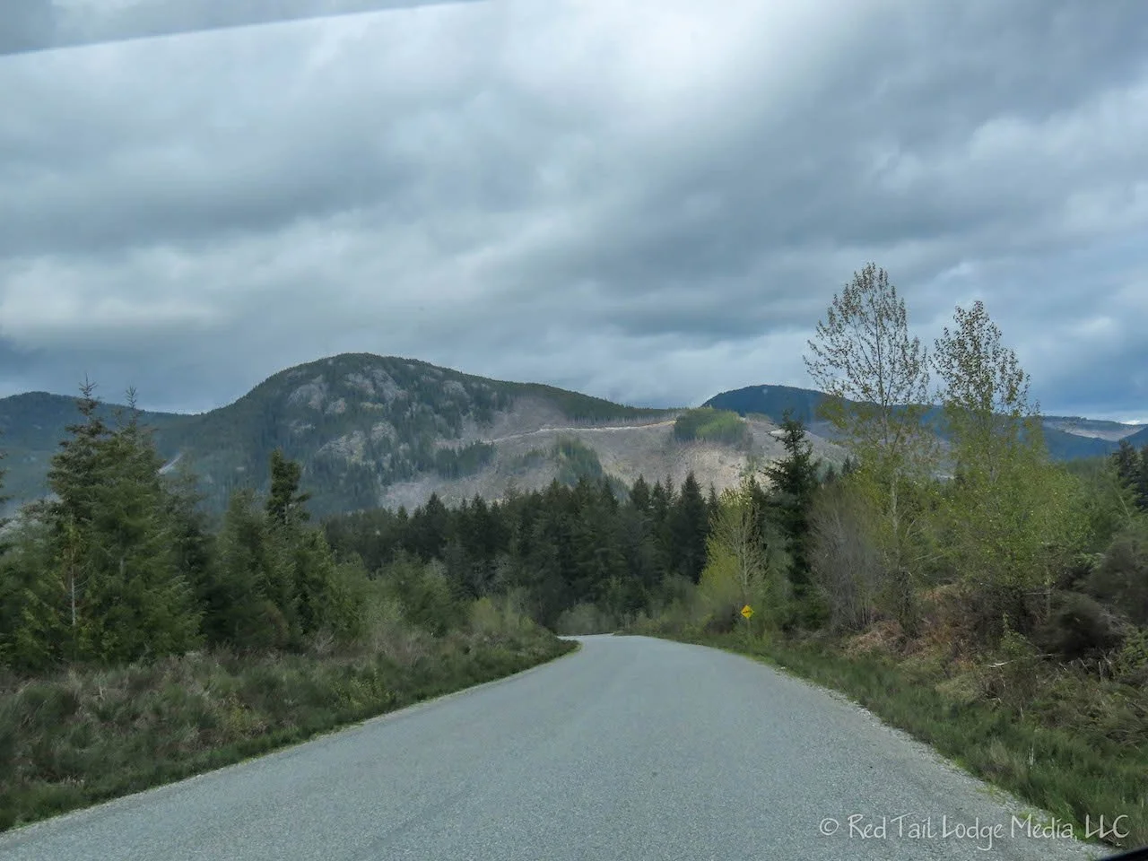
From Port Renfrew, the Pacific Marine Circle Route heads back inland. The road had been progressively getting worse since we left Sooke. Not only is the road narrow and windy, it needs some repair. It is paved the whole way, but there a lots of patches, dips, and rough spots. You won’t be setting any speed records, especially in an RV. We bounced around quite a few times in our Red Tail Lodge (our camper van). Taking a large RV on this road is probably not a good idea. The road was probably good training for the Alaska Highway and Top of the World Highway we will be traveling on later which are known for their frost heaves.

There are also quite a few one lane bridges, with some of them being hard to see if someone is coming the other direction. One of those bridges was labeled Harris Canyon. As we crossed the bridge, we caught a glimpse of a gorgeous little canyon. Fortunately, there was a place to pull over just past the bridge. We got out and walked back out on the bridge to get a better view of the canyon. Keith kept an eye out to alert Ann when traffic was approaching as she took pictures. However, the bridge was wide enough for cars to pass us with no problems. We still wanted to be prepared in case a driver did not see us standing there.

Our last stop along the route for the day was a tree called Harris Creek Sitka Spruce. It is not the largest sitka spruce on the island, but it is big and easily accessible. However, it is not very well marked. There is just a little sign posted on the side of the road, near where Google Maps lists the Harris Creek Sitka Spruce Recreation Site, but not exactly. Just keep a look out for the small sign when you get close. A short little trail brings you to the tree. The base of it is fenced off. And it is big, about 13 feet in diameter at the base.
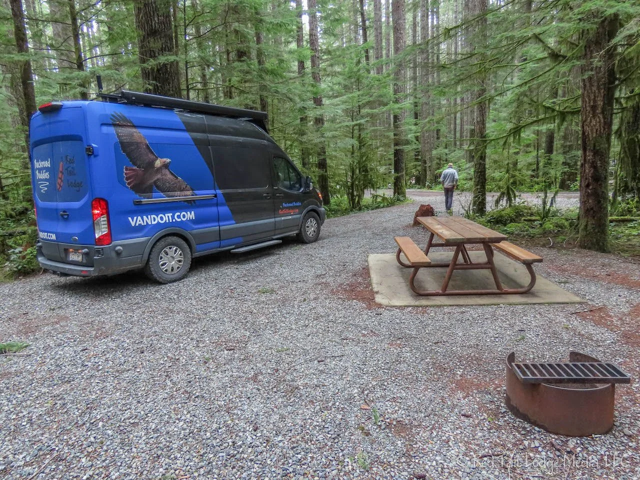
The Gordon Bay Provincial Park was another lovely campground. It has such a great feel, in a thick forest, with sites that are spaced far apart. Unfortunately, we were only staying one night. We normally like to stay at least two nights, but when we were booking the next campground, we discovered they required a three night minimum stay due to to the upcoming three day holiday weekend, Victoria Day. So we had to leave this one a day earlier than we originally planned.

Friday we finished our Pacific Marine Circle Route by stopping in Duncan after leaving Gordon Bay Provincial Park. Duncan is a little town known for its totem poles. There are over 40 totem poles scattered around the downtown area. We stopped at the Cowichan Regional Visitor Center to pick up a map of the totem poles. However, a map is not necessary. For one, the town is not that big and two, there are yellow footprints painted on the pavement that leads you around to all of the totem poles.
Driving most of the Pacific Marine Circle Route was a lot of fun. It was a great way to live up to our name “Backroad Buddies”. The road was definitely a backroad. And visiting little points of interest along the way is the way we like to travel.
Check out our related video: Pacific Marine Circle Route, British Columbia
(Ann)