
Organ Pipe Cactus National Monument, Arizona - September 21st to 24th, 2023

We visited Organ Pipe Cactus National Monument in their off-season, which meant we pretty much had the place to ourselves. The disadvantage was that it was hot. But it’s a dry heat, so it cooled off during the night. Again, we shifted our daily schedules to concentrate our activities in the mornings and evenings, trying to stay out of the sun during the hottest part of the day.

Thursday was a drive day from Lost Dutchman State Park near Phoenix, to Organ Pipe Cactus National Monument near the Mexico border. We stopped in Apache Junction for groceries along the way.

Twin Peaks Campground inside Organ Pipe Cactus National Monument does not have hook ups, so we didn’t have air conditioning during our stay. Temperatures got up close to 100 degrees on most of the days, but the nights cooled down nicely to the low 70’s and high 60’s at night, so we had no trouble sleeping.

When we arrived at Organ Pipe Cactus, our first stop was the Kris Eggle Visitor Center. We had a rough idea what we wanted to see and hike at Organ Pipe Cactus, but the knowledgeable ranger there helped us refine our plans and informed us of the current conditions of the road. Ann had seen notices on the website about a couple of road closures along the border, but the ranger reassured her that those were border control roads along the wall and not the South Puerto Blanco Drive.

At the campground, Keith finished hooking up the solar panels to the Kisae DC to DC charger (paid link), bypassing the Xantrex solar controller that came with the Winnebago EKKO. We’ll see if it works better in the days to come.

For dinner, we made gazpacho soup, since it requires no cooking as we didn’t want to heat up the inside of Red Tail (our EKKO). As the sun set, turning the clouds on the horizon into a gorgeous red and pink glow, we walked the loop around the campground. It was almost a mile. The campground is large, with over 200 camp sites. However, there were only two other campers spending the night besides us.

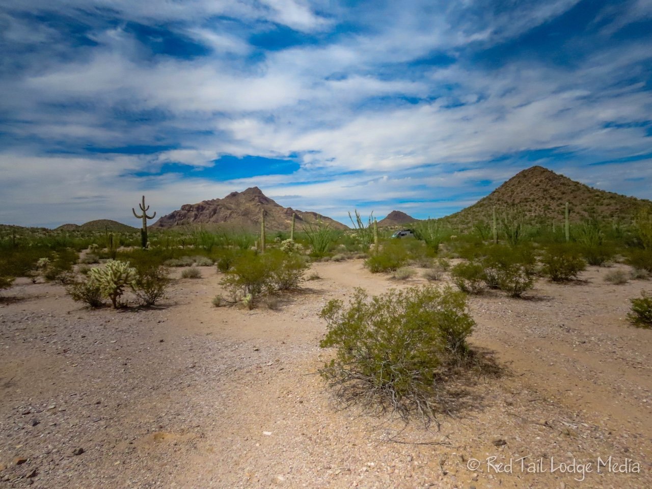
Thursday, we got up early to go for a long hike. We decided to go on the hike recommended by the ranger, the Baker-Milton Trail. It was a loop, about 10 to 11 miles long, which is longer than we usually hike. However, there wasn’t a lot of elevation gain, so we knew it was in our wheelhouse. Thursday was forecasted to be the coolest day while we were here, highs in the 90’s. Getting an early start, we were hoping to get back before the hottest part of the day.

We got up at 6 am and were on the trail just a little after 7:30 am. There are three trailheads along the Baker-Milton loop, two of them are along the Senita Basin road. However, the ranger recommended we start at the Red Tanks Tinaja Trailhead along the North Puerto Blanco Drive. She wasn’t sure Red Tail could handle the Senita Basin road, as it has some patches of deep sand. A normal passenger car can usually handle the North Puerto Blanco Drive up to the picnic area. After that point, the road turns into a one way road and requires a high-clearance 4WD vehicle. None of the scenic drive roads within the park allow vehicles longer than 25 feet. Red Tail is 23 feet, so we should be fine.

We hiked the loop in the counter-clockwise direction. First we passed the Baker mine. The park is littered with copper mines along with some silver and gold mines. The Baker mine is just a hole in the ground, but we scrambled up the slope to peer into the mine. There wasn’t much to see there.

On the way back down the slope, Ann managed to brush up against a cholla. A clump broke off and attached itself to her pant leg. Luckily it didn’t attach to her skin. Thankfully, she was wearing long pants and not shorts. Cholla propagate by attaching to animals that walk by. They have barbs on their spines, so they hang on well. We’ve heard they can be quite painful to remove from your skin. The recommendation is to first use a comb to remove most of the cholla, then use tweezers or pliers to pull out the remaining thorns. By the time Ann reached the bottom of the slope, most of the cholla had fallen off her pants. Keith pulled out his Leatherman and used the pliers to pull off the remaining needles.

There are several different types of cholla. One type has a rather fuzzy appearance. We believe that it is called the teddy bear cholla. But don’t try to snuggle up to one of those!

The Milton Mine was a little more interesting. In addition to the mine, there were remnants of structures and garbage dumps. Plus there were quartzite rocks and malachite mineral scattered all around the area. Malachite along with azurite are indicators of copper. The Milton Mine was a copper mine. The bright turquoise color of the malachite is hard to miss. It doesn’t look natural. If we hadn’t known better, we would have thought the rocks were painted.

We sat down on a foundation wall at Milton Mine for a snack. There really wasn’t any shade to be found, but we were wearing hats, long sleeves and long pants, so we were not very exposed to the sun. Luckily, there were overcast skies up to this point, but then the sun came out. A refreshing breeze kept us feeling comfortable, though.

There were plenty of organ pipe, saguaro, cholla, and ocotillo cacti along the trail. All of the plants seemed to tower above our heads. Every now and then we would spot a cactus with flowers or fruit. The fruit of the organ pipe is bright red inside, similar to the fruit of a prickly pear cactus, but it looked like it had somewhat fewer seeds.

The trail follows the Senita Basin road for about a mile. This is where we spotted the senita cactus. The senita cactus looks similar to the organ pipe cactus, but has a fuzzy appearance near the top along with fewer facets or spines along its trunks. Thankfully we had seen examples of both plants back at the visitor center, so we knew what we were looking for. We were expecting to see more senita cactus as we left the road and started down the Senita Basin Trail. We looked constantly for about a mile, but didn’t see a single one.

Before leaving the Senita Basin road and starting the Senita Basin Trail, we stopped again for another snack. There is actually a picnic area at the trailhead. Well, there is one picnic table and a trash can. It was the only comfortable place to sit during the whole hike. The picnic table was next to a saguaro cactus. We squeezed our bodies into the shade of the saguaro cactus. We were starting to feel the heat of the sun by this point.

After leaving the Senita Basin Trail, which is a triangular loop, the trail back to Red Tail followed along a dry wash for about a mile. The dry wash had a little bit of shade, but we lost our breeze. By the time we reached Red Tail, we were hot and our feet were tender. We were ready to be done.

In total, we went 10.8 miles with an elevation gain of 709 feet in about six hours. It was our longest hike so far this season, and it was in a hot desert. It was hike 49 of our 52 Hike Challenge for 2023.

We brought along three and a half to four liters of water per person, along with two electrolyte tablets per person. We went through almost all of our water by the time we were through. If we ran into an issue that would have kept us out in the desert longer, such as a twisted ankle, we might have run out of water. If that happened, we probably would have used our Garmin InReach to send for help. There was a large barrel of drinking water at one point along the trail, which would have come in handy during an emergency. However, we’re not sure if there was any water in the barrel, we didn’t test it. The barrel is maintained by Humane Borders, a nonprofit group from Tucson.
When we reached Red Tail, we sat on the back bumper in the shade and drank some ice cold water. It’s so nice to have a freezer with us! Then we drove back to the visitor center to cool off in the AC while we explored the exhibits inside.

Back at the campground, we headed to the showers. Unfortunately, the showers were hot. They use solar collectors to heat the water. There were signs warning you that the water could be hot. We thought the longer the water ran, the cooler the water would get, but it seemed to be just the opposite. The water kept getting hotter. We had to be careful not to scald ourselves. It would have been better if the water had not been heated at all. Of course, we’re not sure where the water is stored, so it may be hot most of the time. Oh well, at least our wet hair eventually made us feel a little cooler, until it quickly dried in the arid climate.

The blisters on our feet from our hike on Friday were still tender on Saturday, so we opted for a drive instead of hiking. We drove out the South Puerto Blanco Drive to Quitobaquito Springs. The drive was not as scenic as the North Puerto Blanco Drive. The view to the south, to the mountain peaks in Mexico, was obstructed by the border wall. The vegetation near the road seemed sparse. There were quite a few signs along the road indicating restoration areas asking people to stay out so plants could grow back. We’re assuming that those areas were damaged during the construction of the border wall.

A little spur, just past where the North Puerto Blanco Drive joins the South, leads to the parking area for Quitobaquito Springs. A short trail led us over to a large pond. The pond looked man made, with almost no vegetation surrounding the water, just white gravel. There were fish in the pond. We’re assuming they were all the endangered Quitobaquito pupfish.

Nearby were several small swimming pool structures. The trail somewhat continued past the pond to what looked like the actual spring, flowing down a man-made channel. There were no interpretative signs to give us a clue as to what we were seeing.

We returned to the Visitor Center where we talked with the park rangers to understand what we saw at Qutobaquito Springs. The springs are natural, but man has been manipulating the springs for decades and even longer, using the water for irrigation. The pond area was originally a marshland. The last family that owned the land, before it was sold to the National Monument in 1957, had dug the pond deeper and added a clay bottom so it would hold water for longer. In 2007, the park service discovered the clay bottom had a large crack and the water level was dropping. The NPS started a long restoration process.

The swimming pools were used to hold all the native plants and animals from the pond while the clay bottom was being prepared. The plants and animals included the pupfish, Quitobaquito spring snail, the Sonoyta mud turtle, and the desert caper plant. They are still in the process of restoring the plants around the pond. It is a very slow process.

The rest of the day we hung out at the campground in the shade of Red Tail. It was hot, but it was tolerable in the shade. At least there were not annoying gnats like at Lost Dutchman (Lost Dutchman State Park, Arizona - September 17th to 20th, 2023), just a few flies.

Sunday we went for more scenic drives and a couple of short hikes. Our feet were still tender from our long hike on Friday. Ann had a couple of blisters that had popped by this time, so we were not in the mood for long or difficult hikes.

The Ajo Mountain Drive starts just east of the Visitor Center, on the other side of Arizona route 85. It is 21 miles long and mostly dirt, similar to the South Puerto Blanco Drive we did the day before. The day before, we picked up the Ajo Mountain Drive Guide from the Visitor Center. It explained in depth what there was to see along the drive. We learned about all kinds of plants, not only the organ pipe, saguaro, ocotillo, prickly pear, and cholla cacti, but also mesquite, creosote, and jojoba.

We stopped at Arch Canyon for a short hike. There is a nice view of a double arch right from the trailhead. If you hike all the way up to the double arches, it is only about 2.5 miles, but over 1000 feet in elevation gain. However, the last part is very steep, a rock scramble up a rocky slope with loose footing. We turned around after about three quarters of a mile when we reached the rock scrambling. Ann was hoping to get a view of the double arches from the back side, but, unless you go all the way to the top, the best view is from the trailhead. It was a pleasant hike along the canyon, though.

After our short hike, we ate lunch in Red Tail. There was no place to sit outside in the shade, so we turned on the AC. It was close to 100 degrees and the batteries had a good charge on them. Connecting the solar panels to the DC to DC charger seemed to be doing its job. Running the AC for almost an hour drained our batteries about 10%.

Our original plan was to hike the Bull Pasture Trail, possibly taking the spur trail up to a viewpoint. It looked like a beautiful hike, but a little too rugged for our sore feet, so we skipped it. Instead, after we finished the Ajo Mountain Drive, we drove up to Alamo Canyon. A three mile dirt road leads back into the canyon. From there, a one mile trail leads back to the remains of a ranch house and coral. It was a pleasant walk, not too long and not too steep, with some history to see. Plenty of saguaro, ocotillo, and pipe organ cacti lined the trail.

We count the combination of the two trails as hike number 50 of our 52 Hike Challenge for 2023. Our combined totals for the day were 3.4 miles with an elevation gain of 367 in just over two hours.

On the way back to the campground, we made our daily stop at the Visitor Center. As usual, Keith picked up a Snickers bar and put it in the freezer for a little while. He made that his routine every day during our stay in Organ Pipe Cactus National Monument. The Visitor Center did not sell soft drinks, so the Snickers was the next best thing, for Keith anyway. Ann’s not a big fan of Snickers, so she settled for a jar of prickly pear salsa and enjoyed some of it with an iced tea back at our camp site.

It was the warmest day of our stay, so we turned on the AC again for a couple of hours to get Red Tail cooled back down. It was too windy for our awning to stay out, so our rig was sitting in the sun. It took a little longer to cool down after sun set this time, but it eventually did. So we were able to open up the windows and sleep to the sound of the desert insects.

Would we have enjoyed ourselves more at Organ Pipe Cactus during the winter months? Perhaps. The temperatures would be nicer, but there might be more crowds of people. The rangers at the Visitor Center told us that the 200 site campground is full during the winter months. We definitely would not want to stay there during the middle of summer since there are no electrical hookups to keep our AC running all day long. But late September suited us just fine. We had a wonderful time.
Check out our related video: Organ Pipe Cactus National Monument, Arizona
(Ann)