
Newport, Rhode Island - August 29th to 31st, 2021

History is everywhere in New England. What surprised us was the beautiful, natural surroundings of many of the historical sites. It was not hard to find something interesting to check out. The hardest question was deciding whether it was worth it to pay admission fees or for guided tours, or limit ourselves to what was free. We did a combination and had a wonderful time.
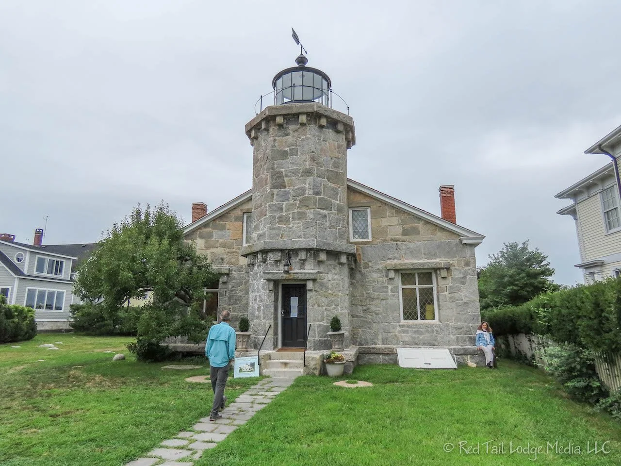
Check out time on Sunday was 11 am at Mystic Seaport RV Park and check in time was not until 3 pm at our next destination, Wawaloam Campground. We had some time to kill, so we headed down to Stonington Point to check out Stonington Lighthouse. The lighthouse is a small museum of local history. However, most of the museum is not about the lighthouse itself and the rooms no longer reflect their usage as housing the keepers, but it was an interesting museum all the same. For $5 per person, you can just visit the museum. For an additional $5, you can climb the short tower for the view of the bay. We opted for the latter option. The lighthouse was built in 1840 to replace an earlier lighthouse and remained in operation until 1889, when it was replaced by beacons on the harbor breakers. The lighthouse is currently undergoing a restoration project, so when we climbed the tower, the Fresnel lens was not at the top of the tower, However, this gave us a better 360 degree view because the lens was not blocking it.

There is a little park and beach called Dubois Beach at Stonington Point, so we ate our picnic lunch with a great view. We still had a few hours to kill, so we searched for an ice cream shop in Pawcatuck, Connecticut. Mel’s Downtown Creamery looked interesting, so we set that as our next destination in our navigation apps. We’ve started using two navigation apps at the same time. In the eastern part of the United States, we’ve heard there are a lot more roads with low clearances. Since our van needs ten foot of clearance, we wanted a navigation app that would avoid routes that we could not take our Red Tail Lodge on. Google Maps has been our navigation app of choice for years; however, it does not indicate low clearances. We signed up for Togo RV. Not having much experience with Togo RV, we also bring up Google Maps on our other phone at the same time, just to give ourselves a little more comfort. The two apps don’t always agree what route to take and not just because there is a low clearance issue. It makes life a little more interesting as we try to decide which instructions to follow as we go along. We’ve also noticed that the estimated time for a given route is longer with Togo RV than the time indicated by Google Maps. We’re assuming that Togo RV assumes you are driving an RV and may not always be going the speed limit.
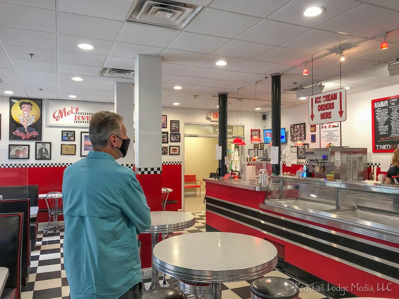
The town of Pawcatuck sits on the western bank of the Pawcatuck River. On the eastern bank is the town of Westerly in the state of Rhode Island. The two towns really feel like one. We parked on a street in Westerly and walked back over the river to Mel’s Downtown Creamery. It was a cute shop, decorated like an old fashioned diner or soda fountain. They served Hershey’s ice cream, but did not have a large selection of flavors. After our tasty treats, we walked around town.

Over in Westerly is a stunning library building, initially built in 1894, with several additions added later. Behind the library is Wilcox Park. The park was designed in 1898 by Warren H. Manning. We had a wonderful walk around the park among the trees and park fountain.

From Westerly, we followed the Scenic 1A over to Charlestown. Neither navigation app does very well when you want to follow a scenic route as they keep trying to take you the fastest route to your destination. Is there an app out there that allows you to pick a scenic route? At Charlestown, we tried to drive down to Charlestown Beach to check out the view. However, you have to pay to park in a lot before you can walk over to see the beach and the view. We decided it wasn’t worth paying for parking for just a quick glimpse of the beach, so we turned around. Now the navigation apps did their job getting us from Charlestown to Wawaloam Campground in Richmond. There was no direct route, so the apps took us on backroads, zig-zagging our way to our destination. The apps did not always agree, but Google Maps usually showed the route Togo RV wanted to take as an alternate route, so we kept selecting the alternate route in Google Maps to get the two apps to agree. As we were traveling on the backroads through the woods, we noticed a lot of damaged and downed trees. We’re guessing they were damage from Hurricane Henri that came through the area the week before.
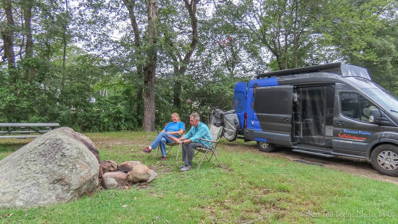
We pulled into the campground just minutes before check-in. The woman who checked us in gave us some nice pointers on what to see in the area, including a great ice cream shop in North Kingston called The Inside Scoop. We put that on our list of things to do the following day. The woman also confirmed that there was a lot of tree damage from the storm. She rode out the storm at the campground. They were concerned about being hit by falling trees, so they drove their vehicle to the middle of a field to feel safer. The campground was without power for several days due to damage from Henri. The campground is quite large. We took an evening walk around the grounds and came across an historic graveyard from the 1800’s. How cool is that?
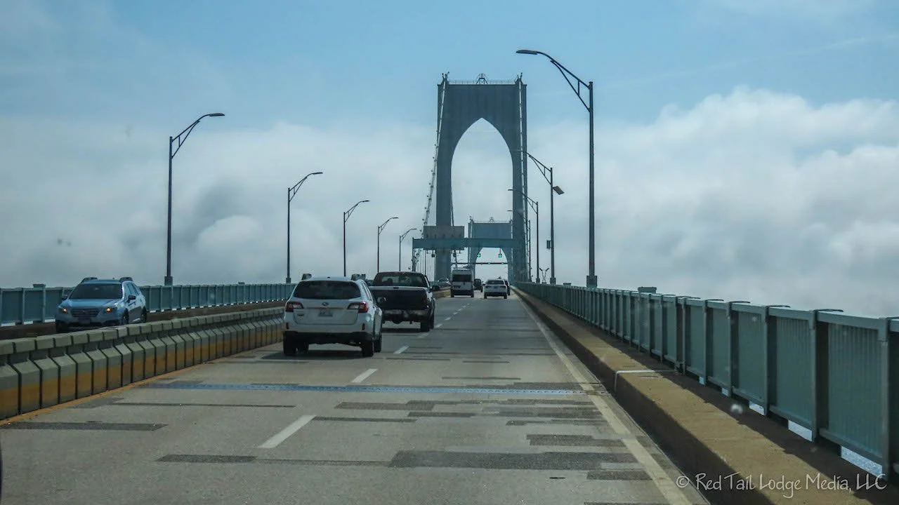
On Monday, we headed into Newport, Rhode Island. We crossed over two long bridges to get there. The first bridge is the Jamestown-Verrazano Bridge which took us past the Plum Beach Light to Conanicut Island which hosts Jamestown. The second bridge is the Claiborne Pell/Newport Bridge which took us over to Aquidneck Island where Newport is located. The second bridge is a toll bridge, $2 per axle. Unlike the toll bridges in the state of New York that we crossed last week, Rhode Island lets you pay in cash at a toll booth.

We parked at the public lot at Easton Beach. On weekdays, you can park there all day for $15. Parking machines in the lot let you pay with a credit card and give you a slip to display inside your vehicle.

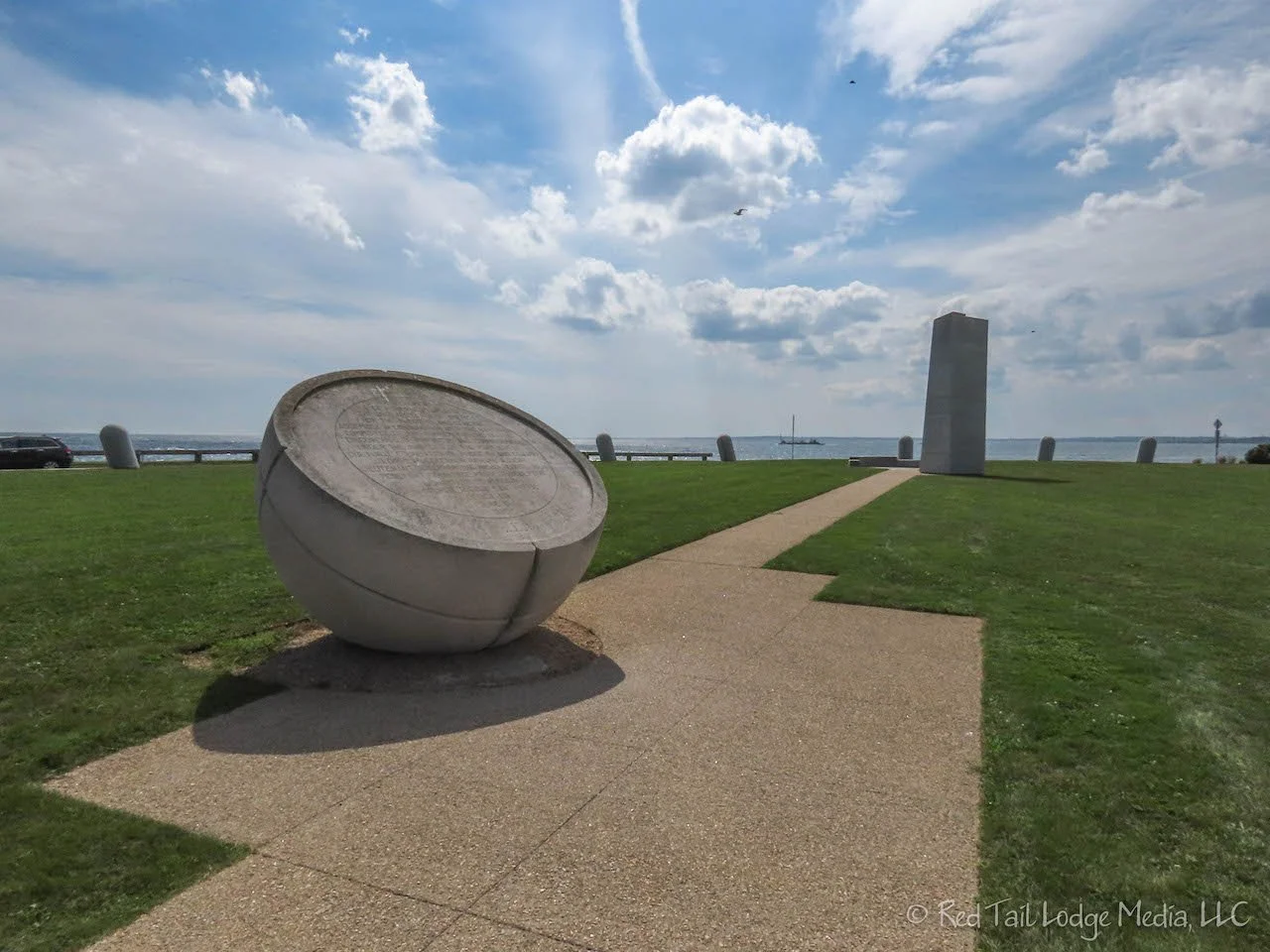
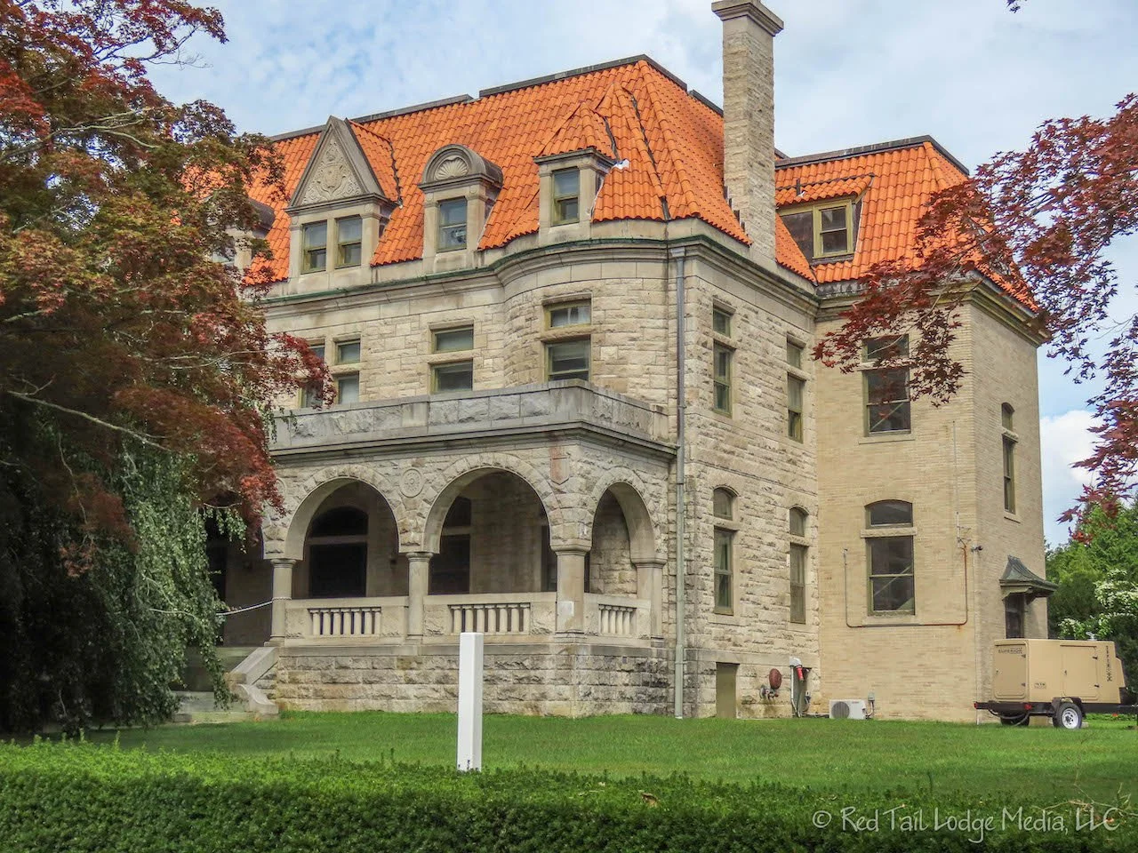
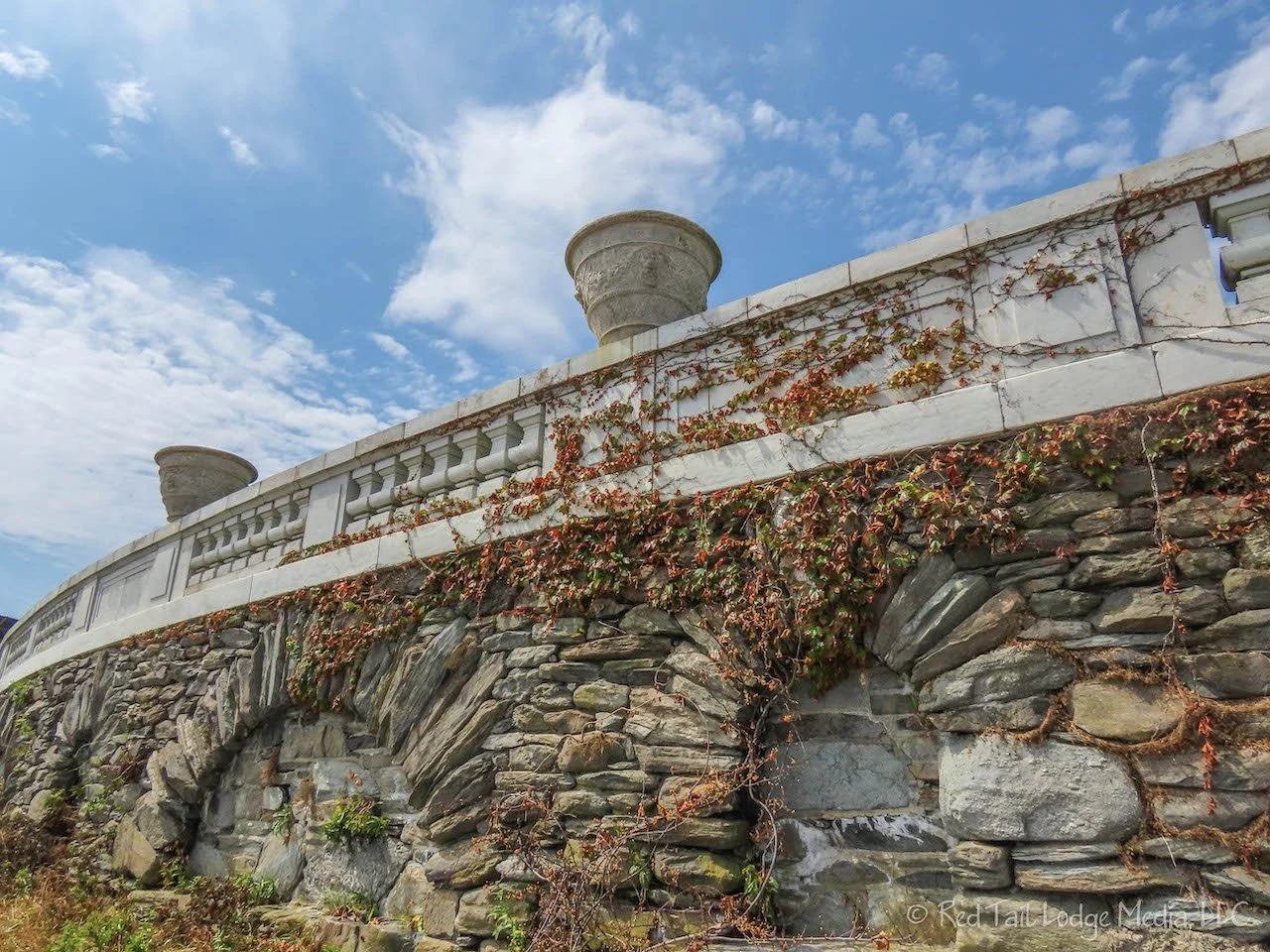
Our goal for the day was to walk the Cliff Walk. The Cliff Walk is a public walkway across private land along the ocean front. On one side you have the ocean waves breaking on the rocky cliff below you. On the other side are historic mansions, including the Breakers. The walk was originally developed by the estate owners from 1880 to 1920. In 1976, the Cliff Walk was designated a National Historic Walking Trail. The walk is 3.5 miles long, starting at the west end of Easton Beach and following the coastline around Bellevue Avenue near the east end of Bailey’s Beach (a private beach).

Most of the walkway is easy, but part of it, near the end, is across rough, unleveled, and jagged rock which gives your ankles a workout. The best part about the Cliff Walk is that it is free! From our parking spot at Easton Beach, we walked about eight miles. We almost went to the other end of the Cliff Walk, but we turned around just a little bit before reaching Bellevue Avenue, after Bailey’s Beach was in sight. We counted this as hike #36 of our 52 Hike Challenge, completing the eight miles with 328 feet of elevation change in four hours and 19 minutes.

Even though the hike was not that difficult, we decided we were done for the day. On the way back to the campground, we stopped at the Inside Scoop ice cream shop. RB had her predictable mint chip and chocolate peanut butter cup waffle cone. LB also stayed predictable with his vanilla shake. It was delicious, just as recommended. So now you have the inside scoop on Inside Scoop.

After spending Tuesday morning doing our laundry at the campground, we headed back to Newport. As we were crossing the toll bridge for the third time, we were starting to consider purchasing the EZ Pass, which is valid across most of the northeast. We would have stopped at the EZ Pass Service Center near the bridge, but it was only open on Mondays, Wednesdays, and Fridays.

Our goal this time was to drive the Ocean Drive. It follows the coast line around the southern end of the island on the south side of Newport. The drive starts out on a narrow road lined with cute little shops.

Our main stop along the drive was Fort Adams. You can do a self-guided tour of the fort for $7, but we opted for the $15 guided tour. The guided tour turned out to be the right choice for us. It was about an hour and 15 minutes long with a knowledgeable guide. The best part was that the guided tours takes you into parts of the fort that are not accessible by the self-guided visitors. The highlight was being armed with flashlights and walking into the tunnels. The current Fort Adams was built from 1824 to 1857. Unfortunately, the fort was neglected from the 1950’s to the 1970’s and received a lot of damage from the elements and vandalism. The Fort Adams Trust is slowly trying to restore the fort, but it will take a lot of time and money.

Docked right next to Fort Adams was the SSV Oliver Hazard Perry tall ship. It is not a replica, but the ship is similar to those that Commodore Perry would have commanded in the early 1800’s. The ship is owned by a non-profit and is used as a sailing school vessel. We would have loved to take a tour of the ship, but it was not open while we were there.

Also outside of Fort Adams was a Del’s Soft Frozen Lemonade food truck. We had seen a few of these trucks the day before in Newport. Being a warm day, we decided to give them a try. The fresh-squeezed lemonade slushy was very refreshing.
We continued the Ocean Drive around to Brenton Point State Park. The ocean views were spectacular from here. Many people were enjoying the view and flying kites. The consistent strong breeze off the ocean made the park an ideal location for kite flying. There was even a little truck selling kites. RB was fascinated by the one person flying a kite that they could skillfully manipulate to do all kinds of fancy rolls and turns.
The Ocean Drive eventually catches up with the same coastline as the Cliff Walk. This time we were passing the front of the mansions instead of the backside.

Back across the two bridges, we drove into Wickford Village, the place the campground staff had recommended to us. It is a cute, small, historic village with a harbor in a small cove. There are nice little shops and restaurants along Brown Street and Main Street. We got out and walked these two streets. The shops are only along a few blocks. We continued east down Main Street past the shops, to several blocks of old, historic homes. Just like in Mystic, the homes had plaques on them indicating their build dates and original owners. We finished the day just like the day before, at the Inside Scoop, which is not far from Wickford Village. We mixed it up a little bit this time. RB had the chocolate mouse and mint chip waffle cone while LB had a chocolate malt. Still delicious.
So we paid for the full admission to Stonington Lighthouse and paid for the guided tour of Fort Adams. However, we skipped paying for tours of the Newport mansions and opted for the free Cliff Walk. Whether you stick to the free options or paid tours is up to you, depending on your budget. We feel you can’t go wrong either way. There are plenty of free things to enjoy, but paying money provides opportunities for even more experiences. It’s all up to you!
Check out our related video: Newport, Rhode Island
(RB)