
New River Gorge National Park, West Virginia - May 29th to June 1st, 2023

New River Gorge, which was designated a National River in 1978, became a National Park recently in 2021. The 70,000 acre park encompasses 53 miles of the New River. Despite its name, the New River is among the oldest rivers in the world. It is known for its world-class whitewater rafting, but the park has so much more to offer than just rafting.

The drive from Black Mountain Campground in North Carolina to Babcock State Park in West Virginia on Monday was gorgeous. The route followed the Appalachian Mountains. Even the sections of interstate that we were on were pretty. Tree covered mountain sides surrounded us. The interstate even had tunnels that went right through a couple of mountains.

Our route took us through a sliver of eastern Tennessee and through Virginia. We passed through the town of Damascus in Virginia. When Candy, the manager of the Black Mountain Campground, heard we were heading north to West Virginia, she recommended the Virginia Creeper National Recreation Trail in Damascus. The Creeper Trail is a 34 mile rail-to-trail that goes from Abingdon, through Damascus to the Mount Rogers National Recreation Area. From what we saw of the area around Damascus, we could only imagine it is a beautiful trail. We’ll put the Creeper Trail on our list of future things to do.

We arrived at Babcock State Park by dinner time. There was a decent AT&T cell signal, so we spent the evening researching New River Gorge National Park and planning out the next three days.

Tuesday, we started our tour of New River Gorge National Park at the Canyon Rim Visitor Center in Fayetteville. It was a good thing we discussed our plans with a park ranger there. We learned a few things and changed some of our plans.

We were a little surprised that, even though there are quite a few trails in the park that allow bicycles, only one of the trails allows e-bikes. That was the 2.7 mile Stone Cliff Trail. That short of a trail doesn’t seem worth the effort of getting the bikes out, so we skipped using our bikes in the park. We’re not quite sure why Class 1 and Class 2 e-bikes are not allowed everywhere a regular bicycle is allowed. The motors turn off when you reach 20 mph and they are quiet, unlike a gas powered motor. It is a little frustrating, especially since we use our bikes mainly as bikes, meaning we normally have the power assist turned off, only turning it on when we need a little boost. Right now, it seems like the trend is to treat e-bikes like motorized vehicles. Hopefully, regulations will change in the future. We spent a lot of money on our bikes and don’t have the room to carry two different types of bikes with us. We also don’t want to give up our e-bikes. They allow us to go further, longer, and more often, at least when the local regulations allow us to ride. When we are on unfamiliar trails or roads, we don’t have to worry about our legs or knees giving out or a bike chain breaking when we are ten miles away from Red Tail (our Winnebago EKKO). The motor will help us get back.

The park ranger also recommended that we not hike the Endless Wall Trail because parking at both the trailheads there may be difficult with our 23 foot RV. He recommended hiking the Long Point Trail on the other side of the river instead. He also said we might have trouble parking at the Kaymoor Mine Trailhead. The good news was that he said our RV was small enough to go on the Fayette Station Road scenic drive.

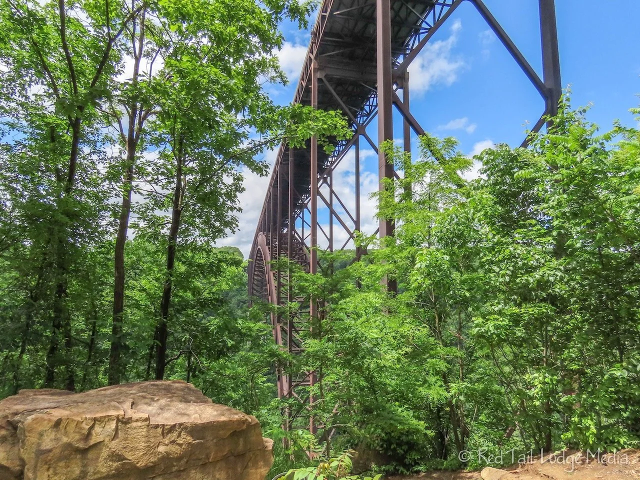
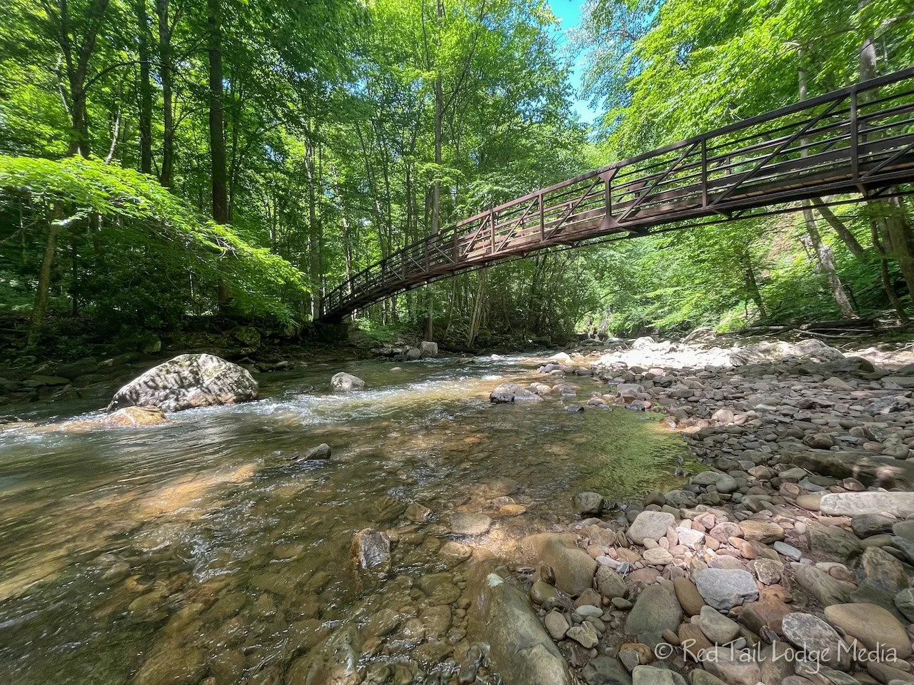
After watching the park film at the visitor’s center, we walked down to the views of the bridge from the Canyon Rim Overlook Boardwalk. The New River Gorge Bridge is the longest single-span arch bridge in the Western Hemisphere. It carries US 19 over the New River, 876 feet above the river.
The Fayette Station Road Tour starts off of Lansing-Edmond Road, just north of the visitor’s center off of US 19. The park ranger made sure to mention that the road behind the visitors center does indeed connect to the scenic drive; however, you have to navigate “Stupid’s Corner” as the locals call it. They just had to have someone towed out of there the previous Saturday because they high-centered their vehicle on Stupid’s Corner. Don’t be that guy. Get the correct directions from the visitors center.

The Fayette Station Road is one way most of the way. It follows the route that people had to take to cross the New River before the big arch bridge was built. The road is eight miles long with several hair pin turns. It crosses the railroad tracks that run on both sides of the river along with crossing under the big bridge twice. The road crosses the river on a small bridge close to the water. There are several pull outs and informational signs along the way. The park service recommends allocating 45 minutes to drive the eight mile road.

The drive is both scenic and informative. Just after passing under the big bridge the first time, there is an area that seems popular for rock climbers, called Bridge Buttress. There were a handful of climbers there when we passed by.
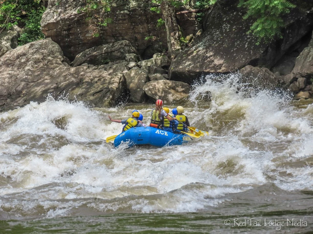
We stopped and walked out onto the small bridge to watch some white water rafters go by. There is a section of rapids just past the little bridge, called the Fayette Station Rapid. It was fun to watch the rafts go through the exciting turbulence of water. We stopped again at the parking area near the boat launch, which was closer to the rapids. From there we watched a few more rafts bouncing through the high waves.

Red Tail did fine on the scenic drive. We had to use a three point turn on only one of the hair pin turns. Keith also took the turns slowly and swung as wide as he could around all the tight turns. We enjoyed the drive and recommend it. However, we also recommend checking with a park ranger to make sure your vehicle is appropriate for the drive.

After the drive, we headed over to the Long Point Trailhead. For some reason, we didn’t change into our hiking boots. That was a mistake. The trail was full of muddy spots and our trail runners ended up pretty dirty. Our trekking poles would have been useful as well, since some of the mud was a little slippery. However, there wasn’t a lot of elevation gain. If the trail had been dry, our trail runners and no trekking poles would have been appropriate. But, noticing all the widening of the trail and trampled areas as people were avoiding the wet and muddy areas, it looks like those areas are often messy.
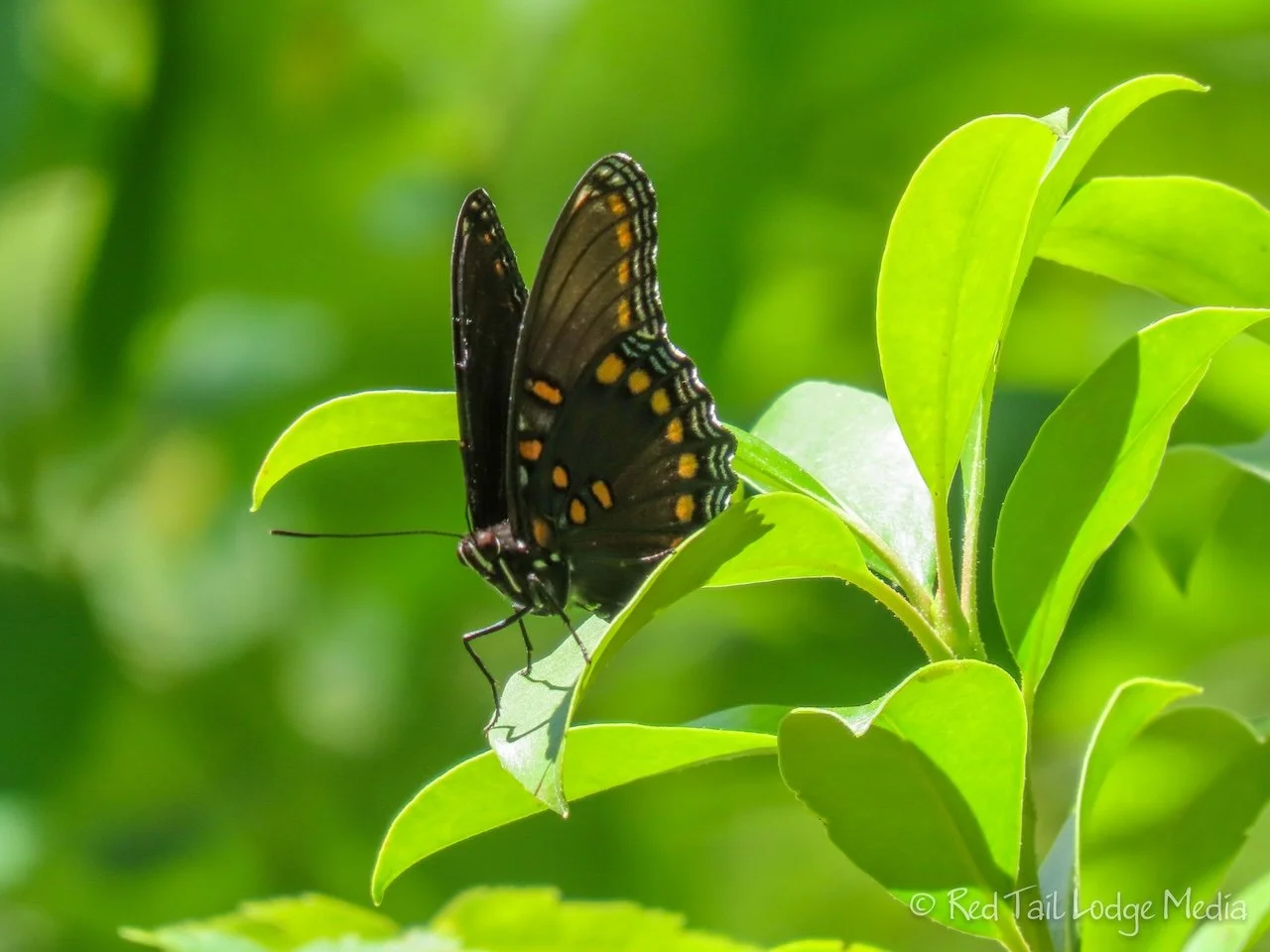
The trail is a nice walk through the woods, with nothing special until you get closer to the end of the trail and the viewpoint. The last section of trail is through a thicket of rhododendrons and mountain laurel, with swarms of butterflies. Then you pop out on a rocky point that projects out towards the river.
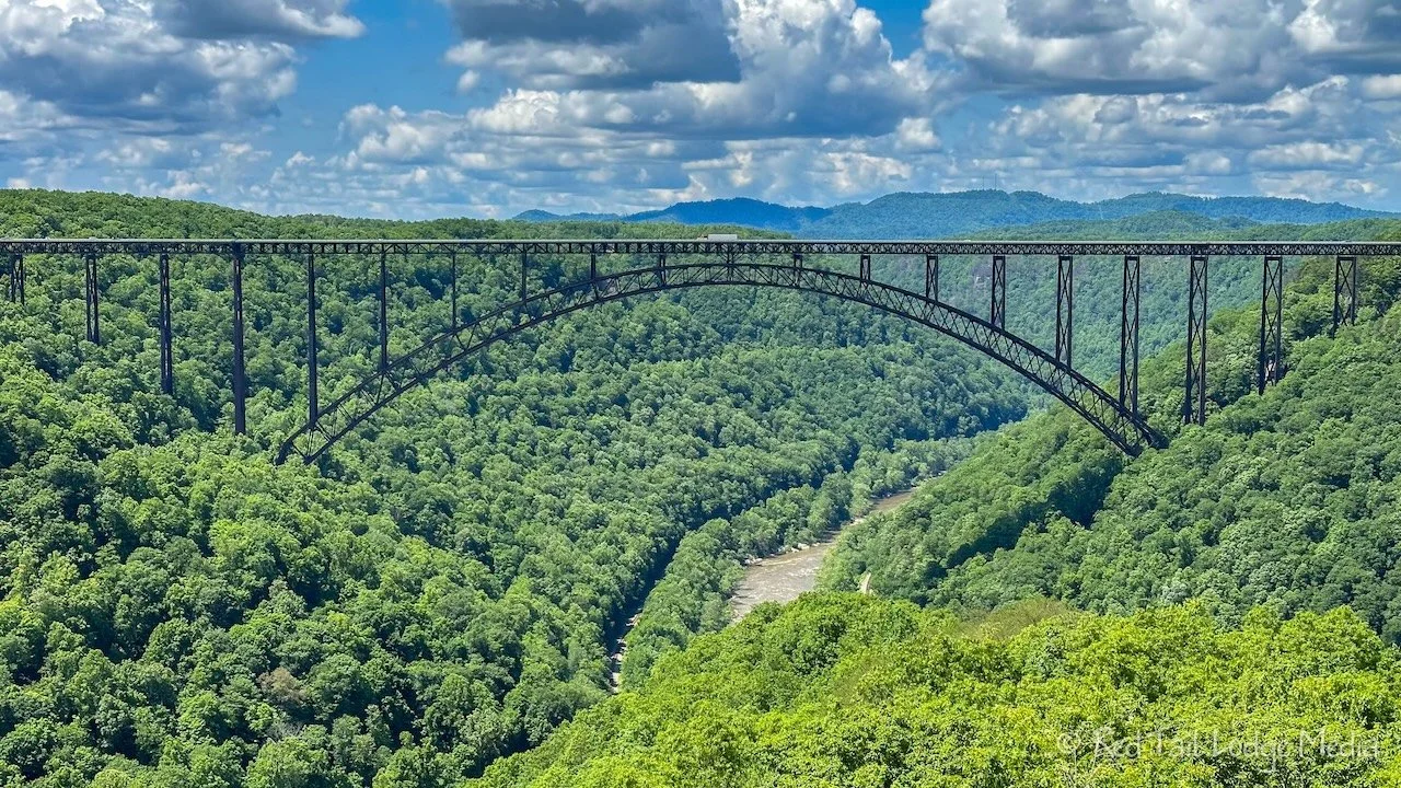
The views of the bridge, the river, and the gorge from Long Point are sensational. For us, the trail was 3.2 miles with an elevation gain of 367 feet which we completed in an hour and 40 minutes. We combined it with the Canyon Rim Boardwalk to count it as hike #23 of our 52 Hike Challenge for 2023. The combined distance was 3.6 miles with 449 feet of elevation gain in a total of almost two hours.

Keith was getting over a cold and not up to par, so, after the hike, he was done for the day. We headed back to Babcock State Park to take showers, make dinner, and relax for the evening.

While Tuesday was mainly about the New River Gorge Bridge, Wednesday was about the coal mining and railroad history of the area. We started the day with a hike down to the historic coal mining town of Nuttallburg. There is a narrow, windy road that takes you down to the remains of the town, but we decided not to drive it in our RV. Instead, we parked at the Short Creek Trailhead just off Beauty Mountain Road, then hiked down the Headhouse Trail.

The trail is pretty steep. First we passed a rock climbing area. No one was climbing when we started our hike, but there was an emergency back board stored beside the trail. There were a couple of climbers on our way back out later in the day.
In less than a mile, we reached the main mine entrance and the headhouse. From the head house, coal was loaded onto a conveyor belt that delivered the coal from the mine all the way down to the town, where it was processed.

The trail continues and changes names from the Headhouse Trail to the Conveyor Trail. Since the Conveyor Trail has so many switch backs, we were not expecting it to be as steep as it was. The soft dirt trail was narrow, with the trail giving way if you stepped too close to the edge. Thank goodness we were wearing our hiking boots and using our trekking poles. There were a couple of views of the conveyor along the way, but the best views were at the Headhouse and again at the end of the Conveyor Trail, where it joined the Town Loop Trail.
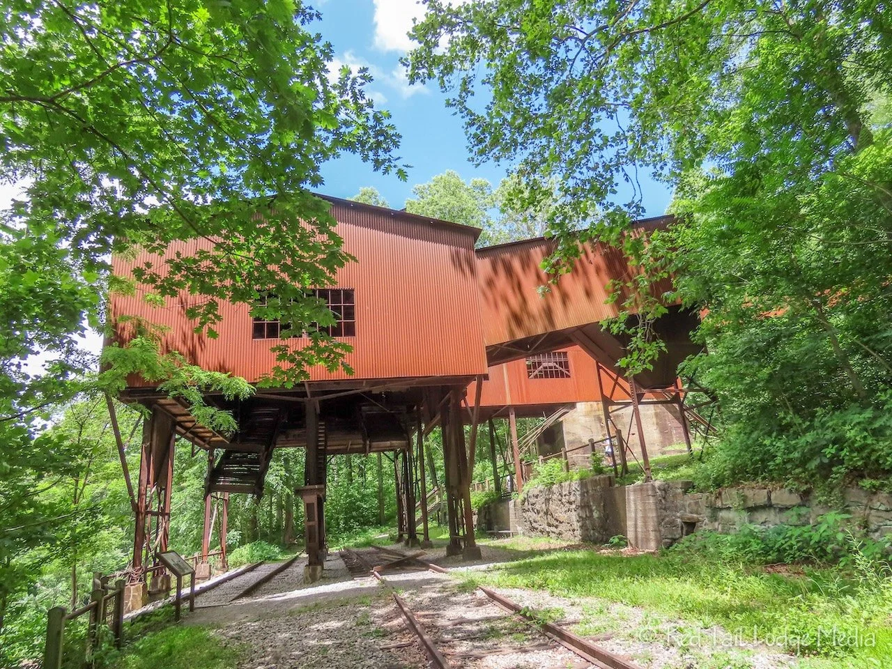
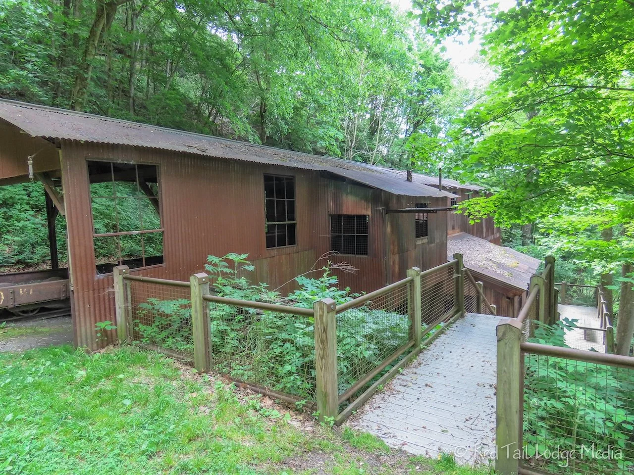
The Town Loop Trail was aptly named. It looped around the remains of the town, which were mostly foundations of a school, church, and homes. The Tippel building has been restored. It is a large structure over the railroad tracks, used to load the coal into the train cars. Leading off from the Tippel was a long row of coke ovens. The ovens were used to process the coal before shipping it off on the trains.
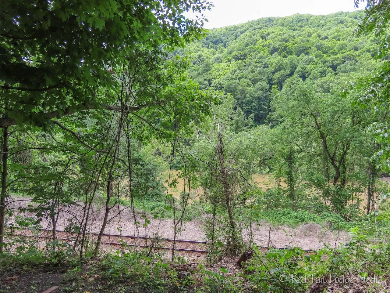
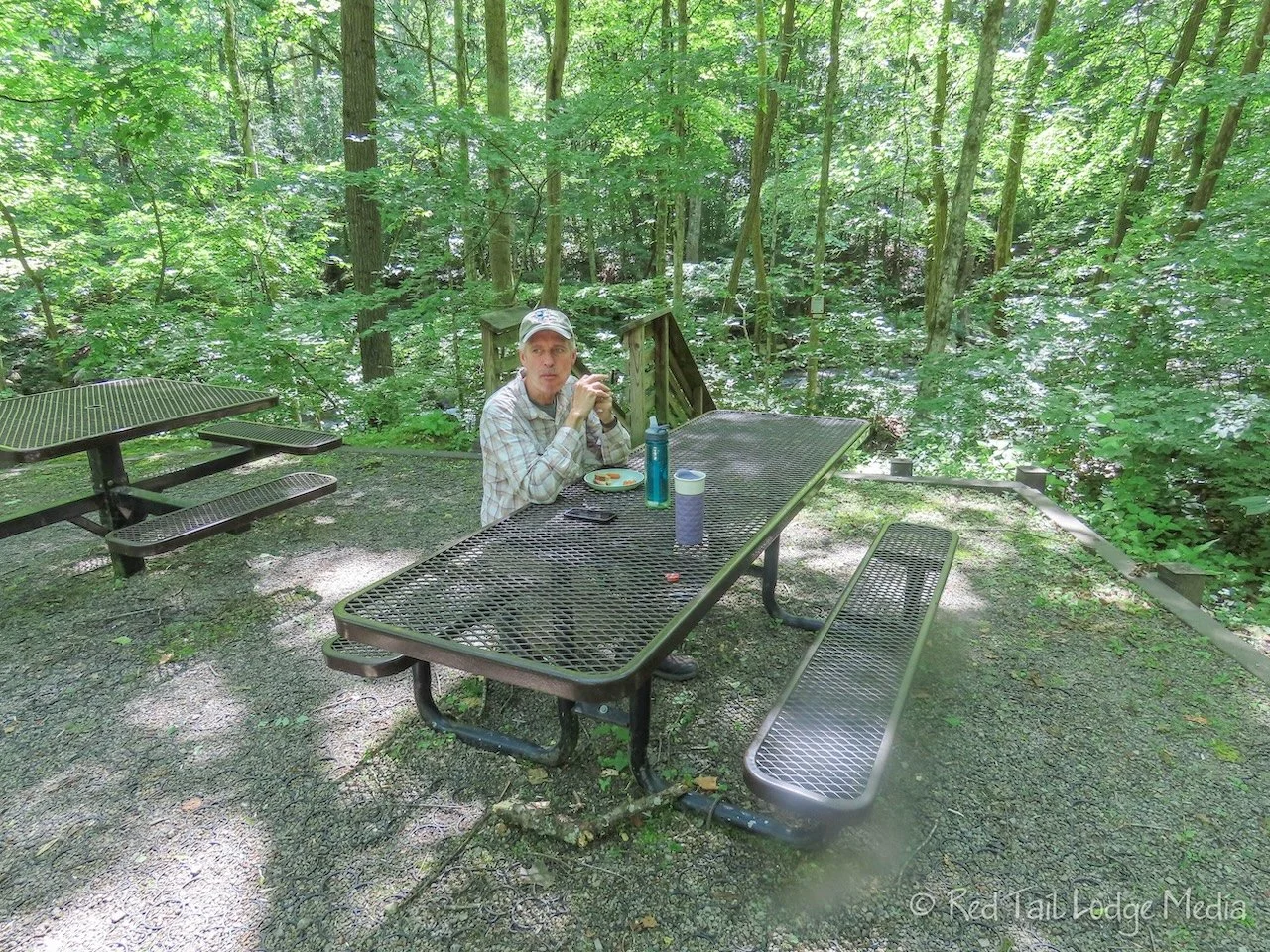
We sat down on a bench near the parking area to eat our snacks before starting our steep hike back up. The bench faces the river, but we were not that close to the river, as the still active railroad tracks were in between us and the river. A train went by just as we were starting our hike back.

We were surprised that the hike back up only took us about an hour. The Conveyor Trail didn’t seem as sketchy on the way up as it did on the way down. In total, we covered 5.2 miles with an elevation gain of 1122 feet in three hours and 15 minutes. We counted it as hike 24 of our 52 Hike Challenge for 2023 and hike 33 of our National Park Series.

We would not recommend hiking the Conveyor Trail if you have a vehicle that is suitable for driving down to the town. We would recommend exploring the Town Loop Trail at the bottom, then driving up to the Short Creek Trailhead and hiking down to the Headhouse. There isn’t much to see on the Conveyor Trail itself. However, if you are concerned about taking your vehicle down the road and you have the skills and conditioning, hiking all the way down is an option.

After our hike, we drove over to Thurmond. Along the way, we stopped at the Frozen Barn in Oak Hill. The Frozen Barn is a cute ice cream shop. Their tasty ice cream helped revive us.
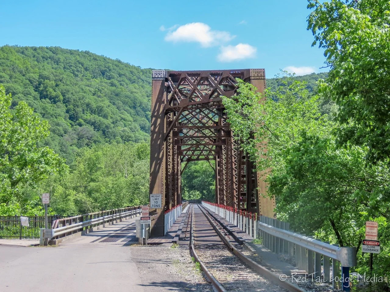
The road out to Thurmond is a beautiful drive, following alongside the Dunloup Creek. The road crosses the New River on a one lane bridge that is attached to the side of the train bridge.

Thurmond is a ghost town, but the train depot there is still active. It is flag stop for Amtrak. The old buildings along the main street are right next to the train tracks. A couple of old houses also remain. The water tanks are gone, but the coaling tower is still standing. It was used to drop coal into the tenders of the train engines.
Thursday was all about the water. Keith was still fighting off a cold, so he slept in and we got a late start on the day. The different areas of River Gorge National Park are far apart. Even though the park looks all connected together as one piece along the New River, to get to each area by vehicle requires driving out of the park and around on local roads and highways, then driving back into the park again. For example, if you start at the Canyon Rim Visitor Center in the north end of the park and want to go to Sandstone Falls in the south end, it is an hour drive (48 miles) to the Sandstone Visitor Center, and an additional 34 minute drive (another 20 miles) from the Sandstone Visitor Center to the Sandstone Falls.
Our first destination for the day was the Lower Glade Creek Trailhead, which was a 45 minute drive from Babcock State Park Campground. It was 11 am by the time we arrived at the trailhead, so we decided to go ahead and eat lunch first. That meant it was noon before we were on the trail.

This was the trail we were originally hoping to ride our e-bikes on, until we found out they were not allowed. The trail allows bicycles, but, after seeing the condition of the trail, we would not recommend it for even mountain bikes. So much of the trail is wet and muddy. There are also quite a few obstacles to get around or over, such as fallen trees and rock slides. There are sections where a mountain bike would be fine, but the trail is straight and the effort to get around the obstacles would not make for a fun ride in our opinion.

The trail, however, is ideal for hikers. The trail follows Glade Creek the whole way. The creek is a series of small, cascading waterfalls. Between the sound of the water and the gorgeous sights of the creek, you forget how sloppy the trail is. Hiking boots and trekking poles would be our recommended gear, and your camera. The park ranger mentioned that this was his favorite hike in the park. We can understand why.

Be sure to divide your attention between the creek and the trail under foot. There are plenty of tripping hazards, and snakes. Ann was about three or four feet from a rattlesnake when she was startled by the sound of the snake’s rattle. Even with the roar of the creek, the sound of the rattle made her stop dead in her tracks and retreat a couple of feet before she even realized what the sound was. It was a good thing she reacted to the rattle, because if she had continued walking forward, she would have stepped on the snake in a few more steps. As we watched the snake from a safe distance, it reluctantly slithered off the trail and we continued on.

We were hoping to make it to Kates Falls, which is a small spur trail about 4.5 miles from the trailhead. However, right before the spur, there was a sketchy stream crossing, right along the top of a small waterfall. It looked doable, perhaps even being able to keep our feet dry. But it also looked like it had the potential for serious harm. Not knowing how slippery the rocks might be, we didn’t want to risk slipping and falling. It would be a long hike back to the trailhead with an injury. So we decided to turn around and head back. It was a little frustrating being so close to our goal and not reaching it, but it was better than getting hurt. The older our bodies get, the longer they take to heal. Breaking her tailbone early in Season Four was still fresh in Ann’s mind (link to Shades State Park). Not an experience she cared to repeat.
Even though we cut the hike short, it was still a very respectful distance. Our hike was 10.1 miles with an elevation gain of 781 feet which took us four hours and 15 minutes to complete. It was hike number 25 of our 52 Hike Challenge for 2023.

It was our last day in the park and there were still a couple more items on our list of things to see. One was the Grandview area, with its panoramic viewpoints out over the river. As the crow flies, Grandview was only a couple of miles from the Lower Glade Creek Trailhead. However, it took 50 minutes to drive the 28 miles to get there, including several miles on Interstate 64. Even though the lighting was not the best, as the sun was playing hide and seek behind the clouds, the views were nice. We went to both the Main View behind the Grandview Visitor’s Center and the Turkey Spur Overlook.

It was getting late, so we decided to skip the last item on our list, the Sandstone Falls Boardwalk. According to the ranger we spoke with on the first day, these are the prettiest falls in the park. We’ll just have to save those for the next time we visit.

Even though we didn’t go whitewater rafting, three full days within New River Gorge National Park was not enough for us to enjoy all the areas of the park. Depending on what you like to see and do, you could spend quite a few days there. Plan accordingly.
Check out our related video: New River Gorge National Park, West Virginia
(Ann)