
McCarthy, Alaska - July 25th to 28th, 2022

McCarthy is a small town at the end of a 60 mile dirt road from Chitina. Five miles beyond McCarthy is Kennecott, a National Historic Landmark inside of Wrangell-St. Elias National Park. Is it worth the long, bumpy drive to get there?

The rain was back on Monday. An inch of rain was expected in Valdez for the day. We dumped and filled our tanks in the rain and hit the road. We’ve heard the drive out of Valdez is gorgeous. Due to the rain and fog, we thought we would miss most of it. And we’re sure we did miss some of the views.

As we headed out of town, the highway passes through Keystone Canyon. The canyon is narrow, so the canyon walls are close to the road which enabled us to see them. Horsetail Falls and Bridal Veil Falls were spectacular.

As the day wore on, the rain got lighter. Our destination for the day was Chitina, on highway 10, a spur road off of Richardson Highway (route 4). We needed to top off our gas tank before the day was over. We only saw two gas stations on Google Maps. The first one was along highway 10, a Tesoro station at Kenny Lake. However, when we arrived there, the single gas pump was taken all apart and two guys were working on it. They said it would be a while before it was working again. So we continued on to Chitina.

Just after the Chitina post office, we spotted a gas pump, so we stopped and filled up. It was the highest price gas we’ve paid so far this season, $6.40 per gallon. However, this unmanned station was not listed in Google Maps, so there is another station in Chitina, at the Wrangell View Store. We’ll have to check their price on our way back out of this area to see if they are any cheaper.

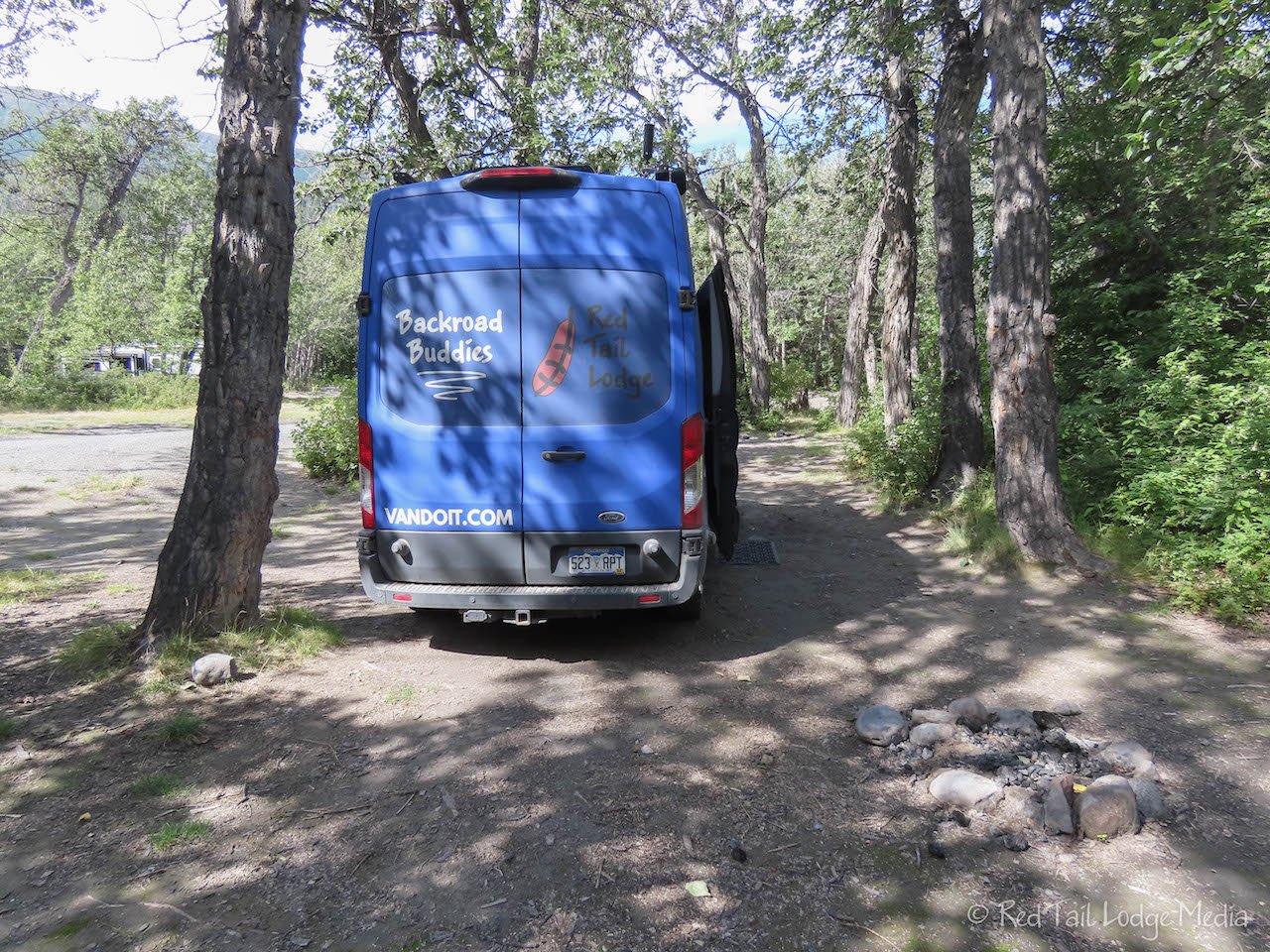
The rain had stopped by the time we reached the campground along the Copper River. There are two places to camp just after the bridge on McCarthy Road. The one to the right of the road is in the woods with a vault toilet and trash cans. On the left side there is public land where you can camp on the gravel bars by the river. However, you have to cross Ahtna tribal land to get to it. The signs were faded that indicated what was tribal land (and costs $30 per night) versus what was public land (and free). We chose to stay in the campground on the right side of the road, Copper River Campground, which was also free. It was windy, so being in the protection of the trees sounded better, plus Ann wanted a toilet nearby. What was unusual was that the trash cans were uncovered, just open barrels. That’s the first time we’ve ever been in a campground where the garbage containers did not have lids. In Alaska, we would expect the garbage to be in bear proof containers. It is hard to believe they don’t have an issue with bears or other critters here. To be fair, we have not seen any bears in Alaska yet, outside of Brooks Falls in Katmai National Park (Katmai National Park, Alaska - July 11th, 2022).

We arrived around noon. There were a handful of other campers in the campground, but within the hour, they all left. They must have been camping there the night before. After eating our lunch, we went for a walk. Back on the far side of the bridge were a few people dipnetting. Dipnet fishing is only allowed for Alaska residents and they are limited to how many salmon they can catch in a year. We saw one person catch one fish, but then they took a break. Dragging a fish in a net at the end of a long pole looked like it took a lot of effort.

Further upstream, we could see several fish wheels, but they were just sitting there on the gravel bars next to the river. No one was around them. We’re not sure how often they are used. It would be nice to see them in operation. Perhaps they’ll be in use when we come back through in a couple of days.

After dinner, we went for another walk. The people who were dip netting were packing up for the day. When we got back to the campground, another camper showed up. By morning, only a couple more campers stopped for the night. That made us feel a little better. Being the only ones made us wonder if there was something going on that we were not aware of, such as bad weather or flooding. In the evening, there were some light rain showers, but that was it. All the rain must have stayed down in Valdez.

Tuesday was a gorgeous, warm, sunny day. We drove from Chitina to McCarthy. It is only 60 miles, but it took us three and a half hours to get there, not including a half hour stop for lunch. Google Maps says it is a two hour drive. Well, that must just be for heavy duty four wheel drive trucks and jeeps with beefy suspension. The road is dirt/gravel most of the way. We laughed when we saw a 35 mph speed limit sign. Our top speed for the day was 30 mph. There were a lot of long washboarded and pot-holed sections where we had to keep our speed under 10 mph to keep the vibrations down to a tolerable level. Much of the time we were going 20 to 25 mph. We passed a road grader which we were grateful for. That section of the road was pretty decent.

The drive is beautiful. Various moutain ranges were in the distance. The road passed by several lakes and ponds. We kept our eyes open for moose in the marshy areas, but didn’t see any. There were a couple of trumpeter swans poking their heads above the tall grass. A couple of loons were making some noise on one of the lakes.

The road crosses over the Kuskulana River on a one lane bridge. The Kuskulana Bridge was formerly a railroad bridge. It is a beautiful truss bridge, originally built in 1910, and spans the canyon for 525 feet at 238 feet above the river.

At the Gilahina River, the road descends down to a short bridge over the river. However, towering above the road is the old railroad trestle bridge. There is a wayside rest area near the river which made a great place to stop, use the restroom, and take nice pictures of the old bridge.

About ten miles from the end of the road is an Alaska State Forestry Wayside, with picnic tables and a restroom. Even though we didn’t have much farther to go, Keith was ready to take a break, so we stopped for lunch. Driving the rough road was rather stressful. He had to constantly stay alert to spot the rough sections and pot holes, which were especially hard to see with all the tree shadows speckled across the road.

Although McCarthy Road looks like it is in Wrangell-St. Elias National Park most of the way, much of the land along the road is privately owned. All of the national parks inside of Alaska allow for private ownership and use within the preserve areas of the park, as allowed by the Alaska National Interests Lands Conservation Act of 1980.

We finally reached Base Camp at the end of the road. The general public is not allowed to drive vehicles into McCarthy and Kennecott (only residents and local businesses are allowed access). McCarthy Road ends at the foot bridge that crosses the Kennicott River. Base Camp is a parking lot and disperse camping area. They charge $10 per day for parking and $30 per day to camp. That seems rather expensive considering the amenities which are a picnic table and fire ring, if you’re lucky, and one small, old-fashioned privy. There is no trash collection, no water source, and no dump station. What you get is a convenient location to explore McCarthy and Kennecott along with a spectacular view.

We managed to snag a nice spot, with a view of Kennecott, the mountains, and glacier right from our side door. Simply stunning.

From our camping spot, the small town of McCarthy was about a one mile walk. From the far side of the foot bridge, there are shuttles that run into town, saving you about 0.7 miles of walking. There are several different shuttles. Some are for specific hotels. Another one costs $5 per person per ride. The Copper Town Shuttle provides a free service, but it only runs twice an hour. We also seemed to time it poorly and walked into town every time instead of waiting for the shuttle.

McCarthy is not very big, so it didn’t take us long to walk up and down the couple of blocks of Dan Creek Road. We stopped for an ice cream cone at McCarthy Central Store. We checked out a couple of menus for dinner options before heading back to the campground. We were sick back on our anniversary, so we wanted to eat out as a belated treat. Plus, eating out meant we could conserve on our water consumption. We had brought about 15 gallons of fresh water, making use of our collapsible spare jug, from Valdez. That needed to last us four days, until we get to Big Delta. We generally go through about 5 gallons of water a day, so we needed to use it sparingly to stretch the 15 gallons for four days.

We decided to eat at the Salmon & Bear Restaurant. It was rather pricy, but we decided to splurge for our anniversary celebration. We both had the compressed melon salad, the 6 oz tenderloin along with the charred asparagus. For dessert, we had the pound cake with berries. Most of the meal was excellently prepared and very tasty. However, we were not impressed with the dessert.

Our original plan was to walk the five miles from McCarthy to Kennecott and check out Kennecott. Kennecott operated as a copper mine and mill from 1911 to 1938, processing nearly $200 million worth of copper. The town, mill, and mines were designated a National Historic Landmark in 1986.

Fortunately, we talked with one of the staff at the Base Camp office before making the walk. He advised us to take the free shuttle from McCarthy to Kennecott and spend our time and energy around Kennecott. The road from McCarthy to Kennecott is in the trees, with no views. He recommended to walk up to Silk Stocking Row in Kennecott or take the Bonanza Mine Trail to get up high for some fantastic views. We studied the maps on AllTrails and decided to take the Root Glacier Trail over to the glacier, then come back on a higher trail, behind the Kennecott mill, and pick up Silk Stocking Row.

We walked over to McCarthy early in the morning. Keith bought a coffee from The Potato before we hopped on the 9:30 am shuttle over to Kennecott. We were on the trail by 10 am. Most of the people walking the trail over to the glacier were with guided groups. Since we had already done a guided glacier hike back at Matnuska Glacier (Matanuska Glacier, Alaska - June 26th to 27th, 2022), we opted to just hike to the glacier and not hike on it. We did have our Yaktrax (paid link) with us, but you really need crampons to safely walk on glaciers.

The trail is pretty flat until the last little section before the glacier, where it descends down a rocky slope. Along the way, there is a pretty waterfall where the trail crosses Jumbo Creek. The descent down the glacier was pretty steep with lots of loose rocks and dirt, but it wasn’t too bad if you just go slowly. At the bottom, all the tour groups were busy putting on their crampons before heading out onto the ice. We sat down and enjoyed our snacks, while watching all the groups get their quick lessons on how to walk in crampons.

The first hump of ice was covered with a layer of rock and dirt. We could probably get up there safely and take a selfie. We thought about putting on our Yaktrax, but we decided to be lazy. It probably would have been better if we had, but we made it up to the top of the first small mound and back without incident.
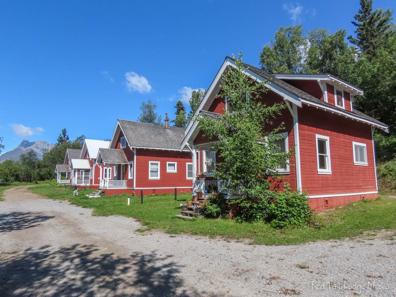
On our way back, we left the Root Glacier Trail where the Bonanza Mine Trail branches off. When the trail split again, we took the right branch which brought us to the top side of the Kennecott Mill. The views from there were fantastic. Continuing on the trail, we took the left branch of another split that took us on a bridge over the National Creek and another pretty waterfall. Then the trail becomes the Silk Stocking Row, a road that switched back and brought us back down into town. Silk Stocking Row was where the administrators of the mining operation lived. The houses are now mostly privately owned, but they are cute houses with a view.

By the time we returned to town, we had gone 5.7 miles with an elevation gain of 781 feet in three hours and 40 minutes. It was hike number 26 of our 52 Hike Challenge for 2022.

It wasn’t even 2 pm, and we hadn’t really explored the town of Kennecott yet. We decided to sign up for the 3:30 pm historic walking tour of Kennecott, since it was the only way to go inside the large, 14 story mill. Since we had some time to kill, we walked down to the Meatza Wagon, a food truck. We didn’t order anything fancy. Keith had a Coke and bag of chips, while Ann had the kid’s cheese quesadilla. Ann was impressed with the quesadilla, nice and crispy on the outside. What was even better was the view from the picnic shelter next to the food truck. It looked out over the glacier moraine valley and the Kennicott River, with a backdrop of mountain peaks.

The walking tour was two hours long, covering a mile, with steep stairs and ladders inside the mill. They make you sign a liability waiver and provide you with a hard hat. Not only did the tour provide us with interesting tidbits about the history of the town and the milling and mining operations, but the views from inside the mill were spectacular. The windows framed the scenery nicely. At the end of the tour, they provided a hand-washing station, just in case you might have picked up any heavy metals while inside the mill and leaching plant.

Most of the other buildings that you can enter without a tour, the tour did not go into. We could have explored them on our own, but it was 5:30 pm by the time our tour ended and we were exhausted. It had been a long, but fulfilling day. Right after our tour, we headed over to wait for the 6 pm shuttle. The free shuttle between Kennecott and McCarthy runs only once an hour. While we were waiting, there was a $5 shuttle bus sitting there. We were tempted to pay so we could leave earlier. Another family did just that. We wondered why there was a $5 shuttle when there is also a free one, but now we understand why. By the time 6 pm rolled around, there were more people waiting for the shuttle than room on the shuttle. The shuttle bus was only a 15 passenger van. The driver did tell everyone that another shuttle was coming in about 10 minutes. They must run some extra ones at the end of the day to make sure no one is stranded in Kennecott. The last free shuttle on the schedule is at 7 pm. Still, we would advise not waiting until the last shuttle. Five miles is a long walk at the end of the day.

We were back in McCarthy by 6:15 pm. It would be another 15 minutes before the shuttle left McCarthy to the foot bridge, the last free shuttle for the day. Again, despite being tired, we opted not to wait, especially since there was no guarantee that there would be room on the shuttle for us. So we walked the mile back to our campsite. Luckily dinner was quick and easy so we could spend more time relaxing in our camp chairs and enjoying the view.

Thursday we drove back to Chitina. Keith was not looking forward to driving McCarthy Road again. However, the road conditions seemed better this time. We passed two road graders this time instead of just one. They must have been busy the day before. It took us only two hours and forty minutes this time instead of the three and a half hours to drive it earlier on Tuesday.
It was lunch time when we reached the Copper River Campground in Chitina. There were a few more people in the campground this time. The site was had before, probably the best one in the campground, was already taken. We found another site that was acceptable. The sites come in quite a variety of quality. Some have picnic tables and fire rings, others do not. Some are level, most are not. Some are dry and others are muddy. Some have some privacy, others are out in an open central area. By the end of the evening, most if not all of the sites were taken. Quite a change from Tuesday night.

After lunch we walked down to the bridge. There was not anyone dip netting this time, but there were people over by the fish wheels and a group of vehicles down by the river with boat trailers. However, the fish wheels still did not seem to be operating. Perhaps we missed it, because there was a group of seagulls swarming around one of the fish wheels. Somebody was probably cleaning their catch.

We relaxed back at our campsite in the afternoon and walked out to the bridge again after dinner. This time there was one person dip netting a little ways from the bridge. We watched him catch one fish. The people who were out by the fish wheels earlier had left. It would have been nice to see the fish wheels in operation. Maybe we’ll see them again somewhere else before we leave Alaska.

We were glad we planned on a full day to drive McCarthy Road, both on the way out and on the way back. Is it a rough road? Yes. Is it worth it? Yes! Just take your time, but don’t take a large rig or new vehicle. It will take a beating. A 4WD or high clearance is not necessary, but a good suspension system will make the drive more pleasant.
Check out our related video: McCarthy, Alaska
(Ann)