
Kings Canyon National Park, California - May 31st to June 1st, 2024
Kings Canyon National Park is adjacent to Sequoia National Park. The two parks are managed as one. Even their National Park website is combined into Sequoia and Kings Canyon National Parks. We covered our visit to Sequoia National Park in a previous post. This post covers our time in Kings Canyon National Park. In order to explore Kings Canyon, we were camping in Stony Creek Campground in the Sequoia National Forest, which sits in between the two national parks.

Friday was a scenic drive day. We started out by driving over to the Kings Canyon Visitor Center in Grant Grove Village. It should have only been about a 25 minute drive, but the crews were busy taking down dead trees along the highway. We had to wait about 15 minutes for them to take a break and let us through. The people in front of us had to wait longer. They were already standing outside their vehicles when we pulled up in line to wait. The park website warned that there could be up to 30 minutes of delay along the highway.

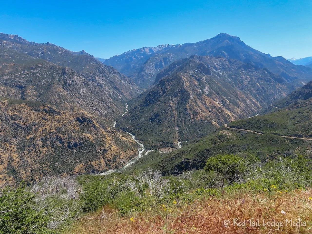
On the way to the visitor center, we stopped at a couple of overlooks. The first one was Kings Canyon Overlook, with views out over the canyon. We noticed the vanity plate of a little airstream, “Luftzug”. It means air train in German. It also may be a play on words as the German word for airplane is “Luftzeug”. How cute.

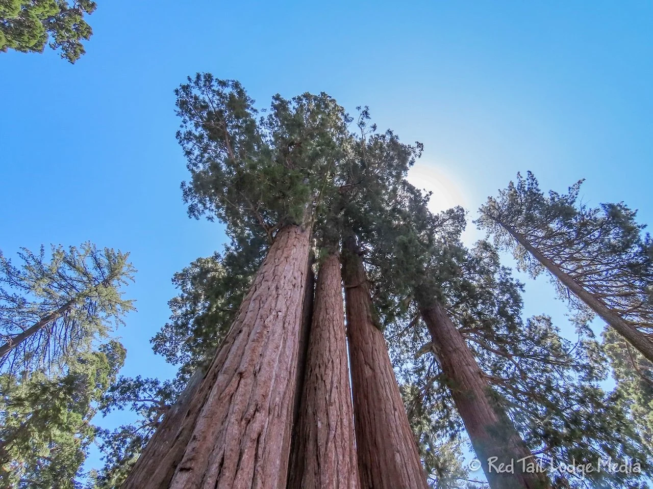
The second overlook was Redwood Mountain Overlook. It was on the other side of the highway, with views out over a young Sequoia grove. Sequoia trees start out with a pointed crown, but when they mature, the tree stops growing upward, the point drops off, and all of the tree’s growth goes into making the trunk thicker and wider.

The rangers at the visitor center confirmed that the Kings Canyon Scenic Byway was open out to Grizzly Falls, but you still can’t reach the Cedar Grove area. It was just a couple of weeks prior that the highway opened up beyond the Hume Lake turnoff. Crews are not expected to finish the highway repairs to Cedar Grove until mid June. We believe all the road damage was caused by flooding and/or avalanches.
We also learned that the Hume Lake road is now paved all the way, but the road to Panoramic Point is dirt. The roads are narrow and winding, but there are no length restrictions, including the road out to Grants Grove.

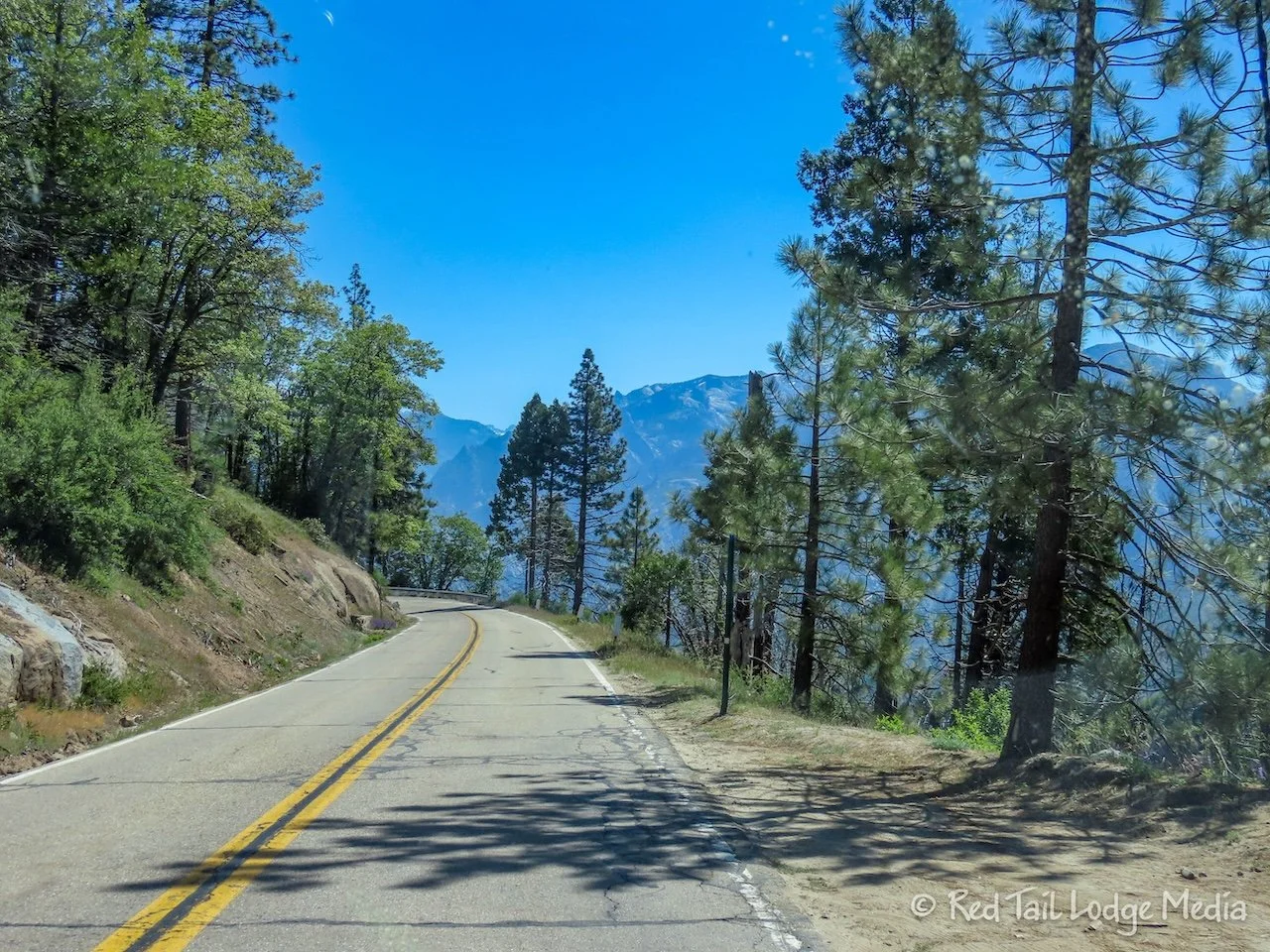
We headed out the Kings Canyon Scenic Byway towards Grizzly Falls. Once we passed the Hume Lake road, the scenery became stunning. The scenic byway slowly descends down into the canyon, with changing views as the road follows the contours of the canyon walls. We stopped at a couple of overlooks, including Junction View, to stare at the views. An outfit at Boyden Cavern offers cave tours, but we didn’t stop to check them out.

Once the highway reaches the valley floor, it runs alongside the South Fork of the Kings River. The river was raging this time of year. However, there were signs warning people that the river is always frigid, turbulent, and swift at all times.
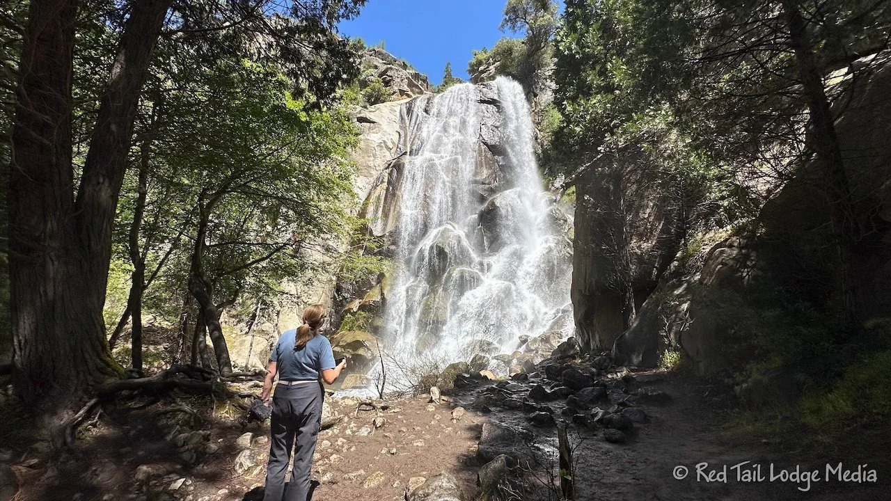
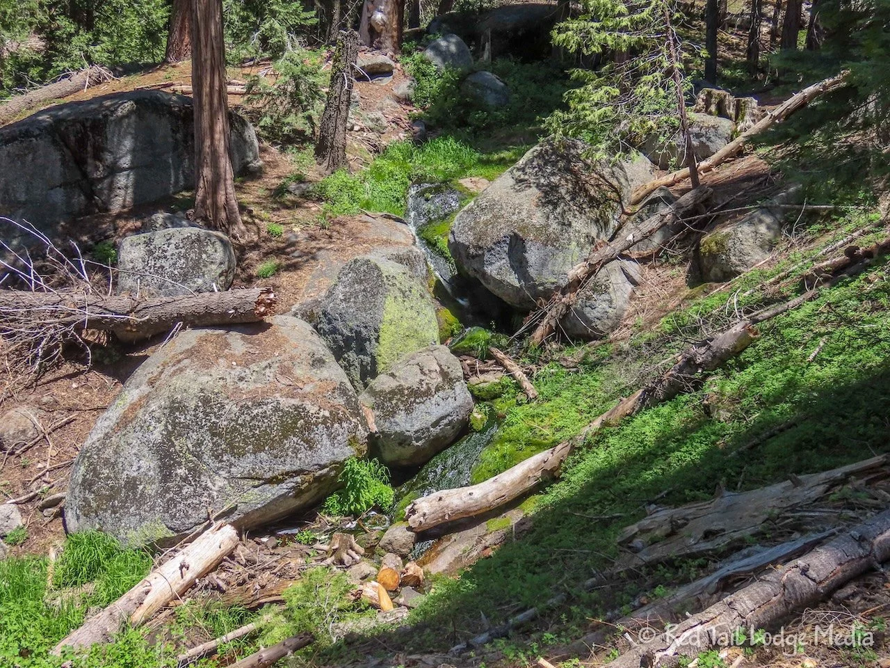
Grizzly Falls was impressive. It is along a small tributary to the river. You can walk up to it, where you can feel the strong mist and get a real sense of its power. There is a picnic area there, but we opted to drive back to Junction View to have lunch. The canyon is tall and narrow near the falls and we were hoping to get Starlink connected during lunch.

At Junction View, we put the Starlink dish up on Red Tail’s roof (our Winnebago EKKO). We had a clear, open view of the sky at the overlook. It took about ten minutes to get connected and download Starlink updates. Then we had wonderful internet service. There is no cell service in the canyon. This was the whole reason for getting Starlink.
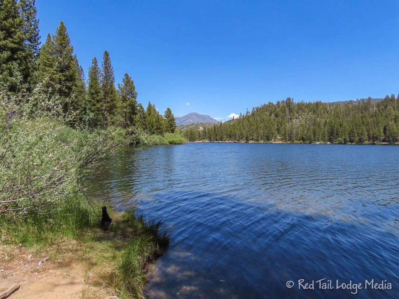
After lunch, we drove back to Hume Lake Road and up to Hume Lake. We parked in the National Forest day use area next to the Hume Lake Campground. The lake is pretty. People were fishing and paddling on the calm, manmade lake. There is a trail that circles the lake, almost three miles in length. We just walked a short section of the trail, from the campground over to the Hume Lake Christian Camps, at the southwest end of the lake.

Hume Lake Christian Camps is privately owned, but there is public access along the Hume Lake Road and lakeshore. The property is beautiful, with a wonderful view out over the lake with mountain peaks as a backdrop. We went into their General Store for drinks and ice cream novelties. Ann had an It’s It, a mint one, just like she had at Lodgepole market in Sequoia. Keith opted for an ice cream sandwich. Ann doesn’t quite understand his love for ice cream sandwiches. She believes it is a nostalgic thing, even though she also spent her youth eating her share of ice cream sandwiches. Somehow, she doesn’t share his passion for them. An It’s It isn’t much different than an ice cream sandwich, but Ann believes it tastes so much better.

Along the Hume Lake Trail, we noticed lady bugs flying everywhere. We’ve never seen so many lady bugs in one area before. It was like walking through a swarm of them. We overheard someone at the Hume Lake Christian Camps talking about a lady bug bloom. We believe it.
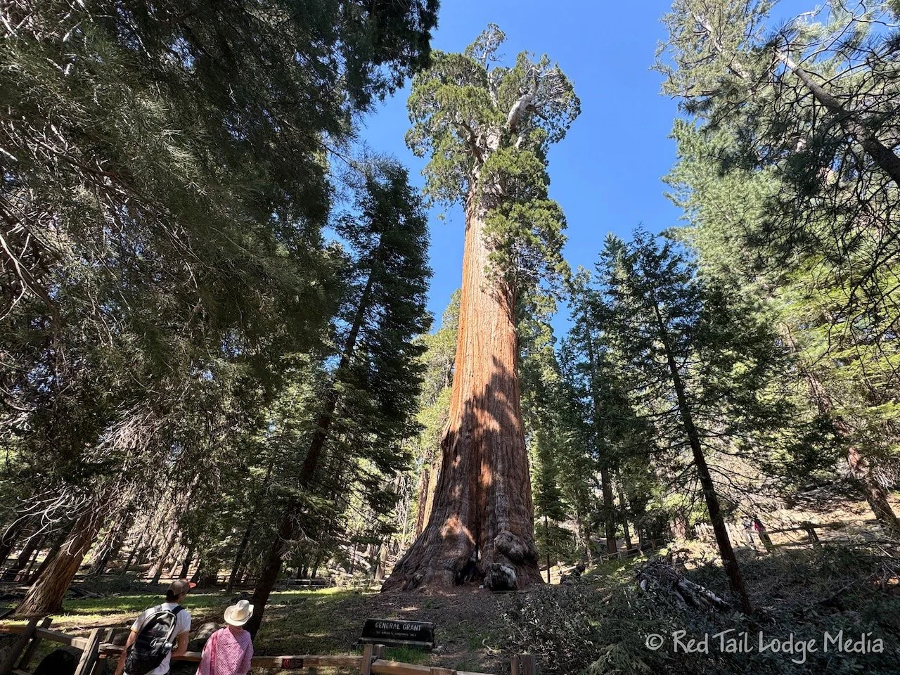
From Hume Lake, we drove back to Grant Grove. A half mile path circles among the Sequoia trees in the grove. The largest tree, General Grant, is the second largest tree in the world, with the General Sherman tree in Sequoia National Park being the largest. The sign claims that General Grant is the third largest, but we heard from a ranger that the previously second largest tree has fallen, so now General Grant is the second largest.

Also in Grant Grove is a fallen Sequoia tree that you can walk through. Sequoia trees are resistant to decay, so the trunks can lay on the forest floor for centuries. It was a neat perspective to walk the length of the trunk through the middle of it.

Kings Canyon National Park is about the same size as Sequoia National Park, but it is not as accessible. There are really only two sections that are reachable by car. The first is the Grant Grove area. The second is the Cedar Grove area, which we could not access due to the road closure. So most of our day was spent in the Sequoia National Forest. This included the Kings Canyon Scenic Byway and Hume Lake.

When we returned to Stony Creek, we tried something new when leveling Red Tail. When we put the GoTreads on top of the 2x6’s, the GoTreads like to slide along the boards, especially when Keith brakes hard to prevent falling off the other side. We had an extra door mat that we didn’t like and had already replaced. We cut it in half and put it in between the GoTreads and the boards to increase the friction between the two. It seemed to work, but it may have been that Keith didn’t brake as hard.
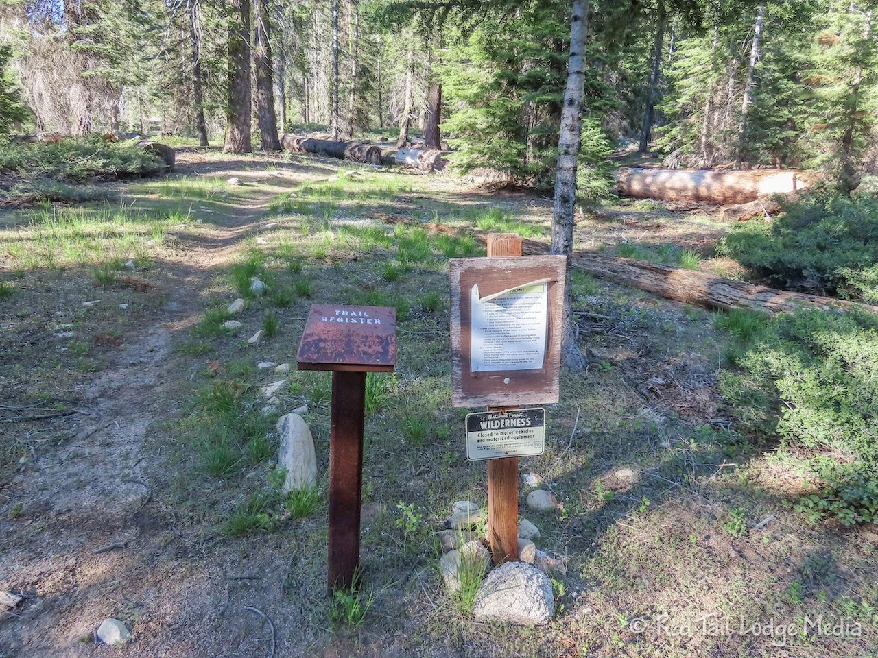
Ann went for a walk around the campground and across the highway to the Upper Stony Creek Campground. The other campground is dirt instead of paved, but, otherwise, it is pretty similar to the one we were staying in. The Stony Creek Trailhead is at the far end of the Upper Stony Creek Campground, with a small parking lot. There is a trail registry at the start of the trail, since it is entering the Jennie Lakes Wilderness area. Ann did not venture up the trail.
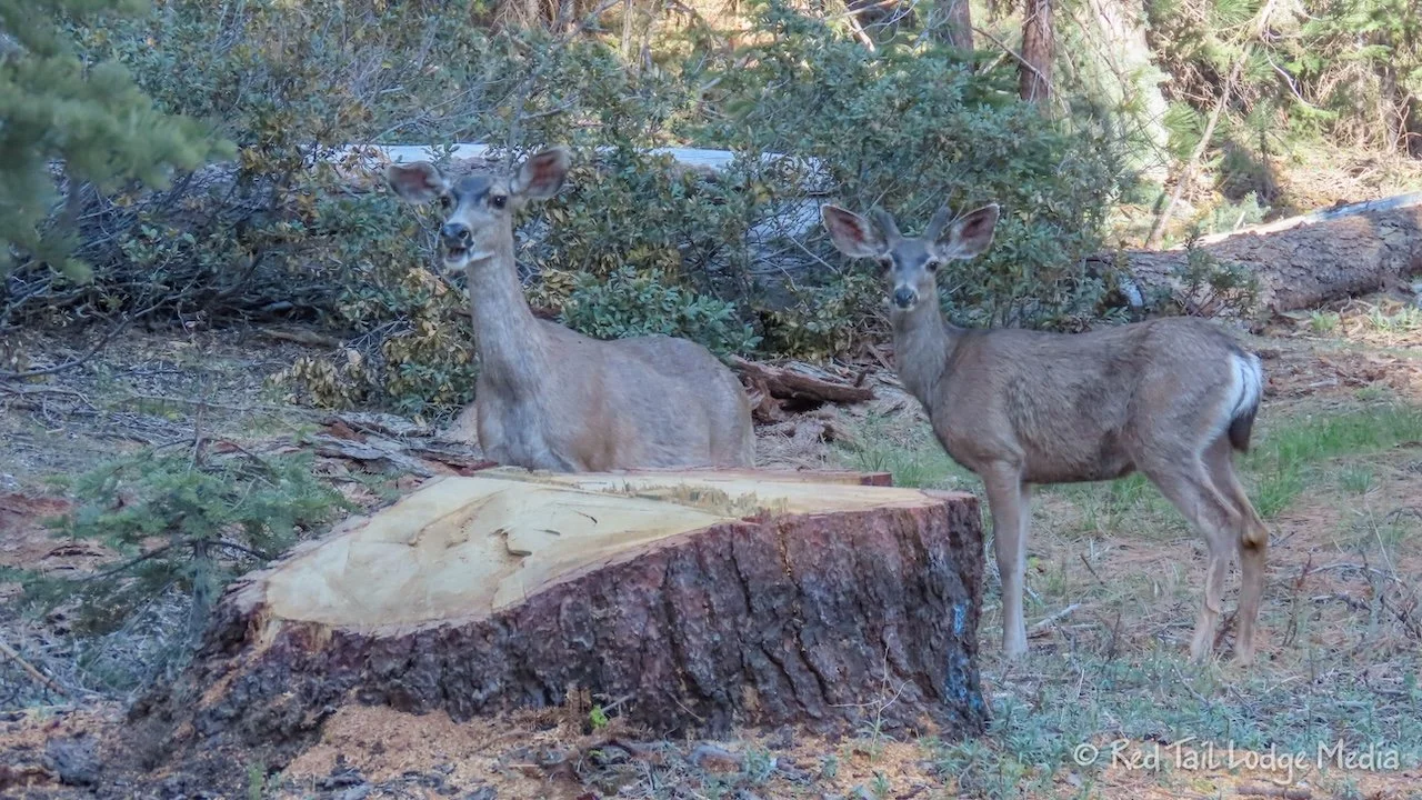
The deer visited us again in the evening. They just really add a special something to the atmosphere of the campground.

Saturday we went for a hike in the Grant Grove area of Kings Canyon. On the way, we stopped at the Stony Creek Resort to get gas. Ann cleaned all the tree pollen off the windshield. Before she was even done, more pollen had already accumulated on the glass.

Since it was Saturday, there were no crews out removing trees, so it only took us 25 minutes to get to the Visitor Center. We arrived before 10 am and were able to get an RV parking spot. Our backup plan was to park in the lot at Grant Grove, since the hike we planned passed right by there.
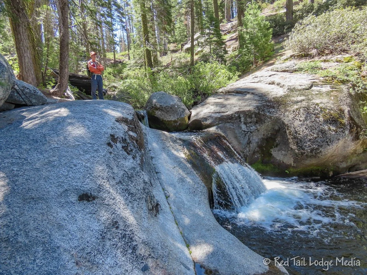
The hike we picked out was Ella Falls Loop. It starts from the Visitor Center, circling around the edge of Sunset Campground, heading down the valley towards Sequoia Lake. We took a little spur trail over to Viola Falls which added a little over half a mile to the route, as a couple of commenters on AllTrails recommended. There was a small group of people at Viola Falls taking a dip in the small pool below the falls.

Little lizards scurried off the trail in front of us. Ann spotted a small snake quickly slithering off the trail to hide in a bush. Butterflies fluttered around us.

Before reaching Ella Falls, we caught a small glimpse of Sequoia Lake through the trees. Our hike would not take us all the way down to the lake, but there are trails that do. Sequoia Lake is actually just outside the national park.

We didn’t see many people along the trail, but there were about a dozen people at Ella Falls. There is not a whole lot of room for people to sit and enjoy the falls. We found a little spot next to the lower section of the falls, but trees and bushes blocked our view of the main falls. Still, it was a nice spot to relax and enjoy our snacks.

Not long past the falls, the trail joins an old road bed which is sparsely paved with broken asphalt. We’re guessing most of the people at the falls had come down that way. It was much easier and faster hiking on the road bed, but we enjoy the narrow dirt trails better, finding them more interesting.

Ella Falls is much more impressive than Viola Falls, so you’ll have to decide for yourself whether the extra half mile to Viola Falls is worth it or not. Most of the hike from Ella Falls is uphill, back out of the valley. Part way up, there is a much better view of Sequoia Lake. Keep a look out for it, because you might miss it.

Just like the day before, we encountered a lady bug swarm. We’re not sure if this is a regular occurrence or the conditions were just right this year.

After we passed the Dead Giant Loop trail, the trail got more interesting again. It passes through a wetland area, surrounded by Sequoia trees. Pretty butterflies and dragonflies darted around us.
The trail then reaches Grant Grove. We did not take the half mile trail through the grove, as we did that the day before. If you haven’t yet, it is worth adding that to your hike.
From there, the trail passes through the Azalea Campground to return to the Visitor Center. However, they did a good job routing the trail by meadows and along small streams that you really don’t seem like you are passing through a campground.

By the time we reached the Visitor Center, we covered 7 miles with an elevation gain of 1263 feet in three hours and 50 minutes. It was hike number 23 of our 52 Hike Challenge and hike number 38 of our National Park Series.

We made the decision to eat at the cafe at the Grant Grove Restaurant and Courtyard. But it was a little too early for dinner, so we took turns taking a shower in Red Tail. Have we ever mentioned how we like having everything with us? It was so nice to get cleaned up right away after our hike right at the trailhead.
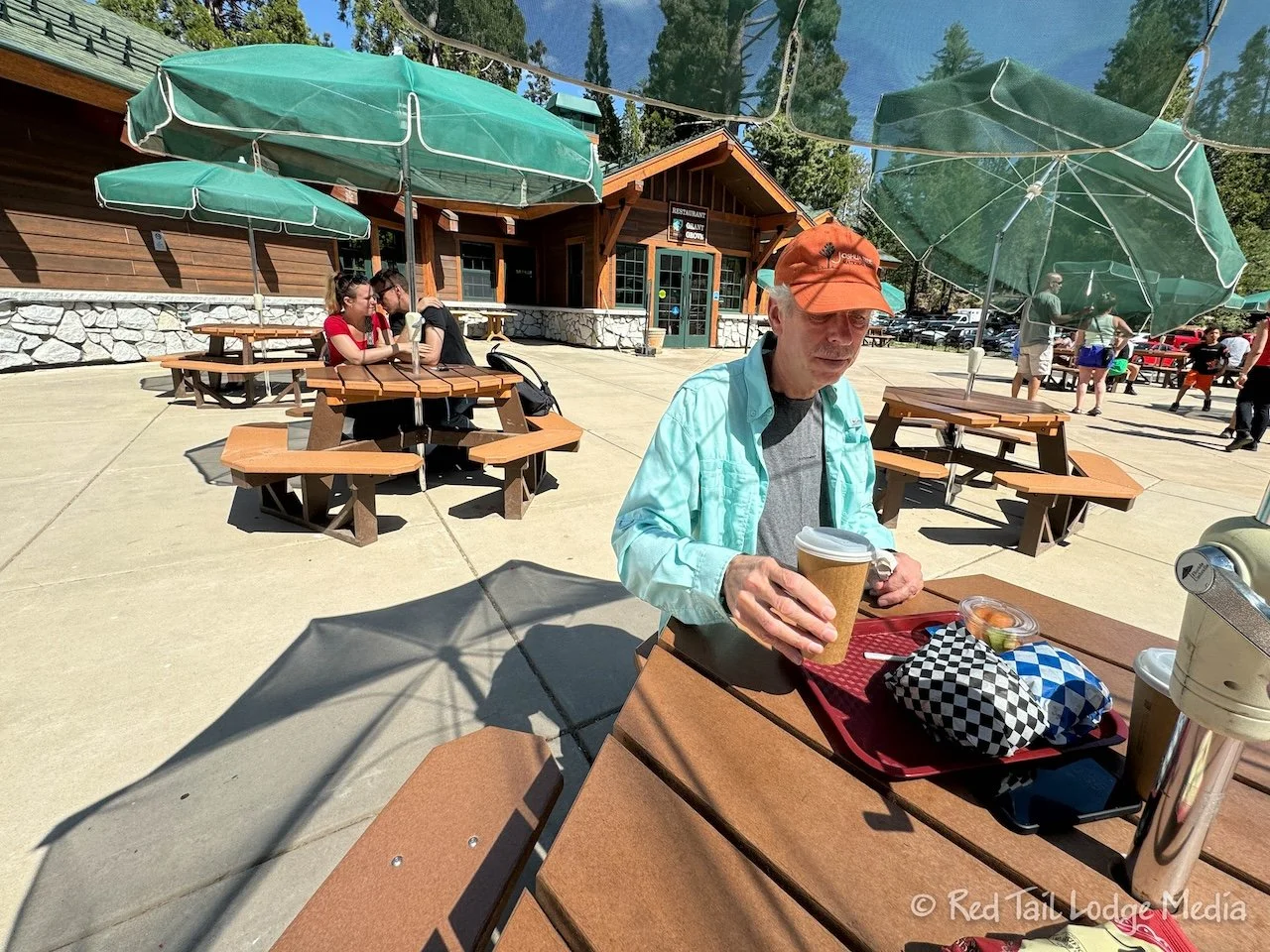
Ann had a burger and chips while Keith opted for the trout sandwich and fruit cup. The food was nothing to write home about, but it saved us from cooking that evening.

From Grant Grove, we drove over to Lodgepole Campground back in Sequoia National Park to use the dump station. Stony Creek did not have a dump station, our next campground didn’t either, and the folks at Lodgepole told us previously that we could come back and use the one at Lodgepole for free. That added about 40 minutes to our drive back to Stony Creek, since it is 20 minutes past Stony Creek. Driving the extra 40 minutes after our hike was better than adding another 40 minutes to our long drive the following day, on Sunday.

Even though we couldn’t explore the Cedar Grove area of Kings Canyon, we still had a lovely time. Now we have an excuse to return to Kings Canyon so we can check out Cedar Grove. However, we really don’t need an excuse to revisit a national park. They are always worth visiting multiple times.
Check out our related video: Kings Canyon National Park, California
(Ann)