
Kinaskan Lake Provincial Park, British Columbia - September 5th to 6th, 2022

Sometimes the unexpected makes the best memories. We had no expectations of what the Cassiar Highway and Kinaskan Lake Provincial Park had in store for us. So the beautiful scenery we encountered created a wonderful impression.

There was a fog over Boya Lake when we woke up Monday morning. The sun came out and burned it off. Our drive for the day was from Tā Ch’ilā Provincial Park to Kinaskan Lake Provincial Park. Kinaskan Lake campground is first come/first serve, so, despite getting up multiple times the night before in an attempt to see the northern lights, we got up early to get an early start on our drive.

The scenery along the way was gorgeous. The morning sunlight lit up the mountain sides as we wound our way through them. The little bit of fog and clouds in the sky added some drama. The Cassiar Highway passes alongside several very large, long lakes. Even though you cannot see the lakes through the trees most of the time, you catch glimpses every now and then.

The abundance of wildlife seemed to be increasing. What we thought at first was a squirrel crossing the road in front of us, looked like a marten as we continued looking at it. Of course, by the time we realized it wasn’t a squirrel, it was too late to capture a picture of it before it disappeared into the brush on the other side of the road. When we stopped at an overlook near a marshy area, Keith spotted a moose in the distance with his binoculars. A mama black bear ran across the road in front of us, followed by her two cubs.

We stopped in the small First Nation town of Dease Lake for gas and a few groceries. The small grocery store there had a wonderful selection of items, including a variety of fresh vegetables. In addition to some bread and chips, we bought a couple of ice cream novelties. It was a little early for ice cream, but, since Keith defrosted our small freezer the week before, we had room to store them in our freezer for after lunch. We were hoping that there would be a cell signal in town, but no such luck. We hadn’t had a cell signal for three days, since Watson Lake. So it looks like another two days or more without cell service.

It was raining when we reached Kinaskan Lake campground. It was about 1 pm and we had no problem finding an open camp site. This campground worked differently than most. Instead of filling out an envelope and placing your money and information into a fee box, an attendant drove around in a cart to fill out the paper work and take your cash.

When the rain let up, we walked around the campground. Most of the campsites are on the lakeshore, but still within the shade of trees. Only a few are on the other side of the campground road. There is a water pump, but, unlike Tā Ch’ilā, this one came with a two minute boil recommendation before using. We haven’t touched our 5 liters of fresh water in our collapsible container yet, so we’ll probably gamble that we can find fresh water at or near our next campground, Meziadin Lake Provincial Park.

At the far end of the campground is the trailhead for the Kinaskan Lake Trail. The sign said it was 2 km round trip (or 2 km return, as they say). After dinner, we decided to check out the trail. We followed it along the lakeshore for about half a mile. The trail became very muddy, as it was mostly in a marshy area. Then the trail disappeared into a small body of water. We were not willing to wade through water and we didn’t see where the trail continued on the other side, so we turned around. There were nice views out over the lake. The trail was close enough to the rocky shoreline that you could walk onto the narrow, rocky beach. Keith saw a lot of small, flat stones that he could not resist skipping a few across the water. We flushed a large bird out of a tree along the way. We think it was a golden eagle.

We decided to give the northern lights one more try. Monday was the last of three days where the aurora activity was forecasted to be high (Aurora Forecast). So we went to bed early and set our alarm for midnight. It was Ann’s turn to get up and check the conditions. Even though it had been overcast all day, when Ann stepped outside the van, the sky was mostly clear, with lots of visible stars, and only a few clouds on the northern horizon. We were lucky that our view of the lake from our campsite was to the north. Ann didn’t see any aurora yet, but she figured this was probably her last chance this year, so she stood outside for a little while. Just in case, she went ahead and started the time lapse on the GoPro.

Then the northern horizon started getting brighter. It looked like the beginnings of an aurora, so she woke up Keith. We both stood outside for over an hour. The northern lights would come and go, with some light making rays up from the horizon. They weren’t really bright and didn’t dance as much as some of the footage we’ve seen of the aurora, but they were still pretty cool to us. Keith took a few pictures with his iPhone that turned out pretty decent. After being jealous of seeing other people’s pictures of the northern lights on Facebook, we finally got to see some for ourselves! The aurora seemed to die down around 1:30 am, so we packed up our cameras and went back inside to bed…with smiles on our faces.

Tuesday we went for a hike. AllTrails only listed one trail inside Kinaskan Lake Provincial Park, the Natadesleen Lake Trail, but the information board in the campground listed two more, the Upper Cascade Falls Trail and the Lower Cascade Falls Trail. Those sounded more interesting to us. The trailhead for the Lower Cascade Falls Trail is accessible only by boat. The suggested route for paddling to the Lower Cascade Falls Trailhead is to put in at the boat dock on Kinaskan Lake and paddle down the Iskut River to the Natadesleen Lake and to the trailhead. Then when you are finished hiking, they suggest paddling across Natadesleen Lake to the end of the Natadesleen Lake Trail and portaging your boat out to the Natadesleen Lake Trailhead along the Cassiar Highway. Since we didn’t have a boat, we chose the Upper Cascade Falls Trail.

The Upper Cascade Falls Trailhead is right along the Cassiar Highway about 8 kilometers south of the campground, and about one or two kilometers past the Natadesleen Lake Trailhead. Unlike the Natadesleen Lake Trailhead, with a small parking lot, litter bins, and a pit toilet, the Upper Cascade Falls trailhead is not very well marked from the road. There is no parking area on the west side of the highway where the trailhead is. We actually missed the trailhead and had to turn around on the highway. We parked across the highway from the trailhead behind a gravel pit. When we left, we noticed there is a small area right off the highway where you can park, just north of the trailhead.

The trailhead sign says the trail is 5 km return (round trip), having an elevation gain of only 63 meters, and taking about 90 minutes to complete. That sounded perfect.

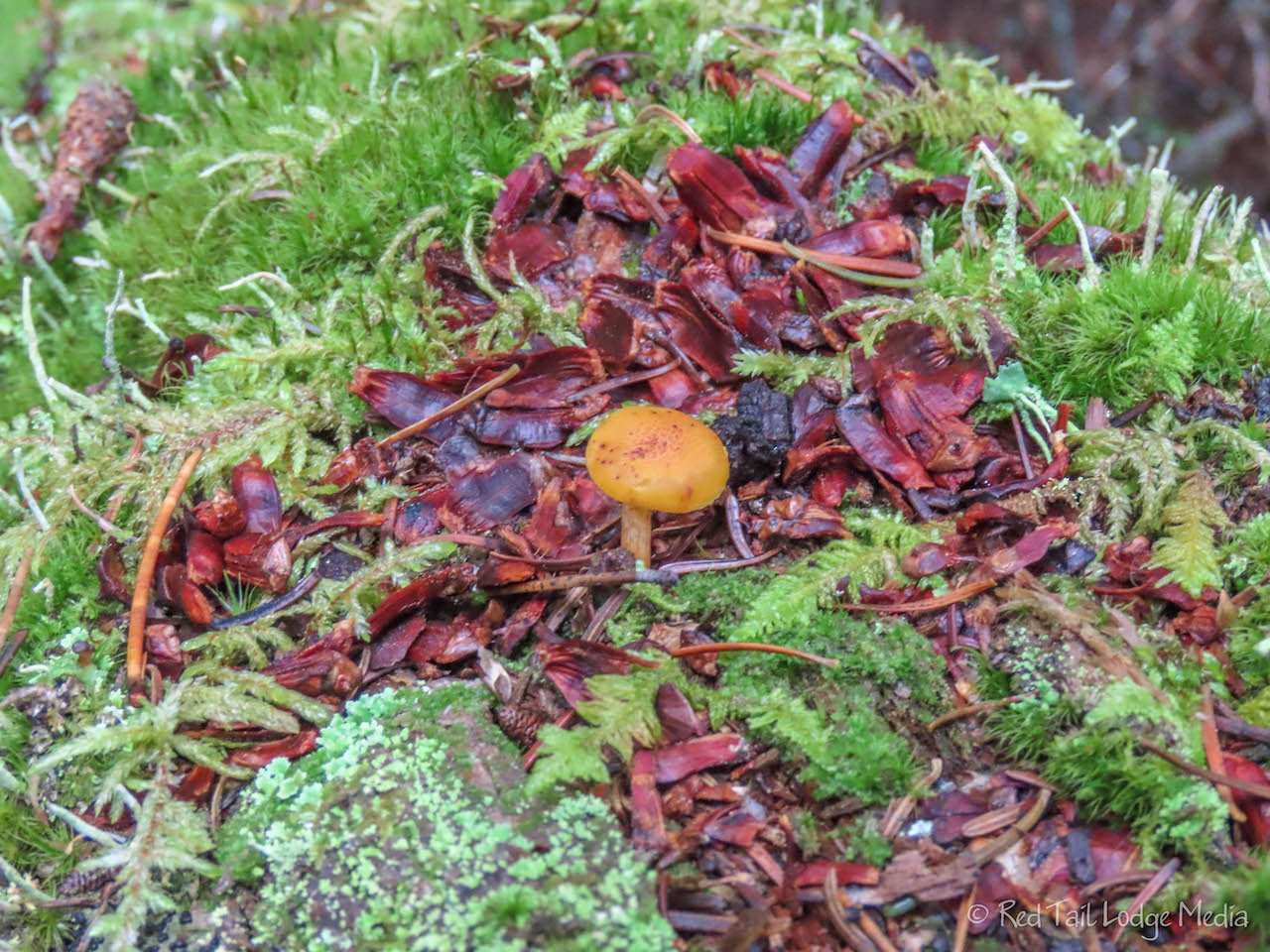
The trail goes through a couple of wetland areas, with boardwalks over the wettest spots. Most of the trail is a soft, dirt trail through the trees. The woods are a combination of pine and spruce trees with a carpet of green vegetation flowing over the rotting logs and tree stumps. The green carpet is speckled with a variety of red, orange, and blue berries and an occasional clump of mushrooms.

The trail ends at a cliff overlooking the Iskut River at the top of a strong, gushing, and powerful cascade of falls, right where the river splits in two around an island. You can see that there are more falls below where the water disappears over a cliff on each side of the island. The Lower Cascade Falls Trail would take you to the bottom of the falls on the far bank. We believe the picture that is posted on the park info board is from the Lower Cascade Falls Trail. However, the view from the Upper Cascade Falls Trail was pretty impressive to us.

We completed the 3.2 miles of 325 feet of elevation gain in two hours and fifteen minutes. We are not very fast hikers, especially with the frequency that Ann stops to take pictures. This was hike number 40 of our 52 Hike Challenge for 2022.

We returned to our camp site for a late lunch. The forecast we received from our Garmin InReach (paid link) called for sun in the morning and rain in the afternoon, with a high around 50. The InReach was wrong about the morning sun and temperature. It was overcast all morning with temperatures barely reaching into the 40’s. However, it did rain for most of the rest of the day. There was a break in the rain at about 4 pm, so we strolled the campground then cooked an early dinner outside. The rain started again just as we finished cooking our meal.

The rest of the day was spent inside our Red Tail Lodge (our camper van). However, we had a nice view of the lake and could hear the loons calling every now and then. The drive the day before was not long enough to fully recharge our lithium batteries, so we idled our engine for about ten minutes to make sure we would have enough power to make it through breakfast the following morning. Since we were up so late the night before watching the northern lights, we turned in early on Tuesday evening.
Our time in Kinaskan Lake Provincial Park turned out to be very memorable. We really enjoyed the area, between witnessing the northern lights and hiking through the landscape, with its variety of colors and textures, to an impressive waterfall.
Check out our related video: Kinaskan Lake Provincial Park, British Columbia
(Ann)