
Guadalupe Mountains National Park, Texas - August 4th - 7th, 2023

We cherish the journey more than the destination. At Guadalupe Mountains National Park, we didn’t accomplish all of our goals, but we got more than we bargained for with our experiences.
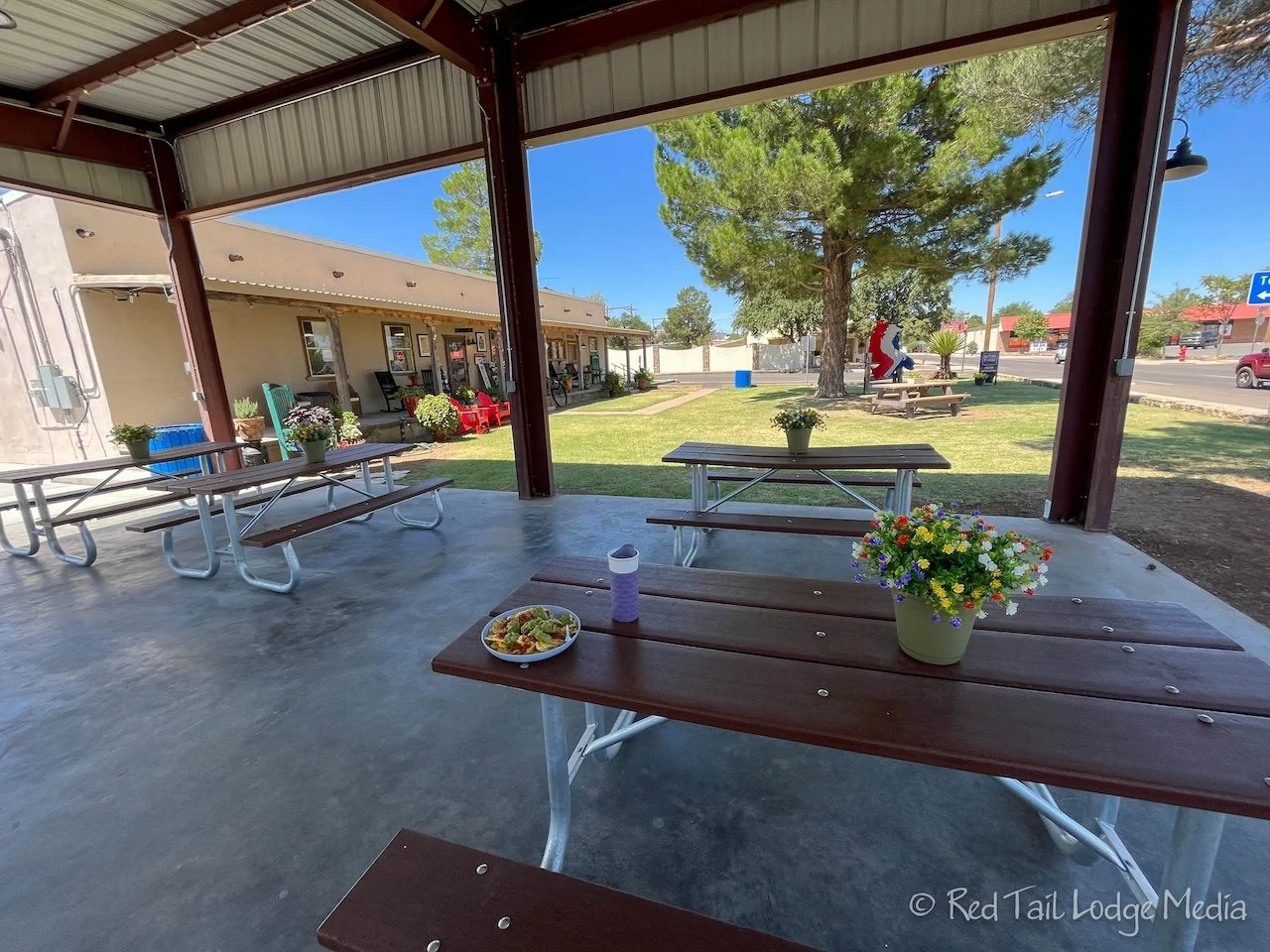
Friday was a travel day, from Terlingua, just outside of Big Bend National Park, to Pine Springs Campground in Guadalupe Mountains National Park, about a four hour drive. Our major stop for the day was in Alpine, for gas, groceries, and a picnic lunch. There were shaded picnic tables outside of the town visitor center, right along the highway within town, so that is where we ate. We stopped for gas and rest room break again Van Horn. Trying to keep our tank at least half full. We didn’t want to get caught in the Chihuahuan Desert without gas.

The drive seemed rather remote, but we did pass a few quirky sights. First there was the display at Little Reata, the film site of the 1956 movie Giant. Then there was the strange looking Tethered Aerostat Radar System, followed by the Prada Store art sculpture in the middle of nowhere. The final point of interest was the Blue Origin launch site. We saw the launch pad from a distance and wondered what it was. Then we passed the Blue Origin sign before we had a chance to take a picture of the sign, but we did get a picture of the launch pad.

In between the sites was mainly wide open desert with a splattering of desert mountains. More dust devils than we could count would spring up and then disappear. Then, just outside of Van Horn, a large pecan grove appeared. It seemed rather out of place. That must have been a major engineering feat to get that much water piped into the area for all of those trees. We’re not sure if the water is pumped up from an aquifer or diverted from a nearby river.

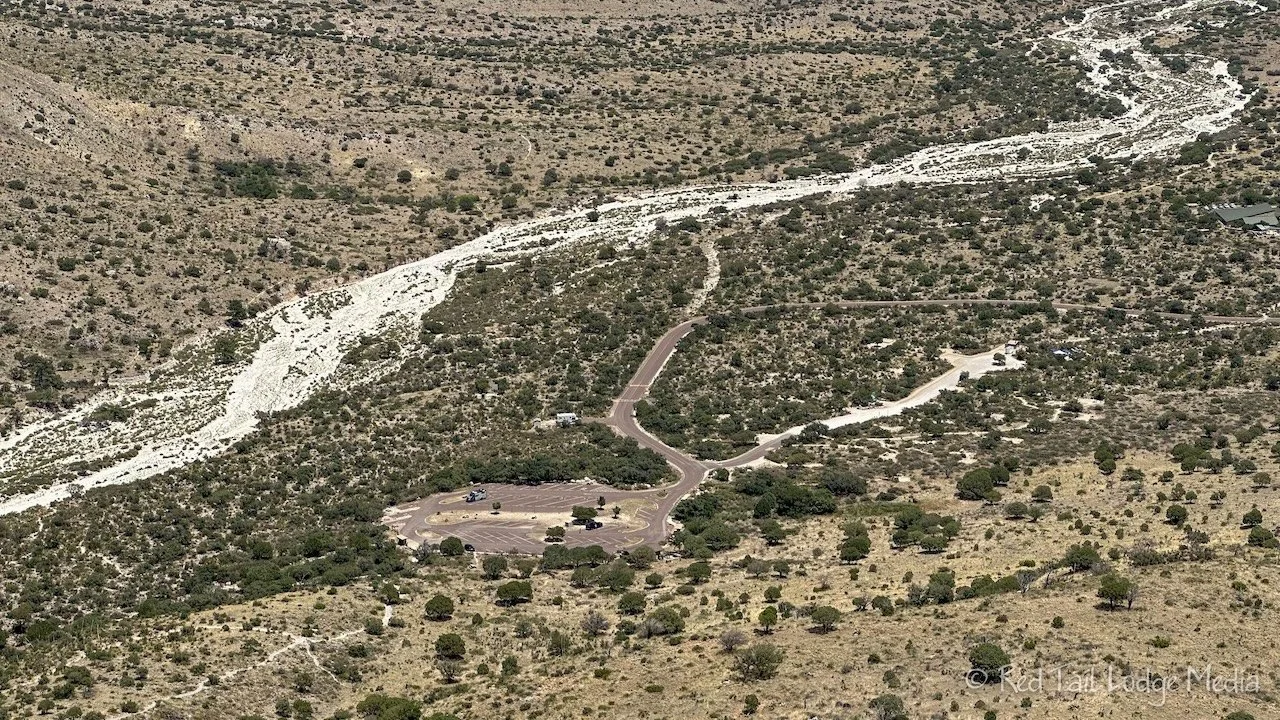
We arrived at Pine Springs Campground in the late afternoon. We gained an hour since Guadalupe Mountains National Park is in the Mountain time zone. The campground hosts greeted us and explained all the rules and current trail closures. We were the only RV campers in the campground, but another camper was expected to arrive that day. Most of the park was closed due to record high temperatures and extremely high fire danger. There were only four trails open, three of them starting from the trailhead at the campground and the fourth one over in the hot Salt Basin Dunes area.

The RV campground is just a glorified parking lot, dry camping only. There is no dump station and the water station is for filling water bottles only, no tank filling. But there are flush toilets and a dish washing station.

Temperatures were in the mid-90’s with a slight breeze. It felt comfortable to us in the shade. However, there were these annoy insects that kept buzzing our ears. They didn’t seem to bite, but they drove us nuts, so we didn’t last long sitting outside. Ann even got the Thermacell (paid link) out, but it didn’t seem to help much.

By the time we went to bed, the temps had dropped down to 80. It was very comfortable sleeping weather for which we were very thankful for. Since we didn’t have electrical hookups, we couldn’t run our AC, but the open windows and running fans kept us so cool that we had covers on us by morning. When we woke up with the sun, it was 72 degrees.

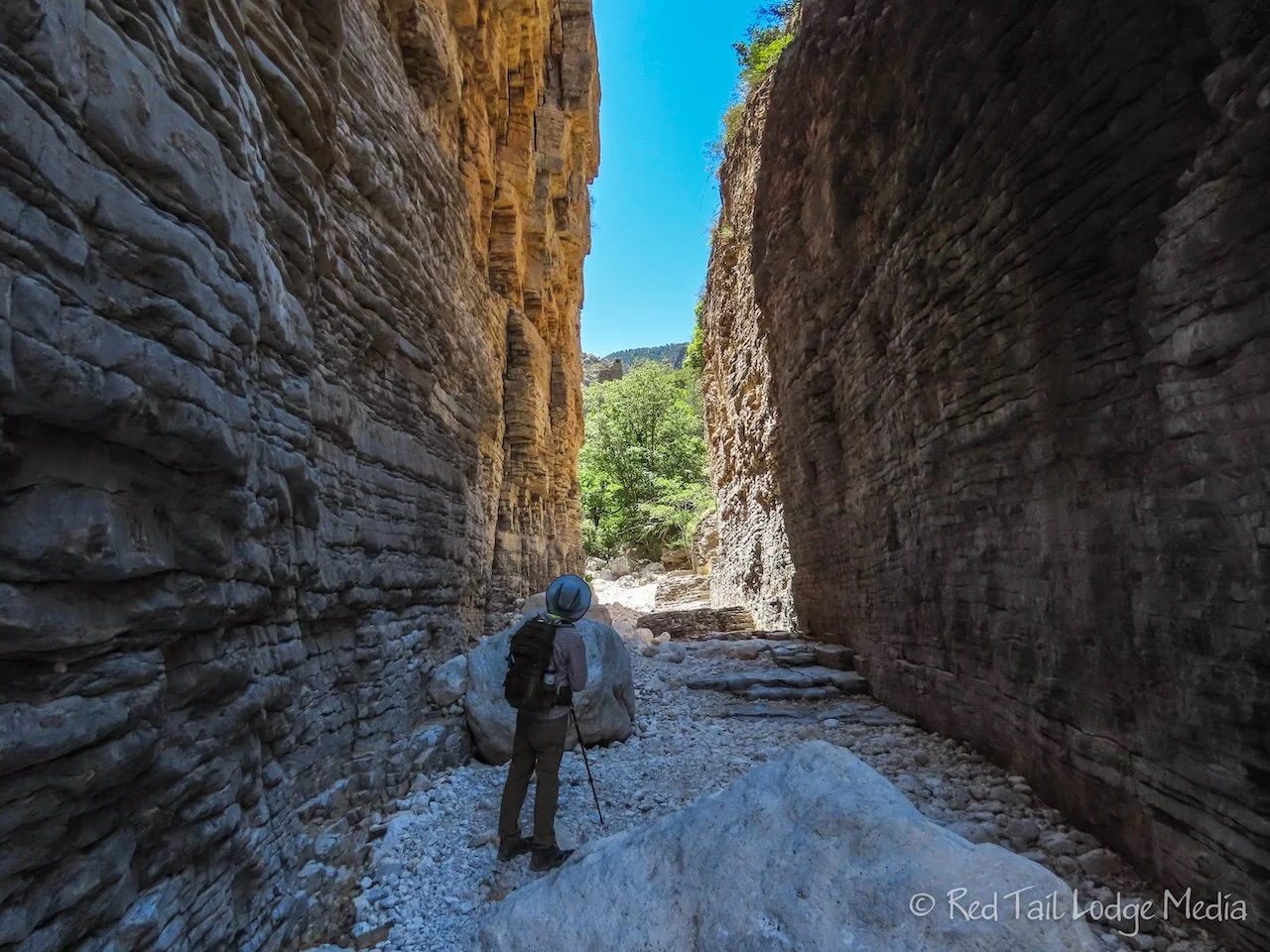
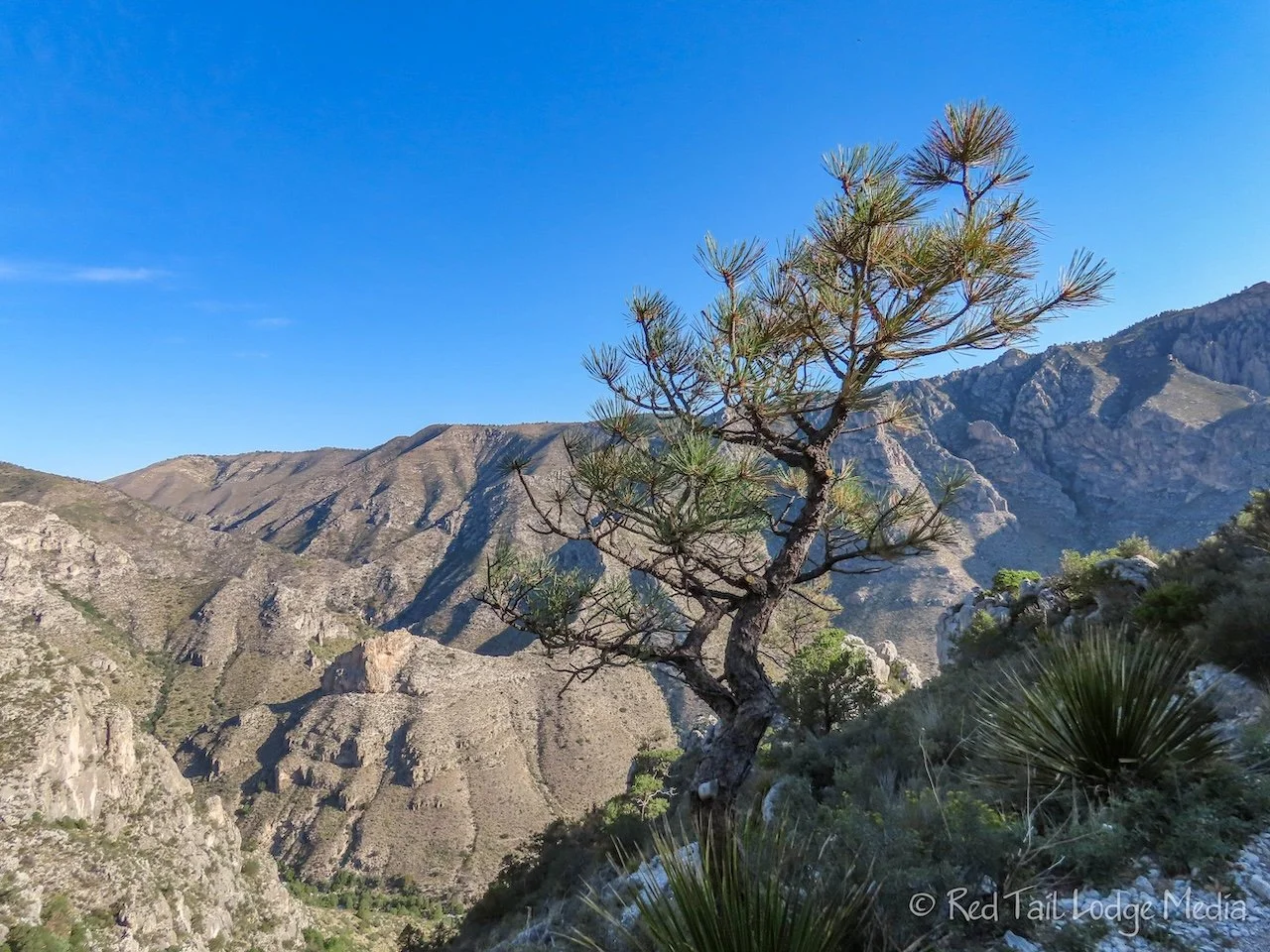
Saturday, we hiked one of the open trails, Devil’s Hall Trail. We started about 9 am, not terribly early. Many people started hiking much earlier. There were about a dozen cars in the parking lot as we began our hike. Some of the cars had been there before sunrise. Other hikers came over from the tent campground.

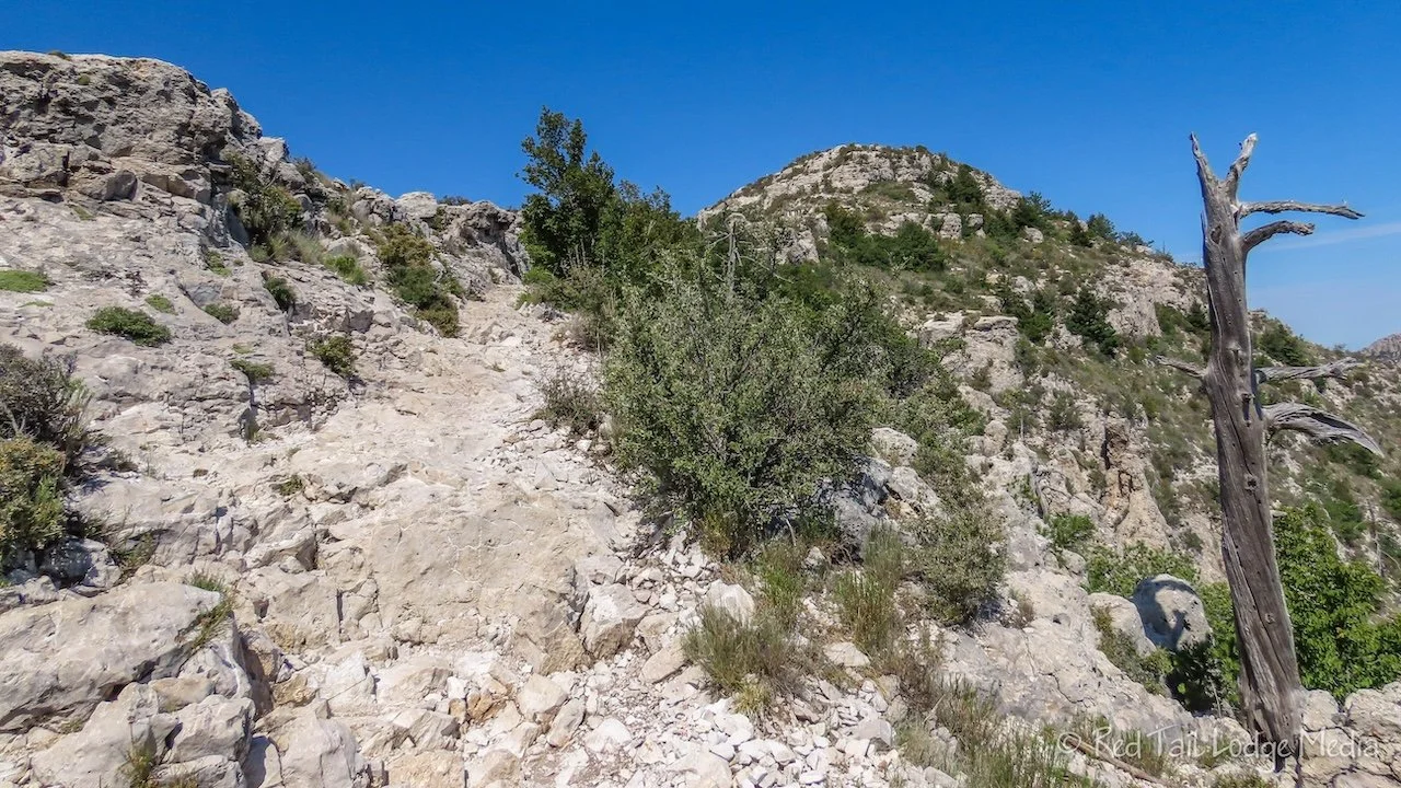
The first mile of the trail is pretty easy, following along the side of the canyon. But then the trail drops down into the dry wash at the bottom and is a rock and boulder scramble most of the rest of the way. Even though the trail is only about four miles round trip, it is a workout and a challenging hike.

Before reaching the dry wash, the trail crosses a small gully of boulders. A hiker was coming up the gully at right angles to the trail. That was the way she had entered the dry wash. She did not notice that the trail continued straight across the gully. Don’t make that mistake if you take the trail, that will add quite a bit more rock scrambling to your hike.

At one point, Ann got up a tricky section by using some complex moves. She was so proud of herself, until Keith figured out a different route around that section that was much easier.
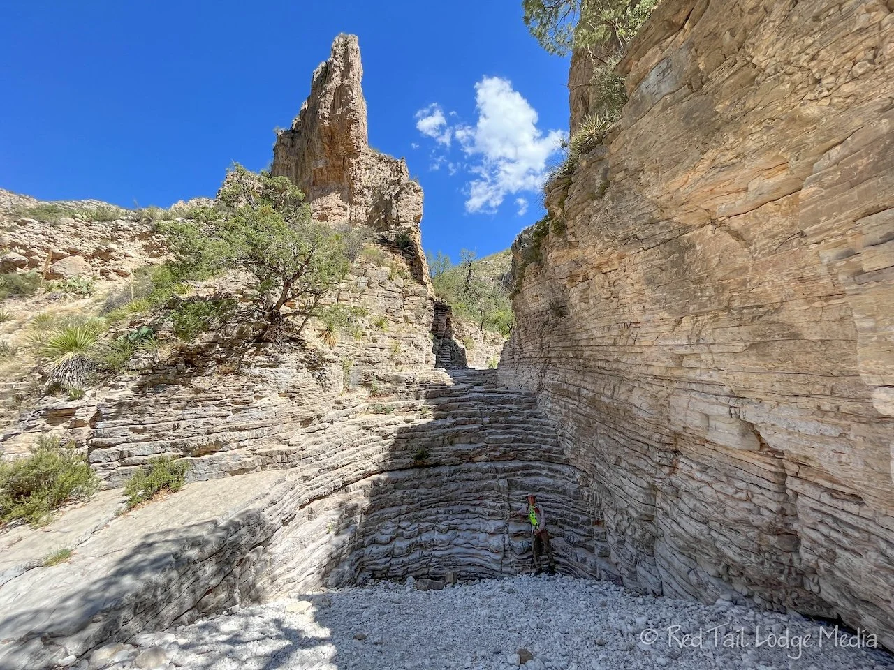
Near the end of the hike, there is a wall of layered rock, like shallow steps. We climbed up them on our hands and feet. At the top is a pool of stagnant water, complete with flies, wasps, and bees. The trail continues past a short wall hug.
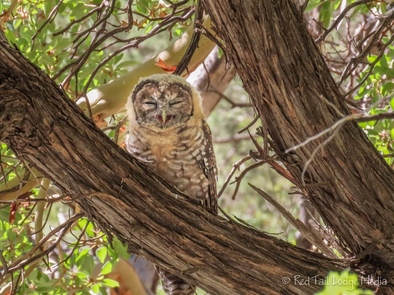
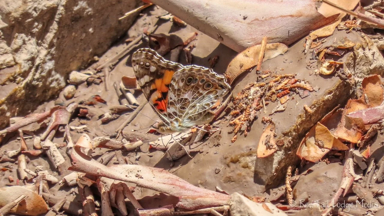
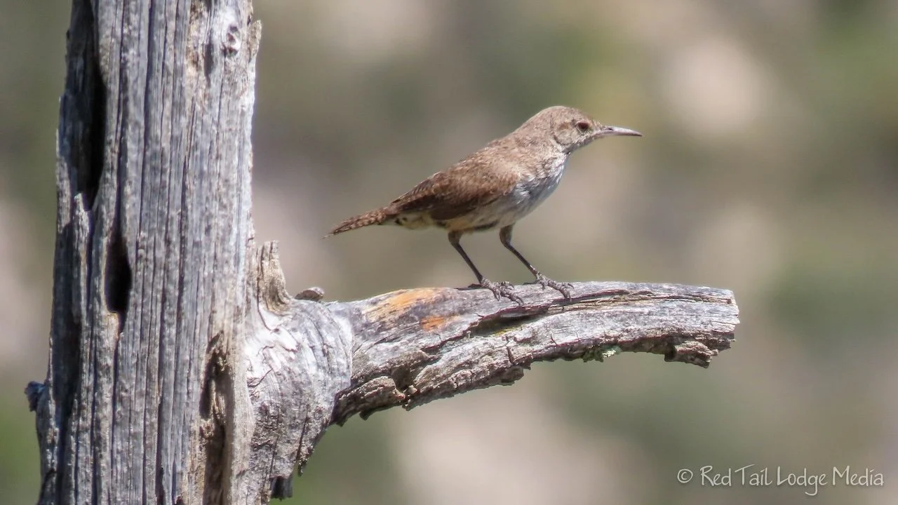
We heard an unusual noise that we were pretty sure was coming from a bird. As we tried to identify the source of the screech, we saw them, three owls in a nearby tree. Not far after that, we reached a sign at the start of where the canyon turned into a tall, narrow passageway. Ann didn’t read the sign and thought it was the sign indicating the end of the trail, so she suggested going back to a stepped rock layer in the shade to eat our snacks, just past the water pool.
As we were talking during our snack break, our conversation revealed that the sign read Devil’s Hall. The narrow passageway was Devil’s Hall and we were not at the end of the hike yet. Ann confirmed it by looking at her AllTrails. She apologized for jumping to conclusions.
After our snack, we went back to Devil’s Hall and continued along the trail. On our way back through, the owls were gone. The trail didn’t continue much further before reaching the sign indicating the area past it was closed from March through August to protect some wildlife habitat. Then we turned around and headed back.

The wall of steps was a little trickier on the way back down. Ann tried skirted around them along some narrow ledges, but that seemed more dangerous as there was one point with a pretty high drop if she should slip and fall. Keith used his hands and feet to half slide, half climb down on his butt. That seemed like the safer option.

We made much better time on the way back down through the wash than on the way up. There was one section of scrambling we bypassed on the way back by following a short trail along the bank. Then we had to keep our eyes open for where the trail headed back out of the wash. We knew it was easy to miss. As we entered the wash earlier, we looked around and made mental notes of landmarks so we would recognize it on the way back. There was a line of rocks sort of pointing to the bank along with a sign up on the bank. We found it with no problems.
By the time we returned to Red Tail (our Winnebago EKKO), we had gone 5.2 miles with an elevation gain of 827 feet in about four and a half hours. It was hike number 39 of our 52 Hike Challenge for 2023. That’s a slow pace, even for us, but we had fun. Even with the temperatures in the 90’s, there was a breeze that kept us comfortable.
After resting in the shade of our awning for a while, snacking on cold watermelon and chips, we walked over to the visitor center. There is a little exhibit inside along with a small gift shop, with air conditioning. But we didn’t hang out there very long before going back to Red Tail. The rest of the day was spent trying to stay cool. Most of the time we were sitting outside in the shade. Luckily there was a breeze, but the annoying part was the bugs. One type liked to buzz our heads like they were trying to go into our ears. Then there were little ants that we found crawling on us. However, none of them seemed to bite us.
It didn’t cool down as much as it did the first night. It was still in the 90’s when we went to bed, but fans blowing on us made it comfortable enough to sleep. It was 85 degrees when we got up at 6:30 am the next morning.

Sunday we drove up to Carlsbad Caverns National Park to do the self-guided tour of the Big Room. We’ll cover that visit in our next post.

Before leaving Carlsbad Caverns, we plugged the Balmar alternator back in. Since it is under recall for safety concerns, we’ve been traveling with it unplugged since July 5th. However, since we don’t have hookups at Guadalupe, we wanted to get some charge back into the batteries. We only left it in during our drive back. It didn’t charge the batteries much. We’ve also been noticing that the solar panels have not been charging the batteries much either. We’ve been parked in the sun for two days now, and it hasn’t had much effect. Investigating these issues is on our list of things to do.
On the way out of Carlsbad Caverns, there is a small strip mall with a gas station, grocery store, and gift shop. We stopped at the grocery store, which is more like a campground store than a grocery store. However, we wanted to be prepared for our long hike the next day. We believed we needed to take four liters of water with us per person and we didn’t have that many water bottles. Ann already picked up a new water bottle at the Carlsbad Caverns gift shop, but we needed more along with more snacks like granola bars. We purchased three bottles of Gatorade along with two bottles of water. The Gatorade should help us with electrolytes while on the trail. We normally don’t like to purchase bottles of water, but we thought we would put those two in our freezer overnight so we could take them on the trail frozen. We didn’t want to risk damaging our good water bottles in the freezer. The store didn’t have granola bars, so we got some Lärabars instead.

When we got back to the campground, we got all our hiking gear ready to go. Our plan was to hike Guadalupe Peak the next day. It is a long steep hike in the heat, so we wanted to get an early start. To help with the heat, we put as many water bottles as would fit in our fridge along with the two bottles of water in the freezer.

Our alarms were set for 6 am. We were hoping to be on trail by 6:30, but it was about 6:50 am by the time we were starting up the trail. Although Ann ate her usual breakfast that morning, Keith skipped his morning coffee. There was a hanging scale at the trailhead. Out of curiosity, we weighed our packs. Keiths was about 18 pounds while Ann’s was closer to 23 pounds.
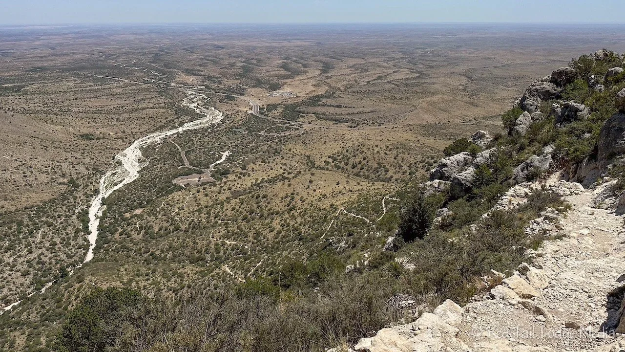
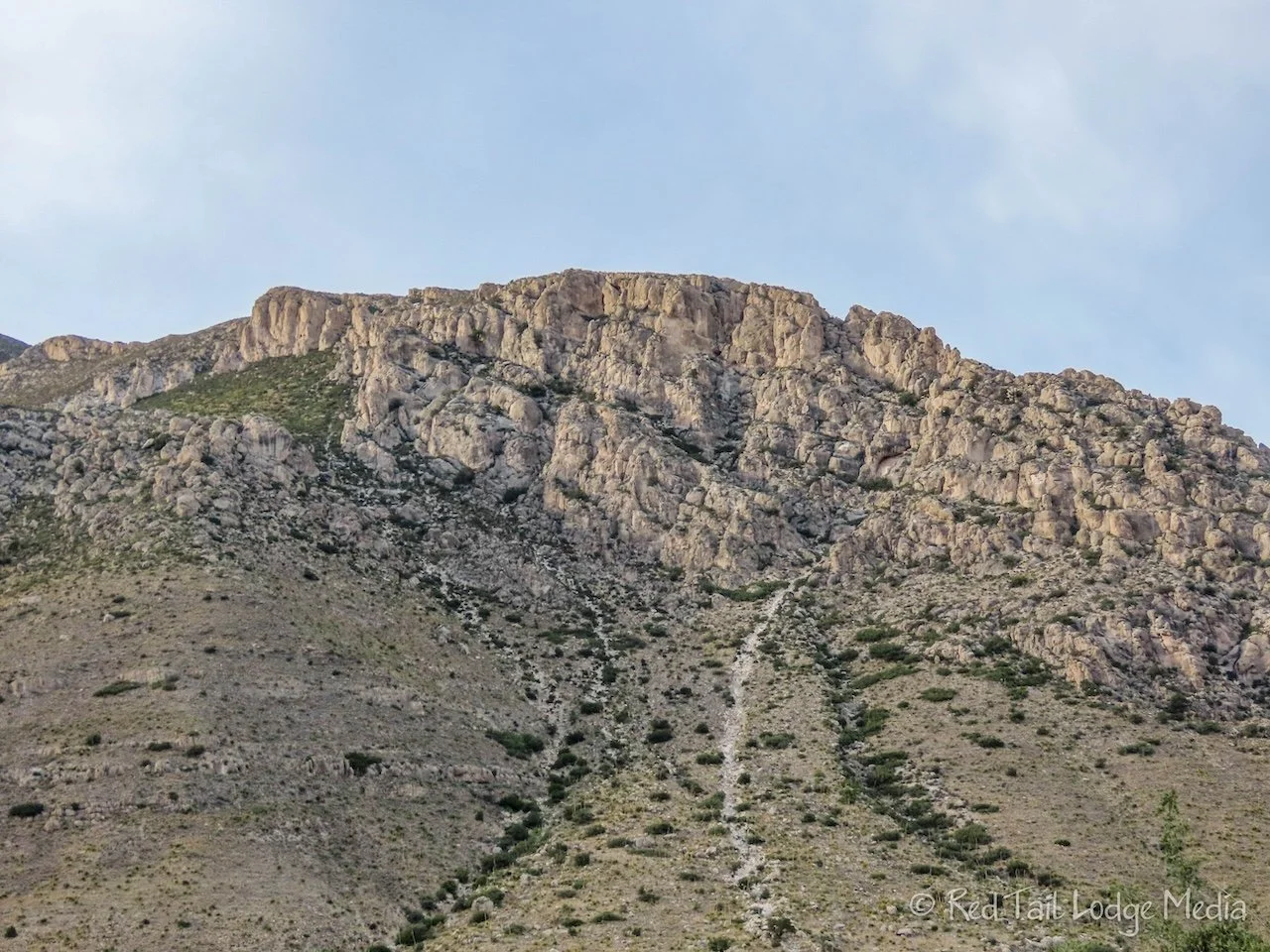
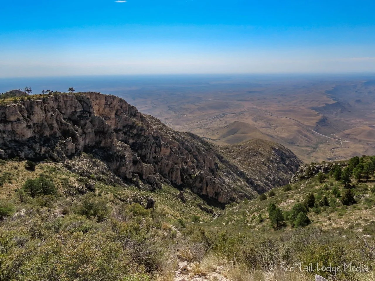
The Guadalupe Peak Trail is 8.4 miles with an elevation gain of 2949 feet. We didn’t know if we’d make it all the way to the top, but we were going to try. It was about 80 degrees in the morning when we got up. The high for the day was forecasted to be 97. Luckily, quite a bit of the trail was shaded in the morning. It is a steady climb most of the way, with the first mile of switchbacks and the last mile of switchbacks seeming to be the steepest.

On the way up, we were stopping every 15 minutes and taking a drink of water. Every mile we would stop for a little longer of a rest. Keith had a granola bar or Lärabar at each mile, but since Ann ate a full breakfast before we started, she just had a granola bar at mile two. At mile three, Keith switched from water to one of his bottles of Gatorade.
When we were about half a mile from the peak, in the last set of steep switchbacks, Ann hit a wall physically. She switched to drinking Gatorade, but she was still having issues with shortness of breath. She struggled through another quarter of a mile, stopping about every 30 yards to catch her breath. That was not normal. She crawled under a bush for some shade to rest. Ann drank more Gatorade, ate another granola bar and an apple. Poor Keith sat and baked out in the sun, since there was not room for two in the shade.

We were so close to the peak. We were past all the switchbacks and it was a straight shot to the top. We could see the wooden hitching posts for the horses. It was about a tenth of a mile away. Normally Ann is the one who likes to push herself and continue on. She has a hard time quitting. But as she sat there under the bush, reason crept in. She was either suffering from high altitude sickness or an electrolyte imbalance, also called water toxicity or water poisoning. High altitude sickness can occur anywhere above 8000 feet. Guadalupe Peak is at 8751 feet, the highest natural point in Texas. Water toxicity is rare, but can occur with strenuous physical exertion, especially in excessive heat when consuming large amounts of water. Ann had already consumed two liters of water in three hours. That’s still within the guideline limit of one liter per hour, but she should have been eating more food as well to balance out the electrolytes.

Whether it was high altitude sickness or an electrolyte imbalance or both, the treatment was the same. Reduce the physical exertion and get below 8000 feet of elevation. We needed to turn around and start heading back down.
Ann felt much better as we descended. There were a couple of short sections which briefly went uphill. Ann immediately was out of breath again. We stopped about half a mile later so Keith could sit in the shade for a while to cool off. When we stood up again, Ann was breathing hard just from the exertion of standing up. Yes, turning around was the right decision.

Ann felt fine as long as we were going downhill, so the return trip to the trailhead went pretty smoothly. The trail was exposed to more sun on the way back as the sun was now overhead. On the last section of switchbacks down to the trailhead, we broke out our frozen bottles of water. Well, they weren’t frozen any more, but they still had a little piece of ice left in them. The ice cold water was so refreshing. We were so glad we thought of doing that. Not only did we finish our hike with ice cold water instead of hot water, the ice in our packs helped keep the other water bottles cool during the hike as well. A great tip for a hot day.
By the time we returned to Red Tail, Ann had just finished all of her four liters of water, but Keith still had about half a liter or less left. We weighed our packs again to see the difference. This time Keith’s was about 10 pounds while Ann’s was close to 14. Yup, four liters of water weighs close to 9 pounds.
Even though we didn’t make it to the peak, AllTrails claimed we went 8.4 miles with an elevation gain of 2795 feet in seven hours and 40 minutes. It was hike number 40 of our 52 Hike Challenge for 2023. And it definitely counted as a challenging hike.

Later that afternoon, a young man that we had passed on the trail on the way back down was sitting under the shade of a tree at the trailhead. Our friendly and helpful camp hosts, George and Renee, were trying to make the man more comfortable, as he was not feeling well. He originally started the hike with his girlfriend, but then walked her back to the trailhead when she didn’t feel well. Then he went back on trail, all the way to the peak. His girlfriend was pouring cool water on the back of his neck while George gave him a bottle of Liquid IV to replenish his electrolytes. After about half an hour or so, he was feeling better.

Back at Red Tail, we plopped down in the our camp chairs in the shade, drank ice cold beverages and ate a large serving of cold watermelon. Not too long after that, we were snacking on tortilla chips. Then Ann’s hands and hamstrings started cramping. Maybe more food was the right answer, so she had another serving of watermelon. Thank goodness we had leftover pasta we could reheat in the microwave for dinner, because neither one of us felt like cooking. Healthy servings of ice cream were for dessert. Just before bedtime, Ann still didn’t feel quite back to normal, so she snacked on a spoonful of peanut butter.

Thunderstorms started in the evening and lasted into the night. They cooled the temperatures down into the upper 70’s. The high winds and rain meant we could only have the windows in the locked position, just cracked and not fully open, but we still felt the nice cool air. We slept well that night. Surprisingly, we had no muscle cramps during the night.
We didn’t reach Guadalupe Peak, but we felt very accomplished. We were proud that we made smart decisions to enable a positive outcome instead of turning it into a dangerous situation with possibly disastrous results. Maybe we’ll come back some other time to reach Guadalupe Peak, or maybe we won’t. It really doesn’t matter. We enjoyed our experiences in Guadalupe Mountains National Park regardless of reaching our goal or not.
Check out our related video: Guadalupe Mountains National Park, Texas
(Ann)