
Great Smoky Mountains National Park, North Carolina & Tennessee - November 2nd to 7th, 2021

Great Smoky Mountains National Park is a fantastic combination of spectacular scenery, local history, wonderful wildlife, and great hiking trails. While we were there, the autumn colors were starting to fade, but so were the crowds of people. Not everything went according to plan, but we remained flexible, kept our positive attitudes, and had a lovely time.

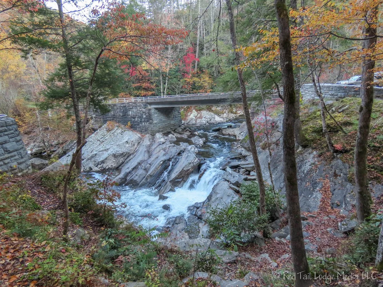
At the end of the Blue Ridge Parkway, we turned onto the Newfound Gap Road, US 441, to cross straight through the Great Smoky Mountains National Park to the north side. As soon as we entered the park, there was a heard of elk in the open field near the road. It was a nice greeting to let us know that we had entered a great national park.

At the top of Newfound Gap, we turned onto Clingmans Dome Road. Clingmans Dome is the iconic place to be in the Great Smoky Mountains. We’ve been to the park a few times before, but it had been decades. The thing about the park that we both remember the best is Clingmans Dome. The seven mile road ends at the parking lot of the Clingmans Dome Visitor Center. From there, it is a half mile walk up to the observation tower. By the time we reached the observation tower, we were engulfed in fog. It reminded us of the two attempts we made to see the view at the summit of Mount Mitchell the week before on the Blue Ridge Parkway (Blue Ridge Parkway, Virginia & North Carolina - October 23rd to November 2nd, 2021). OK, let’s not make a habit out of going to mountain summits in the fog. When we returned to the parking lot, we came out of the fog and could see some views.

As we descended down the other side from Newfound Gap, the fog increased in density. Right Buddy (RB) was put in charge of turning on our flashers when the fog became really thick to make us more visible. It was almost 6 pm by the time we reached Elkmont Campground, our destination for the day. Sunset was not until around 6:30 pm, so we had time to get set up before it got dark.
We were lucky that we had a campground reservation for Elkmont. Six months earlier, RB tried to make campground reservations for our stay in the Great Smoky Mountains National Park. The reservation window for the campgrounds is normally a six month window. However, at that time, RB was only able to make reservations for Cades Cove. The recreation.gov website said that November was the off-season and the Elkmont and Smokemont Campgrounds become first come/first serve only. So we were assuming we could just arrive and get a campsite. However, that was also true at the time for the campgrounds on the Blue Ridge Parkway. We did not have reservations for Rocky Knob, Julian Price, nor Linville Falls on the parkway. We had no problems getting a campsite at those campgrounds. However, we noticed that some people had reservations. How can that be? Apparently, at some point in time, the rules had changed. Fortunately, those campgrounds set aside some of the sites as first come/first serve all season.
So when we were in Asheville, camping at Mama Gertie’s with a good cell signal, we thought we’d better check to see if the rules had changed for Elkmont and Smokemont. Yes, the rules had changed. And the campgrounds were now by reservation only, no walk ups allowed. RB quickly reserved two nights at Elkmont. However, we planned to stay at Smokemont on Saturday and Sunday nights. Saturday night was sold out, but RB was still able to snag a site for Sunday. So she reserved a site at the Cherokee KOA just outside the park for Saturday night.

We know that the pandemic has caused things to change, and keep changing. And we know that camping has become more popular than ever, especially in our national parks. However, it is frustrating when you think you’ve done your research and the rules change without your knowledge. We are thankful that we found out before we showed up at Elkmont Campground at 6 pm, when we would have had to scramble and find a campground outside the park at the last minute. We like to make reservations because we don’t like spending time searching for a place to stay at the last minute while we’re on the road.

The plan for Wednesday was to go on a longer hike. It had been a couple of weeks since we’d gone on a hike that was over five miles long, so we were ready for it. The hike we picked out originally was the Porters Creek Trail over in the Greenbrier section of the park.

To get to Greenbrier, we had to drive through Gatlinburg. It is quite the tourist trap. The main road through town is lined with shops and attractions, such as mirror mazes, Ripley’s Believe It or Not, and mini golf. There were two chair lifts that slowly took you up to two of the nearby hillsides. Despite the cold, there were people riding them. The temperatures were only in the 30’s.
We headed down the road about a mile to the Greenbrier Ranger Station. A sign was posted indicating there was road damage ahead and that vehicles larger than pickup trucks were not allowed. The road up to that point was not that great and we were not in the mood to drive on bad road conditions and possibly get stuck, so we turned around. The kiosk at the ranger station had a trail map for $1 so we purchased one. The trail map was a better map of the park than the map on the park brochure. It was well worth the dollar.

As RB scanned the trail map for other trails in the area. She spotted Rainbow Falls Trail. It was on Cherokee Orchard Road just outside of Gatlinburg. RB was able to download the trail in her AllTrails app before we lost our cell signal again.

We arrived at the trailhead a little after 10 am. There were not many open parking spots left, but we did find one. Thankfully there was a restroom at the trailhead because the morning coffee had completed its trip through Left Buddy’s (LB’s) body by this time.
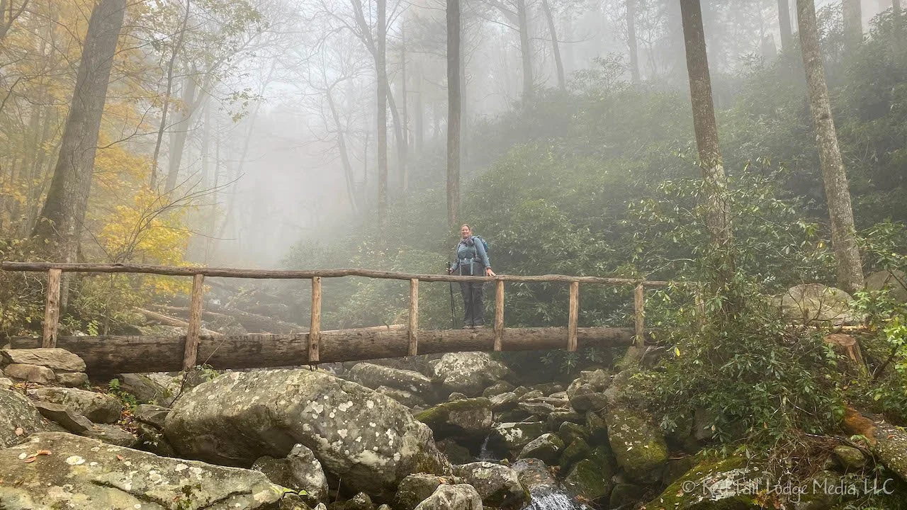
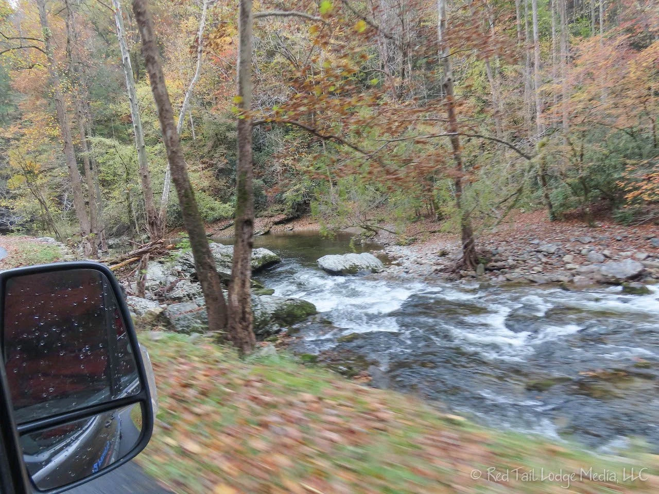
The trail was lovely. It was a steady uphill climb to the falls. For about the first three quarters of a mile, the trail is right alongside a gushing mountain stream with a series of small cascading waterfalls. The sound of flowing water always seems to regenerate our spirits. The last section of the trail has a few switchbacks that cross over several small streams with more small waterfalls.

The skies were somewhat clear when we started the hike, but the higher we got, the foggier it got. When we reached the sign that said Rainbow Falls, all we could see were small waterfalls next to the trail. Then another hiker pointed out the tall waterfall through the mist about 50 yards from the trail. We sat down on a boulder within view of the falls to have a snack. The view of the falls faded in and out while we were there.

We didn’t stay too long because our sweaty bodies were getting cold in the low temperatures while sitting on the cold rocks that were stealing our body heat. LB put his puffy coat back on and RB put her gloves back on before we started back down the trail. It took a while for RB’s fingers to warm back up. We made better time going downhill for a change. Normally that is slower for us as we take our time to make sure we don’t hurt our hips or knees, or twist an ankle. However, the footing on this trail was pretty good, so we could pick up the speed without too much trouble.
We completed the 5.5 miles with 1600 feet of elevation gain in three hours and 48 minutes. This was number 52 of our 52 Hike Challenge and hike number 23 of our National Park Series. We completed this year’s 52 Hike Challenge! Yay!
From the Rainbow Falls Trailhead, you have two options to get back to Gatlinburg. The road becomes one way just before the trailhead, but you can loop back to the two-way traffic section and go out the way you came in on Cherokee Orchard Road, a three mile trip back to Gatlinburg. The other option is to turn right at the fork in the road and take the Roaring Fork Motor Nature Trail, a six mile trip back to Gatlinburg. We chose the Motor Nature Trail. Six miles doesn’t sound that far, but the speed limit is only 10 MPH and traffic often is going slower than that.

The Motor Nature Trail goes by the Grotto Falls Trailhead and several other points of interest. The road is narrow and winding, so large rigs and trailers are not allowed. There are places to stop along the route. Some stops are for beautiful views, streams and waterfalls. Other stops are for historical buildings, which include the Ogle Place, Alex Cole Cabin, Ephraim Bales Cabin, and the Alred Reagan Tub Mill. We did not stop at any of the points of interest and it still took us close to an hour to get back to Gatlinburg. If you want to stop and see things along the way, we would recommend allowing two hours or more to complete the full loop.

Back in Gatlinburg, we hung out in the grocery store parking lot for a good cell signal. There was absolutely no cell signal back at the campground and RB’s laptop was acting up the night before, so she wanted to make sure her laptop had all the latest software updates on it.
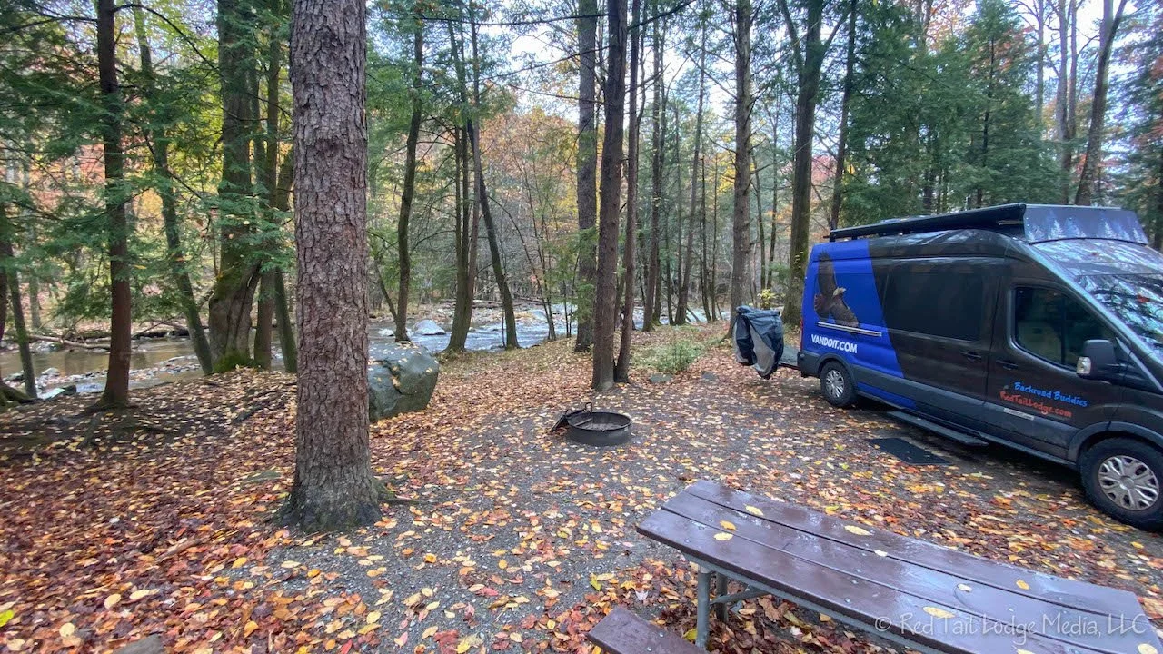
It was after 5 pm by the time we returned to the campground. We originally thought we would have a campfire for a change since it was cold outside and our camp site was in an ideal setting, alongside a mountain stream. But we were tired and didn’t want to bother with building a fire. So we had one of the best settings for a camp site this season and we never sat outside to fully enjoy it. We stared at the stream from inside the van, but somehow that’s not the same.
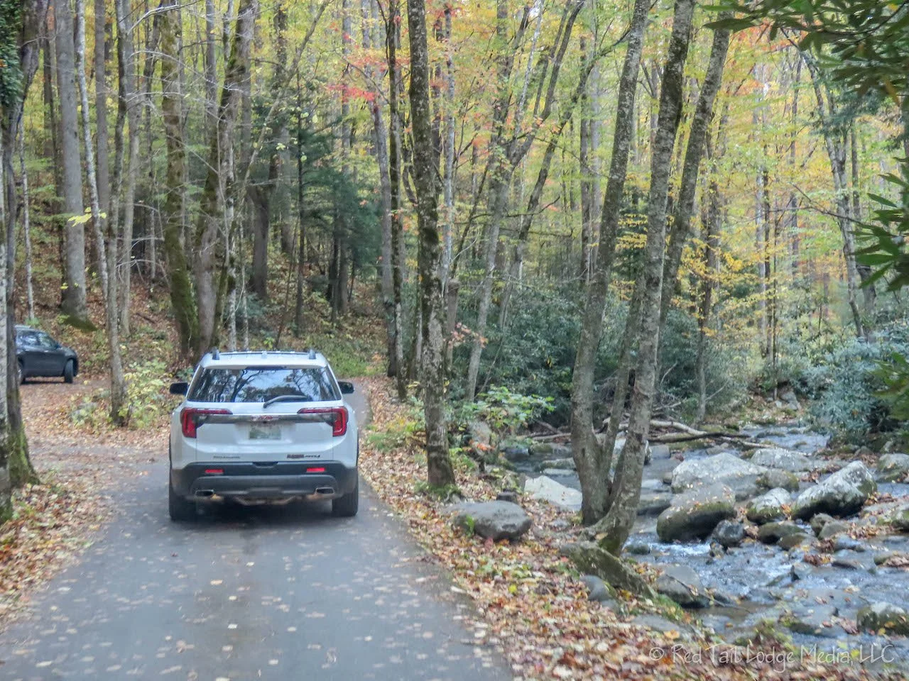
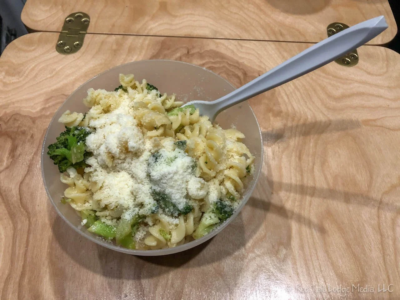
Thursday we woke up to rain. After hanging out inside our cozy Red Tail Lodge (our van) most of the morning, the rain eventually stopped, at least for a while. We didn’t have far to travel that day, just from Elkmont Campground to Cades Cove Campground, about an hour drive away. Along the way we stopped at a picnic area for lunch. We didn’t used the picnic tables, but ate inside the van since everything was wet and it was rather chilly outside. What was important about the picnic area for us was that it had restrooms.
The Little Greenbrier School, built in 1882, was nearby, about a mile. From the map, it looked like there was a road that led right to the school. We tried driving it, but it turned into a narrow, dirt road, so we turned around. The trail map showed the Metcalf Bottoms Trail going from the picnic area to the school, so we could have walked there from the parking lot. However, we planned another short hike for the day and decided to get that hike started.

The Spruce Flats Falls Trail starts at the Great Smoky Mountains Institute at Tremont, which is a mile or two down a spur road off of Laurel Creek Road, the main road between Elkmont and Cades Cove. The Institute delivers experiential learning for youth, educators, and adults through programs that promote self-discovery, critical thinking, and effective teaching and leadership. Their programs include overnight school trips, teacher escape weekends, and summer camps.

The Spruce Flats Falls Trail is about two mile round trip with about a 400 foot elevation gain. We pretty much had the trail to ourselves. Perhaps it was because it was a weekday and the weather was lousy, or perhaps it is not a popular trail. The trail is narrow. The morning’s rain left the trail muddy, covered with wet leaves, making the trail quite slippery in spots.
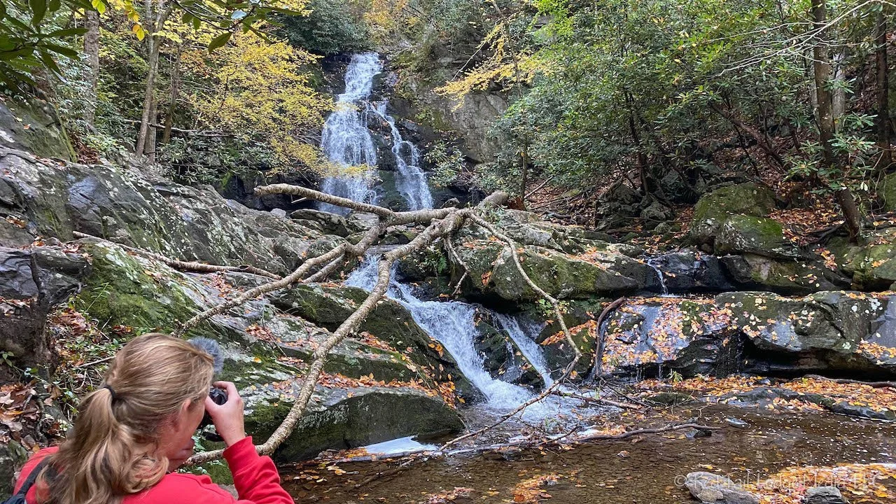
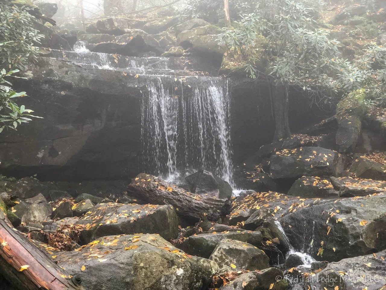
The falls were wonderful. What made them better than the Rainbow Falls the day before was that the Spruce Flats Falls were not shrouded in fog, so we could fully enjoy their beauty. That is not to mean there was no fog around at all, the fog was just not near the falls. The day remained overcast, with spots of fog. By the time we finished our short hike, it was drizzling rain.

We checked into our camp site in the late afternoon and hung out inside our Red Tail Lodge again. Tomorrow’s forecast called for better weather. We crossed our fingers and went to bed.
When we woke up on Friday morning, it was cold and foggy. We got moving early anyway, hoping the fog would burn off soon. Our plan for the day was to drive the Cades Cove Loop and explore all the historic buildings. The loop starts just outside the Cades Cove Campground. We stopped at the orientation shelter, purchased a Cades Cove Tour booklet for $1, and started the 11 mile one way loop rood.
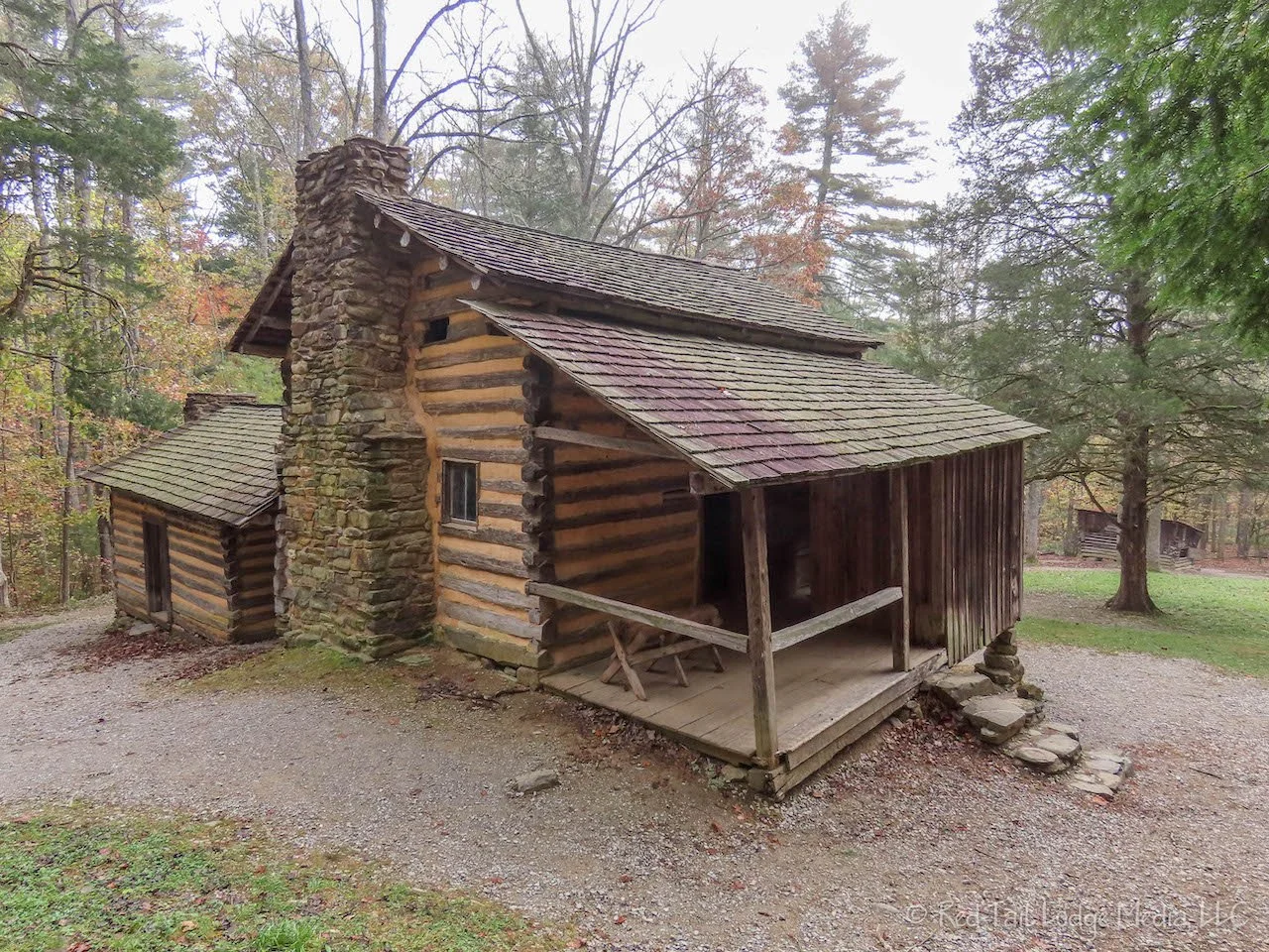
There are several cabins, farm buildings, and churches along the road to stop and see. The Elijah Oliver Place is a short half mile walk from the road. The booklet explains each of the stops and describes the buildings along with what life was like for this community of several hundred people back in the 1800’s and early 1900’s.

Near the parking area for the Elijah Oliver Place, we noticed a group of people gathering across the road. RB went over to investigate. Everyone had gathered at a group of orange cones which indicated the area beyond them was closed. Some of the people said there was a mama bear with three cubs under the tree, just a short distance away. RB patiently hung out there for a while. Every now and then she could see a patch of black fur moving in the tall weeds near the tree. At one point she thought she could make out the mama bear and one of the cubs.

The highlight of the loop is the Cable Mill Historic Area next to the visitor center at the opposite end of the loop. At the time we were there, they were giving demonstrations of the sorghum mill, with a mule walking the circle, hooked up to the mill, which squeezed the juice from the stalks of sorghum cane.
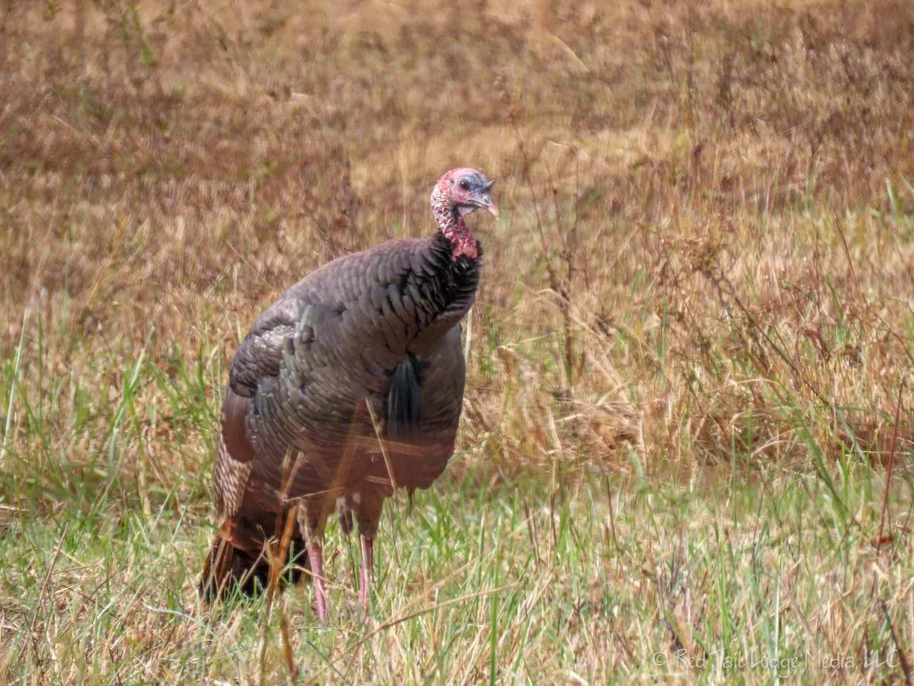
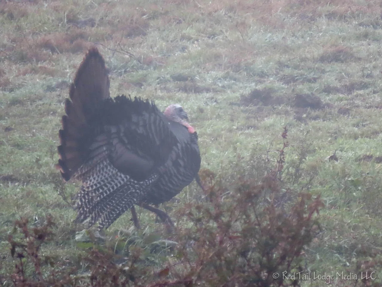
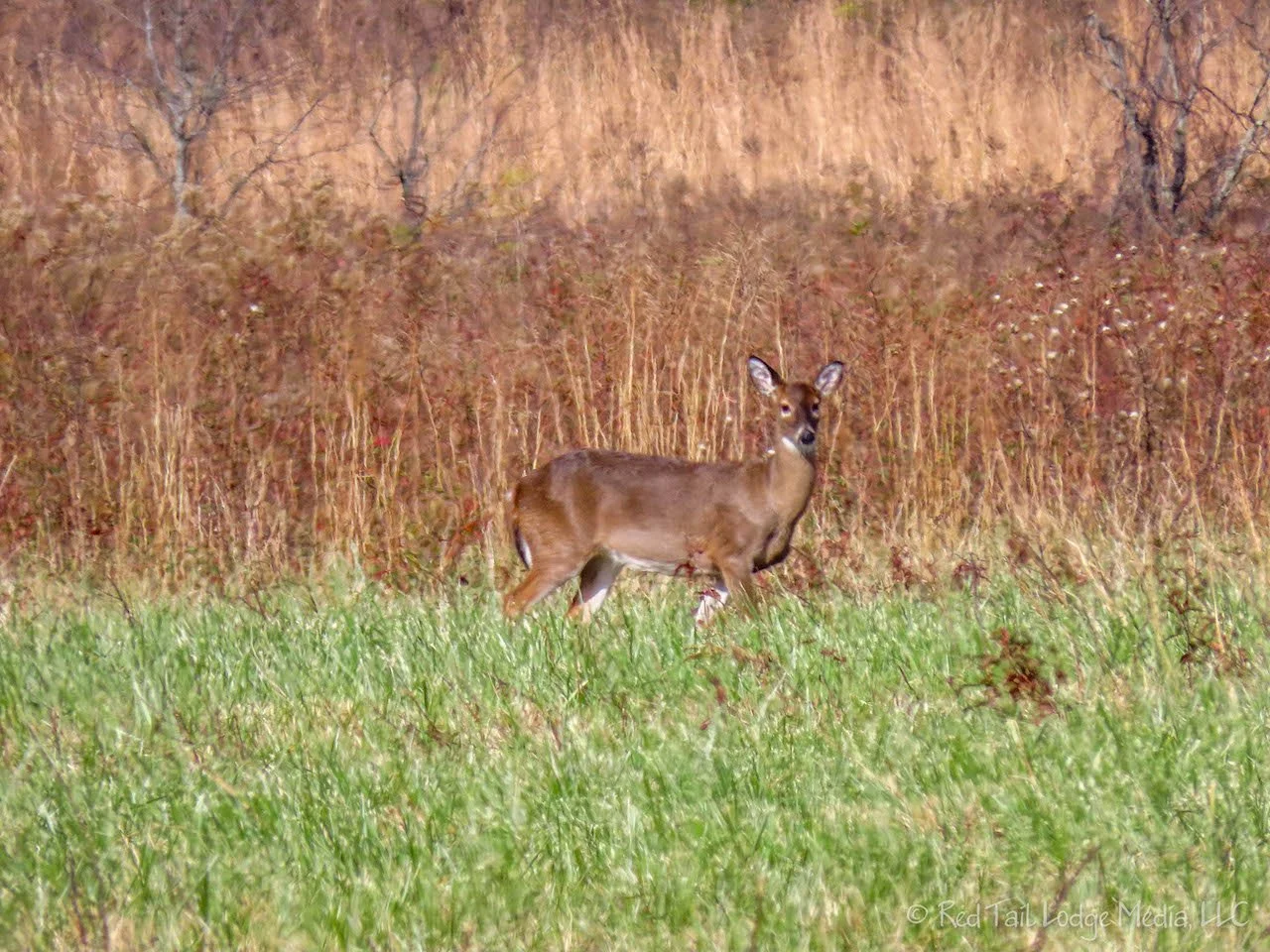
By the time we reached the visitor center, the sun finally cleared out the fog. We then had beautiful views out across the cove. Deer and wild turkeys made several appearances.

As we were wandering though the house at the Tipton Place, we noticed two peep holes in the wall that led to the outside. What were they for? There was a park ranger outside, so we asked her that question. The peep holes were where the telephone lines fed into the house to a hand-cranked telephone in the 1890’s. They believe that part of the house was used as a general store back then. The cove did not have electricity or running water, but they had a hand-cranked telephone! The wires were strung from tree to tree, over the mountain, and to the town where the switchboard was.
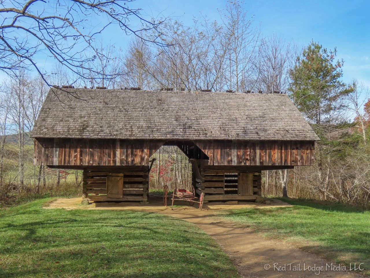
We had a fun time looking at the different farm buildings and trying to guess what each building was used for. We could identify the smokehouse because it had no floor, sometimes built over a large slab of rock, with rafters to hang the meat from. The drive-through barns had a breezeway through the middle of them, where the hay can be off-loaded from the hay wagon to the hay loft above and then later fed down to the animal stalls located on each side.
Even though the loop is only 11 miles long, we spent most of the day driving it, along with spending time at all the stops. The traffic was pretty thick in the afternoon. So, even though the speed limit was 25 MPH, many times we were going slower than that or stopped because the cars in front of us were enjoying the scenery or wildlife that they saw along the way. During the summer months, the Cades Cove Loop Road is closed to vehicle traffic on Wednesdays so that visitors can enjoy the 11-mile loop on foot or bicycle. We would have preferred to tour the loop on bikes, but we were too late in the season.
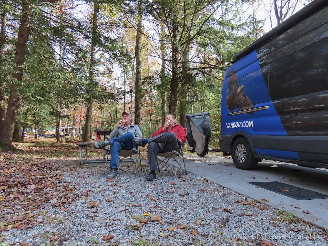
When we returned to the campground, the sun was shining and the air felt warmer. So we bought soft-serve ice cream at the camp store. Our camp site was a short walk from the store, so we enjoyed our vanilla-chocolate twist waffle cones while sitting in our camp chairs back at our camp site. It had been several days since it was nice enough to sit outside in the evening, so it felt really good. Although, after we finished our cones, we followed them up with cups of hot tea to warm ourselves back up.

Saturday was another moving day, this time from Cades Cove Campground to a KOA in Cherokee, North Carolina, just outside the park. We got up early so we could reach Clingmans Dome in the morning. It was supposed to be a nice day and we were hoping for a nice view this time.

We reached the parking lot for Clingmans Dome about 9:30 am. At that time, there were plenty of parking spots to choose from. The sun was shining. We could see fog in the valleys below. We decided to head up to the dome while the view was good.
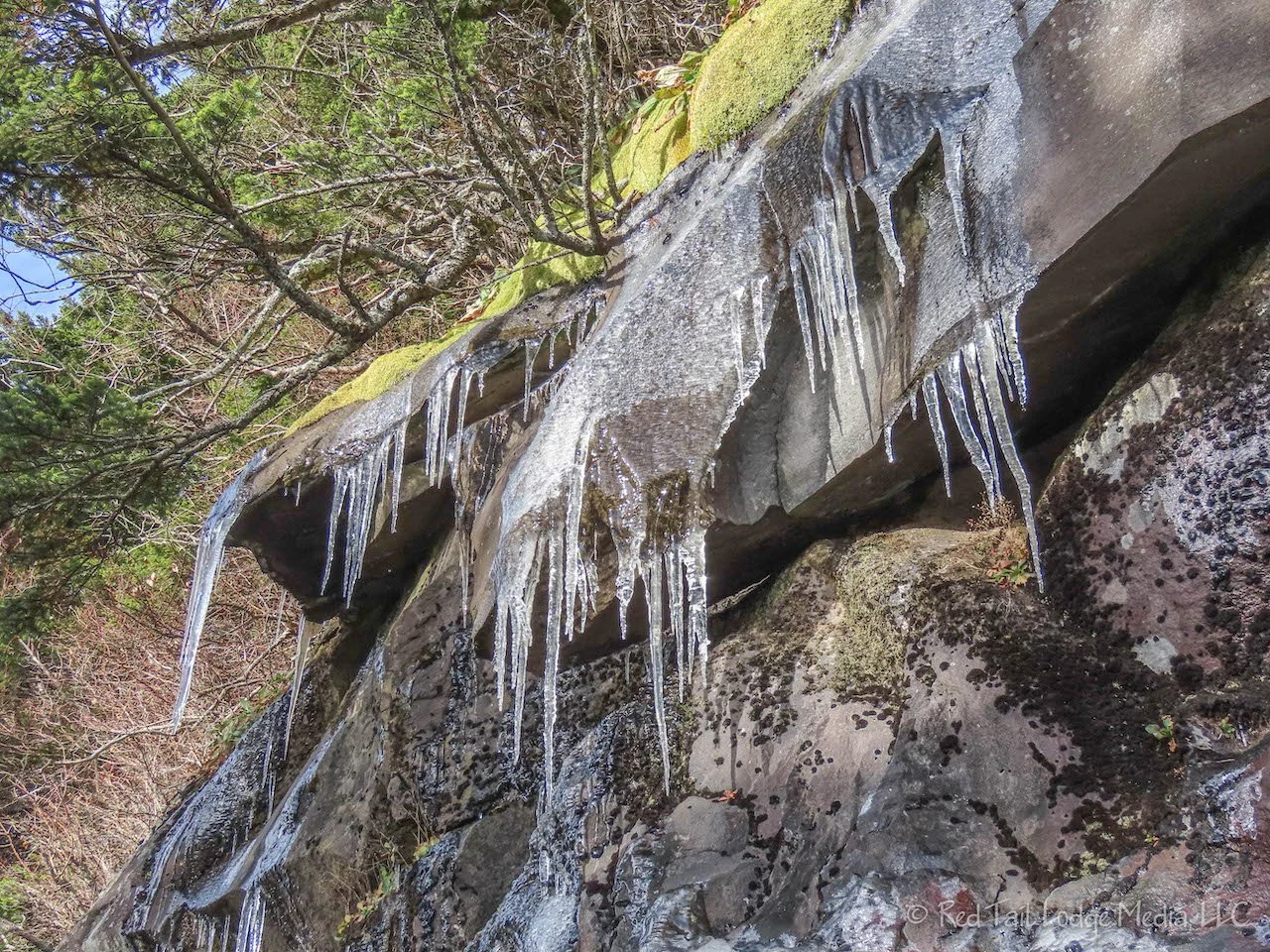
The sun was shining, but the air was cold and the winds were blowing. It was the kind of wind that makes your eyes water. Icicles were hanging from the rocks and small patches of snow were on the ground. When we were getting rain on Thursday down in Elkmont Campground, Clingmans Dome was getting an inch of snow. According to the park ranger, it was their first snowfall of the season.

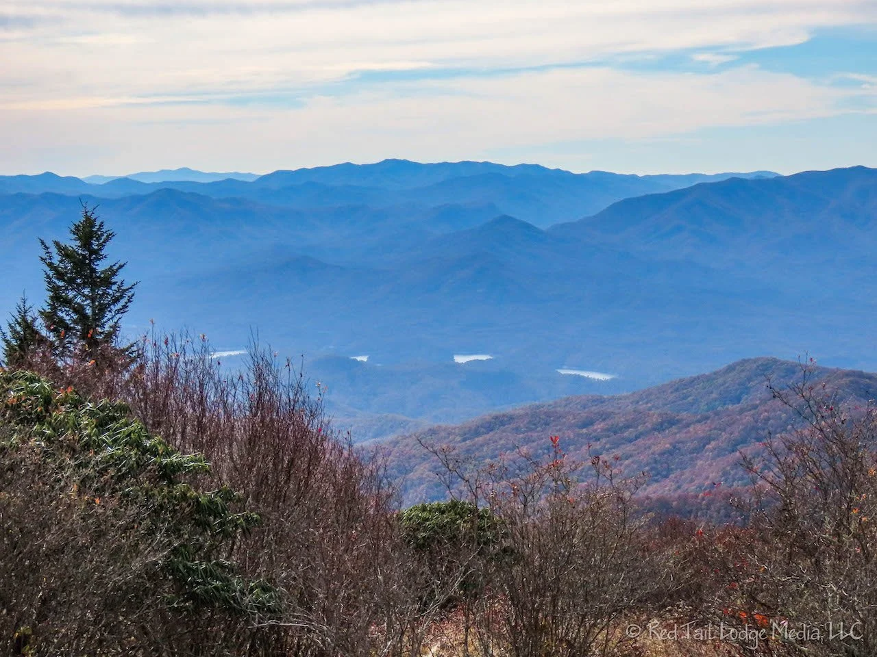
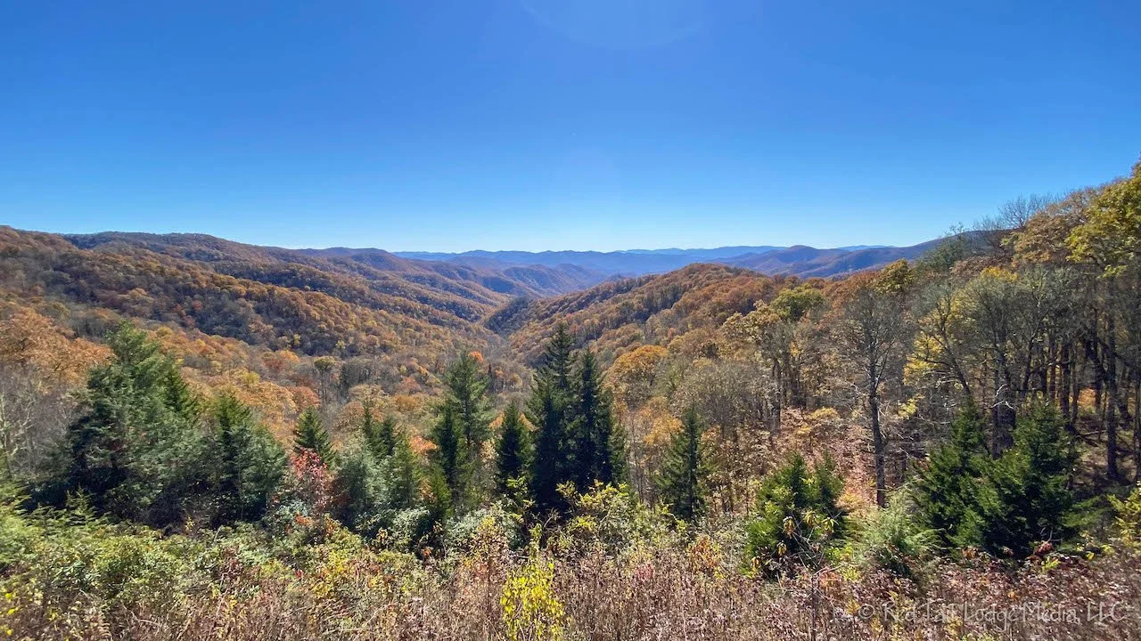
The view from Clingmans Dome was spectacular. What a huge difference from the previous Tuesday when we couldn’t see anything but fog. We didn’t spend a lot of time at the top of the dome because of the cold wind. After taking in the view, we headed back down the half mile trail towards the warmth of our Red Tail Lodge.

By the time we reached the van, a little after 10 am, the parking lot was pretty full and cars were starting to slowly circle the lot looking for spots. We made ourselves a couple of hot drinks and hung out inside the van. We had basically no cell service the past several days so we had a lot of emails and text messages to catch up on. RB also had a phone call she needed to make.
We didn’t mind hanging out in the van for a while. The plan was to hike over to Andrews Bald from there, but we wanted to wait for the sun to warm things up a bit first. After we got our fill of the internet, we ate some lunch. OK, we think it’s warm enough now for a hike.

The Andrews Bald Trail was wonderful. It is about three and a half miles round trip with an elevation gain of 860 feet. It is easy footing along the trail, so you can spend time looking around at the scenery instead of at your feet the whole time. Trees surround the trail for protection from the wind until you reach the bald.

By the time we arrived at the bald, the sun was brightly shining, the temperatures had risen, and the winds had calmed down. Quite a few people were hanging out at the bald, having a picnic lunch, and basking in the sun. We sat down on a rock to soak in the views and the sun. The sun rays felt so wonderful on our faces.

The views from the bald were spectacular. You can even see Fontana Lake from there. It was not quite a 360 degree view, but close to it. Was the view better than on top of Clingmans Dome? Perhaps not, but the setting was better. The rocks and grass on the bald is a much better place to hang out than the concrete dome.

RB struck up a conversation with a family from Knoxville, David, Ann, and Elizabeth. They were interested in camper vans and traveling out west, so RB was more than happy to provide them with information from our travels. We hope their trip goes well!
After we got back from our hike and waited in the long line at the restrooms, it was time to give up our parking spot. The long line of cars trolling the loop through the parking lot stretched back from the parking lot for almost a mile. It was a beautiful Saturday in the fall and everyone seemed to be there to try to enjoy it. We’re so glad we arrived early.
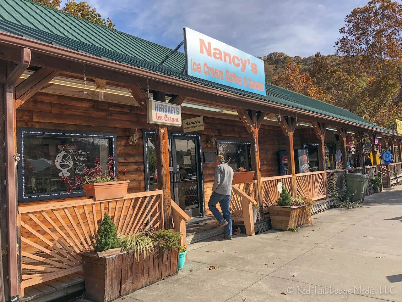
From there we drove the rest of the way down into Cherokee. You guessed it. It was time for ice cream. We found Nancy’s Ice Cream, Coffee, and Sweets in town. They served Hershey’s ice cream. Perfect! Well, almost perfect. They didn’t have RB’s favorite flavor of Hershey’s peanut butter cup, but they did have mint moose tracks and chocolate. That will do just nicely.
We settled into our camp site at the KOA for the evening. There was cell service! Twice in one day! The evening was spent watching YouTube videos, trying to catch up on the channels we follow.

Sunday was a relaxing day. We hung out around the Cherokee end of the Great Smoky Mountains National Park.
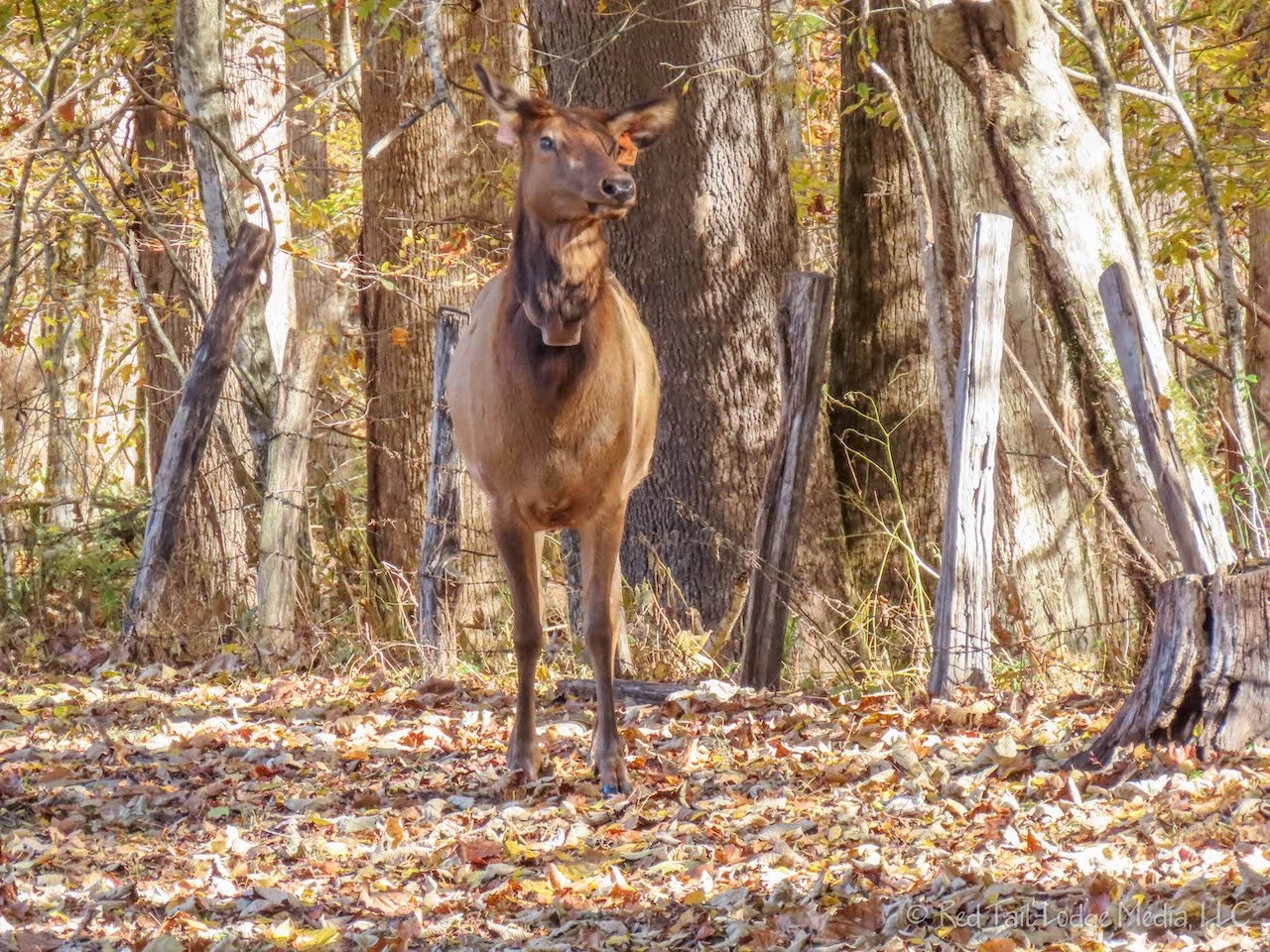
First we drove over to the Oconaluftee Visitor Center. A herd of elk was grazing in the field next to the visitor center, just like they were when we first entered the park the previous Tuesday. The Mountain Farm Museum is also located here, but first RB walked a little ways down the Oconaluftee River Trail alongside the farm to try to get a better picture of the elk. While she was busy taking pictures, LB told her to look behind her. When she turned around, there was a single elk standing not far behind her in the farm museum. It looked like the elk wanted to cross over the trail to join the rest of the herd. RB and a couple of other people who were on the trail near her all backed up the trail to give the elk room. A woman grabbed a small child who was running along the trail unaware he was getting close to an elk. Sure enough, after we were all out of the way, the elk hopped the fence, crossed the trail, and walked across the field to the herd.

The farm museum was nice. The collection of historic buildings along with the accompanying informational signs provided a good insight into farm life in the Smokies back in the late 1800’s and early 1900’s. The collection included a blacksmith shop, a corn crib, a sorghum mill, an apple house, a spring house, and a pig pen. Some restoration efforts were underway on the log house, so we couldn’t peek inside.
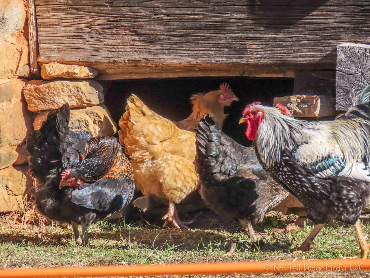
Animals added to the experience. About a dozen chickens roamed the farmyard and a hog was in the pig pen.
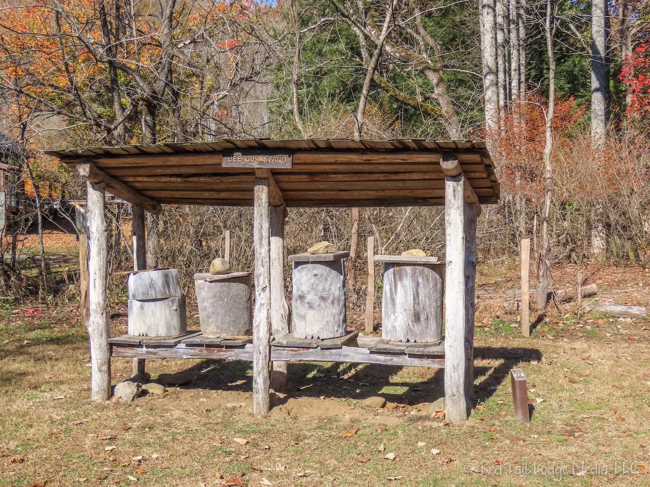
A roof structure covered a row of hollowed out sections of tree trunks with a cover on top of the trunks. The sign read “bee gum”. RB had to look that up to figure out what it was. She saw something similar at Tipton Place in Cades Cove a few days earlier and wondered what it was. A bee gum is a beehive made using the trunk of a black gum tree.

From there we headed over to the Mingus Mill, just a little ways down the road from the visitor center. The Mingus Mill, built in 1886, does not use a wooden water wheel. Instead, it uses a small steel turbine. The water from the flume flows into the top of a penstock, a tall wooden tower, that feeds into the turbine from the bottom of the penstock, where the water pressure is greater.
Since the sun was shining and there wasn’t a cloud in the sky, we decided to drive up Newfound Gap road for a few miles. RB remembers driving by a beautiful overlook on the way down from Clingmans Dome the day before and wanted to go back to check it out. The overlook is between the trailheads for the Deep Creek Trail and the Thomas Divide Trail. Short walkways extend along the road back to the expansive view from parking lots at each end. We stopped at the west end of the view.
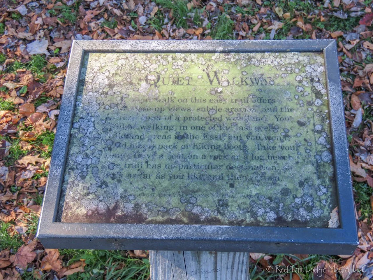
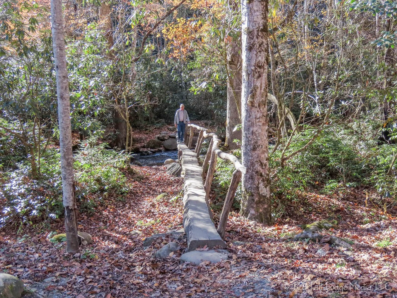
As we were heading back to the van, we noticed a small sign and a trail leading from the other end of the parking lot. The sign was faded, but it indicated the trail was a “quiet walkway”. AllTrails lists the trail as Swinging Bridge Quiet Walkway. We’re not sure why it is called swinging bridge, because we didn’t see any swinging bridges. When we were over on the Tennessee side of the park, we noticed several pull-outs that were labeled with road signs indicating “quiet walkway”. We talked about stopping at one to see what it was about but never did. So we headed down the Swinging Bridge Quiet Walkway. It was just like it sounded, a short trail in the woods with no particular destination. The sign at the trailhead instructed people to walk as far as they wanted and turn around to come back.
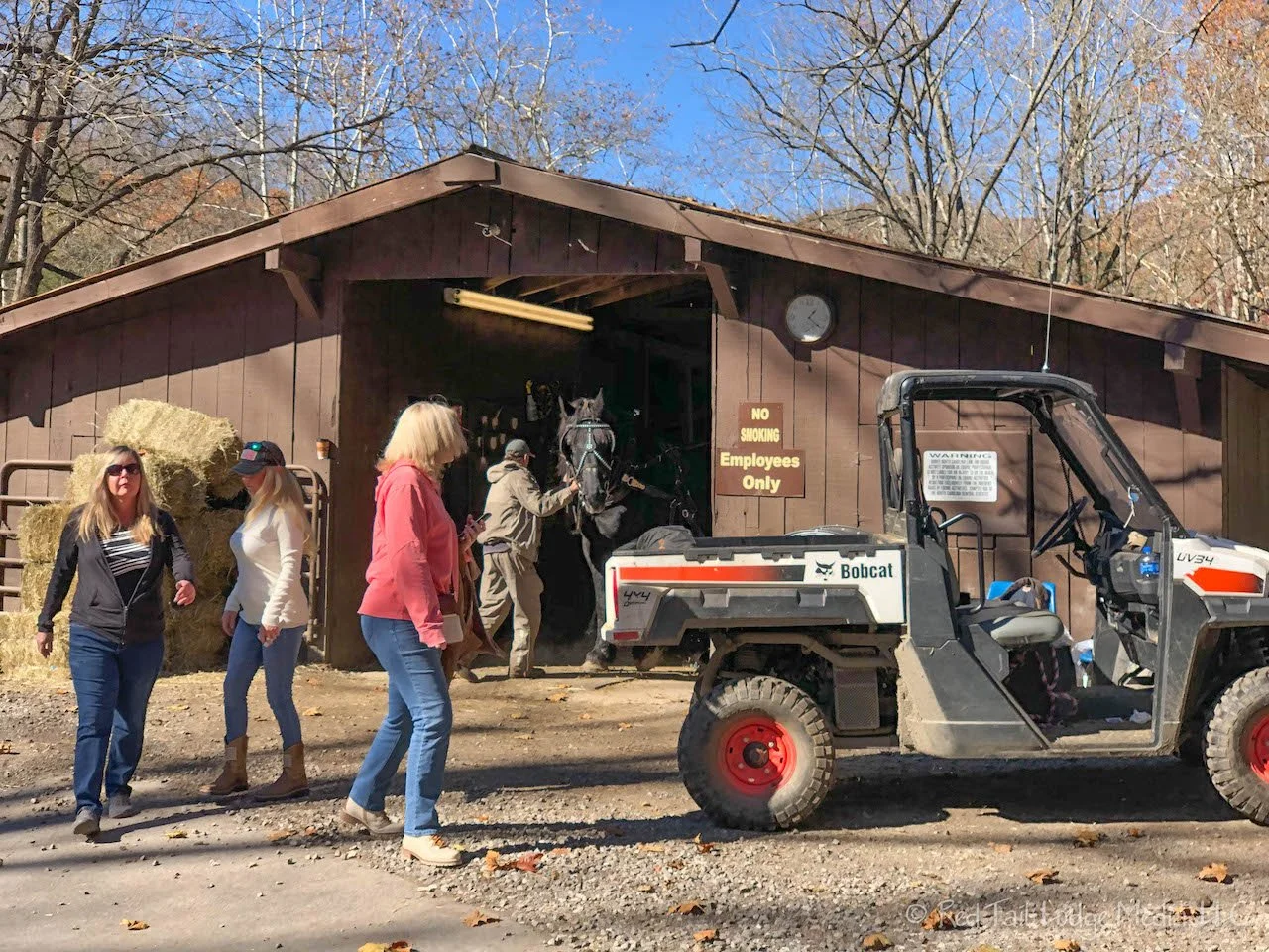
Even though it was still early afternoon, we checked in to Smokemont Campground. Firewood was sold at the nearby horse stables, so we drove over and picked up a bundle. Yes, you heard that right. We’re finally going to have a camp fire this season.

Smokemont Campground is in a lovely setting. The long and narrow campground is along the Bradley Fork stream. Since this was the start of the off-season, only a couple of the campground loops were open.
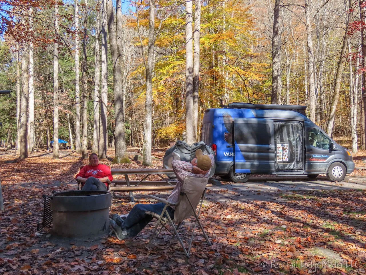
After setting up our Red Tail Lodge in our camp site, we sat and relaxed in our camp chairs under the colorful trees that surrounded us. This was the warmest day we had all week. It was so nice to sit outside and not be cold. As we sat there, sipping our drinks, we watched the leaves falling from the trees.
After finishing our drinks, we went for a stroll. Not far from our site was a foot bridge over the Bradley Fork to a nature trail. We crossed the bridge, but the nature trail was a narrow trail up through the woods. We decided we wanted to stay closer to the stream. The sound of the flowing water was so inviting.

We walking along the closed campground loops, alongside the stream, to the far end of the campground. The Bradley Fork Trailhead is at the far end. The trail is very wide, wide enough for a car. The trail, as its name indicates, follows alongside the stream. We continued our stroll for about half a mile down the Bradley Fork Trail. As we were sitting on a log next to the stream, enjoying the view and sounds of the water, a group of people on horseback rode by.

Returning to our camp site, we prepared an early dinner. Daylight Savings Time ended the night before and our bodies were telling us it was time to eat even though the clock did not. We had a long drive ahead of us the following day, so keeping to an earlier schedule was better for us. LB started up the campfire while we ate our supper.

We had no cell service at the campground, so we just huddled around the campfire and watched the flames dance around. Why is fire so mesmerizing? After a couple of hours, the fire turned into a bed of glowing red hot coals. RB thought it was a shame to let those beautiful hot coals go to waste, so she cored an apple, wrapped it in aluminum foil, and placed it in the coals. She turned the apple with a pair of metal tongs every five minutes. After half an hour, she had a wonderful, hot baked apple. Adding a little butter and brown sugar turned it into a tasty dessert. What a perfect way to end the day!

We left Great Smoky Mountains National Park with a sense that we had done it justice. We learned a little history, hiked some nice trails, and enjoyed the views. Seeing elk in the Smokies was a nice surprise for us. Even though we’ve seen many elk in the Rocky Mountains, we didn’t realize there were elk in the Smokies as well. It felt like Season Three was winding down for us, but we still had a few more sites to see before starting to head home. Our next stop? Williamsburg, Virginia.
Check out our related video: Great Smoky Mountains National Park, North Carolina & Tennessee
(RB)