
Grand Canyon North Rim in Depth - September 1st to 5th, 2023

We’ve visited the Grand Canyon a couple of times before. During our previous visit, we camped one night in a tent on the North Rim before starting our Rim-to-rim backpacking trip (North Rim: Grand Canyon - Sep 15, 2019). However, we didn’t get a chance to really explore the North Rim. So this time we took in as much of the North Rim as we could during our four day stay.

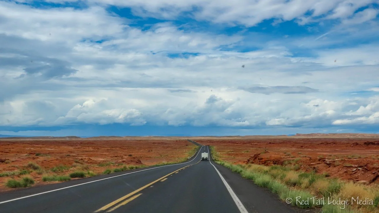
Friday we drove from Canyon de Chelly National Monument to the North Rim of the Grand Canyon. It was a beautiful drive. We had to keep an eye on Google Maps, because it wanted to route us the shortest way, on unpaved roads. No thank you! The unpaved roads may have been shorter and faster, but they are more stressful on the driver and on our rig. This is when a physical road atlas comes in handy. The roads Google wanted us to take started out paved, but we could easily see in the atlas that they turned into unpaved roads. Yes, we are the Backroad Buddies, but we prefer paved roads when possible.
We stopped in Tuba City for gas, groceries, and a picnic lunch. Since it was a long driving day, over five hours, we didn’t look for a park to have lunch in, we just ate in the parking lot of the grocery store. The Bashas’ grocery store was decent, with a good selection. We noticed there was one in Chinle as well. Our worries about finding good groceries inside the Navajo Nation were unfounded.

Our next stop was at the Navajo Bridge near Lee’s Ferry, inside the Glen Canyon National Recreation Area. The bridge crosses the Colorado River and is worth getting out onto the bridge for the scenery. The original Navajo Bridge was built in 1927. In 1985, a stronger bridge was built alongside the original bridge, in the same style of the original. Pedestrians can now walk out on the old bridge to take in the views of the Colorado River below. A condor was sitting on the rocky cliffs above the river while we were there.

The road then follows alongside the Vermillion Cliffs National Monument. However, by this time, a large storm cloud came rolling in and it started raining. The cliffs were still beautiful, even in the dim light and rain. Hopefully we’ll get a better view of them on our way back from the North Rim.

Our last stop was at Jacob Lake Inn. We needed a restroom break. We topped off our gas tank and were shocked by the price, $5.95 per gallon. Where were we, Alaska? We went inside the lodge to buy some drinks, but came out with milkshakes and cookies.

Jacob Lake appeared to be known for their cookies, so, naturally, we had to check them out. Ann got a chocolate raspberry cookie and a lemon zucchini cookie. Keith stuck to his favorites, snickerdoodle and gingersnap. Ann had a chocolate malt while Keith stuck with his usual vanilla shake. The shakes were made from soft serve and they were very thick. They were so thick they did not serve them with straws, only a spoon. Keith was hoping to drink his shake while we continued our drive, but that was not possible. So we sat there and ate our shakes before driving on. We saved our cookies for dessert after dinner. They all were delicious.

When we arrived at the campground, we decided to get our laundry done while the machines were available. There were seven washers and eight dryers. Unfortunately, only four of the washers were working and only two of the dryers were working, according to the signs posted on the machines. Of the four working washers, one said it didn’t have hot water, but we found that all of them only had cold water. At least they were cheap. It was $1.50 per load to wash and $1 to $1.50 per load to dry. However, our clothes were not quite fully dry by the end of the 30 minute dry cycle. We also heard campers complaining about the cold showers. One exclaimed that it was the coldest shower she’s ever taken. One man went to the store to complain about the cold showers. He was told that they had no control over it. The laundry, store, and showers are run by a concessionaire, Aramark. The showers are coin-operated. If I had taken a cold shower, I would be asking for my money back. Come on, Aramark! You can do better than that. At the very least, provide an explanation of why there is no hot water and start calling someone to come out and fix the problem. Just saying that it is out of your control is not very good customer service. We feel sorry for the backpackers who may have just come out of the canyon and not be able to take a hot shower.
The weather forecast called for rain most of Saturday. However, it looked like there would be a break in the rain from 11 am to 2 pm. So when the sun started peaking out at 10:30 am, we grabbed our day packs and walked over to the lodge.
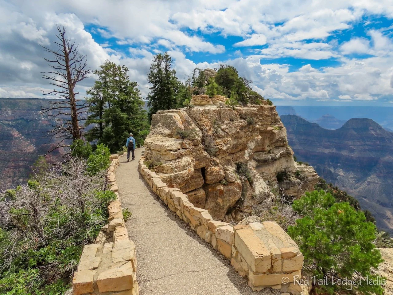
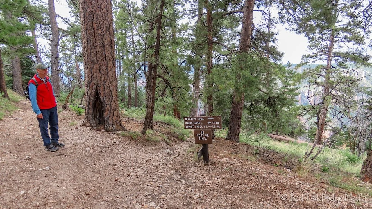
It was like walking down memory lane. Just like we did four years ago, we walked the Transept Trail over from the campground, then walked out to Bright Angel Point. The sun was playing peak-a-boo with the clouds, lighting up some of the view for us.
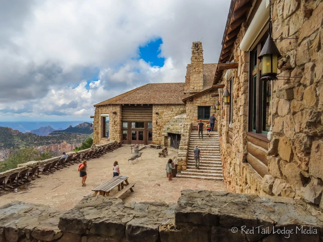
We continued our repeat trek, stopping in the Welcome Center to ask some questions, then into the Deli in the Pines for lunch, and over to the veranda behind the lodge to lounge in the chairs, taking in the view.
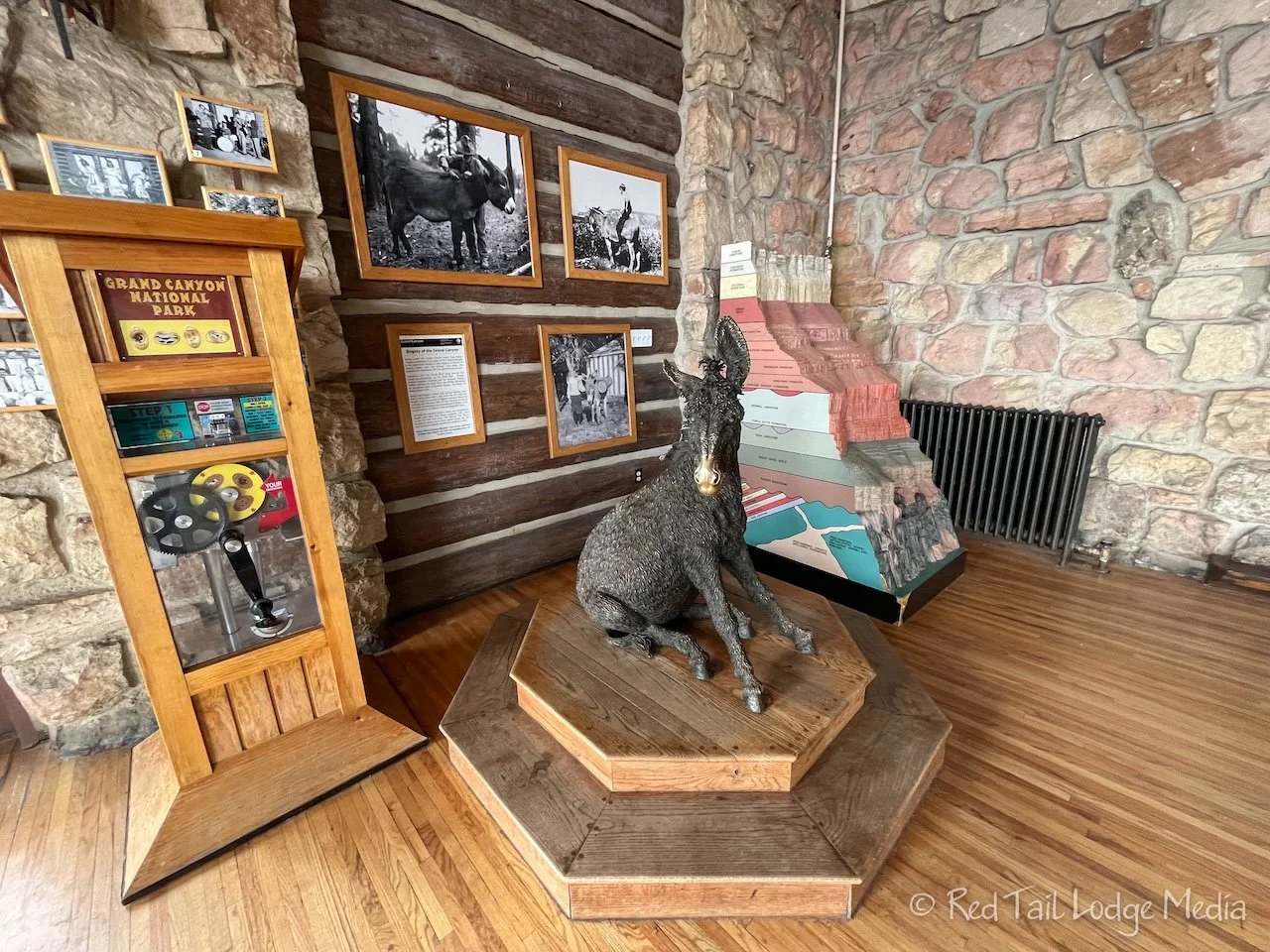
Inside the lobby of the lodge, we rubbed Brighty’s nose. Brighty is a statue of a burro, a character from a 1953 children’s novel. Stopping in the gift shop rounded out our tour of the area before hiking back on the Bridle Path. When we returned to our camp site, it started to sprinkle. Before long, it was pouring down rain with streams of water flowing through the campground and across our site. We timed our walk perfectly!

It wasn’t a complete repeat of our prior visit, as we didn’t stay at the lodge for dinner and a sun set. But we had more days here. Dinner and sunsets were yet to come.

Taking advantage of the time we had on our hands inside Red Tail (our Winnebago EKKO) for the afternoon and evening, we did some needed chores. We cleaned the bathroom and swept the floor. After dinner, Ann made apple brownies in our Omnia Oven (paid link).

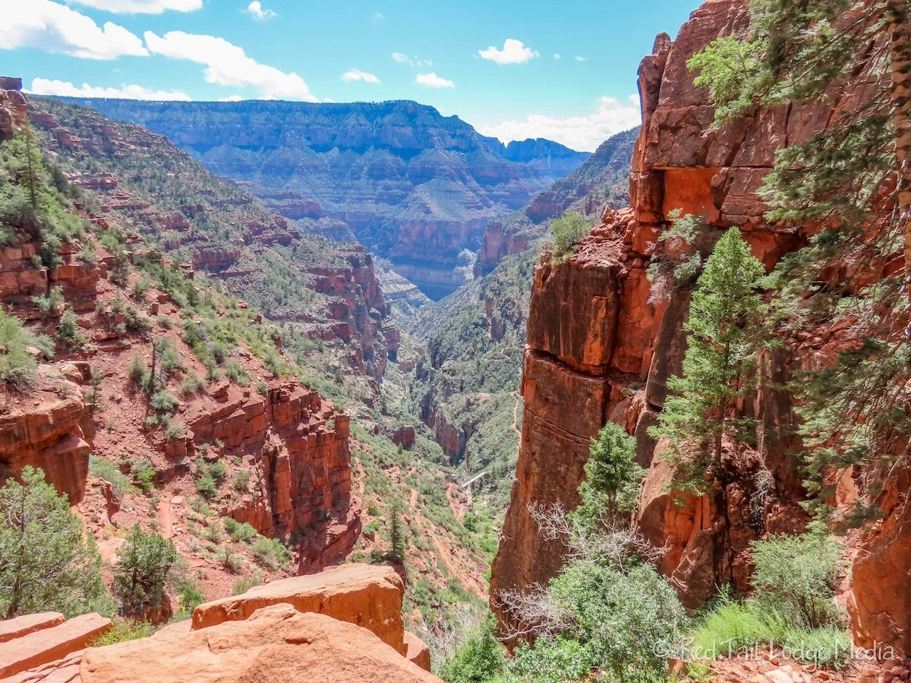
Sunday we went for a hike. Again, this was more of a repeat of our previous visit. We hiked the North Kaibab Trail, but this time just to the Supai Tunnel and back.

The trailhead is about three quarters to a full mile from the campground. We wanted to park Red Tail at the trailhead, in hopes we could park it in more sun than our camp site to recharge our batteries. So we packed up and drove over before 9 am. However, the parking lot was already full and so were the parking spots alongside the road. Back we went to our camp site and walked the Bridle Path over to the trailhead.

The trail this time around didn’t seem so steep as it did the first time. It may have had something to do with having a much lighter pack and having a better night’s sleep the night before. This time around, Ann also didn’t have a foot that was still recovering from surgery along with a knee and hip giving her issues. And perhaps we were in better shape than we were four years ago. We didn’t really get back into hiking until a year before our rim-to-rim backpacking trip and we’ve been going on more than 50 hikes per year ever since.

The views from the trail were still beautiful. This time around, we had more time to stop and enjoy them.

The mule tours still run down to Supai Tunnel, so we had to stop and let them go by numerous times. We didn’t mind that. What we could have done without were the puddles and piles left on the trail by the mules. The odor was pretty strong in a few spots and you had to watch where you stepped.

We stopped just before the tunnel for our lunch. There is a water source here, when the water pipes aren’t broken. This was not one of those times. The water system that pumps water up from Roaring Springs supplies water not only along the trail, but also all the water for the North and South Rims. It is an aging system that breaks often. There was still water up on North Rim despite the pipes being currently broken. We’re not sure how they achieve that, but perhaps they keep water in tanks in reserve. The park service has been planning a replacement system for years. Work is about to begin as they are currently establishing construction infrastructure and staging areas. The project is expected to be completed in 2027.

Just past the Supai Tunnel, we could see the Redwall Bridge which crosses the creek. It was tempting to continue down to the bridge, but that would have added another 800 feet in elevation gain on the way back. Hiking down into the canyon is tricky, because you go downhill first and don’t realize how much work it is going to be climbing back out.

Along the trail, we passed a couple going the other way. They noticed the sticker on Ann’s camera and asked if we had a YouTube channel. Ann gave them a sticker and they gave us their business card. They run an antique shop in Camp Verde, Arizona called Ruby Road Vintage. It is so fun meeting people during our travels.
From our camp site, we covered 5.8 miles with an elevation gain of 1686 feet in four hours and 20 minutes. It was hike number 44 of our 52 Hike Challenge for 2023.
When we returned from our hike, we took hot showers in Red Tail. There was no way we were going to pay for cold showers at the service building. After feeling refreshed, we walked the Bridle Trail over to the lodge to hang out on the veranda. The views out over the canyon were much clearer than the day before.
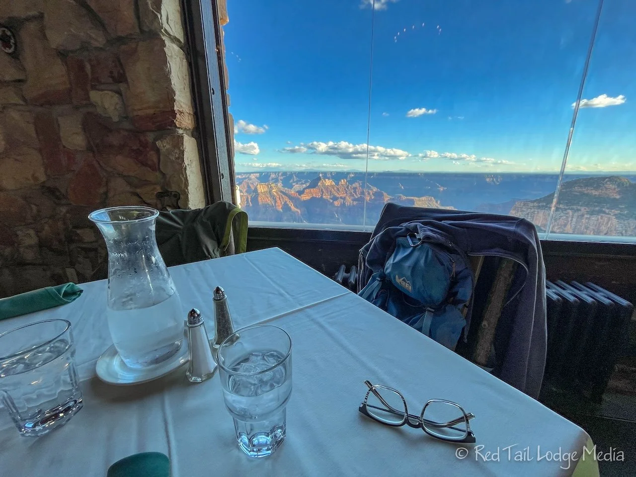
Our dinner reservations were for 6 pm while sun set was at 6:53 pm. We lucked out and got a table right by the window. As we enjoyed our meal, we could watch the light and colors change in the canyon as the sun set. A perfect way to complete our repeat performance on the North Rim.
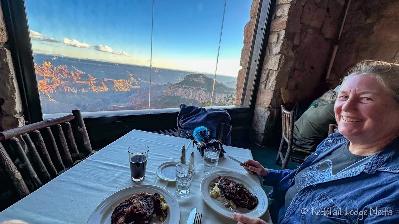
For dinner, we had the Brussel sprout appetizer along with rib eye steaks. The steaks were 14 oz, much more than we normally eat. We usually prefer the 6 or 8 oz filets. By the time we finished our delicious meal, we were stuffed. We should have split a steak instead of us each ordering one. However, somehow we managed to split a piece of carrot cake for dessert.
We waddled the mile back to the campground with our headlamps on. The winds picked up as the sun set, so we bundled up in our jackets. As we walked along, our bodies warmed up and we started stripping some of the layers back off. When we reached Red Tail, we had smiles on our faces. It was a very good day.

Some people respond very well to a particular place for some reason that is hard to explain. The North Rim of the Grand Canyon is that place for Keith. This is one of the few places he calls “his happy place”. If it was only up to him, we would visit here every year.

Monday we explored new areas of the North Rim, at least new to us. The Cape Royal Road is a 23 mile scenic drive. Adding the spur to Point Imperial adds another 2.6 miles. The signs and maps all indicate that vehicles over 22 feet are prohibited on both of these roads. Red Tail is 23 feet long. Two days earlier, we asked how strict the 22 feet is and the people at the Welcome Center told us that our 23 foot rig should be fine. But if you get in trouble for taking a 23 foot vehicle on Cape Royal Road, don’t blame us!

Cape Royal road is a winding road through the forest. There are about half a dozen viewpoints along the road along with a few trailheads. There is no shoulder and the road gets a little narrow in sections, but it’s mainly due to vegetation lining the road rather than rocky walls. Keith had to pay attention to low hanging branches, as Red Tail sits just over 11 feet tall.
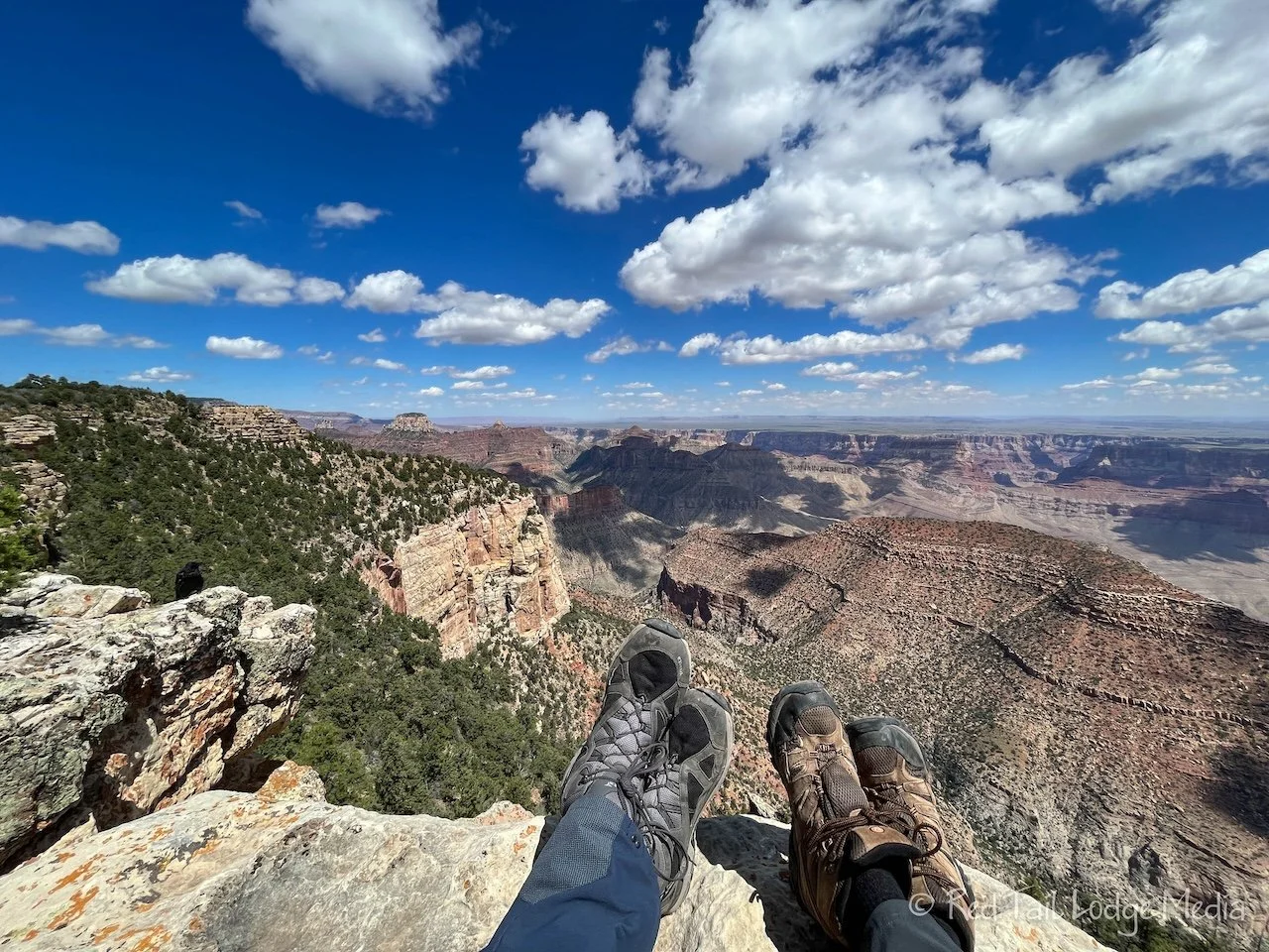
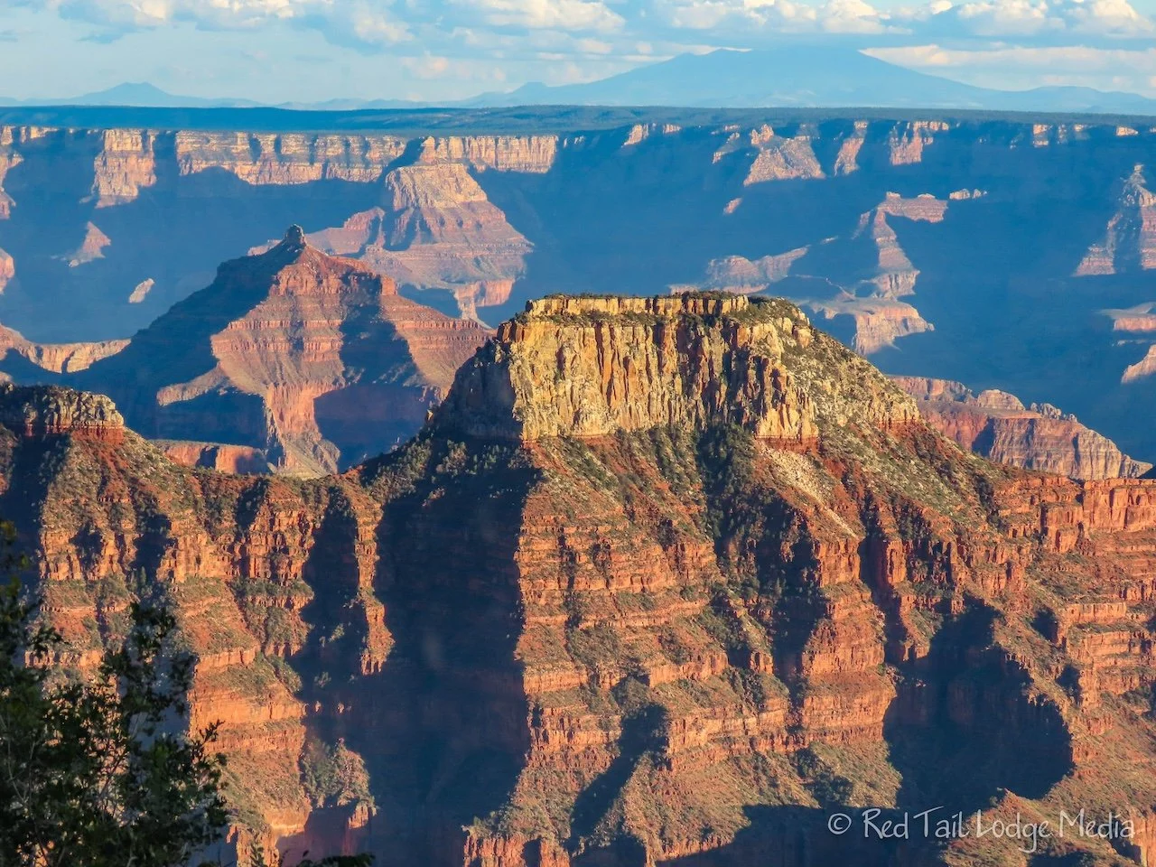
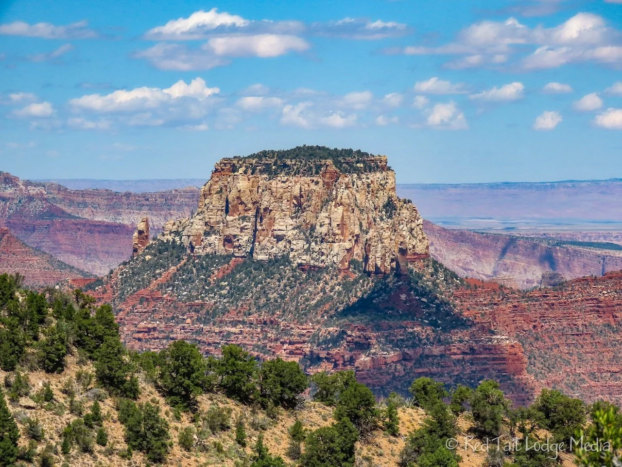
We started our day by driving out to Cape Final Trailhead. The trail is four miles round trip. It is a pleasant stroll through the woods. After about a mile and a half, the trail passes a few viewpoints out over the canyon, giving you sneak peeks, hinting at the stunning view that is yet to come. At just over two miles, there is a short rock scramble up to the top of Cape Final, with a breathtaking panoramic view of the canyon. A small section of the Colorado River is visible from there. A small bump on the South Rim is visible. It is the Desert View Tower.

We hung out on top while eating our lunch. Ravens quickly noticed we were there and paid us some close-up visits. However, they were not aggressive. If you bring children or people afraid of heights, be forewarned that our idyllic perch had sheer drop offs. Pay close attention and plan accordingly.

We continued a little further, following the rim line, to catch a few more views before heading back. We managed to turn our hike into 4.7 miles with an elevation gain of 515 feet in two hours and 45 minutes. It was hike number 45 of our 52 Hike Challenge for 2023.

After our hike, we continued driving down the road to Cape Royal. From the large parking lot there, a paved trail leads out to Cape Royal and over Angels Window. The trail is only 0.8 miles round trip. Angels Window is a large hole or window in the cliff, with a view of the Colorado River through the window when viewed at the right angle. These stunning views of the canyon did not require a two mile hike to reach them, just a vehicle that was allowed on Cape Royal Road. Interpretative signs lined the paved path.

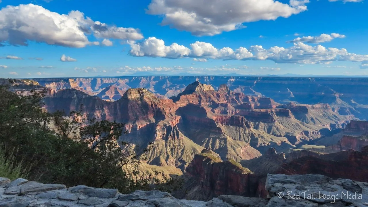
Our original plan was to visit all the sights along the road on the way back. However, we were starting to get tired. So we just stopped at the highlights, Roosevelt Point and Point Imperial. It is amazing how different the canyon looks from different angles and different areas. Even different times of day and weather create different shadows and colors. Point Imperial is the highest point in the Grand Canyon National Park, at 8803 feet. At that height, not only can you peer down into the canyon, but you can see the expanse of the plateau beyond the South Rim. A wonderful perspective.

Back at camp, we ate an early dinner. We didn’t feel like cooking, so Keith ate leftover soup while Ann heated up nachos in the microwave. We completed the day by making our daily walk over to the lodge. This time we took the Transept Trail over to Bright Angel Point again. Then we bought a couple of drinks and found a lovely spot on the west veranda to sit, relax, and watch the sunset. Again, we walked the Bridle Trail back to camp with our headlamps on. A perfect ending to a wonderful day.
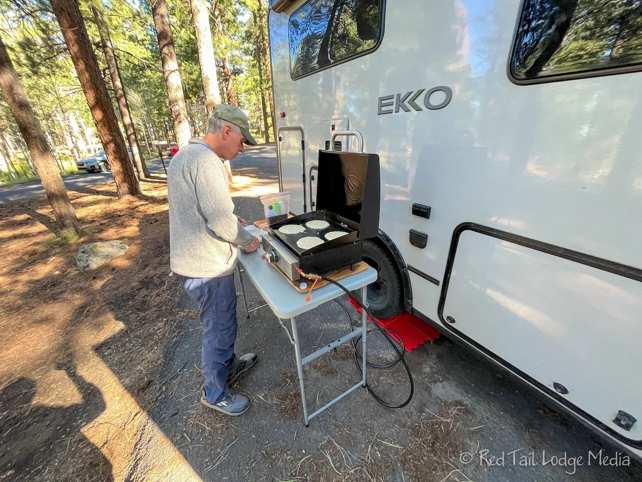
We were in no hurry to leave the North Rim on Tuesday. Our destination for the day, Lee’s Ferry in Glen Canyon National Recreation Area, was less than two hours away, less than 90 miles. Keith wanted to linger longer in his Happy Place, so we ate a large breakfast. We had picked up eggs and bacon at the General Store at the campground the day before. Keith, who normally doesn’t eat breakfast, cooked bacon, eggs, and pancakes on the Blackstone Griddle (paid link). We decided it was our brunch and we skipped lunch. After cooking and cleaning up, we still had an hour of relaxation before we needed to pack up. Check out was 11 am.
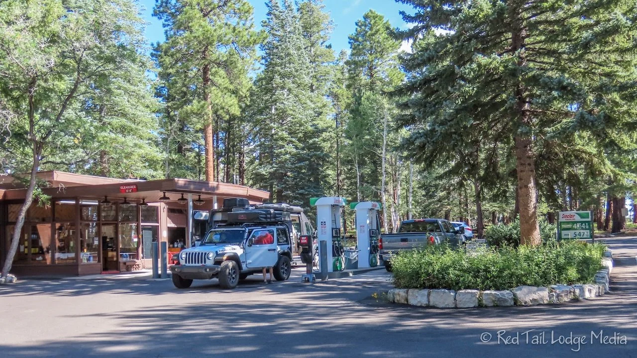
On the way out, we dumped our black and gray tanks and stopped at the gas station to fill our gas tank. The gas station at the campground had much cheaper gas than Jacob Lake Inn on our drive in. To our surprise, the campground gas station was full service. The sound of the familiar gas station “ding ding” as we pulled in brought back memories of our childhoods. We had forgotten what it was like to just sit back and let someone else take care of us. The service station employee did a wonderful job cleaning our windshield.
The North Rim of the Grand Canyon is a special place. It is not as crowded as the South Rim. The North Rim has a much slower and relaxed feel. It is a place to rejuvenate the soul and soak in the awe-inspiring views of the canyon. We’ll definitely be back so Keith can spend more time in his Happy Place.
Check out our related video: Grand Canyon North Rim in Depth
(Ann)