
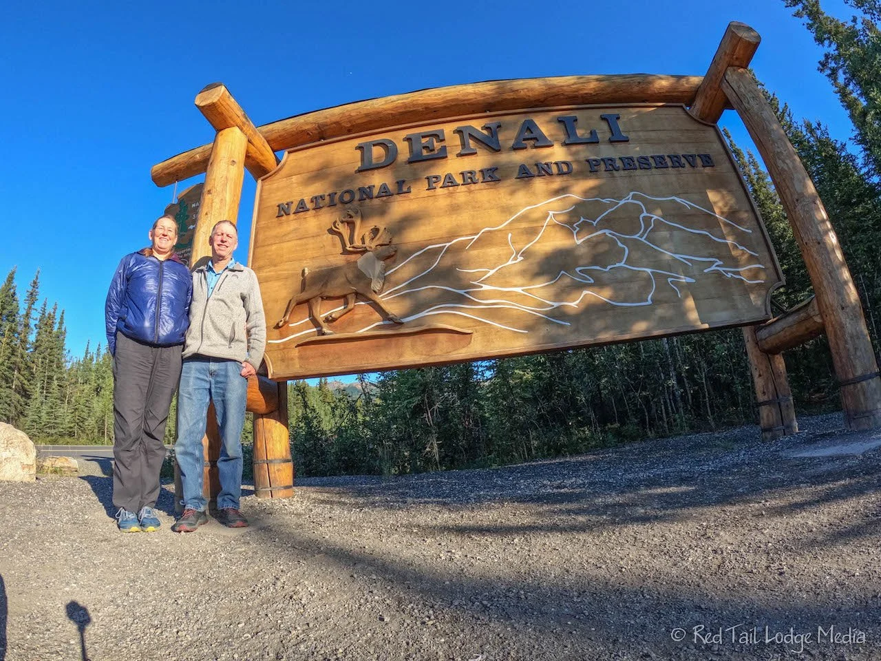
Denali National Park: Teklanika River, Alaska - August 4th to 8th, 2022
This is the second of three posts on our stay inside Denali National Park. It covers the three nights we camped in the Teklanika River Campground along with the following two nights back in the Riley Creek Campground.
Thursday was even better weather than Wednesday. When we woke up at 7 am, there was not a cloud in the sky. We packed up by 8 am and headed over to the dump station. We were moving to the Teklanika River Campground and we needed to take enough fresh water and have enough gray water capacity to last us three days. After dumping and cleaning the bugs off our windshield, we popped into the Riley Creek Mercantile, since it is right next to the dump station, and picked up a loaf of bread. OK, we’re ready to start driving the Park Road.
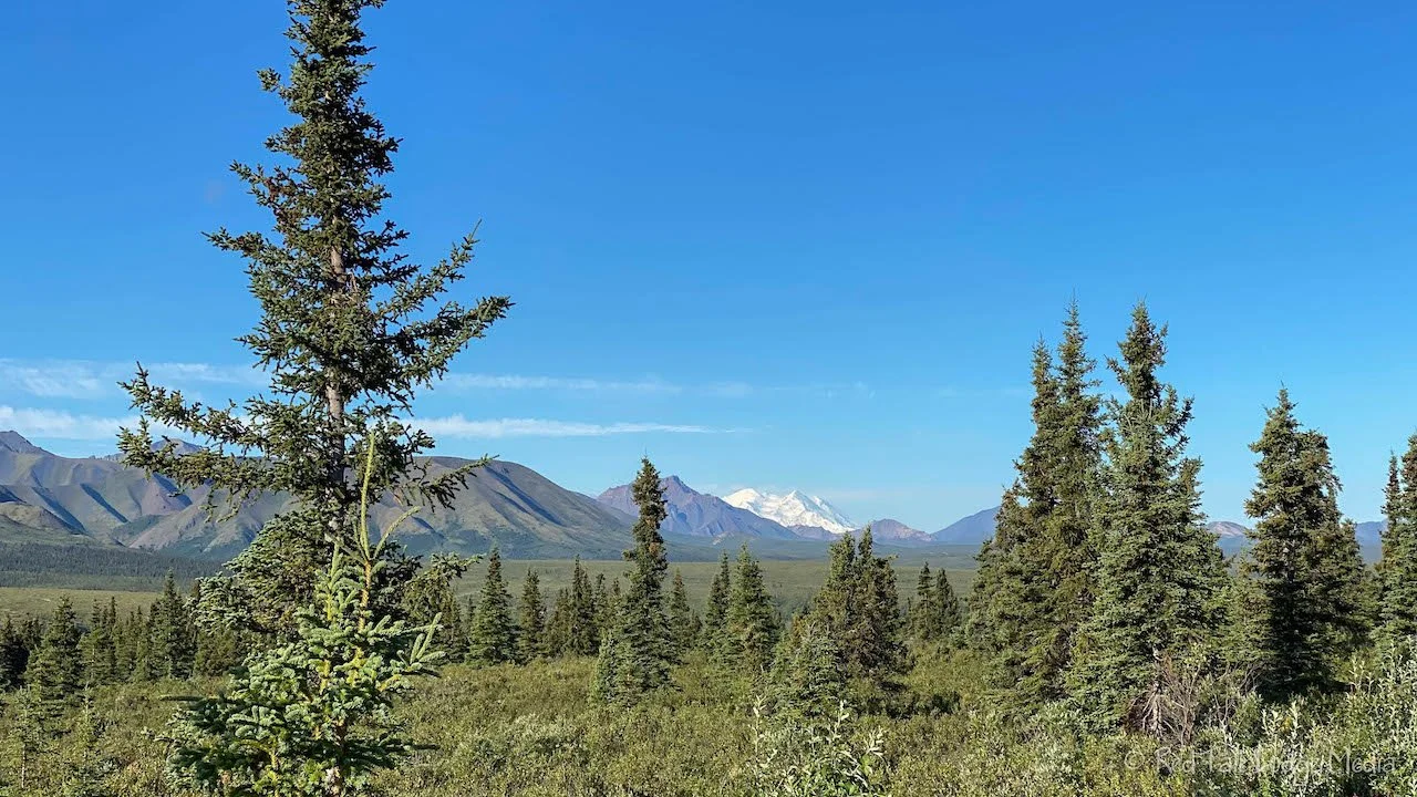
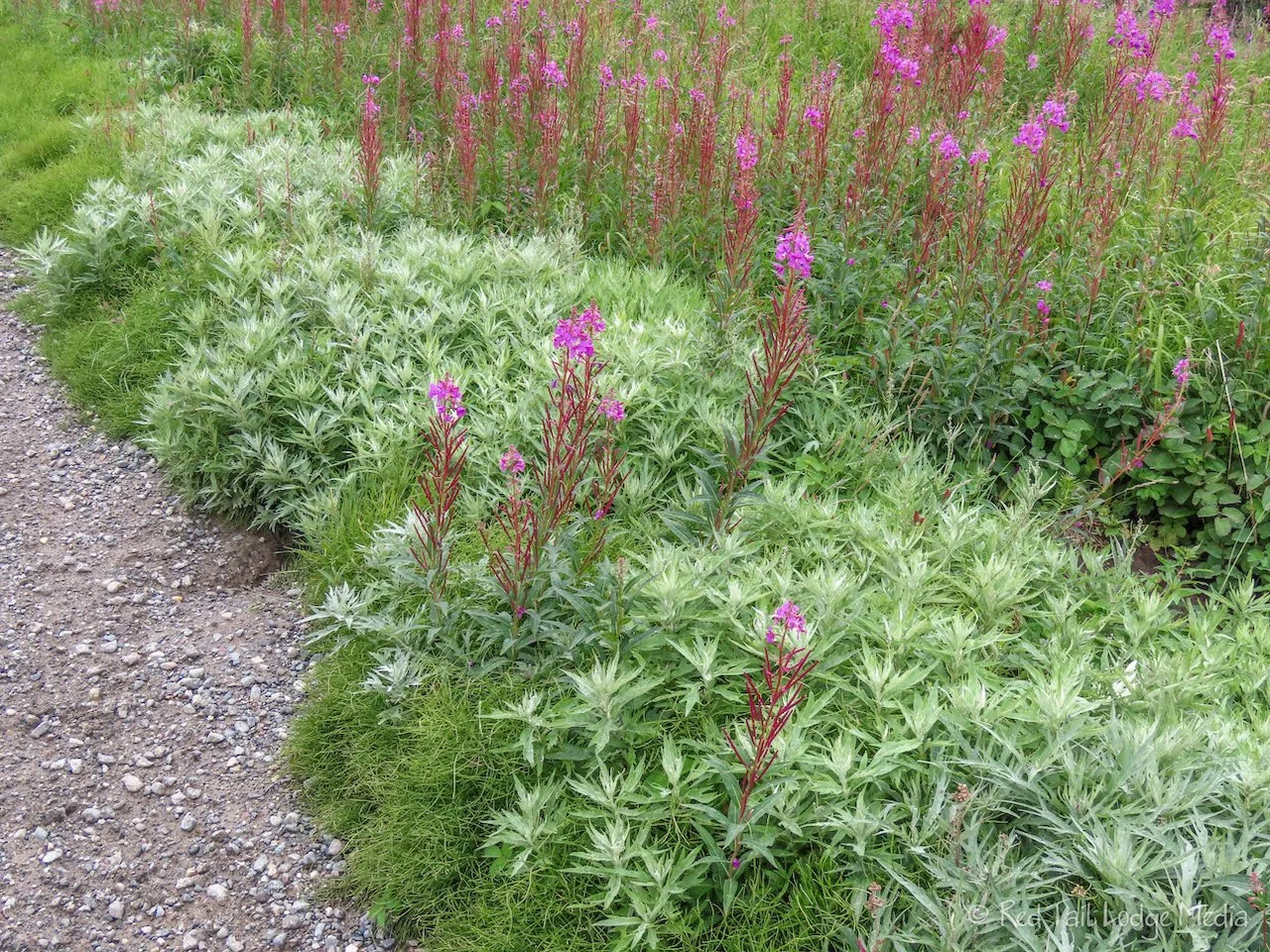
The morning light cast beautiful shadows on the mountains, giving them so much definition and interest. As we approached mile 9, we saw it. It is hard to miss. It is the only mountain peak completely covered in snow. Yes! We had a clear view of Mount Denali. We were now part of the 30% club! Well, according to our tour bus driver the day before, the 30% is for seeing any glimpse of Denali. It is more like the 10% club that sees a clear view of Denali. Yes, we feel grateful. Don’t worry, we took lots of pictures of it to share with you.

The views of Denali continued for about four miles. Of course we stopped almost at every viewpoint and sometimes in-between to get a slightly different view of the mountain. We were still quite a distance away. Keith pulled out his peak finder app when we caught the first glimpse of it and it claimed the peak was about 70 miles away.

We stopped at the Mountain Vista rest area. There was a 0.7 mile trail that we started to walk down. However, we kept going lower in elevation and the views of Denali kept getting worse as the mountains in front of Denali started cutting off more of the view. We decided to turn around and continue driving down the road.

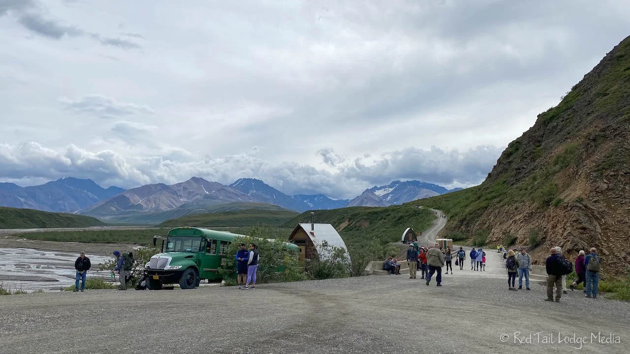
Not long after the rest area, we reached Savage River at mile 15. This is where the public access and pavement ends and the dirt/gravel road begins. There is a park gatehouse there where we had to stop and show our pass to drive out to Teklanika River Campground at mile 29. The ranger there took some time with us explaining all the rules. Buses have the right of way. If they have their flashers on, do not pass. Only pass if they have their right turn signal on. If they approach you from behind and turn on their left turn signal, find a spot to pull over and turn on your right turn signal to let the bus pass.

There is a marked sheep corridor. Do not drive through it between the top of the hour and ten minutes after. If you reach the corridor within that time, stop and wait until ten after before passing through it. This allows the sheep a ten minute window of no traffic on the road. The corridor is in an area where the sheep like to cross the road to reach a fresh water stream. Somehow, to us, ten minutes doesn’t seem like enough time. Hopefully it makes a difference.

Just like the day before, we didn’t see any wildlife until after passing Savage River. Just after the checkpoint station, we spotted a ptarmigan along the side of the road. We didn’t spot anything big this time, mainly just a few large birds soaring around. We’re not sure what types of birds they were, we’ll have to study our pictures later. However, there were more views of Denali. By this time, a couple of clouds had started to roll in.

We reached the campground at about 11:30 am. This gave us time to pick out our camp site, get set up (5 minutes), and eat lunch before our scheduled 1:10 pm East Fork Transit bus pick up time. The bus stop is at the entrance to the campground. Our bus ticket can get us on any East Fork Transit bus that has room, but we had a guaranteed spot on the 1:10 pm bus for our first ride.

As we waited for the bus, we chatted with a couple from Ohio. They told us a 66 year old relative of theirs came down with COVID even after having the vaccine and booster, then passed away one month later. We are so sorry for their loss. It makes us feel even more grateful that we had a mild case of COVID (Seward, Alaska - July 13th to 18th, 2022).

The sky was becoming increasingly cloudier as the day progressed. However, we did get one more view of Denali on our way out to the East Fork Toklat River at mile 43. From Igloo Creek Campground to Sable Pass, the road is in Igloo Canyon, so Denali is never visible from there.
While they don’t advertise the East Fork Transit bus as being narrated, our bus driver provided a nice narration. In fact, she used to be a tour bus driver. However, the narration seemed to be geared more towards the people wanting to hike in the area. So she pointed out places that people like to hike and the areas that are closed due to wildlife protection.

The bus stops at both the Teklanika Rest Area (just a few minutes after we boarded at the campground) and at the turn around point. Many people get off at East Fork and take a later bus to get back. Some people would walk the two miles along the closed road to the landslide area. Others would take stairs down to the East Fork Toklat River and walk along the river among the gravel bars. A few would take off through the tundra. In addition to port-a-potties, there was also a shelter bus that you could duck into to warm up or get out of the rain while you waited for the next bus to arrive. Since colder temperatures and rain were in the forecast for the next day, we planned on coming back to East Fork for a hike.

The protocol on the East Fork bus was similar to the tour bus the day before. If you see wildlife, yell out “stop!”, then give the heading of the wildlife sighting based on the face of a clock, such as 12 o’clock for straight in front of the bus, and 3 o’clock for straight out to the right of the bus. On the way back to the campground, Ann spotted a caribou in one of the same spots that we saw one the day before.

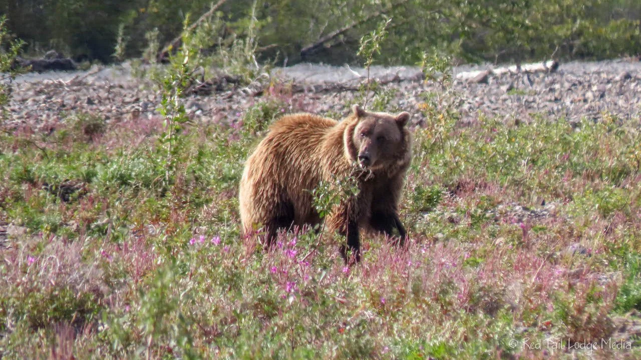
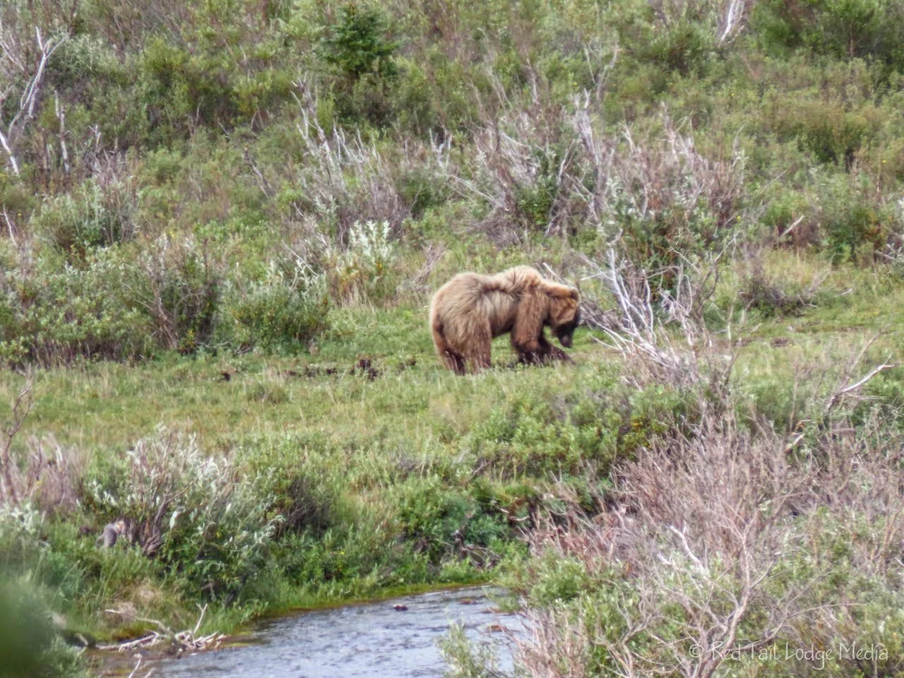
Then the person right behind us spotted a grizzly a distance below us next to a stream. Good eye! Thank you! That was our first grizzly bear sighting outside of Brooks Falls (Katmai National Park, Alaska - July 11th, 2022). Somehow this sighting seemed more legit, since you are almost guaranteed to see bears at Brooks Falls.
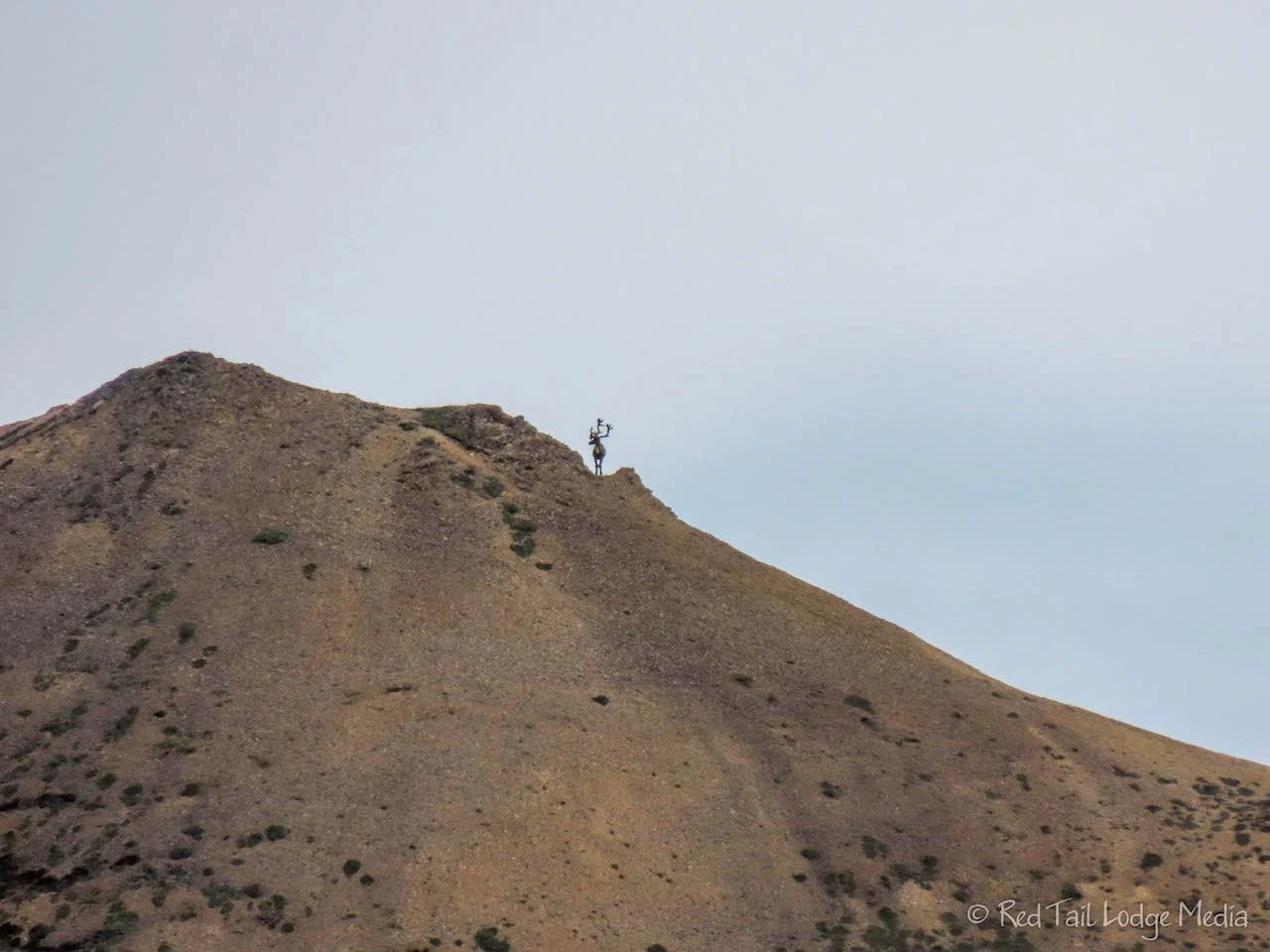
Fortunately, the bear was just before another sheep crossing corridor, so the bus was able to stay there for over ten minutes while we watched the bear follow the stream up the mountain side. While we were there, we also saw a caribou high up on the ridge line, just standing there, silhouetted against the sky.

So what are you getting for paying more money for a Tundra Wilderness Tour bus ride? The tour bus provides a little snack box, bottled water (in a reusable/recyclable aluminum bottle that you can keep), plus a little souvenir booklet. The In addition, the tour bus has better windows to take pictures from. The tour bus that we were on earlier in the week had windows that opened from the sides (Denali National Park: Riley Creek, Alaska - August 2nd to 3rd, 2022). On the other hand, the East Fork Transit buses have more traditional school bus windows that open from the top, with the metal strip of the fixed bottom window right in your line of sight. The school bus windows were also harder to open and close.
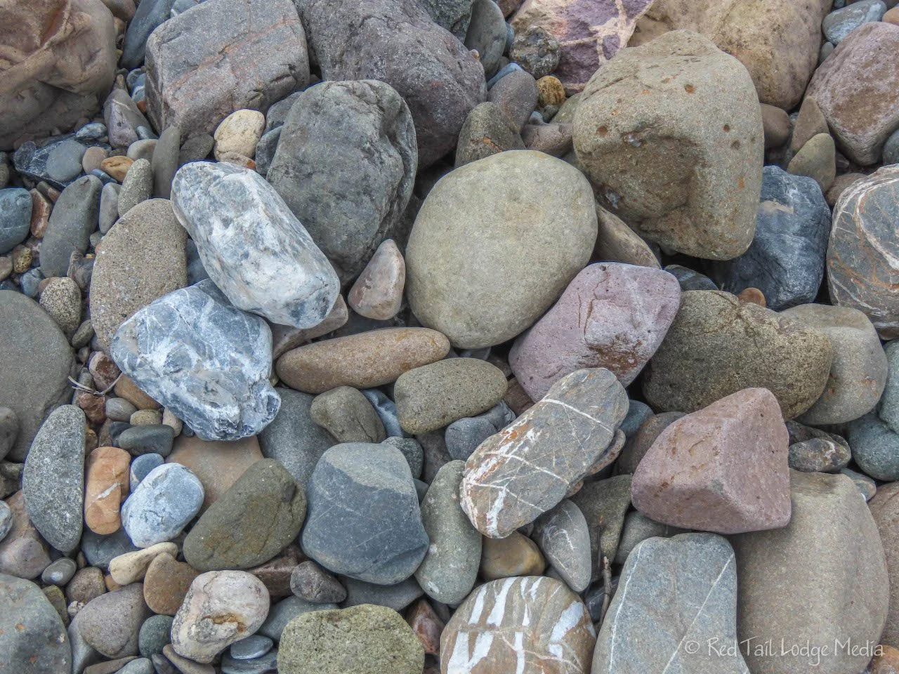
We were back at the campground by 3:30 pm. There was still time before dinner, so we walked down to the Teknalika River from our camp site. We walked out onto the gravel bars, admiring all the different colored rocks. Then we turned around and looked back towards the shore. We realized we had not noticed where we came out of the woods. It all looked the same. However, we managed to find the opening that we came from. We definitely need to pay more attention next time. This is not a place where we want to get lost, especially when we had no gear with us.

It was raining on Friday. We layered on our warm and rain layers, laced up our hiking boots, put extra layers and snacks in our daypacks and were ready for a hike in the rain. After Ann’s experience with getting water inside the view finder and the lens of her Canon Powershot during our glacier and wildlife cruise in Valdez (Valdez, Alaska - July 20th to 25th, 2022), Ann wrapped her camera in a plastic bag this time. It may not look pretty, but it should do the job.
We caught the East Fork Transit bus from the campground at 9:45 am. There were six of us at the bus stop trying to get available seats on the bus. We lucked out; there were just enough seats left, so none of us had to wait half an hour for the next bus. However, the seats were not together. Ann’s seat mate was Sabina from Dusseldorf, Germany, while Keith’s seat mate was from Scotland. We had the same bus driver as the day before, so we got to hear the same stories she told before. That’s got to get old, saying pretty much the same thing day after day.

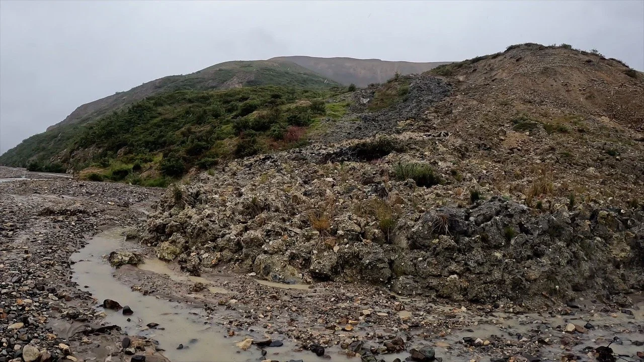
Our plan was to hike the 2.5 miles on the closed road at the East Fork Toklat River to the landslide, just to see it. Then we would hike along the riverbed until we decided we had enough. On the way to East Fork, we heard on the radio that they closed the river bed to hikers due to some bear activity. When we arrived, Ann overheard Sabina talking with her friends. They were planning on walking the road to the landslide, but her friends backed out after they found out it was 2.5 miles in the rain. Sabina still wanted to go, but she didn’t have her bear spray with her. Ann invited her to join us and she seemed delighted. When we were about to start our walk down the road, we heard they were only allowing people to go about a mile, due to two aggressive bears fighting each other. We decided to go anyway. Then, just as we started, the dispatcher comes riding by on his bike yelling the road is closed. However, the riverbed was now open. OK, change of plans again, we’ll hike the riverbed. The dispatcher warned us to be alert and watch out for the bears.

We climbed down the stairs to the river bed and started to work our way along the gravel bars and ribbons of water. It seemed like it would be easier going if we got up on the gravel bar with the willow shrubs. When we got up there, we realized that the shrubs reduced our visibility. Just after Ann said we should watch out because of the reduced visibility, she saw a grizzly bear, about 30 yards in front of us, running through the shrubs. Everyone started shouting “bear!”. There was another group of three men who were close to us. The bear ran by all of us, coming within about 20 yards of our group, then ran up the bank to the road, right next to the stairs. The bear paused for a moment at the top of the stairs, then crossed the road and starting climbing up the rocky mountain side.

Keith had his hand on his bear spray. It didn’t even occur to Ann to grab the spray, she was too busy trying to get the plastic bag untied to get to her camera, a true photographer. She managed to get a few pictures and video of the bear as it made its way up the mountain.

Well, now what do we do? The bear is back near where we came from, so we decided to continue our hike down the riverbed. However, we decided it was better to negotiate all the water than stay up among the bushes. The river bed is wide and open. Like most glacier fed rivers, the East Fork Toklat River is a braided river. The glaciers form wide, flat valleys, so the rivers flowing from the glaciers don’t have a well defined path to follow. The water forms many channels and they change all the time. We even saw water starting to flow down a new channel during our hike.

Walking along the river bed is not the most exciting hike, as the view was wide-open and the scenery did not change much. However, the variety of colorful rocks lining the river bed were interesting and you have to pay attention to chose your route through the maze of water channels, trying your best to keep your feet dry. Every now and then, we would see some crumbled pieces of coal. Our bus driver gave us some history on the building of the park road. Up to East Fork, the road crews had been using wood to cook the meals for the workers. However, at East Fork, the road was going above tree line, so wood was hard to find. Then they found a seam of coal and started using that. The coal we saw was probably carried downstream by the glacier from coal seams higher up.

It was nice having Sabina with us, having someone new to share stories with. She was in Denali as part of the Wilderness Volunteer program. Sabina was helping with trail maintenance. In exchange for her hard work, the park provided her with a place to sleep. Normally the program only provides tents, so she was excited that Denali put her up in a two-person cabin, with access to showers.
We couldn’t see the damaged road from the riverbed, but we think we went as far as the landslide. There was something that looked like a landslide flowing down to where we were. That was good enough for us. By this time, we were all soaking wet and starting to get cold, so we turned around and headed back. We covered 3.6 miles in two hours with an elevation gain of 295 feet in elevation gain. This was hike number 28 of our 52 Hike Challenge for 2022.
It was nice to go inside the shelter bus to warm up while we waited for the next available bus. However, we didn’t have to wait long. This time we got on a Camper Bus instead of an East Fork Transit bus. The Camper Bus is used to transport backpackers and tent campers into the park. It is also a green bus, but it has an area in the back to put people’s gear. There also was no narration at all on this bus. However, he did stop for us to get a look at a few caribou laying on the mountain side.

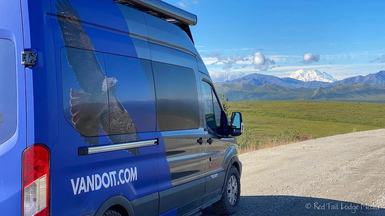
Of course, by the time we returned to our Red Tail Lodge (our camper van), the rain stopped. We changed out of all of our wet gear into dry clothes, and spread out all our wet things around the limited space we had in our van. Then we cranked up the Espar heater (unpaid link), hoping everything would dry by morning so we could go out and hike again. A hot cup of chocolate and coffee had us feeling pretty good.

By dinner time, the sun came out. We took a walk over to the Teklanika River again. This time there was another couple already there. They were quick to warn us that there was a bear on the river. He was still several hundred yards away, looking intently over at the opposite bank. As we tried to figure out what he was looking at, we spotted it, another bear along the bank. We watched them for a little while, but then the one started walking our way. Time to go!

We walked around the campground loop, back to our Red Tail Lodge. Just as we reached our van, we could hear a couple of other campers on the other side of the loop yelling “Bear!”. We got inside and looked around, out through the windows, but we didn’t see the bear. We’re guessing the one that was walking towards us along the river decided to take a stroll through the campground.

It was raining again on Friday. Luckily, our gear dried out inside our Red Tail Lodge by morning. So we put it all on again and headed out to the shuttle bus stop. We were able to get on the East Fork Transit bus at the same time as the day before, 9:45 am. However, we had a different bus driver this time. He was not as good of a narrator as yesterday’s driver, so we think we were just lucky on Friday. Saturday’s bus driver mainly kept his talk to rules and hiker safety, with just a couple of tidbits of history thrown in. We also noticed that not all the tan buses (Tundra Wilderness Tour buses) had the nicer windows. Quite a few of them had the same school bus windows as the East Fork Transit buses. In our experiences so far, the extra money for the tour is for a guaranteed good narrator and the nice camera projected on the monitors for wildlife sightings. Yes, we don’t like paying money to get out into the wilderness just so we can see wildlife on a monitor, but it helped to know where to look for it with our own eyes and binoculars because you are normally far away from the animal, the views are expansive, and the animals like to blend into the scenery. Having the monitor as a guide is a lot faster than the people around explaining where to look. Do you see that one large green area? Then look up to the left of that, about half way up the slope. No, not that green area, the one to the right of that pointy rock outcropping. Do you see it now?

We had the bus driver drop us off at the Igloo Campground. From there we headed west bound on the road. It starts out in the Igloo Forest, but quickly enters Igloo Canyon. Instead of trees alongside the road, bushes appeared next to Igloo Creek. It looked like prime moose habitat, but we didn’t see any. Visibility was not good through the shrubs. We knew there had to be some moose nearby, as we saw quite a few fresh moose tracks along the road shoulder.

Every now and then we would stop along the road and Keith would pull out his binoculars, scanning the rocky mountain peaks around us for Dall sheep. We actually spotted a group of five! They were far enough away that they only looked like white spots with the naked eye, but Keith could see them with the binoculars and Ann could also, with her camera zoomed all the way in.

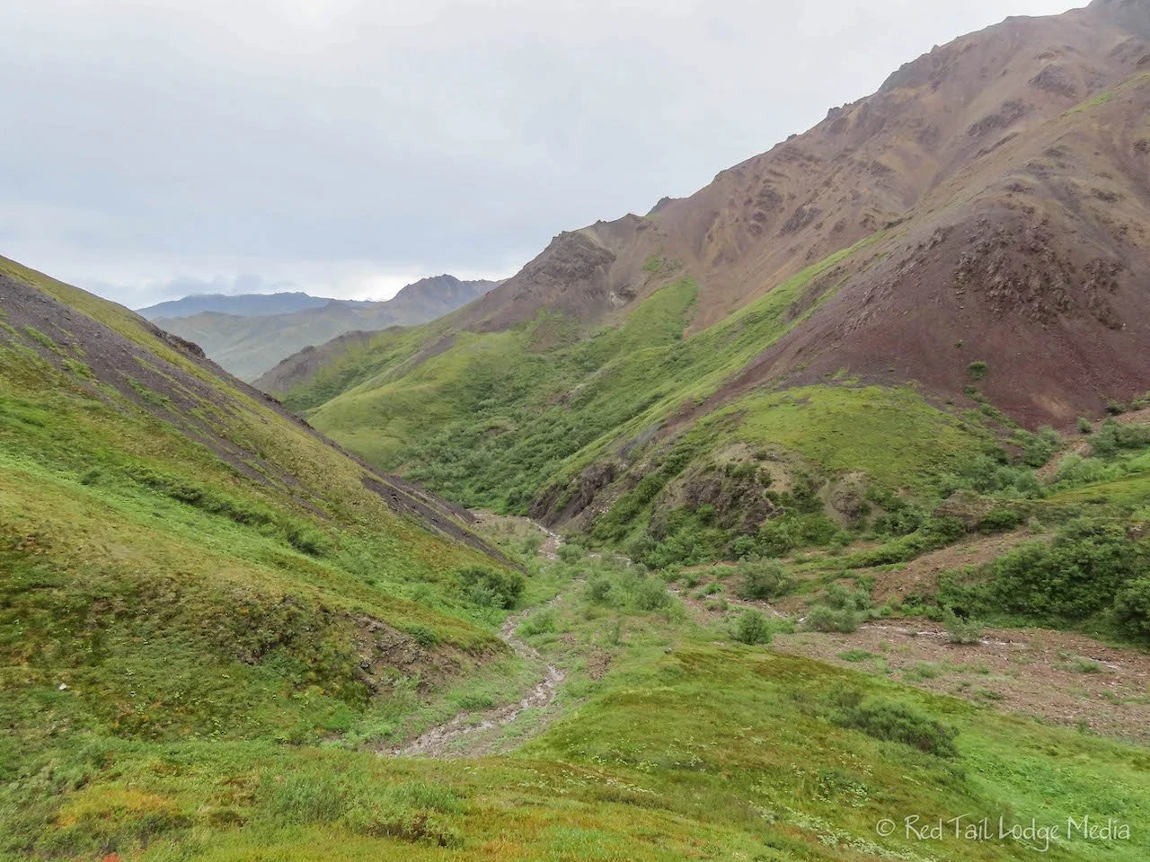
Less than two miles from Igloo Campground, there is a creek that went up from the road to the left. We had spotted it during our bus rides the previous two days. It looked like it would be easy to navigate and would take us up into the mountains, winding behind the peaks, out of sight of the road. We followed the creek for about a mile, crossing back and forth across the water. The creek was small enough that we could easily cross it in most places without getting our feet wet. Even in the rain, it was a very pretty view.

After seeing so many grizzly bears the past few days, we got in the habit of calling out “Hey bear!” on a fairly frequent interval. We were also constantly scanning the shrubbery around us for movement. About half a mile up the creek, we saw two caribou relaxing on a ridge above us.
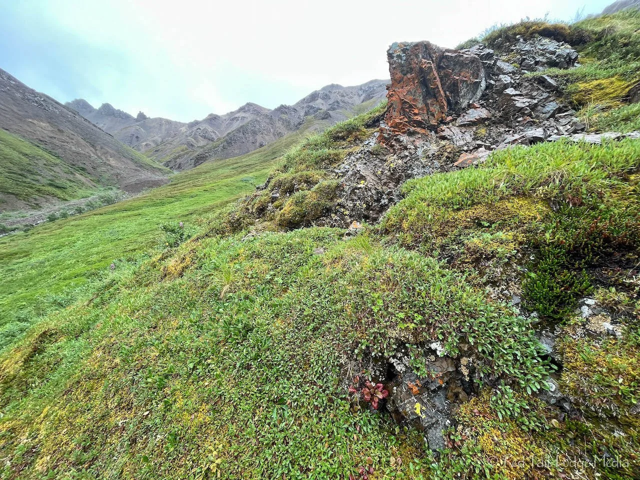
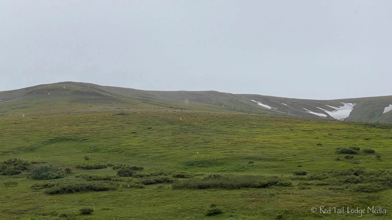
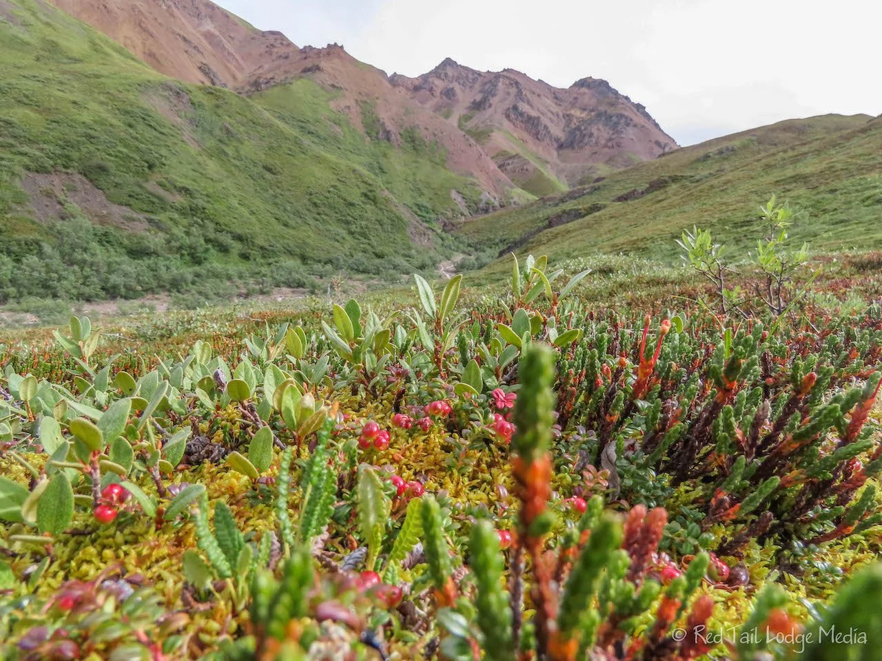
About a mile in, the creek had two tributaries coming in, one from each side. We had reached tundra. There was a little rock outcropping up among the tundra that looked like a good snack stop. We left the creek bed and walked up on the tundra. We didn’t realize we had never really walked on tundra before. We’ve been up among the alpine tundra, especially in Rocky Mountain National Park, but we were always walking on a trail. Most places discourage people from walking on the tundra, because the plants are so slow growing and take decades to recover if damaged. However, because Denali is such a large park and does not get many visitors deep in the park, they actual encourage you to walk on the tundra, creating your own path. There are not many hiking trails in the park. You are expected to go off-trail. However, they do recommend groups of hikers to fan out and not walk over the same ground to minimize damage.

Walking on tundra was like walking on a spongy carpet. The tundra mat seemed thick and you would sink down several inches with each step, sometimes farther. You couldn’t see the rocks or ground underneath. Every now and then, our hiking poles would sink down almost a foot. We’re guessing there are holes in the rocks beneath the tundra. The thought crossed our minds that we might fall into a hole, but, thankfully, that never happened. We’re not even sure that was possible, but it sure seemed like it.

Ann was intrigued by the wide variety of plants and fungus in the carpet. There were all kinds of colors and textures. Some plants had berries and others had flowers. Some just had leaves. The only thing they all seemed to have in common was that they were low to the ground.

The rock outcropping was rather pointy and jaggy, not good for sitting on. So we spread out our small tarp on the tundra to sit on. It was the best seat we’ve ever had on a hike, nice and cushiony. From a perch, we had a great view of the peaks that surround the small valley we were in. By the time we sat down, the rain had stopped.
It was so peaceful. We had not seen another soul since we left the park road. Then we heard a little chirp coming from the mountain face in front of us. Pulling out our binoculars, Keith found the source, an arctic ground squirrel. OK, we were not quite alone.

After our snack, we started heading back down the creek. There was an interesting tundra area that Keith wanted to check out. His goal for the day was to find some ptarmigan. We climbed up the bank of the creek to the green tundra. No sooner had we reached the tundra, we realized that there was a small colony of arctic ground squirrels. We sat down and watched them for a little while. The sun had come out by this time, so we didn’t mind lingering.

Across the tundra was a row of small trees. We walked over to check them out. They were lining a dry wash that led back down to the creek. We remembered passing it on the way up. So we followed the wash down to the creek.

On our way, we spotted one, a ptarmigan. It was just ahead of us in the middle of the wash. We stopped for a while, waiting to see if it would go on its way. However, it just stood there, perfectly still. Its best defense is camouflage. We could hear another ptarmigan, perhaps calling it or trying to lead us away from the one we saw. We decided to go around the ptarmigan on the far side of the wash. Then we realized the second ptarmigan was just a few feet from us on the bank. Well, we might as well just keep going. Then a third ptarmigan bolted as Ann was within one or two feet of it, almost stepping on it because she did not see it at all until it moved. Wow, that is incredible camouflage!
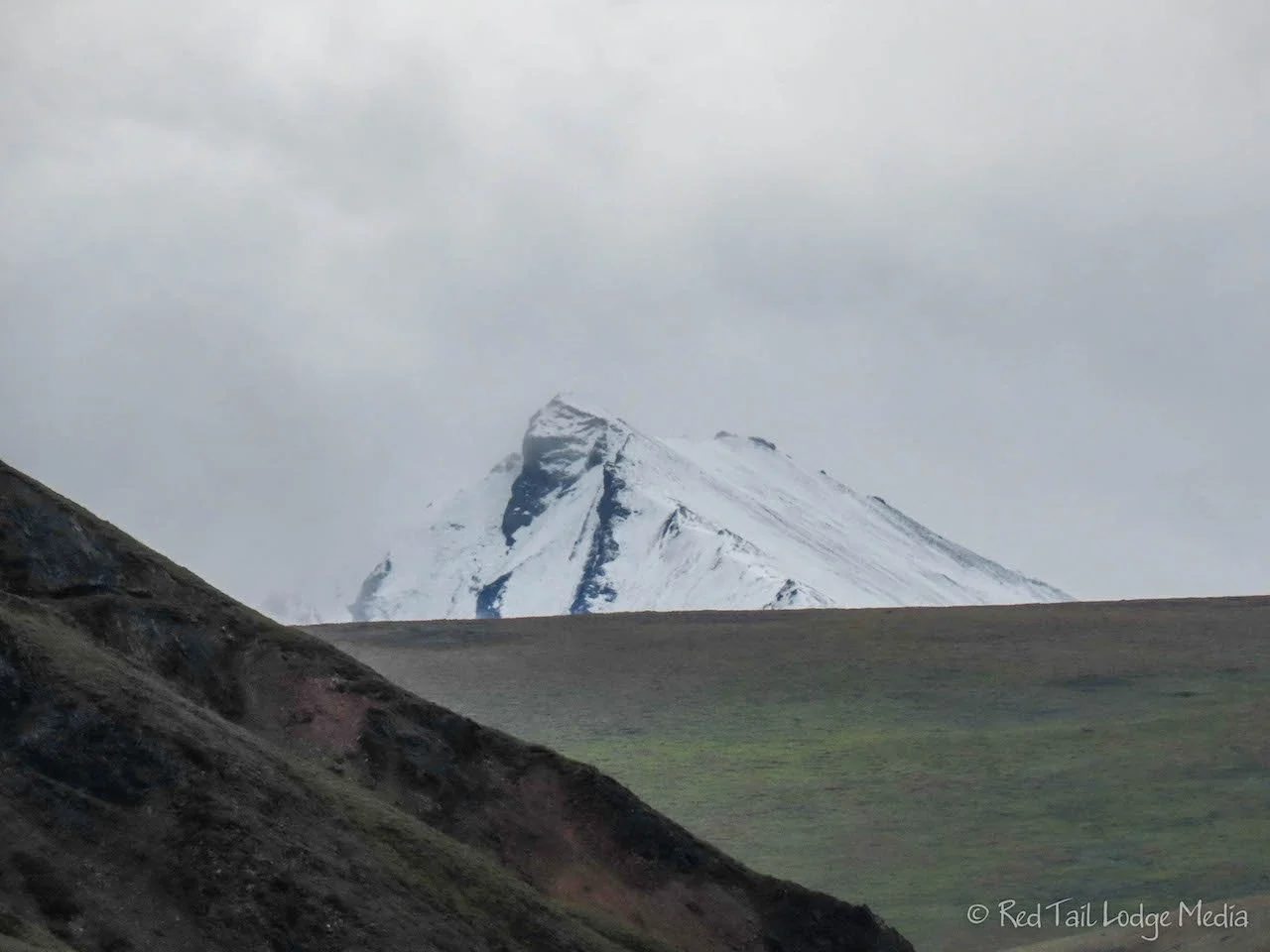
When we returned to the road, we saw the very peak of a snow-capped mountain. Quick! Take a picture while you can! And just like that, the clouds rolled in and it started raining again. Initially we thought the snowy peak was Denali, but, after looking at the picture, we’re pretty sure it was not Denali.
We continued walking down the park road through the rest of Igloo Canyon. It rained on us most of the way. Again we were in prime moose habitat, but again, all we saw were moose tracks. After about another two miles of road walking, we reached Tattler Creek. We decided to stop there and wait for a bus.

Just about at the same time, a man emerged from Tattler Creek. He had just hiked along the creek and climbed Sable Mountain. He was the man from Scotland who was Keith’s seat mate on the bus the day before. We chatted with each other while we waited for a bus. It turns out that he was at the top of the stairs the day before when the bear ran up beside them. He said they looked at each other for a moment, then the bear crossed the road and started climbing up the mountain. And we thought we had a close encounter with the bear! Wow!
Our walk/hike for the day was 5.7 miles with an elevation gain of 1188 feet in three hours and ten minutes. We counted it as hike 29 of our 52 Hike Challenge for 2022.
We got back to the campground in time to make dinner. Our clothing and gear was not quite as soaked as it was the day before, but we still had it strewn about our Red Tail Lodge to dry by morning.

Sunday, we moved campgrounds again, from Teklanika River Campground back to Riley Creek Campground. We decided to hike the Savage Alpine Trail on the way. Originally, we were planning to do the hike while we were staying in Savage River Campground, but the weather looked like it was going to turn cold and rainy on Monday.
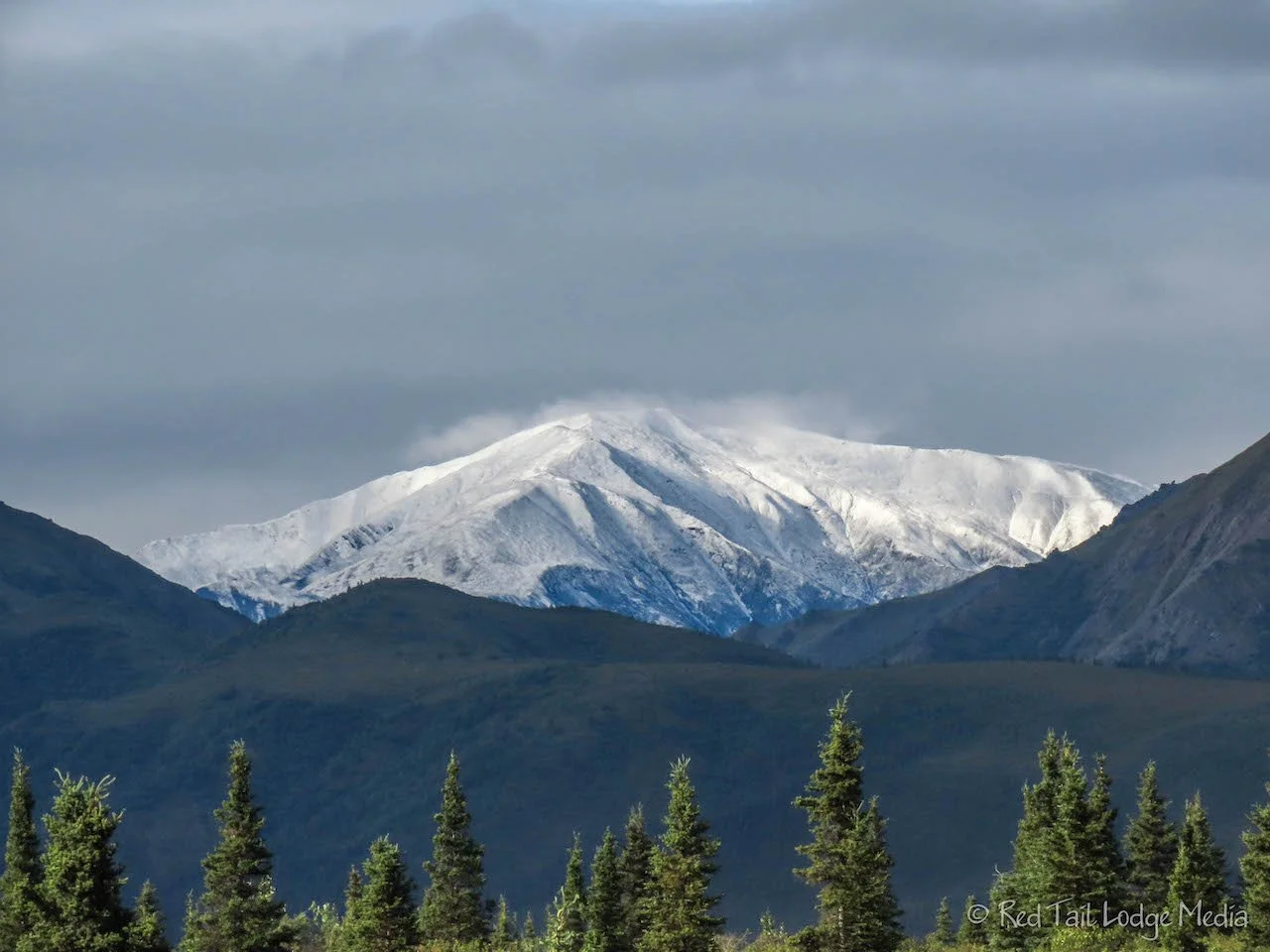
As we pulled onto the Park Road, we noticed that quite a few mountain peaks around us had a fresh dusting of snow from the night before. Peaks, that didn’t have snow the day before, looked like they had been dusted with powdered sugar. The sun was out in the morning, but clouds rolled in as the day progressed.

The Savage Alpine Trail is a point-to-point trail. One end is at the Savage River Trailhead. The other end is at the Mountain Vista Rest Area. Many people start at the rest area, then take the Savage River shuttle bus back. That direction means slightly less elevation gain, with the ascent more gradual than the descent. However, we like to climb up the steepest part of the trail instead of down, putting less stress on our knees and hips. So we parked at Mountain Vista Rest Area and took the shuttle over to the Savage River Trailhead.
On the shuttle ride there, we stopped for a grizzly bear sighting. He was out on the river bed, digging up something out of the ground to eat. There was quite a traffic jam there, since this was still the public access portion of the road. When we reached the trailhead, the rangers there were asking the bus driver for a report on how close the bear was. They were keeping an eye on him to make sure everyone stayed a safe distance away.

The Savage Alpine Trail definitely starts out steep. It is mostly stone steps, weaving among some interesting rock formations. It wasn’t until we reached the first ridge line when the strong winds hit us. We were no longer protected by the mountain side and the winds were flowing from the valley, across the trail, and up the Savage River Canyon. In one area, we noticed the people hiking towards us were leaning sideways into the wind. If the wind would have stopped for some reason, they would fall over sideways. Sometimes our trekking poles would plant into the ground about a foot to the side of where we intended to put them down. The wind was blowing them off course. We not good judges of wind speed, but we’re guessing the wind was somewhere between 30 and 50 mph.

The rocky ridge line looked like prime habitat for marmot and pika, but we did not see any. But we saw quite a few arctic ground squirrels. It was amazing to us that there was an abundance of wild flowers, despite the harsh conditions, being whipped around by the wind.

After walking along a rocky ridge line, the trail traversed around a bowl beneath the mountain peaks. There was a little better protection from the wind there. There were panoramic views of the wide valley below us, but Denali stayed out of view in the clouds. At the other side of the bowl, the trail goes back onto another ridge line and back into the full blast of the wind. Although we were getting rather warm and sweaty on our climb up, the wind, which felt good at first as it cooled us down and dried us out, started to get cold as we could feel it sucking the heat away from us.

Once we dropped down below the ridge line on the other side, the wind started to calm down. A few sets of switchbacks gradually led us back down into low shrubbery, then into trees. As we were coming down, we passed another couple going up, the same ones who were at the Teklanika River Campground who watched the grizzlies with us next to the river. They told us they saw a family of ptarmigan further down the trail, where it follows alongside the creek. When we got there, we looked pretty carefully, knowing that ptarmigan are pretty well camouflaged. However, we could not find them. They either must have moved on, or we just failed to see them.

By the time we returned to Mountain Vista Rest Area, where our Red Tail Lodge was parked, we had gone 4.6 miles with an elevation gain of 1624 feet in two hours and 49 minutes. This was hike number 30 of our 52 Hike Challenge for 2022 and hike 29 of our National Park Series.

It was only a half an hour drive from Mountain Vista Rest Area to Riley Creek Campground. We stopped at the dump station to empty and fill our tanks, then went to pick out our camp site for the next two nights. We ended up at a site next to the one we had before. After making dinner, we spent the evening getting caught up on social media, emails, and watching our favorite YouTube channels. We did not have any cell service for the three days we were at Teklanika River Campground, so we were a little behind.
As Ann was off-loading all the photo and video footage for the day, she realized that she goofed a few days before and missed copying some of the photos and video from her camera. The file numbers had flipped, so a new subfolder was created. She absentmindedly only copied the files from the newest subfolder and didn’t check the previous subfolder. Then she erased the SD card. She downloaded file recovery software and tried to recover the deleted files. There were 169 photos and two videos. But the software could only recover about four of the photos. She could have spent more time and tried different software, but chances were that the data had been overwritten so she gave up. The photos were from our drive out to Teklanika River Campground when Denali was in full view. So many of the pictures of Denali were lost. However, we had pictures from Keith’s camera and video from the GoPro and some of the later pictures of Denali taken past Savage River after the numbers rolled over. Still, Ann was a little bummed to say the least.

Monday was a chill day. Literally, it was chilly and it rained most of the day. The first item on the agenda for the day was to go to the visitor center to see if we could sign up for the Wednesday Discovery Hike. The visitor center opened at 8 am and we arrived before 8:30 am. We were the first ones on the list. Another group of people was right behind us, signing up as well. There is room for only 11 people on the Discovery Hike and you must sign up in person two days in advance.

The ranger spent about 15 minutes with us going over the details and making sure we had adequate gear. The hike for Wednesday was rated as a moderate hike, going about two miles up Sanctuary Canyon. There would be high brush, boggy areas, and a river crossing, up to knee deep water. Luckily the weather forecast for Wednesday looked decent, with a low chance of rain. The high for the day was forecasted as 62 degrees, but that was at the park entrance. Sanctuary Canyon is at a higher elevation, but we didn’t know by how much. And that was the high. The temperatures in the morning would be starting out at about 40 degrees when we start the hike, again, that’s at the park entrance. That’s a little chillier than we would have liked for a river crossing, but we were ready for an adventure. We just need to pack a lot of warm layers, extra socks, and foot warmers for Ann’s sensitive toes.
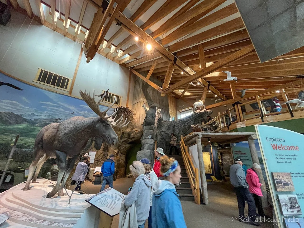
After signing up, we had to then drive over to the bus depot to purchase the bus ticket for the ride to the start of the hike. Thankfully Keith spoke up that we would be camping at Savage River Campground starting Tuesday night, so we arranged for the bus to pick us up at Savage River instead of us traveling back to the bus depot. The bus departs the depot at 7:45 am and should be at Savage Campground by 8:30 am. That allows us to sleep in almost an hour later or more, saving us more than two hours of travel time for the day. Yay! The rest of the day was spent getting chores done. We drove to Healy to pick up groceries and top off our gas tank. Then we headed over to the Riley Creek Mercantile for laundry and showers. In the afternoon, we drove back to the visitor center to watch the two park movies and browse the interpretative displays. A great way to spend a cold rainy day.
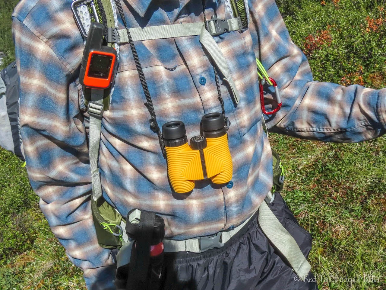
Keith’s binoculars had gotten water inside the lenses, causing them to fog up and be useless, so he went into the gift shop while we were at the visitor center and bought another pair. Buying them at the gift shop, we thought we would have overpaid for them. But we paid the same price as they are listed on Amazon and the company’s website (Nocs Provisions Standard Issue 8x25 Waterproof Binoculars - paid link). He is happy with them. They are not as powerful as the ones he had, but they are smaller, lighter, and, most importantly, waterproof.

Over the past five days, we had gone on three wonderful hikes along with some close encounters with grizzly bears, and some wonderful views of Denali. We were looking forward to more adventures within the park, especially the Discovery Hike. Next up was camping in Savage River Campground.
Check out our related video: Denali National Park: Teklanika River, Alaska
(Ann)