
Blue Ridge Parkway, Virginia & North Carolina - October 23rd to November 2nd, 2021
Where the Skyline Drive ends, in the south of Shenandoah National Park, the Blue Ridge Parkway begins. Both Skyline Drive and the Blue Ridge Parkway wind along the ridge of the Blue Ridge Mountains, part of the Appalachian Mountains, with beautiful overlooks along the way. Despite their similarities, the two parks have two distinct feels. The emphasis of Shenandoah National Park is the natural beauty and the numerous hiking trails throughout the park. The main focus of the Blue Ridge Parkway is the local history and culture of the Appalachian way of life.
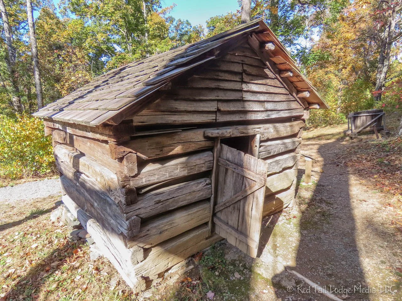
Upon entering the Blue Ridge Parkway National Park from the north on Saturday from Shenandoah National Park, we stopped at the Humpback Rocks Visitor Center. At the visitor center is a group of 1890’s farm buildings. The information signs describing the buildings are a little worn and faded and could use some updating, but the buildings were a good representation of farm life in the mountains from the time period.
The only other stop we made along our scenic drive for the day was at Whetstone Ridge. There wasn’t much to see there, but it wasn’t a bad spot to eat our lunch. There were a couple of picnic tables and restrooms. What more do you need?
At Roanoke, we hopped off the Blue Ridge Parkway to visit friends who live on Smith Mountain Lake. We covered Smith Mountain Lake in our previous post (Smith Mountain Lake, Virginia - October 24th, 2021).

Originally we planned on hiking McAffee Knob Trail with our friends on Monday, but we needed to run a personal errand in Redmond, Virginia (some paperwork required a medallion guaranteed signature). It was a three hour drive to Redmond and a three and a half hour drive to get back to our destination for the day, Rocky Knob Campground on the Blue Ridge Parkway. Even though we left a little after 8 am, we didn’t reach the campground until 6 pm.

It was pouring down rain when we reached Rocky Knob. Thankfully, they had plenty of camp sites left. We were a little concerned because the campground stopped taking reservations for this time of year. It was the start of their off-season, but due to the increase number of people camping this year, we were not sure if they would still have spots left in the evening. It was a weekday. The weekend may be a different story.
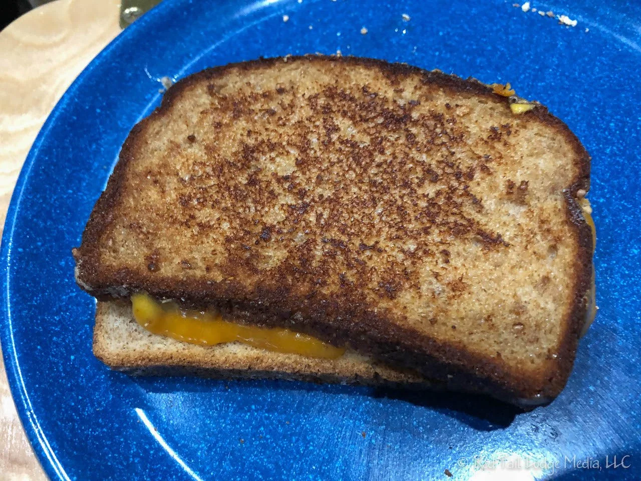
Unfortunately, all the meals Right Buddy (RB) planned for the week required at least some cooking on the butane stove outside. However, it was pouring down rain and the forecast predicted it would not let up until about 9 or 10 pm that night. We didn’t want to wait that long for dinner, so we tried something new. Dinner was tomato soup and grilled cheese sandwiches. After making the soup in the Instant Pot (paid link), RB rinsed out the pot and grilled the sandwiches in the bottom of the Instant Pot on the sautée setting. The cheese seemed to take longer to melt, but otherwise the sandwiches turned out pretty well. RB was a little concerned how hard it was going to be to flip the sandwiches in such a deep pot, but she managed using the same spatula that she would have used with a skillet on the stove.
The rain stopped by Tuesday morning. However, the winds picked up. They were 20 mph with gusts up to 50 mph. Even though the temperatures were in the 40’s, it felt colder. We decided to skip the McAffee Knob hike. We were tired from all the driving the day before and the weather was not helping with our motivation for a long hike. It’s amazing how tired you feel from driving and riding in a car all day. We’ll save the McAffee Knob Trail for a future visit.

Instead, we drove north along the parkway. Since it was raining the day before and we already had a long drive, we came back on the Blue Ridge Parkway from Route 8 through Floyd. Now, as we headed north on the parkway, we stopped at most of the overlooks to see what we had missed the day before. We stopped at the Smart View picnic area for a picnic and bathroom break. The Trail Cabin is also located at Smart View. The cabin was built in the 1890’s by the Trail family.
We were forced to turn around at Adney Gap near mile marker 137 because the parkway was closed due to construction. They did have a detour route set up that brings you back to the parkway at mile 114 on the other side of Roanoke. We chose to turn around and head back south.

At mile 160, we hopped off the parkway and drove down into Floyd. We needed to get gas and it was time for ice cream. Floyd met both of those needs. It is a cute little town with shops lining their Main Street and Locust Street. For ice cream, we went to the Soda Fountain at Floyd’s Country Store. Left Buddy (LB) had the Orange Blossom Special which was an ice cream soda with Mandarin orange soda and vanilla ice cream. RB had her usual waffle cone with mint chocolate chip and chocolate ice cream.
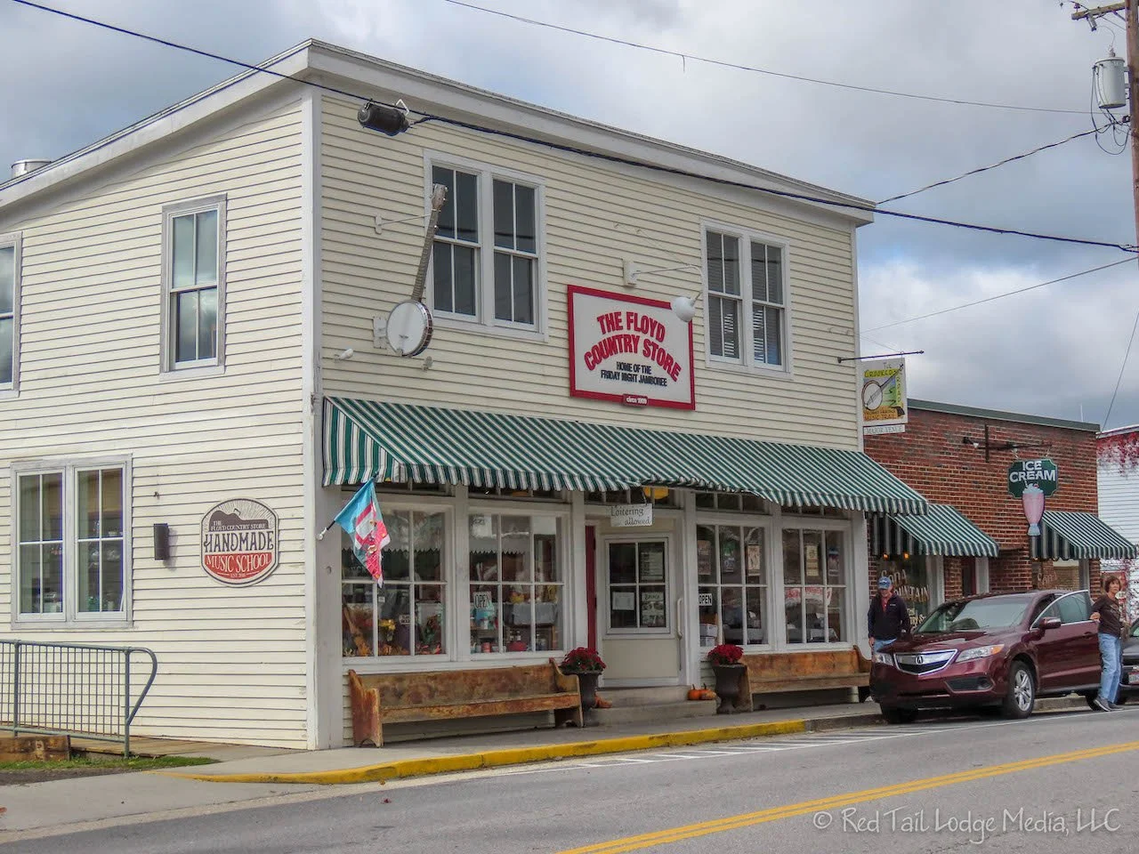
Floyd’s Country Store looked like a great place to visit on the weekend. They host live music and dances on the weekends, usually local heritage music. The Floyd Radio Show is a monthly show of radio plays, comedy bits, jingles, and music. In addition to the live audience, the radio show is broadcast as a podcast.
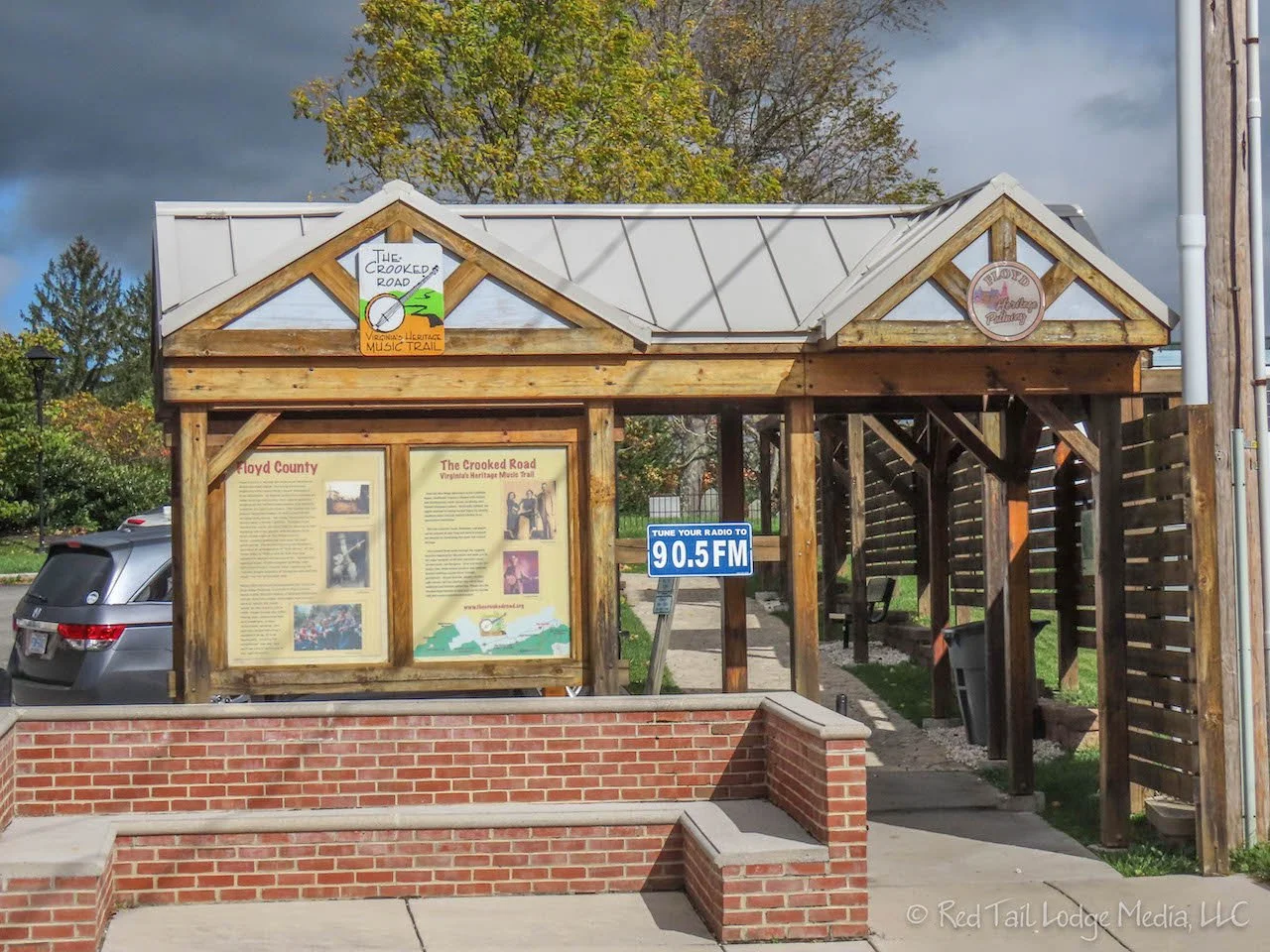
The Floyd Country Store is part of the Crooked Road, Virginia’s Heritage Music Trail. The trail includes many music venues and wayside exhibits that celebrate heritage music, such as old time mountain music, bluegrass, and gospel. The Blue Ridge Music Center on the Blue Ridge Parkway is also a part of the Crooked Road. We should be visiting the Blue Ridge Music Center on Wednesday.

On the way back to our van after our ice cream, we stopped at the Cocoa Mia chocolate shop. A hot chocolate to warm us up after our ice cream seemed like the perfect idea. The hot chocolate was wonderful. It was smooth, rich, creamy, and delicious, the kind of hot chocolate you would expect from a good chocolate shop. It is definitely way above the Swiss Miss mix we have back in the van!
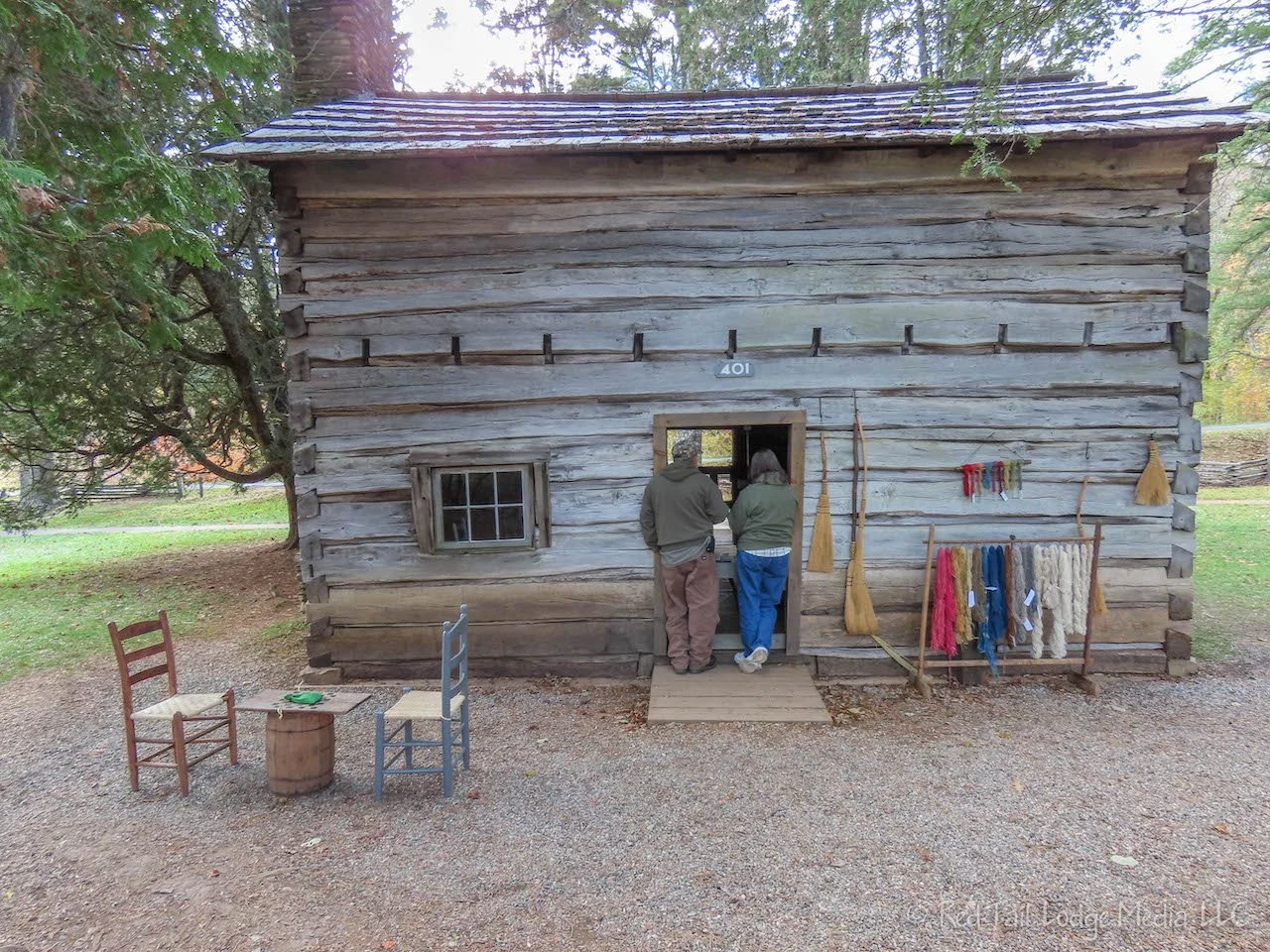
Back on the Blue Ridge Parkway, we visited the Mabry Mill. Besides the restored mill, there are quite a few other buildings and farm implements on display. This farm exhibit is much better than the one back at the Humpback Rocks Visitor Center we visited the previous week. In one of the buildings, a person was working on a loom. There was a display of different colored yarns along with tags indicating how the colors were created. We were surprised of the variety and brightness of the colors they were able to achieve.

Not wanting to hike or walk much in the cold, high winds, we called it a day and headed back to the campground. Dinner was leftover tomato soup and grilled cheese made in the Instant Pot again. It was comforting food for a cold day.

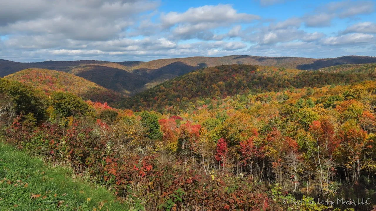
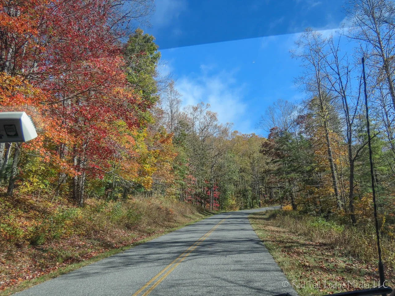
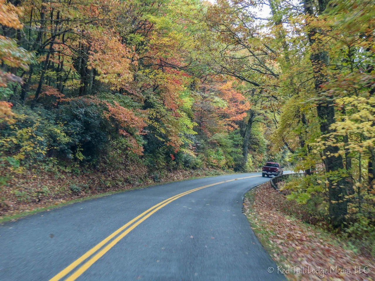
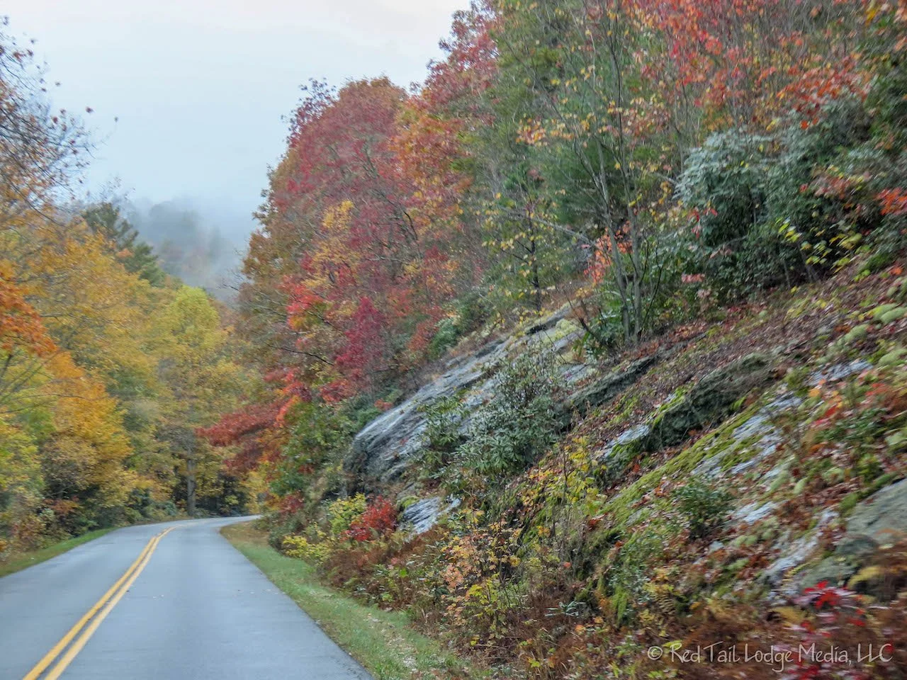
The sun was out and the winds calmed down on Wednesday. We drove from Rocky Knob Campground to Julian Price Campground. It’s only about 130 miles, but that is 130 miles on the parkway, not an interstate, so it pretty much took us all day. Along the way, we stopped at overlooks every now and then. It seemed like many of the trees were close to their peak autumn colors. We made a few other quick stops as well.

At Round Meadow Overlook, there was a 20 minute loop trail that we walked in ten minutes. It wasn’t much of a walk. We were hoping it led to an overlook, but it went down to the stream and under the parkway bridge. It was a nice little walk, but not what we were expecting. It seems like all the pull-offs along the parkway are called overlooks, whether there is a view out over something or not.
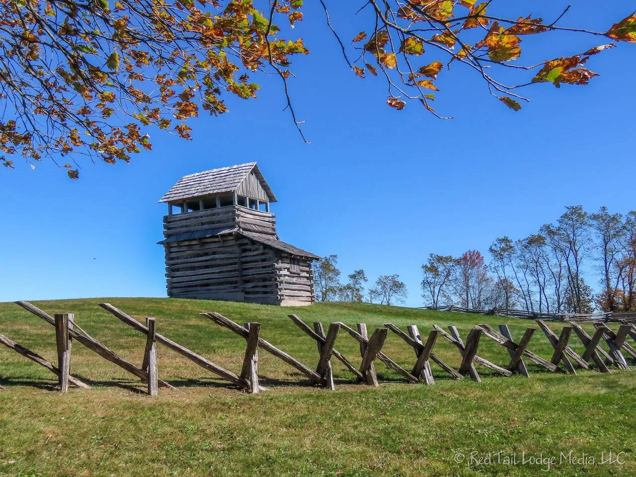
We stopped at the Groundhog Mountain Picnic Area hoping to find a bathroom. There was a restroom building there, but the doors were locked. RB talked to a ranger who had pulled up in her truck. She said the toilets were closed because there was no electricity. The next restrooms heading south on the parkway would be at the Blue Ridge Music Center. She didn’t say why there was no electricity. There was also a log tower in the picnic area. We climbed up it for a nice view and a cold wind.

Another quick stop was Puckett Cabin. The log cabin is where Aunt Orelena Hawks Puckett lived later in her life. She became a midwife when she was in her fifties, delivering 1000 babies before passing away in 1939 at the ripe old age of 102. Ironically, none of her own 24 children lived past infancy.

Brinegar Cabin was yet another quick stop. The cabin was part of a 125 acre farm purchased by the Brinegar family in 1876. The cabin that is still standing was one that Martin Brinegar built some time after purchasing the farm.

Our main stop for the day was at the Blue Ridge Music Center. After eating our lunch in the van, we headed over to listen to the live music playing outside in the the breezeway of the building. There is live music at the center every day from noon to 4 pm. Today, Bill and Maggie Anderson were performing. They play string instruments and sing local traditional music. Bill made the guitar he was playing and the Dobro that Maggie was playing. They play at the music center every Wednesday. Other volunteers play the other days of the week. Bill said they have been playing at the music center ever since the center started having daily live performances, about 12 years ago. We bought a couple of their CD’s, so we will be listening to their music as we drive the rest of the Blue Ridge Parkway.

After listening to Bill and Maggie play a few songs, we went inside the Music Center. Inside is an exhibit hall displaying the history and roots of American music, such as the origins of the banjo. We are not big museum fans, so we didn’t stay very long, but a few displays piqued our interest.

We arrived at the Julian Price Campground just before dinner time. We had no problem finding an open camp site. The campground closes for the season in a couple of days, at the end of the month. Sometimes we feel like we are chasing down the end of the camping season as we head south.
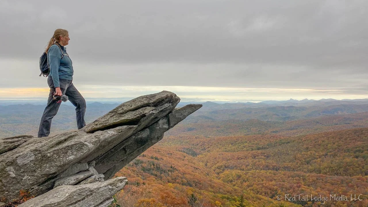
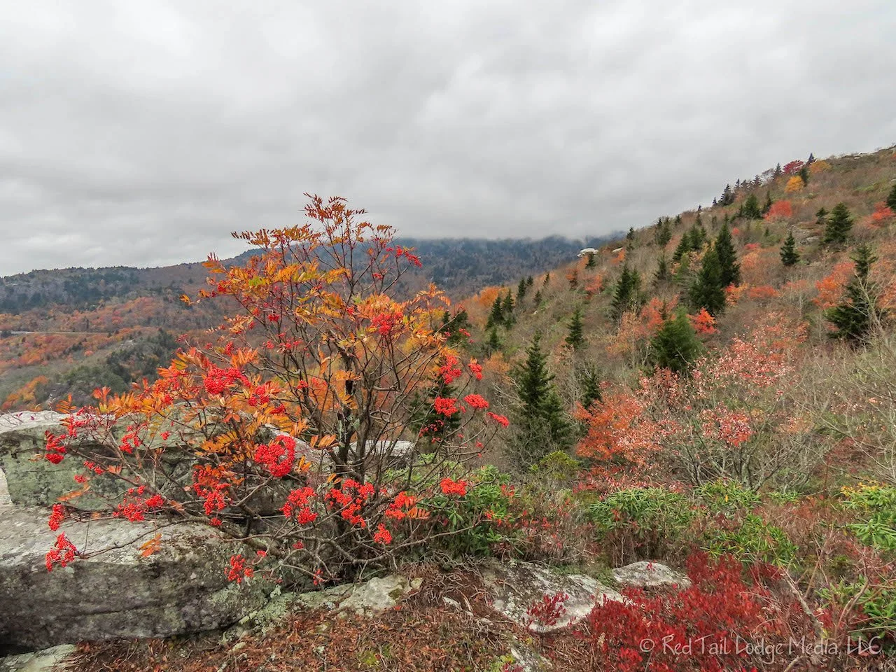
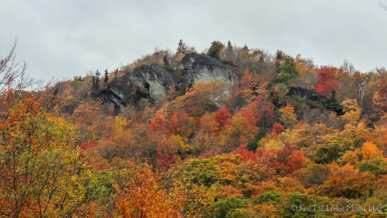
Rain was forecasted for Thursday afternoon, so we got an early start in the morning, hoping to get a short hike in before the rains hit. We drove straight to the Rough Ridge Overlook and took the Tanawha Trail up to the high point. There is a beautiful overlook about a quarter of a mile up. There is a rock outcropping that looks similar to Pride Rock in the Lion King movie. A little ways from there is a similar rock outcropping with gorgeous views.

At the high point, about half a mile from the trail head, are 360 degree views of the surrounding mountains and valleys. The views were stunning despite being a cloudy morning. The trees at the higher elevations had already dropped their leaves, but the trees further down were in their autumn glory. On our way back down to the trailhead, the rain started to drizzle on us. However, it was not hard enough for us to get our rain jackets out of our packs.
From the high point, we could see the tip of Grandfather Mountain, with its suspension bridge leading hikers to the summit. Grandfather Mountain is inside a state park and there is a road the leads close to the summit. We thought we’d try to check it out before the rain got heavy.

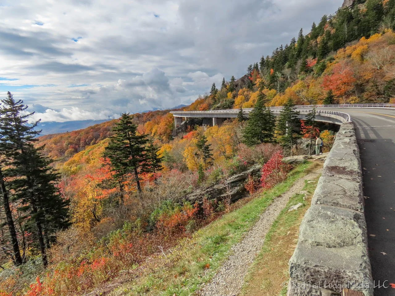
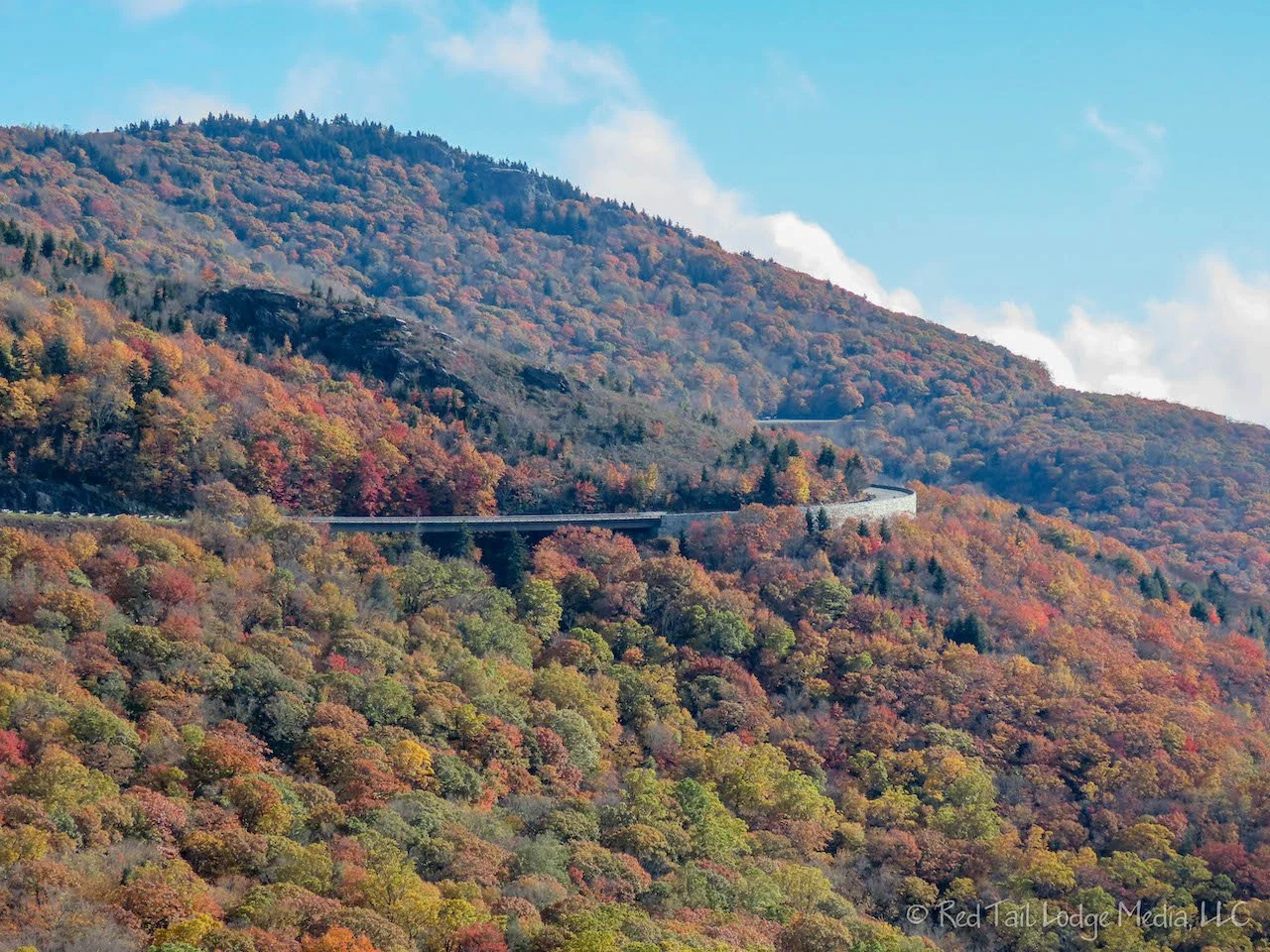
To reach the entrance of Grandfather Mountain State Park, we crossed over the Linn Cove Viaduct. The viaduct is the first of its kind in the United States and was modeled after viaducts in the mountains of Europe. The Linn Cove Viaduct is about a quarter of a mile long, supporting the road bed with tall supports, as the road winds around the curves of the mountain, seeming to float next to them. One of the local hikers we met on the Tanawha Trail told us that the park service closes the Blue Ridge Parkway in the winter and allow people to walk out onto the Linn Cove Viaduct. That would be pretty cool!
When we arrived at the Grandfather Mountain entrance, we discovered that you needed to buy a ticket online to enter the park. On weekdays, there may be tickets you can buy in person at the entrance station. It was a weekday, but we did not bother to ask if there were tickets available. The cost was $22 per adult. That seemed a little expensive to us just to drive up to the top when it may be pouring down rain and/or totally surrounded by clouds by the time we reached the summit.

Instead, we drove back north to Moses H. Cone Memorial Park. The park preserves a country estate that was developed during the 1890s and early 1900s by Moses and Berth Cone. The Flattop Manor houses the Parkway Craft Center. Tours of the manor were not available while we were there. We did browse through the craft center, which had an assortment of interesting Appalachian hand-made crafts. Because of the bad weather, we did not explore the historic carriage roads and trails.
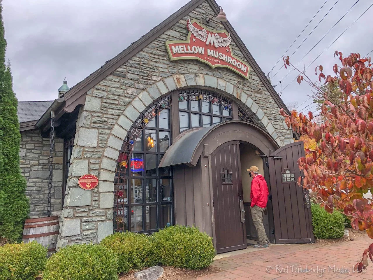
We continued north to the little town of Blowing Rock. We needed to buy gas and pick up some needed items at the grocery store. Being cold and damp outside, eating a cold picnic lunch was not that appealing to us. Pizza at the Mellow Mushroom in town sounded much better. Mellow Mushroom is a chain, but the one in Blowing Rock is located in a historic stone service station. The decor was quirky and the atmosphere was fun. The stone baked pizza was definitely comforting and delicious. LB had his usual pepperoni, tomatoes and mozzarella cheese. RB had one of their new pizza combinations, the Merry Prankster, with chicken, sausage, red and green bell peppers, along with aioli.

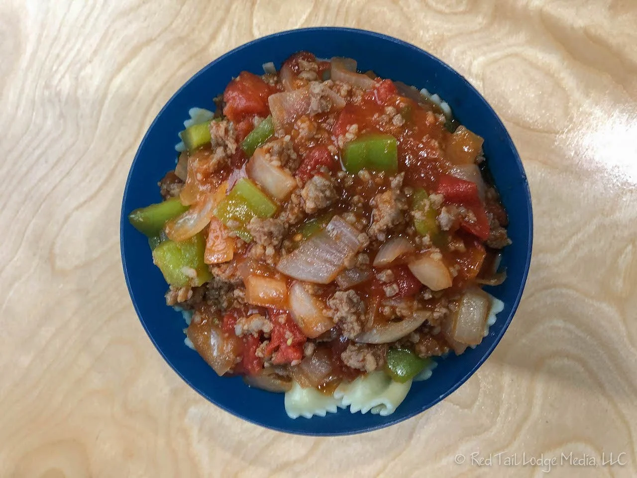
We headed back to the campground to hunker down for the rain. There was a lull in the rain, so LB went outside to cook the rice for dinner, hoping to finish it before the rain started back up. No such luck. At least the rain was not heavy until after the rice was done. The rest of dinner was prepared inside in the Instant Pot, so rain was no longer an issue. For dinner we had Thai peanut curry with chicken and red bell peppers over rice. More warm, comforting food.
It rained cats and dogs all evening and through the night. Normally, we find the sound of rain on the roof of our van soothing and helps us sleep at night. However, we were parked under a couple of trees, so big drops of water kept hitting the roof of our van making loud noises in an erratic pattern. We struggled getting to sleep that night.

The sun peeped out in the morning. More rain was in the forecast for the afternoon, so we quickly broke camp to get some sight-seeing in before the storm hit. We were switching campgrounds from Julian Price to Linville Falls Campground. On the way, we crossed back over the Linn Cove Viaduct. We wanted to stop at the Yonahlossee Overlook to see if we could get a nice picture of the viaduct. However, the overlook was full, so we drove on.
On the other side of the viaduct is the Linn Cove Viaduct Visitor Center. We pulled in to the visitor center, hoping there might be a nice view of the viaduct from there. Maybe there was a view at one time, but the trees were in the way. There was a trail through the woods that lead towards the viaduct. Perhaps there is a viewpoint somewhere down the trail. RB walked a short ways down the trail, but it seemed like she was still in the thick of the trees so she turned around. The visitor center was closed and boarded up, so there was no one around to ask.
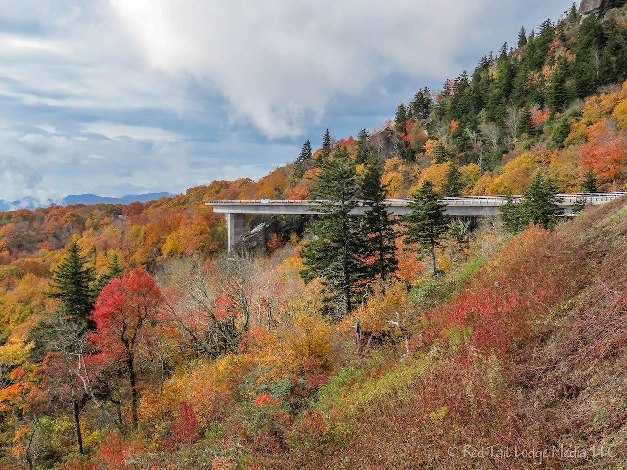
We decided to drive back to the Yonahlossee Overlook and try our chances again to get a parking spot. This time we lucked out and got a spot. There were lots of people along a short trail alongside the road leading back to the viaduct. They were all taking pictures. There were even a handful of photographers with tripods, full frame cameras, multiple lenses and filters set up on a small rock outcropping. Yup. This is the spot to take pictures.

After RB got her fill of pictures of the viaduct, we continued on to Linville Falls. The Linville Falls Visitor Center is at the end of a small spur road around mile 316 or so. This visitor center was open and staffed. There are three trails that start at the visitor center. The yellow easy one is a 0.3 mile loop along a creek. The green moderate one crosses over the Linville River to four different overlooks, three of which are views of the falls. We went on the green trail to all four overlooks. It took us about an hour and ten minutes to complete the 2.2 miles. We counted it as hike number 23 of our 52 Hike Challenge National Park Series.

After the hike, we ate a picnic lunch in our van. We were debating about hiking the third trail, the red trail. It was listed as a difficult trail, but the distance was about the same as the green trail. Two forks of the red trail went out to two different views of the falls from the opposite bank of the river from the green trail views. Since the red trail was listed as a difficult trail, we’re guessing the footing was not as nice as the green trail. The green trail was wet when we hiked it, so we’re sure the red trail will also be wet. After lunch, it was starting to lightly rain. We decided we didn’t need to go on a steep, slippery trail in the rain to see the same falls we’ve already seen.
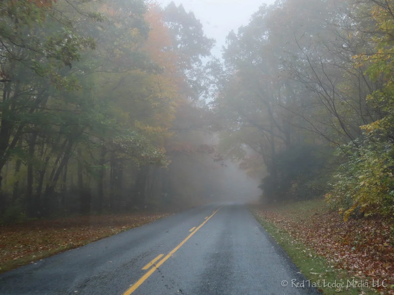
The campground is on the same spur road that the Linville Falls Visitor Center is on. So we drove back to the campground and picked out a site for the next two nights. As we were talking with the campground hosts, we asked them what overlook had the best cell service. RB needed to upload a video. They said it wasn’t bad at the first overlook on the left hand side of the parkway heading south, the Chestoa View. They said there was a nice view from there as well. So we hopped in our van to check it out. The upload speeds for Verizon were good enough to upload a video, so we sat there and worked for a while. However, we didn’t not get to enjoy the view because the clouds had surrounded us and fogged us in.
It rained most of the rest of the day, not hard, but still rain. We headed back to the campground and called it a day. The camp site we picked out was not under any trees. We were hoping the rain would sound better on our roof and we would sleep better. However, the rain stopped by the time we went to bed and we did not hear any rain all night.

The sun was out Saturday morning, but it didn’t stay long. It was raining by the time we left the campground. Our plan was to try to find a bakery in Little Switzerland, then drive up to the top of Mount Mitchell.

Little Switzerland was smaller than we imagined it would be. Other than a large hotel and restaurant, all the other businesses could be counted on one hand. There wasn’t even a gas station. No bakery. How can you have a town named Little Switzerland and not have a cute little bakery selling pastries? We moved on.
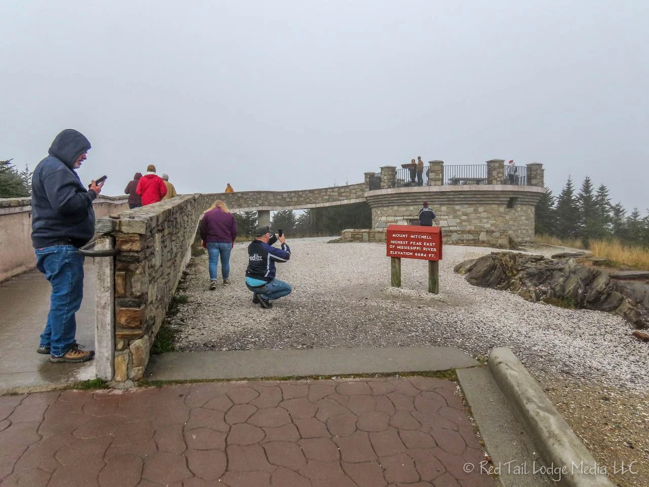
Mount Mitchell is in a state park by the same name. The only road in the park leads five miles from the Blue Ridge Parkway up close to the summit. From the summit parking lot is a 300 foot trail that takes you up to an observation deck at the summit. Along the way is a ranger station with restrooms, a restaurant which was closed for renovations, and a primitive campground. At the top is a gift shop. The restrooms at the top were closed due to construction, but there were port-a-potties.
We stopped at the ranger station for a restroom break. The temperatures were in the mid to high 30’s. It was raining and we were totally surrounded by fog. We ate our lunch to give the skies a chance to clear a little. They didn’t, but we drove up to the summit anyway. At the top, there was still no visibility. We sat in our Red Tail Lodge and had a hot beverage to give the skies another chance to clear. Still no luck, so we left. There was no point in walking up to the summit in the freezing rain if we couldn’t see anything. We’ll try again tomorrow.

On the way back to the campground, we stopped at the Chestoa View overlook for a cell signal to take care of some personal finances. The cell signal which was so good the day before was so poor this time that it wasn’t really usable. OK, we’re 0 for 3 for the day.

The day was not lost, though. Despite the rain, clouds, and fog, there were still some great views from some of the overlooks along the way. The fog and clouds added drama to the landscape.

Our campground hosts had told us about another good cell signal spot, the Walmart in Spruce Pine. We headed over there. The cell signal was much better and we were able to get our business done. While we were there, we popped into Walmart to pick up a couple of items. There was even a gas station there, so we filled our tank while we were at it.
Back at our campsite, the rain stopped long enough for us to cook the pasta outside for dinner. The day didn’t go as planned, but we still had a great time.

Sunday morning, the sun was out again. But yet again, it was only a teaser. We got on the road early. Today we were driving from Linville Falls to Mama Gertie’s Campground in Asheville, North Carolina.

We stopped at the Orchard at Altapass at mile marker 328 on the parkway. The Orchard is run by a non-profit to preserve the culture of the Appalachian Mountains. You can pick your own apples from the orchard or just purchased some already picked at the Apple Shed. Inside the main store is a variety of local products, some exhibits, and live music.

We arrived at the Orchard right when they opened at 10 am. The musicians were just getting set up, so we didn’t really get to hear any music other than some warm ups. RB bought some apple cider and we both had warm apple pie with ice cream. There was a sign that read “free ice cream all day”. We don’t know if they do that every day or just that day. LB thought he overheard someone saying this was their last day for the season. So perhaps they just wanted to clear out their remaining ice cream before closing. Before we left, RB walked over to the Apple Shed and purchased half a peck of York Imperial apples, the only kind they had left. They grow over a dozen or so different varieties of apples, but the York was the only one they had left for sale. There were a handful of other varieties still available if you wanted to pick your own.
From there, we headed to Mount Mitchell again. Along the way, we stopped at a couple of overlooks since the sun was shining through the clouds. As we approached Mt. Mitchell, the sun gave way to clouds, fog, and an occasional drizzle of rain. When we reached the summit, there was no view, just like the day before. We sat in the van and ate our lunch, hoping the skies would clear again. After half an hour, not much had changed. Since it wasn’t raining, we walked the 300 yards to the observation deck. The sun was trying to pierce through the clouds, but still there was no view. We took pictures of the signs on the observation deck that showed what the views would look like in each direction on a clear day. It was time to move on.

We didn’t stop at any of the overlooks the rest of the way to Asheville. The fog stayed with us the whole way. We reached Mama Gertie’s Campground in the early afternoon. We’ll cover Asheville, Mama Gertie’s and the Biltmore Estate in our next post.

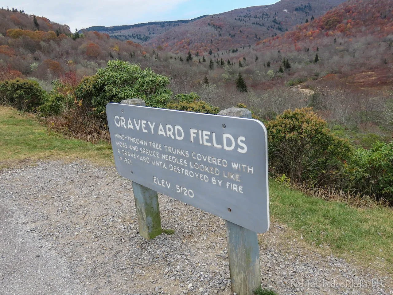
Tuesday found us back on the last section of the Blue Ridge Parkway. The parkway ends right near the entrance to the Great Smoky Mountains National Park. The parkway took us through the Pisgah National Forest and the Cherokee Indian Reservation of the Eastern Band of Cherokee Indians. We tried to stop at the Mt. Pisgah picnic area for a restroom break and a picnic lunch. However, it was closed. As we were approaching the Graveyard Fields overlook, RB spotted a nice waterfall. She told LB to pull into the overlook in hopes there would be a view of the waterfall from there. There wasn’t a view of the falls, but there were restrooms so we stopped. Then we discovered there was a short trail down to the waterfall. Perfect!
After checking out the falls, we ate our lunch in the van. A couple, Bob and Barb, stopped by to check out our van. They had heard of VanDOit, but had not seen one in person. They had a mid-roof Transit cargo van that was converted by another company. We gave them a quick tour of our van. Then we took a tour of their van. The inside of their van was lined with cedar. It was very homey and comfortable inside.

Our next stop was Devils Courthouse. A half mile trail leads up to the top of a rock outcropping, a couple hundred feet up from the parking lot. The view from the top was gorgeous and expansive. The sun made an appearance while we were up there. The view was probably more spectacular the week before, when the fall foliage was more at its peak and all the leaves were still on the trees at the higher elevations.
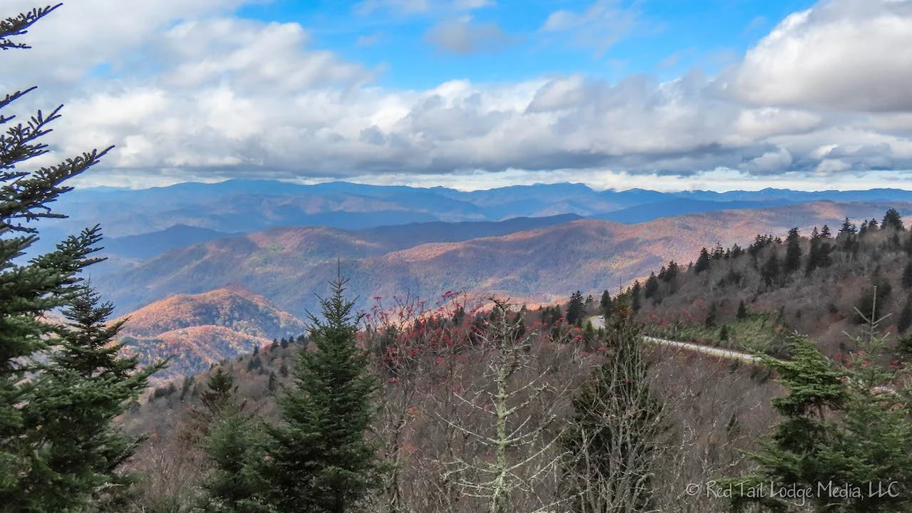
Our last stop on the parkway was at the Waterrock Knob Visitor Center, for the restrooms. From there, it was just heading through a few more low clearance tunnels to reach the end. The views from the parkway this last day seemed like the most expansive compared with the rest of the parkway. The density of tunnels seemed higher here as well.
At the end of the parkway, we turned onto the Newfound Gap Road, US 441, to cross straight through the Great Smoky Mountains National Park to the north side. We’ll cover the Great Smoky Mountains in a future post.

Even though we spent a couple more days on the Blue Ridge Parkway than we did on Skyline Drive, we did not do as much hiking. Part of the reason was due to all the rain we encountered, but the other reason was that there was so much more to see and do on the Blue Ridge Parkway. We felt we got a great taste of Appalachian life. Listening to Bill and Maggie Anderson’s music along the way helped us get into the Appalachian spirit. Next stop? The Great Smoky Mountains.
Check out our related video: Blue Ridge Parkway, Virginia & North Carolina
(RB)