
Black Mesa State Park, Oklahoma - March 4th to 6th, 2023

We haven’t visited much of Oklahoma before, and the last time was quite a few years ago. So we decided to hit a few places at the start of Season Five: Southern States. The first stop was Black Mesa State Park in the northwest corner of Oklahoma.

Saturday morning was cold, in the twenties. Despite that, Friday night was the first night Ann was comfortable sleeping without two pillows against the outside wall. Maybe her body was just adjusting to sleeping in the cold. Not that it was cold inside Red Tail (our Winnebago EKKO). We had the thermostat set to 68 degrees. The issue is the wall next to Ann’s bed, the driver side, has a large metal plate inside of it to support the Batwing Awning. Our EKKO didn’t come with the Batwing Awning, but the support for it is still there. When we drove back from California after picking up Red Tail, Ann didn’t notice the cold wall for those three nights. However, on the first night out for Season Five, she couldn’t get comfortable enough to sleep until after she put on socks and put the two spare pillows up against the wall. However, that really makes the already narrow bed even narrower. So she was glad when she was comfortable Friday night, the third night, without the pillows. Ann is ready for warmer temperatures. We really didn’t get to experience summer weather in Season Four: Alaska Bound. Keith is not as excited. He prefers cooler temperatures over hot temperatures, so we’ll see how well he survives Season Five: Southern States.

Even though we had a four hour drive ahead of us on Saturday, from Cheyenne Mountain State Park to Black Mesa State Park, we took our time packing up camp. We were hoping the temperature would rise before we needed to empty our cassette and gray tank. Handling water with snow flakes still falling was not very inviting. Mother Nature did not cooperate, so at 10 am, we started dumping our tanks. Well, we dumped the cassette, but then the sewer hose, the one that came with Red Tail, was not long enough. We were camped at a site with sewer hook ups, but the drain was at the far side of a large concrete dump pit area, just out of reach for our hose. We’ll wait until the next campground to dump our gray. On the way, we’ll pick up a longer hose, just in case.

The destination for the day was Black Mesa State Park in Oklahoma. It is in the panhandle, just across the border from Colorado. Pueblo, Colorado was on the way. That meant we needed to stop at Angelo’s Pizza Parlor for lunch. It is a tradition for us (Lake Pueblo State Park - August 16th to 19th, 2020). The pizza was just as good as we remembered. We both had the lunch special of one slice of pizza along with a side salad. Ann really enjoys their lemon cucumber dressing.
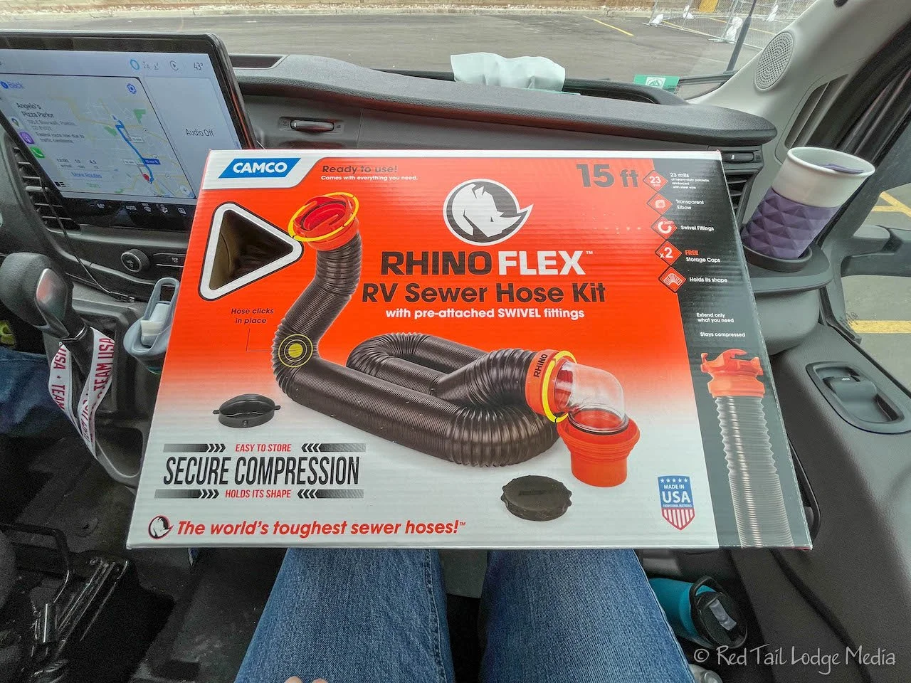
We stopped at a Walmart in Pueblo and picked up the 15 foot Rhino Flex RV Sewer Hose Kit (paid link). Our plan was to replace the original hose and store it in the same place, inside the SuperSlider (paid link) under Red Tail. However, the Rhino Flex does not fit, as we currently have the SuperSlider installed. It is 56 inches long when compressed. Fortunately, the SuperSlider is adjustable. So Keith now had a project to work on while we are at Black Mesa.

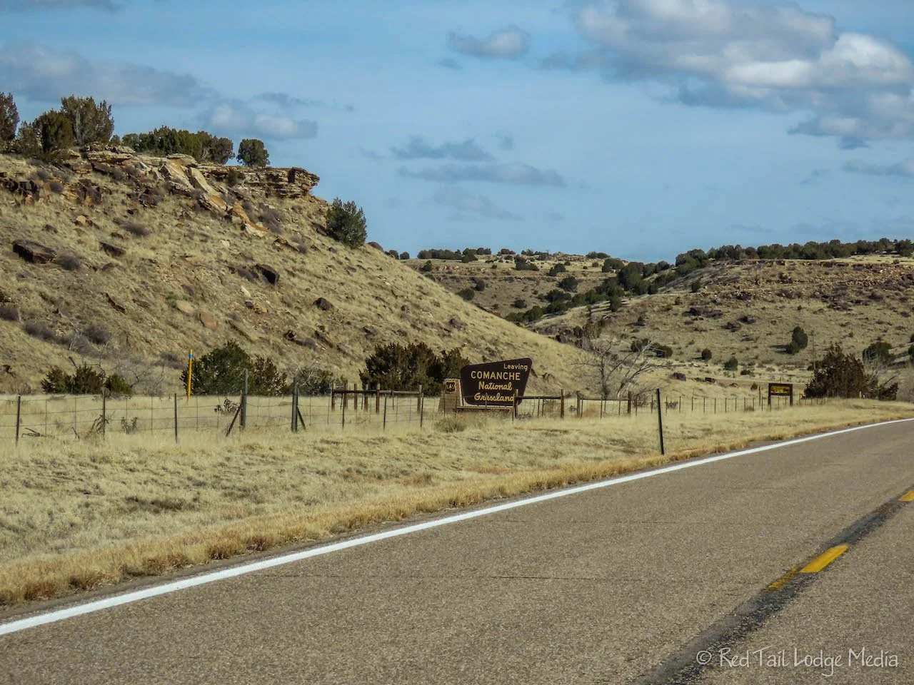
From Pueblo, we turned onto the backroads. Highway 50 east to La Junta, then 109 south to 160 east, through the Comanche National Grasslands. The grasslands are desolate, but pretty, in their own special way.
As we approached the northeast corner of the state, the landscape started changing from flat prairie to a sprinkling of rocky canyons. From highway 160, we turned onto a couple of county roads to drop down into Oklahoma. We didn’t realize the route was taking us onto dirt roads until we turned onto the first county road. We stopped to see if there was an alternative, but all of the paved alternatives were significantly out of the way. So 35 miles of dirt roads was our best option.

The county roads started out pretty rough, but then were not too bad. We were able to maintain about 40 mph most of the time. What was going through our minds was “not another broken windshield, please!”. Red Tail only has about 4000 miles on it, half of those miles were before we took possession, and we’ve already had to replace the windshield once. Fortunately, we did not pass another vehicle the whole hour we were on the county roads. We made it through with our windshield in tact, giving Red Tail a good shake test.

We arrived at Black Mesa State Park after 6 pm, Central Time. We were surprised to see that there was only one other camper in the whole campground. It was Saturday and 50 degrees outside. Where is everybody? We guess it is a little far from populated areas to draw a weekend camping crowd. The camp store was still closed for the winter, but the restrooms and showers were open. A small group of deer greeted us as we pulled into our reserved site.

Black Mesa State Park and Nature Preserve is split between two locations. The state park surrounds Lake Carl Erling. The state nature preserve is located about 15 miles from the lake and includes the mesa that is called Black Mesa. The campground is located in the Black Mesa State Park, near the lake. There are a few short hiking trails in the Lake Carl Erling area. There is a long hike in the nature preserve, that goes up onto Black Mesa and to the highpoint in Oklahoma. The Black Mesa Summit Trail is over eight miles long, round trip.
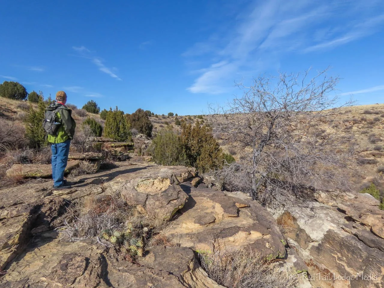
Even though the temperatures were predicted to be warmer on Sunday than on Monday, it was only supposed to be sunny in the morning on Sunday, with high winds developing in the afternoon. So we decided to explore the short trails in the state park Sunday morning, and save the long, summit hike for Monday.
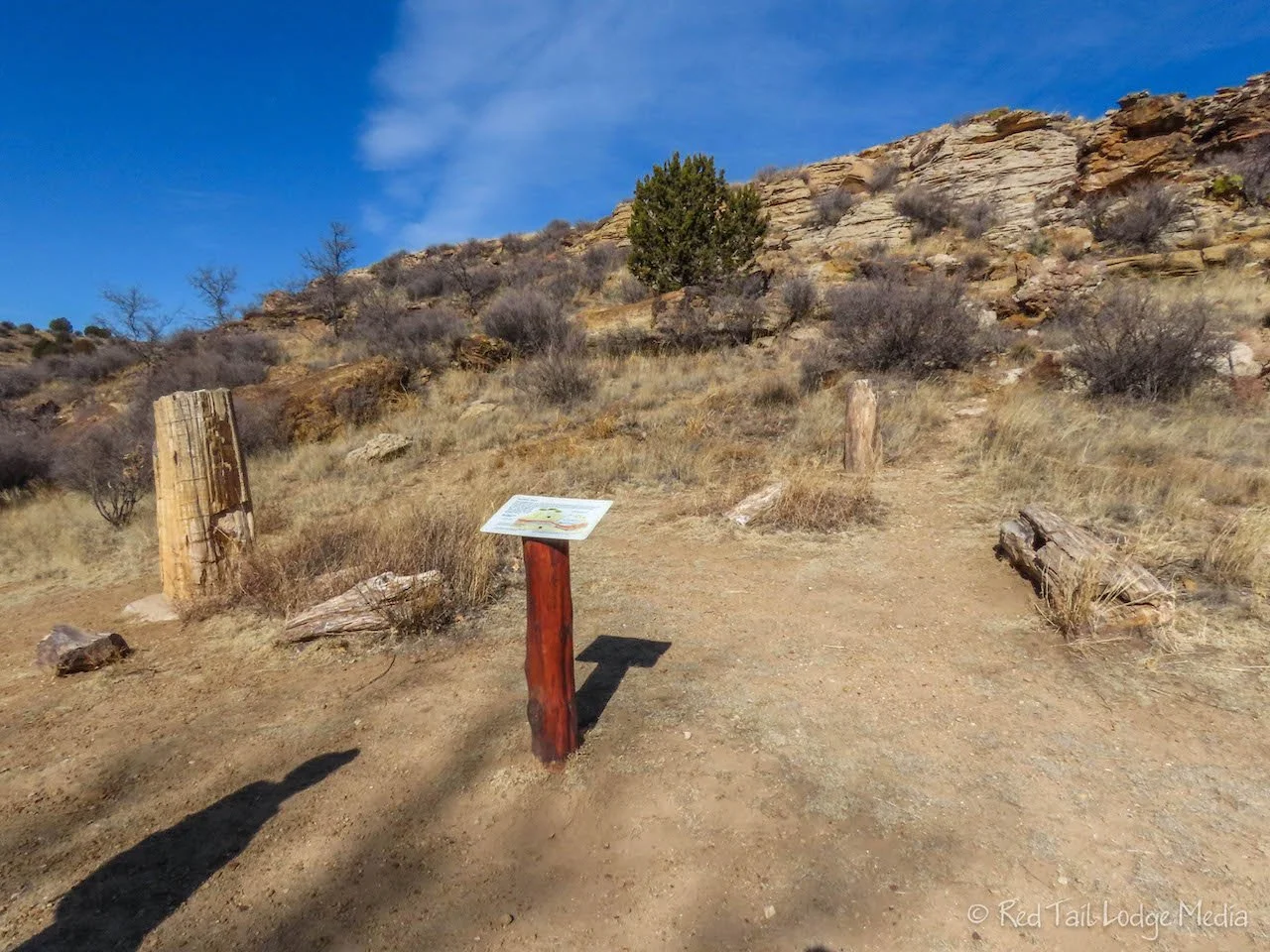
The Vista Trail starts behind the Ranger Station in the campground, so that is where we started. Along the trail, the Bird Haven Trail branches off and leads over to the Petrified Log Exhibit, so we went to check it out. There are a handful of petrified logs that were gathered from the area and placed on display. We then retraced our steps back to the Vista Trail.

The Vista Trail ends at the park road. Heading up the road, we visited the overlook along with some dinosaur tracks in the rocks at the overlook. They were small prints, from a juvenile hadrosaur.

We continued up the park road and tried to find the Rock Garden Trail, since the rocky canyon looked interesting. However, the trail comes close, but doesn’t not come out to the road. We followed the signs that took us down a lake access dirt road and eventually found the trail. The trail was called Rock Garden at the beginning, then turned into Rim Trail and then, after the trail dropped down into the canyon, the name changed again to North Canyon Trail. We exited the canyon at the Group Camping area. The trail continued back to where we started, changing names yet again to the Archeological Trail, but we decided to take the road back to our campsite as we were ready to have lunch.

In total that morning, we walked 3.8 miles with an elevation gain of 305 feet, in one hour and 40 minutes. We decided to up our game this year and not count it towards our 52 Hike Challenge since it was under five miles.
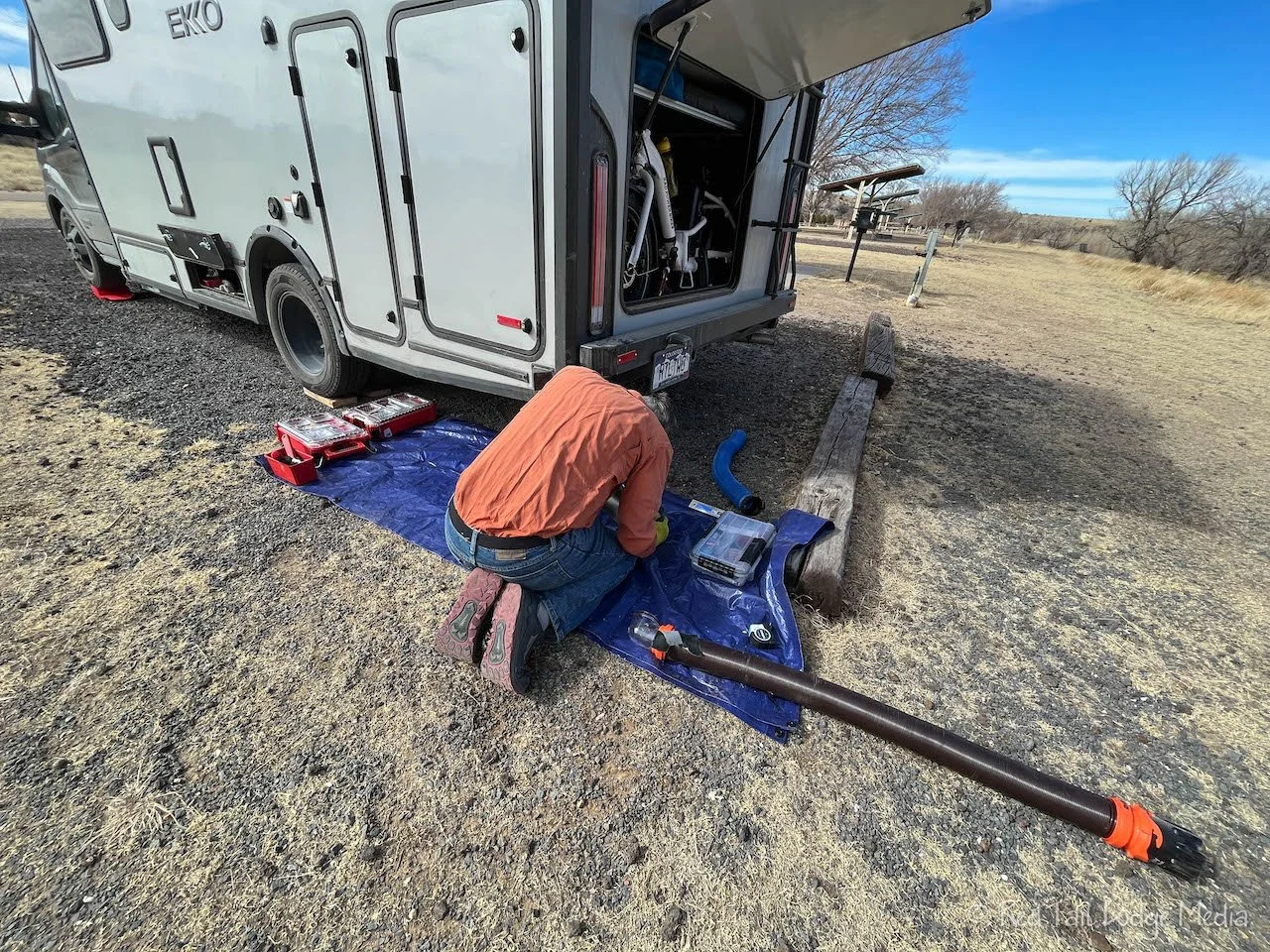
In the afternoon, Keith tried to work on storing our new 15 foot sewer hose. It did not go well. The 15 foot hose compresses down to 56 inches. The SuperSlider that he had installed under our rig will easily expand to 56 inches, but there is not space under the rig to mount it. The water compartment hangs down too low. If we lower the SuperSlider to go under the water compartment, then it sits much lower to the ground and we run the risk of bottoming out on something. If we angle the SuperSlider, we can extend it further, but then the suspension spring gets in the way. We even thought about mounting it vertical next to the ladder on the back of the EKKO, but that would make it difficult to pull the hose out of the tube. Besides, we weren’t too keen on putting holes into the side of the RV to mount it. We needed to come up with a plan B.

Unfortunately, Keith had already dismounted the SuperSlider. He shoved it into the gear garage and called it a day. We’ve decided to try to find a 10 foot hose in the next town we pass through, hoping we can make that work with the SuperSlider mounted at an angle. The sewer hose that came with the EKKO supposedly expands to ten feet, but we couldn’t expand it to anything close to that. It is also unfortunate that the bumper on the EKKO is not large enough to hold a sewer hose inside it, plus there are electrical wires in the way. Many RV’s use the bumper for sewer hose storage, but not the EKKO. Stay tuned for how we ended up solving this issue.

Monday we drove up to the Black Mesa Nature Preserve and hiked the Black Mesa Summit Trail. It was about a 25 minute drive up a county road, but this one was paved. There was a pit toilet at the trailhead along with a registry for hikers to sign in and out.
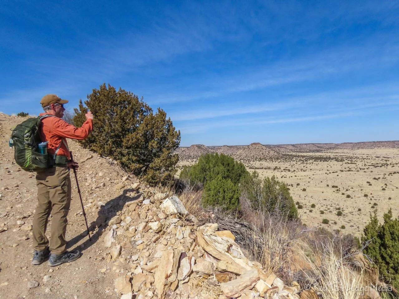
The trail is nice and wide, wide enough for a vehicle to drive down, but vehicles, bikes, and horses are not allowed on the trail. The trail starts out flat alongside the mesa for a couple of miles before it climbs up to the top of the mesa. Once on top, the trail continues for another mile before reaching the monument indicating the high point of Oklahoma. So the majority of the elevation gain is within the same half mile of trail.

There is a nice bench marking each mile of the trail, with a couple of shelters from the wind and sun in between some of the benches. The shelter right before the climb up to the top of the mesa has a water cache. It is stocked with bottles of water and a first aid kit. Temperatures were in the 40’s and 50’s during our hike, so it was quite pleasant. However, we could imagine how brutal the hike would be in the heat of summer, as the trail is exposed to the elements the whole way. The water cache probably has saved lives before. If you hike the trail, please bring plenty of water with you and save the water cache for emergency use.

On our way up to the mesa, we noticed puffs of smoke coming from the one-seed juniper trees. The “smoke” is juniper tree pollen. The pollen is released by the male trees from their small cones. Wind carries the pollen up into the air as a small cloud of smoke. (The Power of Pollen). We didn’t see any clouds of pollen in the afternoon on the way back down. We’re not sure what conditions were different, as there was still a wind present. Perhaps the cones only open up in the morning?

As we were walking on top of the mesa, we spotted a pronghorn off in the distance. He was keenly aware of our presence, stopping every now and then to look back at us. We ate our snack at the monument. After signing the summit registry, we headed back down.
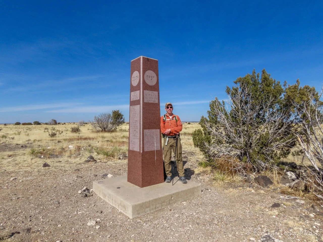
We completed the 8.6 miles with an elevation gain of 738 feet in just under four hours. It was a long hike, but the trail was easy, with good footing, so we were able to keep a fast pace. We counted it as hike #5 of our 52 Hike Challenge for 2023.
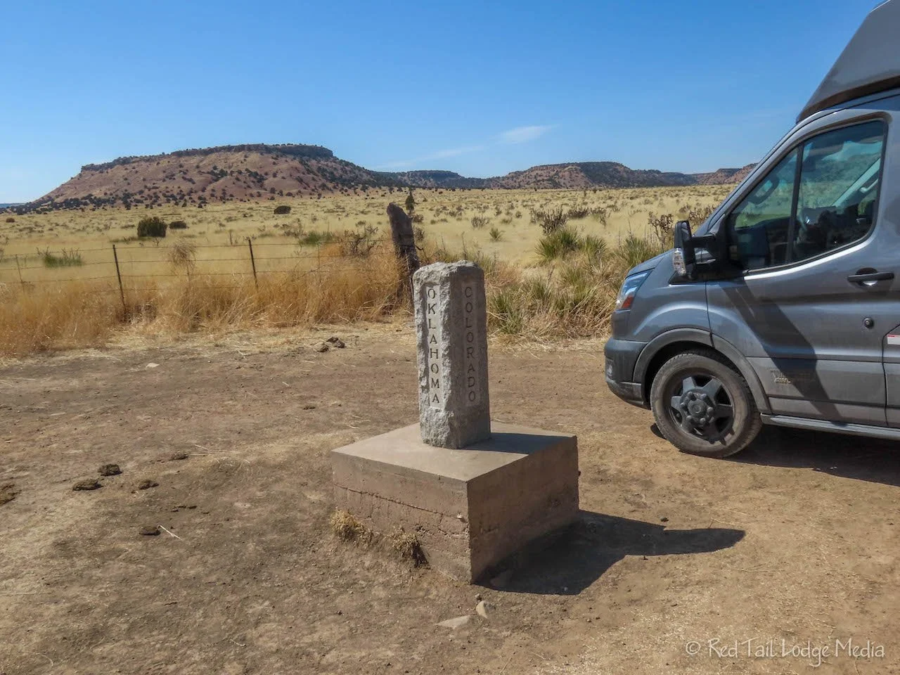
On the map at the trailhead, it showed some dinosaur tracks were just up the road along with “Four Corners” where the states of Oklahoma, New Mexico, and Colorado meet. Don’t ask us why they called that Four Corners instead of Three Corners. Since we were only a few miles away, we thought, “why not?”. The marker for the meeting of the three states was a little ways after the pavement ended on Black Mesa Road. However, the dirt road was in decent condition, so it didn’t take us very long to get there. Other than the marker, there isn’t much else to see there.
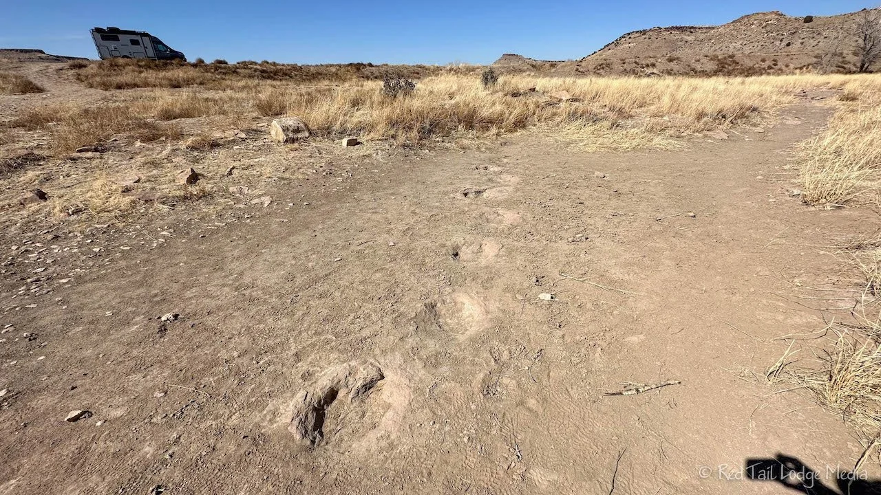
Then we headed over to where the dinosaur tracks were supposed to be. The road was not marked, but Google Maps verified it was the right road. The dirt road to get to the tracks was a quarter of a mile long through a cow pasture, and very rough, with deep ruts and large potholes. We took it slow and made it to the parking area. There were no signs, but a short little path down to a dry creek bed. The tracks must be down there. We walked down and turned right. We didn’t see anything that looked like tracks. There were no signs anywhere. As we headed back up to the path, we found them. We should have turned left instead of right when we reached the creek bed. There were about half a dozen large, round imprints in the rock. Each print was about a foot in diameter. We wish there would have been an information sign indicating what type of dinosaur they believed made these tracks, or at least some other information about them. But there was nothing.

Back at our camp site, we used our Blackstone griddle (paid link) for the first time. We cooked up a couple of tortilla pizzas. First we grilled some onions and green peppers for toppings. Then we placed two tortillas on the griddle and topped it with tomato sauce, seasonings, mozzarella, pepperoni, and the grilled peppers and onions. The griddle worked like a charm and was simple to clean up. It was so nice for us both to enjoy our pizzas at the same time. In previous seasons, when we cooked these on our single burner butane camp stove (paid link), we had to cook them one at a time.

Although Black Mesa State Park seems rather remote, it was a wonderful place to visit. Part of the beauty was its remoteness. Its stark landscape is also wonderful to see and experience. We found it hard to believe that Black Mesa is the high point of the whole state, with the Rocky Mountains so close. But the mountains don’t reach into Oklahoma, so the rest of the state is pretty flat.
Check out our related video: Black Mesa State Park, Oklahoma
(Ann)