
Alcan: Watson Lake, Yukon Territory - June 8th to 9th, 2022

As we travel, it’s fun to join in on some of the quirky traditions of an area. Somehow it makes us feel more connected to other people. Watson Lake is home to the Sign Post Forest. We were prepared to participate. Before we left home, we made our own sign to hang up in the forest.
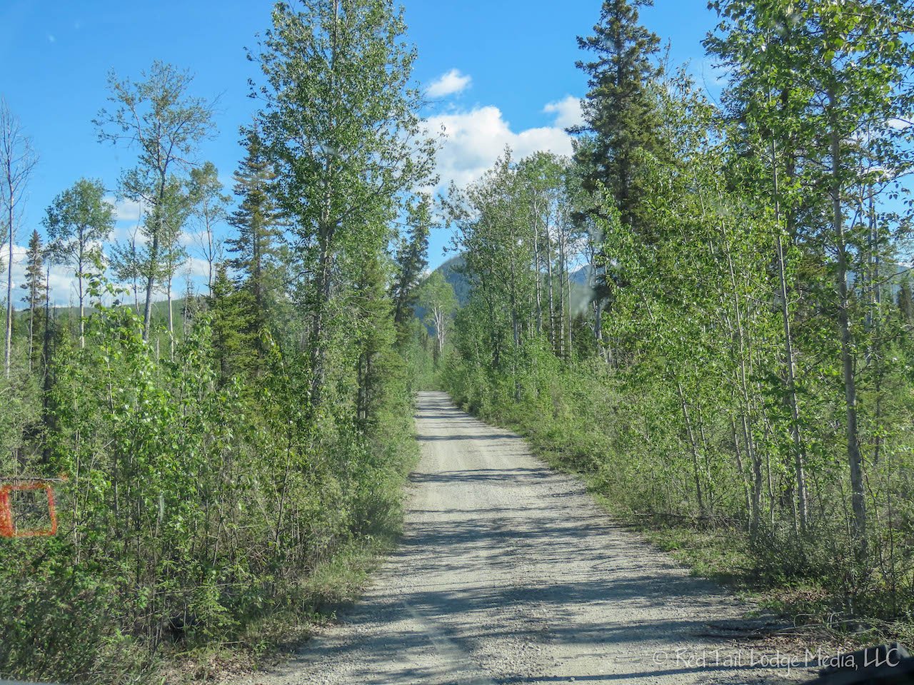
Wednesday found us on the road again. We were moving further up the Alaska Highway, from Liard River Hot Springs in British Columbia to Watson Lake in the Yukon Territory. Our first stop of the day was Smith River Falls. From the highway, there is a 1.6 mile single lane gravel road to get to the parking area for the falls. Keith is not a big fan of single lane roads, especially gravel ones. Luckily we didn’t meet any vehicles coming the other direction until we were almost at the small parking lot. A park operator vehicle saw us and backed up quickly to get out of our way. Thank you!

There is a trail that leads from the parking area to the base of the falls. According to the sign at the parking lot, the trail is 1.4 kilometers round trip and to allow an hour. It also said the trail is very steep, following the path of a former set of stairs. That didn’t sound like something we wanted to do, especially since the mosquitos were swarming us the second we stepped out of the van. You can see the falls from the parking lot. The falls are impressive, but after a minute or two of snapping some photos while swatting insects, we left.

Luckily we didn’t meet any vehicles as we drove back out the gravel road. Between avoiding the potholes, noting where there are spots to let other vehicles pass, and looking for oncoming traffic, Keith found it rather stressful. Was the waterfall worth the effort? Ann thinks so, but Keith may have a different opinion.

The next stop was Coal River Lodge for lunch. According to the Mile Post, they were known for their bison burgers. The cafe was simple, but it was cute inside. We both had the bison burger with pan fries. Ann was going to have the French fries, but their fryer was broken. The burgers were tasty. We especially liked the grilled buns.

Next on the itinerary was Whirlpool Canyon. The parking area was down a short, unpaved road. Much to Keith’s relief, the side road was much shorter than for Smith River Falls. The parking area is right on the banks of the Liard River. The river is wide with a powerful, high volume of water flowing by. At this point there are a couple of small islands that the river flows around, and there is a large whirlpool on the side closest to the parking area. The waves of the rapids were about 10 feet tall. Whole trees were being caught in the large whirlpool, making multiple trips around. There was also a large pile of logs at one spot along the bank, probably ones that got washed up onto the shore during one of their trips around the whirlpool. The power of the water was just phenomenal! This is definitely worth stopping for. If your rig is too big to get down to the parking area, you could walk down to it from the highway.

Cranberry Rapids was the next turnout we stopped at. The rapids here are also impressive, but not quite as impressive as Whirlpool Canyon. It was still worth a stop. We also stopped at Allen’s Lookout, at Historical Mile 570. A small path led us to nice views of the Liard River. Nothing as impressive as the rapids, but still beautiful with a backdrop of a rocky peak.

Our last planned stop for the day was Lucky Lake. Lucky Lake is a popular swimming hole along with a long water slide. It was a hot day, in the 70’s F, but no one was swimming. A 1.3 mile (2.2 km) walking trail led down to the river. It was a nice trail through the woods with a couple of interpretative signs along the way. However, when we got close to the river, a tree was blocking the path. We could have gotten around it, but we saw the trail on the other side was rather muddy. Instead, we opted for a little side trail that took us to the bank of the river. After the other viewpoints along the river earlier in the day, this was rather anti-climatic. We stood there just long enough to snap a couple of pictures and gain a few more mosquito bites before quickly heading back up the trail. It took us about an hour to complete the walk. Would we recommend this walk? Probably not, unless you just want to get out and stretch your legs.

There were a few unplanned stops along the way for some wildlife. A vehicle in front of us was stopped along the side of the road. That was our cue to figure out if they were stopped for an animal. Sure enough, there was a cute little fox along the side of the road. He had some fresh prey in his mouth.

Next was a bison. It looked like he waited at the side of the road for traffic to stop from both directions before slowly strolling across the road. Thanks for the show!

We saw two black bears that day. The first one was up on the hill beside the road and Ann was able to get some nice pictures of it. However, the second one we spotted from a distance, but when we got closer, we couldn’t see it as it was behind a small berm near the tree line.

We arrived at the Downtown RV Park at about 4 pm. It is just a gravel parking lot with full hookups. But it has clean showers and laundry, which we needed. It was also conveniently located. Since rain was in the forecast for later in the evening and into the next day, we took advantage of the sunshine while it lasted. We walked over to the liquor store (Keith was out of beer) and stopped off at the grocery store for a few items. There was no place to get ice cream in town, so we bought a pint of Tim Horton’s double chocolate donut ice cream and shared it between the two of us.

After our refreshment, we walked over to the Sign Post Forest to hang up our sign. The Sign Post Forest was started in 1942 by a construction worker on the Alaska Highway who posted a sign with the distance to his home town. Others joined in and now there are over 90,000 signs. Some are traditional and give distances to towns, but many of them have taken on all sorts of sizes, shapes, and messages. It is amazing how many signs are there and how different all of them are. We noticed quite a few town and street signs from Germany. We brought our sign, screws, nails, hammer and screw driver with us, but most of the empty spots were high up on the posts. Keith walked back to the campground to grab our collapsible ladder (paid link).

No sooner had he left, a retired couple from Alberta, Stu and Claire, whom we met at Liard River Hot Springs (Alcan: Liard River Hot Springs, British Columbia - June 6th to 7th, 2022), arrived with their sign, collapsible ladder, and power driver. Ann chatted with them while she waited for Keith to return. They had a cute, young puppy which was very friendly. Stu is also a nature photographer and has a website called rovingwild.ca. When Keith returned, Stu let him borrow his power screwdriver so Keith had our sign mounted in no time. It would have taken a lot longer to screw in by hand. Thanks, Stu!

Before we left the Sign Post Forest, another couple from Alberta showed up to hang their sign. They did not have a ladder, so we let them borrow ours. It feels good when you can pay it forward. Safe travels everyone!

We managed to cook dinner out on our butane stove (paid link) on top of our new folding table (paid link), since there were no picnic tables, before the rain started. The rest of the evening was spent catching up on emails, Facebook, YouTube videos, and whatever else we needed an internet connection for. We had gone over four days with absolutely no cell phone service. Ann was concerned because one of the popular campgrounds she wanted to reserve a site for Season Five opened up at the start of those four days. She was relieved when she found one site still available. It was probably left because it could only accommodate rigs under 25 feet long. Another reason to travel in a short camper van!
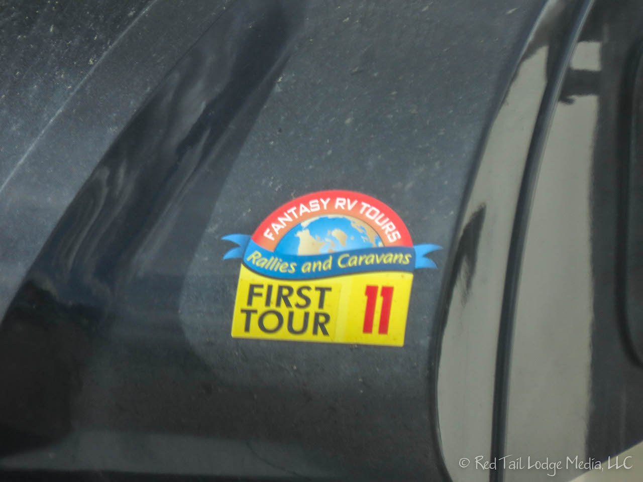
Thursday morning, a 22 rig Fantasy RV Tours caravan pulled out of the campground by 10 am. They are on a 52 day tour to Alaska. It was raining in the morning, so we got our laundry done.

The sun came out in the afternoon. We walked the 1.5 mile loop trail around Wye Lake, which is just behind the campground. It was a pleasant little walk, with patches of lupine and lady’s slipper blossoms adding some color every now and then along the trail. We could hear the chirping of birds, but didn’t see many. There were a few water fowl out on the lake.

Since the sunshine seemed to be holding up for a while, we walked over to the Sign Post Forest. This time we took a slow stroll, noticing the details of some of the unique signs. Some were license plates, hats, shoes, pans, hub caps, and old and/or stolen street signs from all over the world. Some punched holes in metal to make words. Someone glued beads onto a cooking pan. There was a temporary wheel, which claimed to have been used on the Dempster Highway. When our eyes started to glaze over, we called it quits. We thought we would come across at least one of the signs that we’ve seen posted by some of the YouTube channels we follow, but we didn’t spot a single one.

We managed to get our three miles of walking in for the day, but then we stopped by the grocery store on the way back to the campground and bought more ice cream. This time it was Ben & Jerry’s Brownie Batter Core. Despite all of our walking, we’re pretty sure we’re going to return home at the end of the season heavier than when we left home.

Watson Lake made us feel like we were part of a larger pilgrimage. Meeting and helping others who were on their way to Alaska made the experience even more enjoyable.
Check out our related video: Alcan: Watson Lake, Yukon Territory
(Ann)